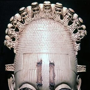
Home > Arts > Artists > B > Benin Benin
Map of the Kingdom of Juida, or Whidah (engraving)
")
![]()
Wall Art and Photo Gifts from Fine Art Finder
Map of the Kingdom of Juida, or Whidah (engraving)
979815 Map of the Kingdom of Juida, or Whidah (engraving) by French School, (18th century); Private Collection; (add.info.: Carte du Royaume de Juida ou Whidah, by Jacques Nichloas Bellin, showing the coastal creeks and lagoons in the area which is today the Republic of Benin. Image taken from Histoire Generale des Voyages, by Antoine Francois Prevost. Published by Pierre de Hondt, 1747.); Look and Learn / Bernard Platman Antiquarian Collection; French, out of copyright
Media ID 23021716
© Look and Learn / Bernard Platman Antiquarian Collection / Bridgeman Images
Benin Creeks Voyages West Africa Lagoons
FEATURES IN THESE COLLECTIONS
> Africa
> Benin
> Related Images
> Africa
> Related Images
> Arts
> Artists
> B
> Benin Benin
> Fine Art Finder
> Artists
> English School
> Fine Art Finder
> Artists
> French School
> Fine Art Finder
> Temp Classification
> Maps and Charts
> Related Images
EDITORS COMMENTS
This engraving, titled "Map of the Kingdom of Juida, or Whidah" offers a glimpse into the rich history and geography of West Africa. Created by French cartographer Jacques Nichloas Bellin in the 18th century, this map showcases the coastal creeks and lagoons that now form part of the Republic of Benin. The intricate details depicted on this print transport us back to a time when exploration and discovery were at their peak. As we study this map, we can imagine intrepid voyagers navigating through these waterways, uncovering new lands and cultures along their journey. Bellin's meticulous craftsmanship is evident in every stroke as he accurately portrays the rivers, lagoons, and coastlines that define this region. The Map of Juida provides an invaluable historical record not only for scholars but also for anyone intrigued by African history. Originally published in Antoine Francois Prevost's Histoire Generale des Voyages in 1747, this particular print comes from a private collection curated by Bernard Platman Antiquarian Collection. Its inclusion within Fine Art Finder allows art enthusiasts worldwide to appreciate its beauty and significance. As we explore this extraordinary piece of cartography, let us marvel at how it connects us to centuries past while reminding us that there is always more to discover about our world's diverse landscapes and cultures.
MADE IN THE USA
Safe Shipping with 30 Day Money Back Guarantee
FREE PERSONALISATION*
We are proud to offer a range of customisation features including Personalised Captions, Color Filters and Picture Zoom Tools
SECURE PAYMENTS
We happily accept a wide range of payment options so you can pay for the things you need in the way that is most convenient for you
* Options may vary by product and licensing agreement. Zoomed Pictures can be adjusted in the Cart.