Home > Europe > United Kingdom > England > London > Museums > National Maritime Museum
Chart of Sierra Leone, Africa, 1732 (engraving)
")
![]()
Wall Art and Photo Gifts from Fine Art Finder
Chart of Sierra Leone, Africa, 1732 (engraving)
7339526 Chart of Sierra Leone, Africa, 1732 (engraving) by Kip, Johannes (c.1652-1722); 34x41 cm; National Maritime Museum, London, UK; (add.info.: Creator: J. Kip); © National Maritime Museum, Greenwich, London
Media ID 38509960
© © National Maritime Museum, Greenwich, London / Bridgeman Images
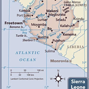
Sierra Leone West Africa West African Western Africans
FEATURES IN THESE COLLECTIONS
> Africa
> Sierra Leone
> Maps
> Africa
> Sierra Leone
> Related Images
> Arts
> Artists
> K
> Johannes Kip
> Europe
> United Kingdom
> England
> London
> Boroughs
> Greenwich
> Europe
> United Kingdom
> England
> London
> Museums
> Greenwich Heritage Centre
> Europe
> United Kingdom
> England
> London
> Museums
> National Maritime Museum
> Europe
> United Kingdom
> England
> London
> Towns
> Greenwich
> Europe
> United Kingdom
> Heritage Sites
> Maritime Greenwich
> Europe
> United Kingdom
> Maps
> Fine Art Finder
> Artists
> Johann Baptista Homann
> Fine Art Finder
> Artists
> Johannes Kip
EDITORS COMMENTS
This stunning engraving from 1732 depicts a detailed Chart of Sierra Leone, Africa, showcasing the intricate cartography skills of Johannes Kip. The print captures the essence of West Africa in the early 18th century, providing a glimpse into the geographical landscape of the region.
The map not only serves as a historical artifact but also highlights the importance of navigation and exploration during that era. It showcases the coastal areas of Sierra Leone with precision and accuracy, offering valuable insights into trade routes and settlements in West Africa.
Johannes Kip's expertise as an engraver is evident in this masterpiece, with each line meticulously etched to create a visually captivating representation of Sierra Leone. The attention to detail in every aspect of the map reflects Kip's dedication to his craft and his commitment to accurately portraying geographic locations.
As we admire this piece from the National Maritime Museum in London, we are transported back in time to an era where maps were essential tools for discovery and understanding. This Chart of Sierra Leone stands as a testament to both artistic skill and historical significance, reminding us of the rich heritage and cultural diversity present in Africa during that period.
MADE IN THE USA
Safe Shipping with 30 Day Money Back Guarantee
FREE PERSONALISATION*
We are proud to offer a range of customisation features including Personalised Captions, Color Filters and Picture Zoom Tools
SECURE PAYMENTS
We happily accept a wide range of payment options so you can pay for the things you need in the way that is most convenient for you
* Options may vary by product and licensing agreement. Zoomed Pictures can be adjusted in the Cart.