Home > Europe > United Kingdom > England > London > Museums > National Maritime Museum
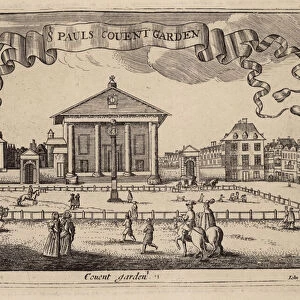
A chart of Brazil bound in Jacob Colom's Atlas of werelts-water-deel en des selfs zee-custen, 1656 (bound sheet)
")
![]()
Wall Art and Photo Gifts from Fine Art Finder
A chart of Brazil bound in Jacob Colom's Atlas of werelts-water-deel en des selfs zee-custen, 1656 (bound sheet)
7340056 A chart of Brazil bound in Jacob Colom's Atlas of werelts-water-deel en des selfs zee-custen, 1656 (bound sheet) by Colom, Arnold (1624-68); 57x65 cm; National Maritime Museum, London, UK; (add.info.: Creator: Arnold Colom); © National Maritime Museum, Greenwich, London
Media ID 38177552
© © National Maritime Museum, Greenwich, London / Bridgeman Images
Brasil Brazil Brazil Brasilian Brazil Brazilian Brazilian Brazilians Latin America Latine America
FEATURES IN THESE COLLECTIONS
> Arts
> Artists
> J
> Jacob Jacobs
> Europe
> United Kingdom
> England
> London
> Boroughs
> Greenwich
> Europe
> United Kingdom
> England
> London
> Museums
> Greenwich Heritage Centre
> Europe
> United Kingdom
> England
> London
> Museums
> National Maritime Museum
> Europe
> United Kingdom
> England
> London
> Towns
> Greenwich
> Europe
> United Kingdom
> Heritage Sites
> Maritime Greenwich
> Europe
> United Kingdom
> Maps
> Fine Art Finder
> Artists
> Arnold Colom
> Fine Art Finder
> Artists
> John Seller
> Maps and Charts
> Early Maps
> South America
> Brazil
> Maps
EDITORS COMMENTS
This stunning print captures a chart of Brazil bound in Jacob Colom's 'Atlas of werelts-water-deel en des selfs zee-custen' from 1656. The intricate details and craftsmanship of this map, created by Arnold Colom, showcase the beauty and complexity of cartography in the 17th century.
Measuring at 57x65 cm, this piece is a true work of art that provides a glimpse into the geographical knowledge and exploration of the time. The map depicts Brazil with precision and accuracy, highlighting its coastlines, rivers, and topographical features.
As one examines this historical artifact, they are transported back to a time when mapping out uncharted territories was both an art form and a scientific endeavor. The black-and-white aesthetic adds to the vintage charm of the piece, emphasizing its age and significance.
Brazilian culture and geography come alive through this map, offering viewers a window into the past while also celebrating the rich history of South America. This print serves as a reminder of how maps have shaped our understanding of the world around us for centuries.
Displayed at the National Maritime Museum in London, UK, this print is not just a representation of Brazil but also a testament to human curiosity and exploration throughout history.
MADE IN THE USA
Safe Shipping with 30 Day Money Back Guarantee
FREE PERSONALISATION*
We are proud to offer a range of customisation features including Personalised Captions, Color Filters and Picture Zoom Tools
SECURE PAYMENTS
We happily accept a wide range of payment options so you can pay for the things you need in the way that is most convenient for you
* Options may vary by product and licensing agreement. Zoomed Pictures can be adjusted in the Cart.