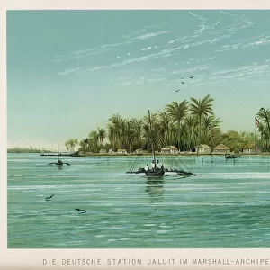
Home > Oceania > Marshall Islands > Maps
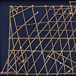
Wapepe navigational chart, late 19th century (sticks, coconut fiber, and shell)
")
![]()
Wall Art and Photo Gifts from Fine Art Finder
Wapepe navigational chart, late 19th century (sticks, coconut fiber, and shell)
8620259 Wapepe navigational chart, late 19th century (sticks, coconut fiber, and shell) by Micronesian (19th century); 78.74x78.74x1.91 cm; Peabody Essex Museum, Salem, Massachusetts, USA; (add.info.: By Artist in Micronesia
Stick chart, Marshall Islands); © Peabody Essex Museum
Media ID 33393670
© © Peabody Essex Museum / Bridgeman Images
Excursion Explore Marshall Islands Micronesia Shell
FEATURES IN THESE COLLECTIONS
> Europe
> United Kingdom
> England
> Essex
> Related Images
> Fine Art Finder
> Artists
> Luis Domenech i Montaner
> Fine Art Finder
> Artists
> Micronesian
> Maps and Charts
> Early Maps
> Maps and Charts
> Related Images
> North America
> United States of America
> Maps
> North America
> United States of America
> Massachusetts
> Related Images
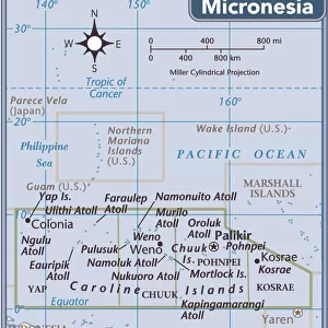
> Oceania
> Federated States of Micronesia
> Maps
> Oceania
> Marshall Islands
> Maps
> Oceania
> Marshall Islands
> Marshall Islands Heritage Sites
> Bikini Atoll Nuclear Test Site
EDITORS COMMENTS
This photograph showcases a remarkable piece of Micronesian artistry and navigational ingenuity. The print features the "Wapepe navigational chart" created in the late 19th century using sticks, coconut fiber, and shells. Measuring at an impressive 78.74x78.74x1.91 cm, this intricate work is housed at the Peabody Essex Museum in Salem, Massachusetts. Crafted by an anonymous artist from Micronesia, specifically the Marshall Islands, this stick chart exemplifies the rich cultural heritage and seafaring expertise of its creators. The delicate arrangement of sticks represents ocean swells and currents while coconut fiber strings depict wave patterns across vast expanses of water. As a tool for navigation, this chart enabled sailors to traverse treacherous waters with astonishing accuracy. By interpreting subtle changes in wave movements and memorizing their corresponding meanings on these charts, seafarers could confidently navigate through uncharted territories. The Wapepe navigational chart not only serves as a testament to human curiosity but also highlights the importance of exploration during that era. It symbolizes mankind's relentless pursuit of knowledge and adventure as they embarked on daring expeditions across Oceania. Jeffrey Dykes' expertly captured photograph immortalizes this extraordinary artifact's beauty and historical significance for all to appreciate. Its inclusion within Fine Art Finder allows enthusiasts worldwide to marvel at its intricacies without having to physically visit the museum. Through this image, we are transported back in time to witness firsthand how ancient civilizations harnessed their surroundings to explore distant lands—a true testament to humanity's enduring spirit of discovery.
MADE IN THE USA
Safe Shipping with 30 Day Money Back Guarantee
FREE PERSONALISATION*
We are proud to offer a range of customisation features including Personalised Captions, Color Filters and Picture Zoom Tools
SECURE PAYMENTS
We happily accept a wide range of payment options so you can pay for the things you need in the way that is most convenient for you
* Options may vary by product and licensing agreement. Zoomed Pictures can be adjusted in the Cart.