
Maps Collection
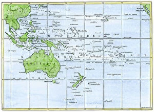
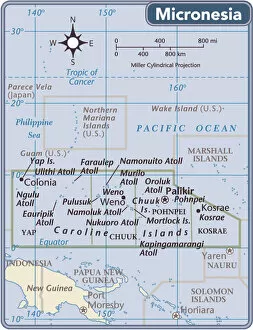
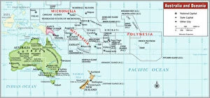
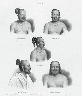
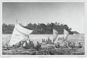
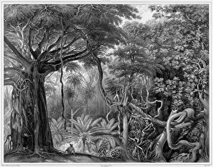
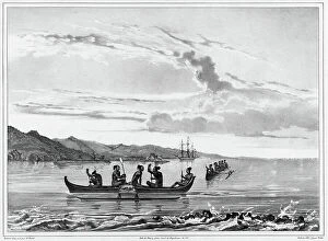
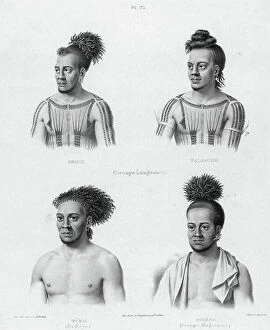
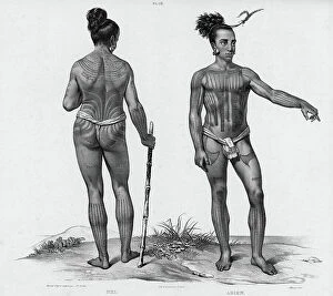
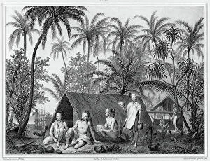
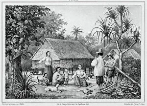
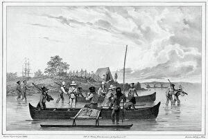
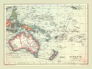
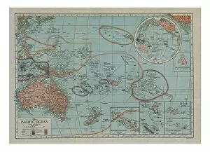
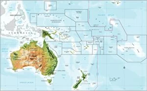
The Federated States of Micronesia is an island nation located in the western Pacific Ocean. It consists of four states: Yap, Chuuk, Pohnpei and Kosrae
Choose a picture from our Maps Collection for your Wall Art and Photo Gifts
34 items


All Professionally Made to Order for Quick Shipping
-
Maps Collection
The Federated States of Micronesia is an island nation located in the western Pacific Ocean. It consists of four states: Yap, Chuuk, Pohnpei and Kosrae. The total land area is 702 km2 and the population is approximately 106,000 people. The country has a tropical climate with temperatures ranging from 25-30°C year round. The main industries are fishing, agriculture and tourism. There are numerous coral reefs surrounding the islands which attract divers from all over the world to explore its vibrant marine life. The capital city of Palikir is located on Pohnpei Island and serves as the center for government activities in Micronesia. English is widely spoken throughout Micronesia making it a popular destination for travelers looking to experience its unique culture and natural beauty without language barriers getting in their way.
+
Our beautiful pictures are available as Framed Prints, Photos, Wall Art and Photo Gifts
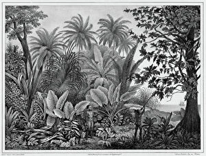
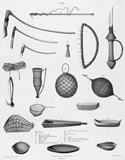
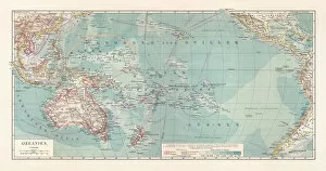
The Maps of Federated States of Micronesia Oceania collection is a stunning assortment of wall art and framed prints offered by Media Storehouse. Our collection features an array of maps that showcase the geography, topography, and landmarks of the Federated States of Micronesia in Oceania. The maps are intricately detailed with vibrant colors that bring to life the beauty and diversity of this region. Each piece in our collection is carefully crafted using high-quality materials to ensure longevity and durability. Whether you're looking for a unique addition to your home decor or want to add some personality to your office space, these maps are sure to impress. From vintage-style maps showcasing historical information about the islands' culture and traditions, to modern-day depictions highlighting its natural wonders like coral reefs, lagoons, and beaches - there's something for everyone in our collection . If you're interested in exploring the rich history and breathtaking landscapes of Micronesia through beautiful artwork, then look no further than our Maps of Federated States of Micronesia Oceania collection.
+
What are Maps of Federated States of Micronesia Oceania art prints?
Maps of Federated States of Micronesia Oceania art prints are high-quality reproductions of maps depicting the geography, topography and landmarks of this beautiful region. These prints are created using advanced printing techniques that capture every detail and color to produce a stunning visual representation of the area. These maps showcase the unique features and characteristics of Federated States of Micronesia Oceania, including its islands, reefs, mountains, rivers and other natural wonders. They also highlight important cultural sites such as historic buildings, monuments and landmarks. Whether you're a history buff or simply appreciate beautiful artwork, these maps make an excellent addition to any home or office decor. They can be used for educational purposes in schools or museums or as decorative pieces in hotels or restaurants. Maps of Federated States of Micronesia Oceania art prints offer a fascinating glimpse into the rich culture and natural beauty found in this part of the world.
+
What Maps of Federated States of Micronesia Oceania art prints can I buy from Media Storehouse?
We offer a wide range of Maps of Federated States of Micronesia Oceania art prints that you can buy. These maps are available in various sizes and styles, including vintage, antique, and modern designs. You can choose from different types of maps such as political maps, physical maps, topographical maps, and more. The Maps of Federated States of Micronesia Oceania art prints available at Media Storehouse are printed on high-quality paper using advanced printing techniques to ensure the best possible image quality. The colors used in these prints are vibrant and long-lasting, ensuring that your map will look great for years to come. Whether you're looking for a decorative piece for your home or office or need a map for educational purposes or research projects, we have something to offer. With our extensive collection of Maps of Federated States of Micronesia Oceania art prints, you're sure to find the perfect one that meets your needs and preferences.
+
How do I buy Maps of Federated States of Micronesia Oceania art prints?
To purchase Maps of Federated States of Micronesia Oceania art prints from Media Storehouse, you can browse our extensive collection online. Simply search for the specific map or artwork that you are interested in and add it to your cart. You may also be able to customize your print by selecting a size or framing option. Once you have added all desired items to your cart, proceed to checkout where you will be prompted to enter your shipping and payment information. After completing the transaction, Media Storehouse will process and ship your order promptly. We offer high-quality art prints created using state-of-the-art printing technology on premium paper stock. Their selection includes a wide range of maps and other artworks from around the world, making it easy for customers to find exactly what they are looking for. Whether for personal use or as a gift, purchasing Maps of Federated States of Micronesia Oceania art prints from Media Storehouse is simple and convenient.
+
How much do Maps of Federated States of Micronesia Oceania art prints cost?
We offer a wide range of art prints featuring maps of Federated States of Micronesia Oceania. Our collection includes high-quality prints that are perfect for adding a touch of elegance to any room in your home or office. While we cannot provide exact pricing information without knowing the specific print you are interested in, our prices are competitive and affordable. We take pride in offering our customers the best possible value for their money, while maintaining the highest standards of quality and customer service. Whether you're looking for a simple black-and-white map or a more colorful and detailed print, we have something to suit every taste and budget. Our art prints make great gifts for anyone who loves travel, geography, or history. So why not browse our selection today and find the perfect map of Federated States of Micronesia Oceania art print to add some style to your space?
+
How will my Maps of Federated States of Micronesia Oceania art prints be delivered to me?
Your Maps of Federated States of Micronesia Oceania art prints will be delivered to you in a secure and timely manner. We take great care in ensuring that your order arrives at your doorstep without any damage or delay. We use trusted delivery partners who have a proven track record of delivering packages safely and efficiently. Once your order is processed, it will be carefully packaged and dispatched for delivery. You can expect to receive regular updates on the status of your shipment via email or text message. Our team is always available to answer any questions you may have about the delivery process. We understand how important it is for our customers to receive their orders promptly, which is why we strive to deliver all orders as quickly as possible while maintaining high standards of quality and safety. With Media Storehouse, you can rest assured that your Maps of Federated States of Micronesia Oceania art prints will arrive at your doorstep in perfect condition.