Home > North America > Mexico > Maps
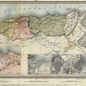
Map of America with sea depth levels along the coasts of Mexico, the Caribbean Islands and the Caribbean. Color lithograph of the 19th century
![]()

Wall Art and Photo Gifts from Fine Art Finder
Map of America with sea depth levels along the coasts of Mexico, the Caribbean Islands and the Caribbean. Color lithograph of the 19th century
NWI4852948 Map of America with sea depth levels along the coasts of Mexico, the Caribbean Islands and the Caribbean. Color lithograph of the 19th century.; (add.info.: Map of America with sea depth levels along the coasts of Mexico, the Caribbean Islands and the Caribbean. Color lithograph of the 19th century.); Photo © North Wind Pictures
Media ID 38479510
© © North Wind Pictures / Bridgeman Images
Atlantic Ocean Caribbean Central America Discovered From America Geographical Map
FEATURES IN THESE COLLECTIONS
> Fine Art Finder
> Artists
> Unknown Artist
> North America
> Mexico
> Maps
> North America
> Mexico
> Related Images
> North America
> United States of America
> Maps
> Popular Themes
> North Island
EDITORS COMMENTS
This stunning 19th-century color lithograph map of America showcases the intricate sea depth levels along the coasts of Mexico, the Caribbean Islands, and the Caribbean. The detailed engraving highlights the varying depths of the Atlantic Ocean with precision and artistry.
As you gaze upon this historical piece, you can't help but be transported back in time to an era when exploration and discovery were at their peak. The vibrant colors bring to life the beauty and complexity of these coastal regions, inviting you to delve deeper into their mysteries.
From the rugged coastlines of Mexico to the idyllic islands of the Caribbean, every detail on this map tells a story of adventure and wonder. It serves as a reminder of how vast and diverse our world truly is, with hidden treasures waiting to be uncovered beneath its shimmering waters.
Whether you're a history buff or simply appreciate fine art, this Map of America is sure to captivate your imagination and inspire your sense of wanderlust. Let it take you on a journey through time and space, revealing new perspectives on familiar landscapes.
MADE IN THE USA
Safe Shipping with 30 Day Money Back Guarantee
FREE PERSONALISATION*
We are proud to offer a range of customisation features including Personalised Captions, Color Filters and Picture Zoom Tools
SECURE PAYMENTS
We happily accept a wide range of payment options so you can pay for the things you need in the way that is most convenient for you
* Options may vary by product and licensing agreement. Zoomed Pictures can be adjusted in the Cart.


