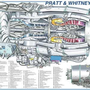
Home > North America > Canada > Maps
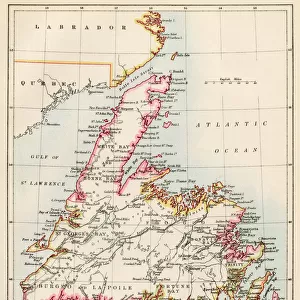
Map of Manitoba and British Columbia, c.1900 (engraving)
")
![]()
Wall Art and Photo Gifts from Fine Art Finder
Map of Manitoba and British Columbia, c.1900 (engraving)
533074 Map of Manitoba and British Columbia, c.1900 (engraving); (add.info.: Map of Manitoba, British Columbia, and the Northwest Territories, Canada, circa 1902, from the 10th edition of Encyclopaedia Britannica.); Encyclopaedia Britannica/UIG
Media ID 38096728
© Encyclopaedia Britannica/UIG / Bridgeman Images
1902 19th Century Style Boundary British Columbia Geographical Border Guidance Illustration Technique Manitoba Navigational Equipment Old Fashioned Part Of Physical Geography The Past Western Script America Continent Canadians
FEATURES IN THESE COLLECTIONS
> Fine Art Finder
> Temp Classification
> North America
> Canada
> Maps
> North America
> Canada
> Related Images
EDITORS COMMENTS
This engraving from the 10th edition of Encyclopaedia Britannica showcases a detailed map of Manitoba, British Columbia, and the Northwest Territories in Canada circa 1902. The intricate cartography and Western script on this vintage print offer a glimpse into the exploration and geographical borders of these regions during the late 19th century.
As we study this historical map, we can imagine the navigational equipment used by early explorers to chart coastlines and boundaries with precision. The illustration technique employed in creating this piece highlights the physical geography of Canada's western provinces, providing valuable insight into their past.
The absence of people in this image allows us to focus solely on the rich history encapsulated within its borders. From sea to land, every detail on this map tells a story of discovery and adventure that shaped the Canadian landscape as we know it today.
Whether you are a history buff or simply appreciate fine art, this print is sure to spark your curiosity about the evolution of cartography and exploration in North America. Displaying this piece in your home will not only add a touch of old-world charm but also serve as a reminder of our collective journey through time.
MADE IN THE USA
Safe Shipping with 30 Day Money Back Guarantee
FREE PERSONALISATION*
We are proud to offer a range of customisation features including Personalised Captions, Color Filters and Picture Zoom Tools
SECURE PAYMENTS
We happily accept a wide range of payment options so you can pay for the things you need in the way that is most convenient for you
* Options may vary by product and licensing agreement. Zoomed Pictures can be adjusted in the Cart.