Fine Art Print > Animals > Mammals > Muridae > Plains Mouse
Fine Art Print : 1 Maps 2 10


![]()
Fine Art Prints from 1x Innovations
1 Maps 2 10
Emiliano Deificus
Media ID 35384766
Brazil Coordinates Emiliano Deificus Framed Latitude Longitude Maps Sao Paulo South America
20"x16" (+3" Border) Fine Art Print
20x16 image printed on 26x22 Fine Art Rag Paper with 3" (76mm) white border. Our Fine Art Prints are printed on 300gsm 100% acid free, PH neutral paper with archival properties. This printing method is used by museums and art collections to exhibit photographs and art reproductions.
Our fine art prints are high-quality prints made using a paper called Photo Rag. This 100% cotton rag fibre paper is known for its exceptional image sharpness, rich colors, and high level of detail, making it a popular choice for professional photographers and artists. Photo rag paper is our clear recommendation for a fine art paper print. If you can afford to spend more on a higher quality paper, then Photo Rag is our clear recommendation for a fine art paper print.
Estimated Image Size (if not cropped) is 40.6cm x 50.8cm (16" x 20")
Estimated Product Size is 55.9cm x 66cm (22" x 26")
These are individually made so all sizes are approximate
Artwork printed orientated as per the preview above, with portrait (vertical) orientation to match the source image.
FEATURES IN THESE COLLECTIONS
> 1x Gallery
> Maps
> Animals
> Mammals
> Muridae
> Plains Mouse
> South America
> Brazil
> Maps
> South America
> Brazil
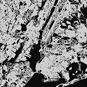
> Related Images
> South America
> Brazil
> Sao Paulo
> South America
> Related Images
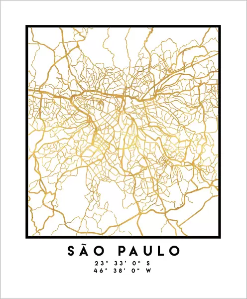
Exploring the Urban Labyrinth of Sao Paulo - A Vibrant Yellow and White Illustrated Map by Emiliano Deificus
EDITORS COMMENTS
Emiliano Deificus' captivating illustrated map, titled "1 Maps 2 10: Sao Paulo," invites viewers to embark on a visual journey through the bustling urban landscape of Sao Paulo, Brazil's largest city. The map, presented in a striking yellow and white color palette against a plain background, is a testament to Deificus' exceptional graphic design skills and his deep appreciation for the complexities of urban environments. The intricate illustration showcases the city's diverse neighborhoods, major landmarks, and thoroughfares, making it an essential tool for both locals and travelers. Longitude and latitude lines crisscross the map, providing coordinates for key locations, while the inclusion of the city's metro system ensures that navigating Sao Paulo's labyrinthine streets becomes an engaging and visually appealing experience. The map's bright yellow and white color scheme not only adds a vibrant pop of color to any space but also creates a sense of clarity and simplicity, making it easy to locate specific areas within the city. The map's clean, graphic design, with its bold lines and minimalist aesthetic, adds to its overall appeal and makes it a standout piece of art in any setting. Framed and ready to hang, this illustrated map of Sao Paulo is more than just a practical tool; it's a beautiful and thoughtful representation of the city's rich history, cultural diversity, and dynamic energy. Whether you're planning a trip to South America or simply looking for a unique and thought-provoking addition to your home or office, "1 Maps 2 10: Sao Paulo" by Emiliano Deificus is an excellent choice.
MADE IN THE USA
Safe Shipping with 30 Day Money Back Guarantee
FREE PERSONALISATION*
We are proud to offer a range of customisation features including Personalised Captions, Color Filters and Picture Zoom Tools
SECURE PAYMENTS
We happily accept a wide range of payment options so you can pay for the things you need in the way that is most convenient for you
* Options may vary by product and licensing agreement. Zoomed Pictures can be adjusted in the Cart.