
Fine Art Print > Maps and Charts > Flat Earth
Fine Art Print : A T-map, 13th century

![]()
Fine Art Prints from Fine Art Finder
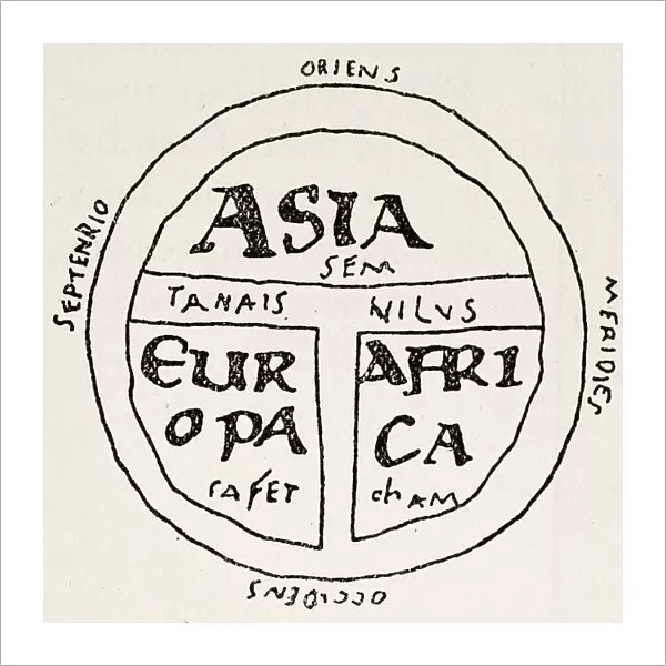
A T-map, 13th century
1578433 A T-map, 13th century; (add.info.: A T-map, showing three known continents on a flat earth projection from the 13th century.); Universal History Archive/UIG
Media ID 38207986
© Universal History Archive/UIG / Bridgeman Images
20"x20" (+3" Border) Fine Art Print
Discover the fascinating world of historical cartography with our Fine Art Print featuring a 13th century T-map. Perfect for adding a touch of vintage charm to any space.
20x20 image printed on 26x26 Fine Art Rag Paper with 3" (76mm) white border. Our Fine Art Prints are printed on 300gsm 100% acid free, PH neutral paper with archival properties. This printing method is used by museums and art collections to exhibit photographs and art reproductions.
Our fine art prints are high-quality prints made using a paper called Photo Rag. This 100% cotton rag fibre paper is known for its exceptional image sharpness, rich colors, and high level of detail, making it a popular choice for professional photographers and artists. Photo rag paper is our clear recommendation for a fine art paper print. If you can afford to spend more on a higher quality paper, then Photo Rag is our clear recommendation for a fine art paper print.
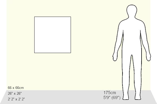
Estimated Image Size (if not cropped) is 50.8cm x 50.8cm (20" x 20")
Estimated Product Size is 66cm x 66cm (26" x 26")
These are individually made so all sizes are approximate
Artwork printed orientated as per the preview above, with landscape (horizontal) or portrait (vertical) orientation to match the source image.
FEATURES IN THESE COLLECTIONS
> Fine Art Finder
> Temp Classification
> Africa
> Related Images
> Maps and Charts
> Flat Earth
> Maps and Charts
> Related Images
EDITORS COMMENTS
This fascinating print captures a T-map from the 13th century, showcasing the known continents of Asia, Africa, and Europe on a flat earth projection. Created during a time of great exploration and discovery, this map offers a glimpse into how medieval cartographers viewed the world around them.
The intricate details and artistic flair of this historical map provide valuable insights into the mindset of explorers during this era. It is evident that they believed in a flat earth model, with each continent depicted in its own unique way.
As we study this T-map closely, we can see the influence of early explorers who ventured out into unknown territories in search of new lands and riches. The lines and markings on the map tell stories of daring journeys across vast oceans and treacherous terrains.
Through this print by Bridgeman Images from Fine Art Finder, we are transported back in time to an age where maps were not just tools for navigation but also works of art that reflected humanity's thirst for knowledge and adventure. It serves as a reminder of how far we have come in our understanding of the world around us while also honoring the legacy left behind by those brave souls who dared to explore beyond their known horizons.
MADE IN THE USA
Safe Shipping with 30 Day Money Back Guarantee
FREE PERSONALISATION*
We are proud to offer a range of customisation features including Personalised Captions, Color Filters and Picture Zoom Tools
SECURE PAYMENTS
We happily accept a wide range of payment options so you can pay for the things you need in the way that is most convenient for you
* Options may vary by product and licensing agreement. Zoomed Pictures can be adjusted in the Cart.


