Fine Art Print > Asia > Iran > Maps
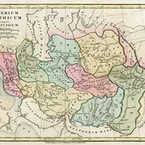
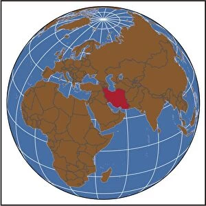
Fine Art Print : Iran Map. Map of Iran showing surrounding countries and bodies of water


![]()
Fine Art Prints from Fine Art Storehouse
Iran Map. Map of Iran showing surrounding countries and bodies of water
Unleash your creativity and transform your space into a visual masterpiece!
Brandon Laufenberg
Media ID 19093335
© Brandon Laufenberg 2018. All rights reserved
20"x16" (+3" Border) Fine Art Print
Discover the rich cultural heritage of Iran with this stunning fine art print by Brandon Laufenberg from Media Storehouse. This intricately detailed map of Iran showcases the country's borders, surrounding countries, and prominent bodies of water. The vibrant colors and meticulous design bring a sense of depth and history to any space. Bring the beauty of the Middle East into your home or office with this exquisite piece of art.
20x16 image printed on 26x22 Fine Art Rag Paper with 3" (76mm) white border. Our Fine Art Prints are printed on 300gsm 100% acid free, PH neutral paper with archival properties. This printing method is used by museums and art collections to exhibit photographs and art reproductions.
Our fine art prints are high-quality prints made using a paper called Photo Rag. This 100% cotton rag fibre paper is known for its exceptional image sharpness, rich colors, and high level of detail, making it a popular choice for professional photographers and artists. Photo rag paper is our clear recommendation for a fine art paper print. If you can afford to spend more on a higher quality paper, then Photo Rag is our clear recommendation for a fine art paper print.
Your artwork will be printed orientated as per the preview above, with landscape (horizontal) or portrait (vertical) orientation to match the source image.
FEATURES IN THESE COLLECTIONS
> Asia
> Iran
> Related Images
> Maps and Charts
> Related Images
> Fine Art Storehouse
> Digital Vision Vectors
> Fine Art Storehouse
> Map
> Reference Maps
EDITORS COMMENTS
This photo print, titled "Iran Map" created by the talented artist Brandon Laufenberg and available at Fine Art Storehouse, beautifully showcases the intricate details of Iran's geography. The map not only highlights the borders of this enchanting country but also provides a glimpse into its surrounding countries and bodies of water. With meticulous precision, Laufenberg has captured every curve and contour of Iran's landmass, allowing viewers to explore its diverse topography. From the rugged mountains that dominate its northern regions to the vast deserts that stretch across central parts, this artwork truly encapsulates Iran's natural beauty. Moreover, this map offers an opportunity for geographical exploration beyond Iran's boundaries. It includes neighboring countries such as Iraq, Afghanistan, Pakistan, Turkey, and Turkmenistan while showcasing major bodies of water like the Caspian Sea and Persian Gulf. This comprehensive representation allows us to appreciate how these geographic features shape Iran's cultural heritage and geopolitical significance in the region. Whether you are an avid traveler seeking inspiration or simply fascinated by cartography artistry, "Iran Map" is sure to captivate your imagination. Its vibrant colors combined with Laufenberg’s attention to detail make it a visually stunning piece that would enhance any space it graces. As you gaze upon this remarkable artwork from Fine Art Storehouse bearing Brandon Laufenberg’s signature style, let yourself be transported on a journey through time and space – exploring both physical landscapes and cultural connections within one frame.
MADE IN THE USA
Safe Shipping with 30 Day Money Back Guarantee
FREE PERSONALISATION*
We are proud to offer a range of customisation features including Personalised Captions, Color Filters and Picture Zoom Tools
SECURE PAYMENTS
We happily accept a wide range of payment options so you can pay for the things you need in the way that is most convenient for you
* Options may vary by product and licensing agreement. Zoomed Pictures can be adjusted in the Cart.