Fine Art Print > Maps and Charts > Americas
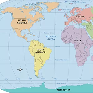
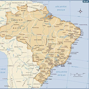
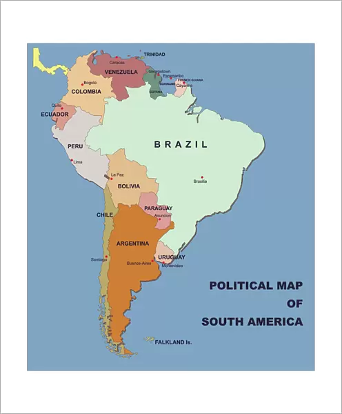
Fine Art Print : political map of south america in vector format


![]()
Fine Art Prints from Fine Art Storehouse
political map of south america in vector format
you can select/edit every state
Unleash your creativity and transform your space into a visual masterpiece!
Media ID 14457461
20"x16" (+3" Border) Fine Art Print
Discover the captivating beauty of politics with our Fine Art Prints from Media Storehouse. This exquisite piece showcases a detailed vector representation of the political map of South America, allowing you to explore every border, every state, and every territory in stunning clarity. Each print is meticulously crafted by our team of talented artists, ensuring the highest quality and authenticity. Add a thought-provoking and visually striking touch to your home or office decor with this unique and intriguing political map of South America. Order now and bring the power of politics into your space.
20x16 image printed on 26x22 Fine Art Rag Paper with 3" (76mm) white border. Our Fine Art Prints are printed on 300gsm 100% acid free, PH neutral paper with archival properties. This printing method is used by museums and art collections to exhibit photographs and art reproductions.
Our fine art prints are high-quality prints made using a paper called Photo Rag. This 100% cotton rag fibre paper is known for its exceptional image sharpness, rich colors, and high level of detail, making it a popular choice for professional photographers and artists. Photo rag paper is our clear recommendation for a fine art paper print. If you can afford to spend more on a higher quality paper, then Photo Rag is our clear recommendation for a fine art paper print.
Estimated Image Size (if not cropped) is 40.6cm x 46.2cm (16" x 18.2")
Estimated Product Size is 55.9cm x 66cm (22" x 26")
These are individually made so all sizes are approximate
Artwork printed orientated as per the preview above, with portrait (vertical) orientation to match the source image.
FEATURES IN THESE COLLECTIONS
> Maps and Charts
> Related Images
> South America
> Related Images
EDITORS COMMENTS
This print showcases a meticulously detailed political map of South America in vector format, offering an immersive and dynamic visual experience. With the ability to select and edit every state, this artwork allows for personalized exploration and analysis of the continent's diverse nations. The vibrant colors and intricate design capture the essence of South America's rich cultural heritage, while also providing a valuable educational resource. Whether you are an avid traveler, a geography enthusiast, or simply curious about this fascinating region, this print offers endless possibilities for discovery. From the towering peaks of the Andes to the lush Amazon rainforest, each state is beautifully represented with precision and accuracy. This art piece serves as both a decorative addition to any space and an informative tool that sparks conversations about history, politics, and regional dynamics. The Fine Art Storehouse has masterfully curated this exceptional print without mentioning commercial use. It invites viewers to appreciate its aesthetic appeal while encouraging them to delve deeper into understanding South America's geopolitical landscape. Perfectly suited for homes, offices, or educational institutions alike; it is sure to captivate minds young and old with its blend of artistic finesse and geographical significance. Embrace the opportunity to explore South America like never before through this remarkable print – an invitation into a world waiting to be discovered!
MADE IN THE USA
Safe Shipping with 30 Day Money Back Guarantee
FREE PERSONALISATION*
We are proud to offer a range of customisation features including Personalised Captions, Color Filters and Picture Zoom Tools
SECURE PAYMENTS
We happily accept a wide range of payment options so you can pay for the things you need in the way that is most convenient for you
* Options may vary by product and licensing agreement. Zoomed Pictures can be adjusted in the Cart.