Fine Art Print > Maps and Charts > Americas
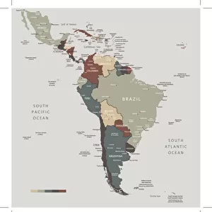
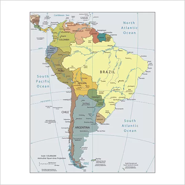
Fine Art Print : Political map of South America

Fine Art Prints from Fine Art Storehouse
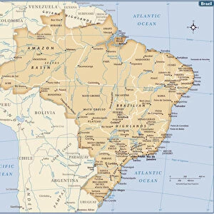
Political map of South America
Vector illustration of the political map of South America
Reference map was created by the US Central Intelligence Agency and is available as a public domain map at the University of Texas Libraries website.
https:/cia.gov/library/publications/resources/the-world-factbook/graphics/ref_maps/political/pdf/south_america.pdf
Unleash your creativity and transform your space into a visual masterpiece!
Media ID 15192876
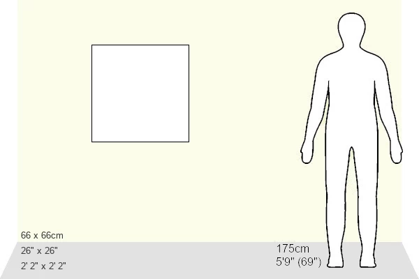
20"x20" (+3" Border) Fine Art Print
Discover the rich cultural and political tapestry of South America with our exquisite Fine Art Print of the Political Map from Media Storehouse. Meticulously crafted as a vector illustration, this masterpiece brings intricate details to life, showcasing the diverse nations and territories that make up this vibrant region. Based on the reference map created by the US Central Intelligence Agency, this print is not just an accurate geographical representation, but also a beautiful work of art that tells a story. Elevate your home or office décor with this captivating addition to your collection.
20x20 image printed on 26x26 Fine Art Rag Paper with 3" (76mm) white border. Our Fine Art Prints are printed on 300gsm 100% acid free, PH neutral paper with archival properties. This printing method is used by museums and art collections to exhibit photographs and art reproductions.
Our fine art prints are high-quality prints made using a paper called Photo Rag. This 100% cotton rag fibre paper is known for its exceptional image sharpness, rich colors, and high level of detail, making it a popular choice for professional photographers and artists. Photo rag paper is our clear recommendation for a fine art paper print. If you can afford to spend more on a higher quality paper, then Photo Rag is our clear recommendation for a fine art paper print.
Estimated Image Size (if not cropped) is 50.8cm x 50.8cm (20" x 20")
Estimated Product Size is 66cm x 66cm (26" x 26")
These are individually made so all sizes are approximate
Artwork printed orientated as per the preview above, with landscape (horizontal) or portrait (vertical) orientation to match the source image.
FEATURES IN THESE COLLECTIONS
> Maps and Charts
> Popular Maps
> Maps and Charts
> Related Images
> Maps and Charts
> World
> South America
> Related Images
> Fine Art Storehouse
> Map
> Reference Maps
EDITORS COMMENTS
This print showcases the intricate details of a political map of South America, rendered in stunning vector illustration. The artist's meticulous craftsmanship brings to life the diverse countries and territories that make up this vibrant continent. Derived from a reference map created by the US Central Intelligence Agency, this artwork is an accurate representation of South America's geopolitical landscape. With its rich colors and precise lines, it offers an engaging visual exploration of the region's boundaries, capital cities, and major landmarks. The inclusion of this particular reference map adds credibility to the accuracy and authenticity of this artwork. As a public domain map available at the University of Texas Libraries website, it serves as a trusted source for cartographic information. Whether you are an avid traveler or simply fascinated by geography, this print is sure to captivate your imagination. Hang it on your wall or display it in your study area to spark conversations about South America's cultural diversity and political dynamics
MADE IN THE USA
Safe Shipping with 30 Day Money Back Guarantee
FREE PERSONALISATION*
We are proud to offer a range of customisation features including Personalised Captions, Color Filters and Picture Zoom Tools
SECURE PAYMENTS
We happily accept a wide range of payment options so you can pay for the things you need in the way that is most convenient for you
* Options may vary by product and licensing agreement. Zoomed Pictures can be adjusted in the Cart.