Fine Art Print > Europe > United Kingdom > Wales > Maps
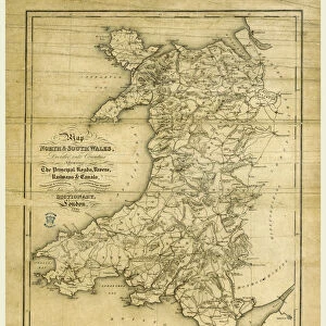
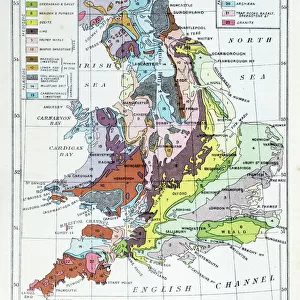
Fine Art Print : Map / England & Wales 1857


![]()
Fine Art Prints from Mary Evans Picture Library
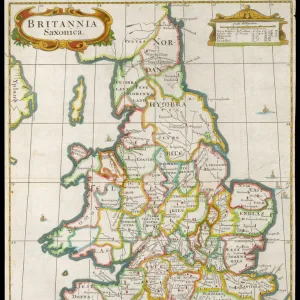
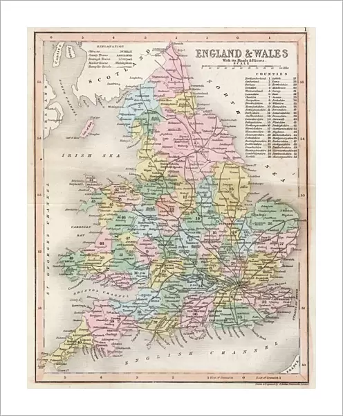
Map / England & Wales 1857
Map of England and Wales showing roads and rivers Date: circa 1857
Mary Evans Picture Library makes available wonderful images created for people to enjoy over the centuries
Media ID 14291473
© Mary Evans Picture Library
20"x16" (+3" Border) Fine Art Print
Discover the rich history of England and Wales with our exquisite Fine Art Print from Media Storehouse, featuring an intricately detailed map dating back to circa 1857. This captivating piece, sourced from Mary Evans Prints Online, showcases the roads and rivers of the time, offering a glimpse into the past. Perfect for history enthusiasts, map collectors, or those looking to add a touch of vintage charm to their home or office decor. Our Fine Art Prints are available in various formats, including high-quality prints and digital downloads, ensuring there's an option to suit every preference. Experience the beauty and history of this map like never before with Media Storehouse.
20x16 image printed on 26x22 Fine Art Rag Paper with 3" (76mm) white border. Our Fine Art Prints are printed on 300gsm 100% acid free, PH neutral paper with archival properties. This printing method is used by museums and art collections to exhibit photographs and art reproductions.
Our fine art prints are high-quality prints made using a paper called Photo Rag. This 100% cotton rag fibre paper is known for its exceptional image sharpness, rich colors, and high level of detail, making it a popular choice for professional photographers and artists. Photo rag paper is our clear recommendation for a fine art paper print. If you can afford to spend more on a higher quality paper, then Photo Rag is our clear recommendation for a fine art paper print.
Estimated Image Size (if not cropped) is 40.6cm x 50.8cm (16" x 20")
Estimated Product Size is 55.9cm x 66cm (22" x 26")
These are individually made so all sizes are approximate
Artwork printed orientated as per the preview above, with portrait (vertical) orientation to match the source image.
FEATURES IN THESE COLLECTIONS
> Arts
> Landscape paintings
> Waterfall and river artworks
> River artworks
> Europe
> United Kingdom
> England
> Maps
> Europe
> United Kingdom
> England
> Posters
> Europe
> United Kingdom
> England
> Rivers
> Europe
> United Kingdom
> Wales
> Maps
> Europe
> United Kingdom
> Wales
> Posters
> Europe
> United Kingdom
> Wales
> Related Images
> Europe
> United Kingdom
> Wales
> Rivers
> Maps and Charts
> Related Images
> Maps and Charts
> Wales
MADE IN THE USA
Safe Shipping with 30 Day Money Back Guarantee
FREE PERSONALISATION*
We are proud to offer a range of customisation features including Personalised Captions, Color Filters and Picture Zoom Tools
SECURE PAYMENTS
We happily accept a wide range of payment options so you can pay for the things you need in the way that is most convenient for you
* Options may vary by product and licensing agreement. Zoomed Pictures can be adjusted in the Cart.