Fine Art Print > Aerial Photography > Africa
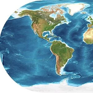
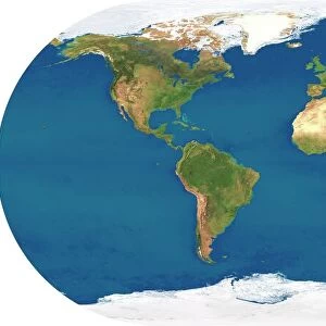
Fine Art Print : Earth, topographic and bathymetric map

![]()
Fine Art Prints from Science Photo Library
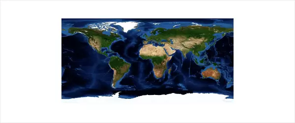
Earth, topographic and bathymetric map
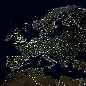
Earth. Blue Marble: Next Generation cloud-free topographic and bathymetric map of the Earth in July 2004. Highlands and lowlands of the continents are shown as ridges and flat areas, with Arctic and Antarctic ice in white. The seabed depth varies from shallow (light blue) on the continental shelves, to deep ocean basins (dark blue). Topographic and bathymetric data is usually gathered by using aerial and satellite imagery combined with radar and sonar mapping. Landcover data is from NASAs Moderate Resolution Imaging Spectroradiometer (MODIS) sensor aboard the Terra satellite
Science Photo Library features Science and Medical images including photos and illustrations
Media ID 6328989
© NASA/SCIENCE PHOTO LIBRARY
Africa Altimetric Altimetry Bathymetric Bathymetry Blue Marble Composite Continent Continental Shelf Continents Depth Earth Observation Flat Projection From Space Global Height Highlands Land Lowlands Mapped Modis Mountains Nasa Next Generation Oceanic Oceanographic Oceanography Pacific Ocean Physical Geography Plains Radar Ridge Satellite Satellite Image Sea Bed Sea Floor Shelves Sonar Mapping Terra Topographic Topography Whole Earth World
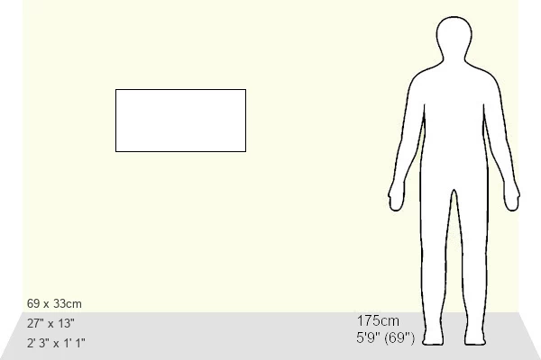
20"x20" (+3" Border) Fine Art Print
21x7 image printed on 27x13 Fine Art Rag Paper with 3" (76mm) white border. Our Fine Art Prints are printed on 300gsm 100% acid free, PH neutral paper with archival properties. This printing method is used by museums and art collections to exhibit photographs and art reproductions.
Our fine art prints are high-quality prints made using a paper called Photo Rag. This 100% cotton rag fibre paper is known for its exceptional image sharpness, rich colors, and high level of detail, making it a popular choice for professional photographers and artists. Photo rag paper is our clear recommendation for a fine art paper print. If you can afford to spend more on a higher quality paper, then Photo Rag is our clear recommendation for a fine art paper print.
Estimated Image Size (if not cropped) is 35.4cm x 17.7cm (13.9" x 7")
Estimated Product Size is 68.6cm x 33cm (27" x 13")
These are individually made so all sizes are approximate
Artwork printed orientated as per the preview above, with landscape (horizontal) orientation to match the source image.
FEATURES IN THESE COLLECTIONS
> Aerial Photography
> Related Images
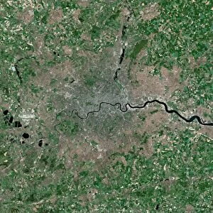
> Africa
> Related Images
> Animals
> Mammals
> Muridae
> Plains Mouse
> Arts
> Artists
> O
> Oceanic Oceanic
> Europe
> France
> Canton
> Landes
> Europe
> United Kingdom
> Scotland
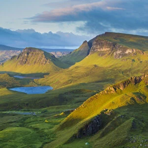
> Highlands
> Related Images
> Maps and Charts
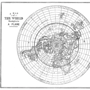
> Flat Earth
> Maps and Charts
> Related Images
> Science Photo Library
> Aerial and Satellite
MADE IN THE USA
Safe Shipping with 30 Day Money Back Guarantee
FREE PERSONALISATION*
We are proud to offer a range of customisation features including Personalised Captions, Color Filters and Picture Zoom Tools
SECURE PAYMENTS
We happily accept a wide range of payment options so you can pay for the things you need in the way that is most convenient for you
* Options may vary by product and licensing agreement. Zoomed Pictures can be adjusted in the Cart.