Home > Maps and Charts > Early Maps
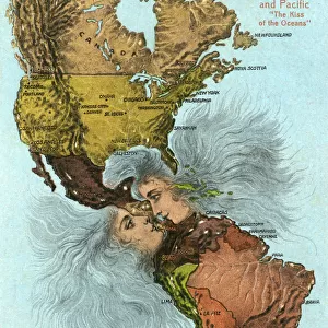
Antique French map of Indian Ocean

![]()
Wall Art and Photo Gifts from Fine Art Storehouse
Antique French map of Indian Ocean
Unleash your creativity and transform your space into a visual masterpiece!
ilbusca
Media ID 24348381
FEATURES IN THESE COLLECTIONS
> Fine Art Storehouse
> Map
> Historical Maps
> Maps and Charts
> Early Maps
EDITORS COMMENTS
This print showcases an exquisite Antique French map of the Indian Ocean, a true testament to the artistry and historical significance of cartography. Crafted with meticulous detail, this vintage map takes us on a journey back in time, offering a glimpse into the exploration and navigation techniques of yesteryears. The delicate lines and intricate illustrations on this map effortlessly transport us to an era when seafarers embarked on daring voyages across uncharted waters. Every curve and contour of the coastlines is intricately etched, while tiny ships gracefully dot the vast expanse of blue that represents the ocean itself. The names of far-flung islands and coastal cities are elegantly inscribed, evoking a sense of wonder about these distant lands waiting to be discovered. As we gaze upon this remarkable piece, we can almost feel the excitement that must have filled sailors' hearts as they set sail towards unknown horizons. It serves as a reminder not only of our shared human curiosity but also highlights how maps were once cherished works of art themselves. Whether you are an avid history enthusiast or simply appreciate fine craftsmanship, this Antique French map print is sure to captivate your imagination. Hang it proudly in your home or office space as a timeless tribute to both artistic mastery and our enduring fascination with exploring new frontiers.
MADE IN THE USA
Safe Shipping with 30 Day Money Back Guarantee
FREE PERSONALISATION*
We are proud to offer a range of customisation features including Personalised Captions, Color Filters and Picture Zoom Tools
SECURE PAYMENTS
We happily accept a wide range of payment options so you can pay for the things you need in the way that is most convenient for you
* Options may vary by product and licensing agreement. Zoomed Pictures can be adjusted in the Cart.