Framed Print > Europe > France > Canton > Landes
Framed Print : Antique Double-Hemisphere World Map, 1686 (coloured coloured engraving


![]()
Framed Photos from Fine Art Finder
Antique Double-Hemisphere World Map, 1686 (coloured coloured engraving
2630127 Antique Double-Hemisphere World Map, 1686 (coloured coloured engraving by Bormeester, Joachim (d.1702); Private Collection; (add.info.: Antique double-hemisphere world map (Nova Totius Terrarum Orbis Tabula) by Joachim Bormeester (Netherlands, d. 1702); hand-colored engraving, 1686.); Photo eGraphicaArtis; Dutch, out of copyright
Media ID 22760270
© GraphicaArtis / Bridgeman Images
1680s Globe Hand Colored Hemisphere Mapmaker Mapmaking
12"x10" Modern Frame
Step back in time with our exquisite range of Framed Antique Prints, featuring this stunning Double-Hemisphere World Map from 1686. Meticulously crafted by Joachim Bormeester and beautifully colored by Bridgeman Images, this collector's item transports you to a bygone era. The intricate details of the map, showcasing the known world at the time, are sure to captivate and inspire. Add an air of sophistication and historical charm to your space with this authentic, museum-quality framed print.
10x8 Print in an MDF Wooden Frame with 180 gsm Satin Finish Paper. Glazed using shatter proof thin plexi glass. Frame thickness is 1 inch and depth 0.75 inch. Fluted cardboard backing held with clips. Supplied ready to hang with sawtooth hanger and rubber bumpers. Spot clean with a damp cloth. Packaged foam wrapped in a card.
Contemporary Framed and Mounted Prints - Professionally Made and Ready to Hang
Estimated Image Size (if not cropped) is 25.4cm x 25.4cm (10" x 10")
Estimated Product Size is 30.5cm x 25.4cm (12" x 10")
These are individually made so all sizes are approximate
Artwork printed orientated as per the preview above, with landscape (horizontal) or portrait (vertical) orientation to match the source image.
FEATURES IN THESE COLLECTIONS
> Fine Art Finder
> Artists
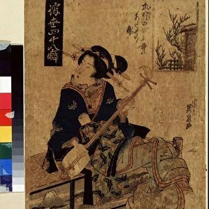
> Kikukawa Eizan
> Europe
> France
> Canton
> Landes
> Europe
> Netherlands
> Maps
> Europe
> Netherlands
> Posters
> Europe
> Netherlands
> Related Images
> Maps and Charts
> Netherlands
> Maps and Charts
> World
EDITORS COMMENTS
This print showcases an exquisite Antique Double-Hemisphere World Map from the year 1686. Created by the talented mapmaker Joachim Bormeester, this hand-colored engraving is a true masterpiece of cartography. The level of detail and precision in this map is truly remarkable, showcasing Bormeester's skill and expertise. The map depicts the entire world in two hemispheres, providing a comprehensive view of the continents, oceans, and various landmarks known at that time. Each region is meticulously illustrated with vibrant colors, allowing viewers to immerse themselves in the rich history of exploration and discovery. As we gaze upon this antique treasure, we are transported back to a time when maps were not just navigational tools but works of art. The intricate engravings capture our imagination as we marvel at the vastness of our planet and ponder on how much has changed since then. This print serves as a window into history, offering us a glimpse into the past while reminding us of humanity's insatiable curiosity about the world around us. It is a testament to both Bormeester's talent as well as our enduring fascination with maps and their ability to connect us to distant lands and cultures. Whether you are an avid collector or simply appreciate fine art, this Antique Double-Hemisphere World Map will undoubtedly add depth and beauty to any space it graces.
MADE IN THE USA
Safe Shipping with 30 Day Money Back Guarantee
FREE PERSONALISATION*
We are proud to offer a range of customisation features including Personalised Captions, Color Filters and Picture Zoom Tools
SECURE PAYMENTS
We happily accept a wide range of payment options so you can pay for the things you need in the way that is most convenient for you
* Options may vary by product and licensing agreement. Zoomed Pictures can be adjusted in the Cart.