Framed Print > Fine Art Storehouse > Map
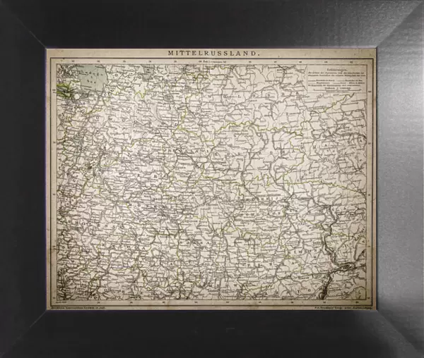
Framed Print : Central Russia


![]()
Framed Photos from Fine Art Storehouse
Central Russia
Unleash your creativity and transform your space into a visual masterpiece!
Nastasic
Media ID 13593297
© Nikola Nastasic
1830 1839 78279 95839 Baltic Countries Baltic Sea Biological Culture Black Sea Chart Crimea Eastern Europe Equipment Geographical Locations Image Created 1830 1839 Image Date Midsection Moscow Moscow Russia Navigational Equipment Provinces Russia Russian Culture South Caucasus Styles Ukraine Image Created 19th Century Novgorod Obsolete Retro Styled Transcaucasia Victorian Style Volgograd
12"x10" Modern Frame
10x8 Print in an MDF Wooden Frame with 180 gsm Satin Finish Paper. Glazed using shatter proof thin plexi glass. Frame thickness is 1 inch and depth 0.75 inch. Fluted cardboard backing held with clips. Supplied ready to hang with sawtooth hanger and rubber bumpers. Spot clean with a damp cloth. Packaged foam wrapped in a card.
Contemporary Framed and Mounted Prints - Professionally Made and Ready to Hang
Estimated Image Size (if not cropped) is 25.4cm x 25.4cm (10" x 10")
Estimated Product Size is 30.5cm x 25.4cm (12" x 10")
These are individually made so all sizes are approximate
Artwork printed orientated as per the preview above, with landscape (horizontal) or portrait (vertical) orientation to match the source image.
FEATURES IN THESE COLLECTIONS
> Fine Art Storehouse
> The Magical World of Illustration
> Nastasic Images & Illustrations
> Fine Art Storehouse
> Map
> Historical Maps
EDITORS COMMENTS
This print takes us back in time to the 19th century, showcasing Central Russia in all its glory. The retro-styled cartography transports us to an era when navigational equipment and hand-drawn maps were the norm. Created between 1830 and 1839, this antique image captures a snapshot of Russian culture during that period. The map encompasses various geographical locations, from Novgorod to Volgograd, stretching across the Baltic Sea and reaching into Transcaucasia. It serves as a reminder of the rich history and diverse cultures that have shaped this region over centuries. With its Victorian-style illustration and obsolete charm, this print evokes a sense of nostalgia for the past. It offers a glimpse into a bygone era when Crimea was part of Ukraine and Moscow stood as the capital city of Russia. As we explore every intricate detail on this horizontal chart, we are reminded of how far our world has come in terms of technological advancements. Yet, it is also a testament to the enduring beauty found within historical artifacts. Whether you are an avid collector or simply appreciate art with historical significance, this print by Nastasic is sure to transport you back in time while celebrating the cultural heritage embedded within Central Russia's provinces.
MADE IN THE USA
Safe Shipping with 30 Day Money Back Guarantee
FREE PERSONALISATION*
We are proud to offer a range of customisation features including Personalised Captions, Color Filters and Picture Zoom Tools
SECURE PAYMENTS
We happily accept a wide range of payment options so you can pay for the things you need in the way that is most convenient for you
* Options may vary by product and licensing agreement. Zoomed Pictures can be adjusted in the Cart.