Framed Print > North America > Belize > Maps
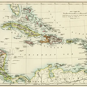
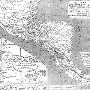
Framed Print : Antique Map of Central America and West Indes


![]()
Framed Photos from Fine Art Storehouse
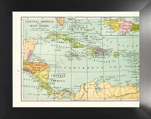
Antique Map of Central America and West Indes
Vintage map of Central America and West Indes, from 1894
Unleash your creativity and transform your space into a visual masterpiece!
duncan1890
Media ID 14898579
© duncan1890
Antilles Bahamas Belize Caribbean Caribbean Sea Cayman Islands Central America Cuba Greater Antilles Guatemala Hispaniola Image Created 1890 1899 Jamaica Navigational Equipment Nicaragua Panama Past Puerto Rico Retro Revival The Americas Turks And Caicos Islands West Indies Image Created 19th Century Obsolete
18"x14" Modern Frame
Step back in time with our exquisite Framed Print of an Antique Map of Central America and the West Indies by duncan1890 from the Media Storehouse Fine Art collection. This beautifully preserved vintage map, originally published in 1894, showcases the historical geography of the region with intricate detail. The rich patina and authentic aging adds to the timeless charm, making it a captivating addition to any home or office decor. Bring a piece of history into your space and ignite conversations with this stunning piece of art.
16x12 Print in an MDF Wooden Frame with 180 gsm Satin Finish Paper. Glazed using shatter proof thin plexiglass. Frame thickness is 1 inch and depth 0.75 inch. Fluted cardboard backing held with clips. Supplied ready to hang with sawtooth hanger and rubber bumpers. Spot clean with a damp cloth. Packaged foam wrapped in a card.
Contemporary Framed and Mounted Prints - Professionally Made and Ready to Hang
Estimated Image Size (if not cropped) is 40.6cm x 35.6cm (16" x 14")
Estimated Product Size is 45.7cm x 35.6cm (18" x 14")
These are individually made so all sizes are approximate
Artwork printed orientated as per the preview above, with landscape (horizontal) orientation to match the source image.
FEATURES IN THESE COLLECTIONS
> Fine Art Storehouse
> Map
> Historical Maps
> Maps and Charts
> Related Images
> North America
> The Bahamas
> Maps
> North America
> The Bahamas
> Related Images
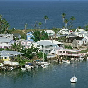
> North America
> Belize
> Maps
> North America
> Belize
> Related Images
> North America
> Cuba
> Maps
> North America
> Cuba
> Related Images
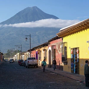
> North America
> Guatemala
> Maps
> North America
> Guatemala
> Related Images
EDITORS COMMENTS
This print showcases an exquisite Antique Map of Central America and West Indes, originating from the year 1894. With its distinct cartography style and retro revival charm, this piece takes us back to the 19th century era of exploration and discovery. The image beautifully captures the essence of Labadee, a place frozen in time where history unfolds. As we delve into this vintage map, we are transported through time to explore the long-forgotten territories of the Antilles, Turks and Caicos Islands, Belize, Panama, Nicaragua, Guatemala, Bahamas, Puerto Rico, Cuba, Hispaniola (Haiti and Dominican Republic), Jamaica - all part of Greater Antilles. We also catch a glimpse of the enchanting Cayman Islands nestled within the vast expanse known as West Indies or Caribbean. The intricate details on this antique map not only depict geographical boundaries but also offer insights into past civilizations that once thrived in these lands. It serves as a window to bygone times when navigational equipment was essential for seafarers venturing across the Caribbean Sea. Duncan1890's skillful preservation has allowed us to appreciate this historical artifact that represents both artistry and scientific precision. This print is more than just an image; it is a testament to our fascination with history and our desire to connect with our roots in The Americas.
MADE IN THE USA
Safe Shipping with 30 Day Money Back Guarantee
FREE PERSONALISATION*
We are proud to offer a range of customisation features including Personalised Captions, Color Filters and Picture Zoom Tools
SECURE PAYMENTS
We happily accept a wide range of payment options so you can pay for the things you need in the way that is most convenient for you
* Options may vary by product and licensing agreement. Zoomed Pictures can be adjusted in the Cart.