Framed Print > Fine Art Storehouse > Map
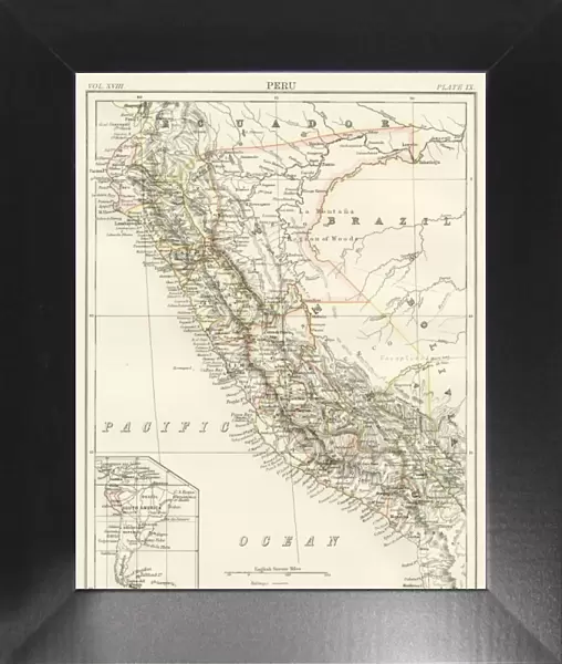
Framed Print : Peru map 1885


![]()
Framed Photos from Fine Art Storehouse
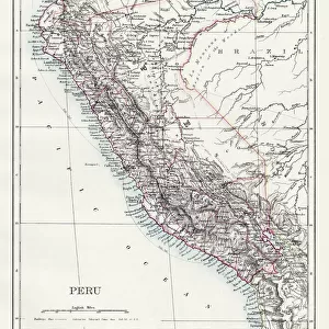
Peru map 1885
Encyclopedia Britannica 9th Edition New York Charles Scribners and Sons 1885 Vol XVIII
Unleash your creativity and transform your space into a visual masterpiece!
THEPALMER
Media ID 14756626
© This content is subject to copyright
Bolivia Brazil Ecuador Pacific Ocean Peru
12"x10" Modern Frame
Step back in time with our exquisite 'Peru Map 1885' Framed Print from ThePalmer, part of our Media Storehouse Fine Art Collection. This antique map, originally published in the Encyclopedia Britannica 9th Edition by Charles Scribner's Sons in New York, offers a captivating glimpse into the cartography of the late 19th century. The intricate details and historical accuracy make this a stunning addition to any home or office. Each print is carefully framed and ready to hang, preserving the rich history and beauty of this rare map for generations to come.
10x8 Print in an MDF Wooden Frame with 180 gsm Satin Finish Paper. Glazed using shatter proof thin plexi glass. Frame thickness is 1 inch and depth 0.75 inch. Fluted cardboard backing held with clips. Supplied ready to hang with sawtooth hanger and rubber bumpers. Spot clean with a damp cloth. Packaged foam wrapped in a card.
Contemporary Framed and Mounted Prints - Professionally Made and Ready to Hang
Estimated Image Size (if not cropped) is 25.4cm x 25.4cm (10" x 10")
Estimated Product Size is 25.4cm x 30.5cm (10" x 12")
These are individually made so all sizes are approximate
Artwork printed orientated as per the preview above, with landscape (horizontal) or portrait (vertical) orientation to match the source image.
FEATURES IN THESE COLLECTIONS
> Fine Art Storehouse
> Map
> Historical Maps
EDITORS COMMENTS
In this print titled "Peru map 1885" we are transported back in time to the late 19th century, where cartography was a true art form. This particular piece is an exquisite representation of a map from the Encyclopedia Britannica's 9th Edition, published in New York by Charles Scribners and Sons in 1885. The intricate details and meticulous craftsmanship showcased in this vintage map take us on a journey through Peru, Bolivia, Brazil, Ecuador, and their surrounding regions. The artist behind this masterpiece has skillfully captured the geographical features of these South American countries with utmost precision. As we delve into the image, our eyes are drawn to the vibrant colors that bring life to each contour line and boundary. The sprawling Pacific Ocean serves as a majestic backdrop for these lands rich in history and culture. "ThePalmer" - an enigmatic name that adds an air of mystery to this artwork - invites us to explore not only the physical landscape but also its historical significance. It reminds us of how maps have always been essential tools for exploration, understanding our world better, and fostering connections between different cultures. This remarkable print from Fine Art Storehouse is more than just a decorative piece; it is a window into another era – one that allows us to appreciate both the beauty of nature's creations and human ingenuity.
MADE IN THE USA
Safe Shipping with 30 Day Money Back Guarantee
FREE PERSONALISATION*
We are proud to offer a range of customisation features including Personalised Captions, Color Filters and Picture Zoom Tools
SECURE PAYMENTS
We happily accept a wide range of payment options so you can pay for the things you need in the way that is most convenient for you
* Options may vary by product and licensing agreement. Zoomed Pictures can be adjusted in the Cart.