Framed Print > Animals > Fishes > R > Rock Cod
Framed Print : MA Barnstable Orleans Vector Road Map


![]()
Framed Photos from Fine Art Storehouse
MA Barnstable Orleans Vector Road Map
MA Barnstable Orleans Vector Road Map. All source data is in the public domain. U.S. Census Bureau Census Tiger. Used Layers: areawater, linearwater, roads, rails, cousub, pointlm, uac10
Unleash your creativity and transform your space into a visual masterpiece!
Frank Ramspott
Media ID 20688383
© Frank Ramspott, all rights reserved
Atlantic Ocean Barnstable Cape Cod City Map Computer Graphic County Digital Composite District Geographical Border Harbor Massachusetts Road Map Text Vector Digitally Generated Image Orleans Pleasant Bay Rock Harbor
12"x10" Modern Frame
Discover the unique charm of the MA Barnstable Orleans Vector Road Map by Frank Ramspott, now available as a stunning Framed Print from Media Storehouse. This intricately detailed map, featuring the scenic towns of Barnstable and Orleans in Massachusetts, is meticulously crafted using public domain data from the U.S. Census Bureau Census Tiger. Each line, curve, and point is rendered with precision, showcasing the beauty and complexity of the region's roads, waterways, and landmarks. Bring a piece of New England history and character into your home or office with this distinctive and captivating Framed Print from Fine Art Storehouse by Media Storehouse.
10x8 Print in an MDF Wooden Frame with 180 gsm Satin Finish Paper. Glazed using shatter proof thin plexi glass. Frame thickness is 1 inch and depth 0.75 inch. Fluted cardboard backing held with clips. Supplied ready to hang with sawtooth hanger and rubber bumpers. Spot clean with a damp cloth. Packaged foam wrapped in a card.
Contemporary Framed and Mounted Prints - Professionally Made and Ready to Hang
Estimated Image Size (if not cropped) is 25.4cm x 25.4cm (10" x 10")
Estimated Product Size is 25.4cm x 30.5cm (10" x 12")
These are individually made so all sizes are approximate
Artwork printed orientated as per the preview above, with landscape (horizontal) or portrait (vertical) orientation to match the source image.
FEATURES IN THESE COLLECTIONS
> Fine Art Storehouse
> Map
> Reference Maps
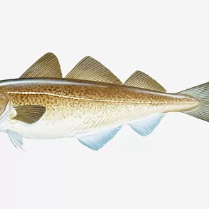
> Animals
> Fishes
> A
> Atlantic Cod
> Animals
> Fishes
> R
> Rock Cod
> Animals
> Mammals
> Cats (Wild)
> Tiger
> Arts
> Artists
> O
> Oceanic Oceanic
> Arts
> Contemporary art
> Digital artwork
> Street art
> Arts
> Street art graffiti
> Digital art
> Digital paintings
> Maps and Charts
> Related Images
> Popular Themes
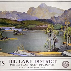
> Lake District
EDITORS COMMENTS
This print showcases the MA Barnstable Orleans Vector Road Map, a stunning piece of cartography art. Created by Frank Ramspott, this digitally generated image is a testament to his exceptional design skills and attention to detail. The map encompasses various layers sourced from public domain data, including areawater, linearwater, roads, rails, cousub, pointlm, and uac10. It beautifully highlights the physical geography of Massachusetts' Barnstable County district with vibrant colors and precise vector lines. In this color image devoid of people but rich in information, you can explore the intricate network of streets and roads that connect towns like Orleans with neighboring areas such as Namskaket and Rock Harbor. The map also showcases prominent geographical features like Tonset Bay and Pleasant Bay along Cape Cod's picturesque coastline. With its digital composite nature and expertly crafted graphical elements, this print serves as both an aesthetic delight for art enthusiasts and a practical tool for those seeking navigation assistance or studying the region's layout. Its inclusion of text labels ensures easy identification of rivers, lakes, harbors, beaches (such as Nauset Beach Dunes), town coves (like Town Cove), and even Tawasentha Hill. Whether you're a fan of maps or simply appreciate visually striking compositions inspired by real-world locations like Barnstable Orleans in Massachusetts' scenic landscape—this artwork is sure to captivate your imagination.
MADE IN THE USA
Safe Shipping with 30 Day Money Back Guarantee
FREE PERSONALISATION*
We are proud to offer a range of customisation features including Personalised Captions, Color Filters and Picture Zoom Tools
SECURE PAYMENTS
We happily accept a wide range of payment options so you can pay for the things you need in the way that is most convenient for you
* Options may vary by product and licensing agreement. Zoomed Pictures can be adjusted in the Cart.