Framed Print > Europe > Italy > Maps
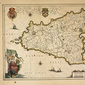
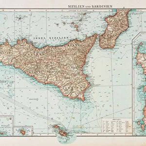
Framed Print : Sicily map 1895


Framed Photos from Fine Art Storehouse
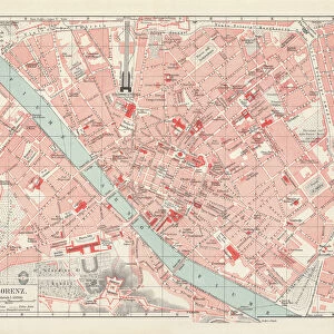
Sicily map 1895
Meyers Konversations-Lexikon. Ein Nachschlagewerk des allgemeinen Wissens, 5th edition 17 volumes Bibliographisches Institut - Leipzig 1895-1897
Unleash your creativity and transform your space into a visual masterpiece!
THEPALMER
Media ID 13609329
© This content is subject to copyright
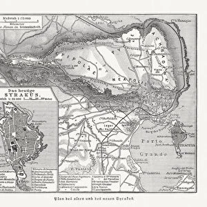
Island Mediterranean Mediterranean Sea Sicily
12"x10" Modern Frame
Introducing the Sicily Map 1895 Framed Print from Media Storehouse's Fine Art Storehouse collection. This exquisite piece showcases a detailed and captivating map of Sicily, taken from the renowned Meyers Konversations-Lexikon, 5th edition published by Bibliographisches Institut in 1895-1897. The intricate cartography of this antique map transports you back in time, offering a glimpse into the historical geography of Sicily over a century ago. With its rich, vintage aesthetic, this framed print adds a touch of timeless elegance to any room, making it a perfect addition to your home or office décor. Embrace the charm of the past with the Sicily Map 1895 Framed Print from Media Storehouse.
10x8 Print in an MDF Wooden Frame with 180 gsm Satin Finish Paper. Glazed using shatter proof thin plexi glass. Frame thickness is 1 inch and depth 0.75 inch. Fluted cardboard backing held with clips. Supplied ready to hang with sawtooth hanger and rubber bumpers. Spot clean with a damp cloth. Packaged foam wrapped in a card.
Contemporary Framed and Mounted Prints - Professionally Made and Ready to Hang
Estimated Image Size (if not cropped) is 25.4cm x 25.4cm (10" x 10")
Estimated Product Size is 30.5cm x 25.4cm (12" x 10")
These are individually made so all sizes are approximate
Artwork printed orientated as per the preview above, with landscape (horizontal) or portrait (vertical) orientation to match the source image.
FEATURES IN THESE COLLECTIONS
> Fine Art Storehouse
> Map
> Historical Maps
> Fine Art Storehouse
> Map
> Italian Maps
> Fine Art Storehouse
> Top Sellers - Art Prints
> Europe
> Italy
> Related Images
> Europe
> Italy
> Sicily
> Related Images
> Maps and Charts
> Italy
> Maps and Charts
> Related Images
EDITORS COMMENTS
This print showcases a historical gem, the "Sicily map 1895" from Meyers Konversations-Lexikon. A true testament to the rich tapestry of knowledge and artistry, this piece is an exquisite representation of cartography at its finest. The map takes us back in time to the late 19th century when Sicily's allure was already well-known. With intricate details etched onto its surface, it offers a glimpse into the island's physical geography and highlights its position in the Mediterranean Sea. Engraved with precision and care, this antique illustration transports us to a bygone era where maps were meticulously crafted works of art. The delicate lines and fine etchings bring forth a sense of nostalgia that only vintage pieces can evoke. As we gaze upon this horizontal masterpiece, our imagination wanders through Sicily's picturesque landscapes - from rugged mountains to stunning coastlines bathed by the azure Mediterranean waters. It serves as both an educational tool for understanding past civilizations and an aesthetic delight for those who appreciate beauty in all forms. "The Palmer" an artist whose name graces this remarkable print, has skillfully preserved history through their lens. This photograph captures not just a map but also the essence of exploration and discovery that lies within every corner of Sicily.
MADE IN THE USA
Safe Shipping with 30 Day Money Back Guarantee
FREE PERSONALISATION*
We are proud to offer a range of customisation features including Personalised Captions, Color Filters and Picture Zoom Tools
SECURE PAYMENTS
We happily accept a wide range of payment options so you can pay for the things you need in the way that is most convenient for you
* Options may vary by product and licensing agreement. Zoomed Pictures can be adjusted in the Cart.