Framed Print > Europe > United Kingdom > England > London > Boroughs > Bromley
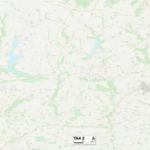
Framed Print : Bromley TN14 6 Map


![]()
Framed Photos from Map Marketing
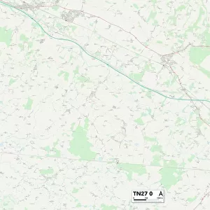
Bromley TN14 6 Map
Postcode Sector Map of Bromley TN14 6
Media ID 19980226
Back Lane Bromley Chapmans Close Church Road Elmfield Close Glebe Road Hurst Lane Main Road Manor Road Mount Pleasant Road New Road Nightingale Lane Norman Street Overdale Penn Lane The Wickets Weald Close White House Lane White House Road Windmill Road Woodside Road Ide Hill
12"x10" Modern Frame
10x8 Print in an MDF Wooden Frame with 180 gsm Satin Finish Paper. Glazed using shatter proof thin plexi glass. Frame thickness is 1 inch and depth 0.75 inch. Fluted cardboard backing held with clips. Supplied ready to hang with sawtooth hanger and rubber bumpers. Spot clean with a damp cloth. Packaged foam wrapped in a card.
Contemporary Framed and Mounted Prints - Professionally Made and Ready to Hang
Estimated Image Size (if not cropped) is 25.4cm x 25.4cm (10" x 10")
Estimated Product Size is 30.5cm x 25.4cm (12" x 10")
These are individually made so all sizes are approximate
Artwork printed orientated as per the preview above, with landscape (horizontal) or portrait (vertical) orientation to match the source image.
FEATURES IN THESE COLLECTIONS
> Animals
> Birds
> Passerines
> Chats And Flycatchers
> Nightingale
> Europe
> United Kingdom
> England
> London
> Boroughs
> Bromley
> Map Marketing
> Postcode Sector Maps
> TN - Tunbridge Wells
MADE IN THE USA
Safe Shipping with 30 Day Money Back Guarantee
FREE PERSONALISATION*
We are proud to offer a range of customisation features including Personalised Captions, Color Filters and Picture Zoom Tools
SECURE PAYMENTS
We happily accept a wide range of payment options so you can pay for the things you need in the way that is most convenient for you
* Options may vary by product and licensing agreement. Zoomed Pictures can be adjusted in the Cart.