Framed Print > South America > French Guiana > Maps
Framed Print : West Indies and Caribbean Map


![]()
Framed Photos from Map Marketing
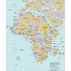
West Indies and Caribbean Map
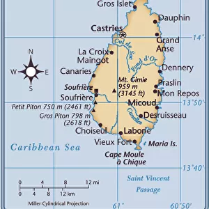
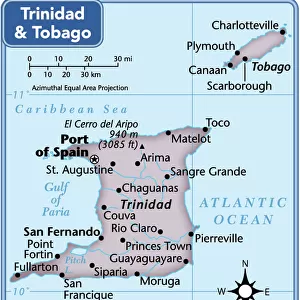
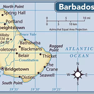
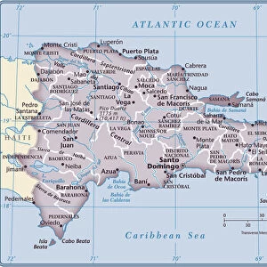
This Caribbean map covers an area from Dallas in the north to Esmeraldes in the south and from Mexico City in the west to French Guiana in the east. The map also includes insets of the Windward and Leeward islands. The map features political country colouring and towns/cities are marked in four population bands. Capital cities are also clearly marked
Media ID 19951711
© Map Marketing Ltd
18"x14" Modern Frame
16x12 Print in an MDF Wooden Frame with 180 gsm Satin Finish Paper. Glazed using shatter proof thin plexiglass. Frame thickness is 1 inch and depth 0.75 inch. Fluted cardboard backing held with clips. Supplied ready to hang with sawtooth hanger and rubber bumpers. Spot clean with a damp cloth. Packaged foam wrapped in a card.
Contemporary Framed and Mounted Prints - Professionally Made and Ready to Hang
Estimated Image Size (if not cropped) is 40.6cm x 35.6cm (16" x 14")
Estimated Product Size is 45.7cm x 35.6cm (18" x 14")
These are individually made so all sizes are approximate
Artwork printed orientated as per the preview above, with landscape (horizontal) orientation to match the source image.
FEATURES IN THESE COLLECTIONS
> Maps and Charts
> Related Images
> North America
> Mexico
> Maps
> North America
> Mexico
> Mexico City
> North America
> Mexico
> Related Images
> Popular Themes
> North Island
> South America
> French Guiana
> Maps
> South America
> French Guiana
> Related Images
MADE IN THE USA
Safe Shipping with 30 Day Money Back Guarantee
FREE PERSONALISATION*
We are proud to offer a range of customisation features including Personalised Captions, Color Filters and Picture Zoom Tools
SECURE PAYMENTS
We happily accept a wide range of payment options so you can pay for the things you need in the way that is most convenient for you
* Options may vary by product and licensing agreement. Zoomed Pictures can be adjusted in the Cart.