Framed Print > Arts > Artists > S > Syrian Syrian
Framed Print : Syria and Lebanon - Tourist Map


![]()
Framed Photos from Mary Evans Picture Library
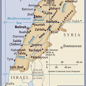
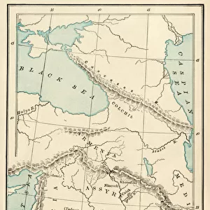
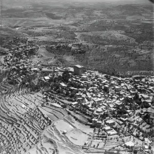
Syria and Lebanon - Tourist Map
Syria and Lebanon - Tourist Map. Date: circa 1910s
Mary Evans Picture Library makes available wonderful images created for people to enjoy over the centuries
Media ID 11562780
© Mary Evans / Grenville Collins Postcard Collection
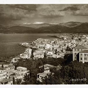
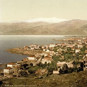
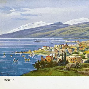
Beirut Damascus Homs Lebanese Lebanon Palestine Syria Syrian Tourist Trans Tripoli Jordania
12"x10" Modern Frame
Discover the wonders of Syria and Lebanon with our exquisite Framed Print from Media Storehouse. This vintage Tourist Map, dating back to the 1910s, showcases the rich history and cultural attractions of these two fascinating countries. Printed from an original Rights Managed image sourced from Mary Evans Prints Online, this framed print adds a touch of nostalgia and adventure to any room. Experience the allure of Syria and Lebanon through the lens of history with this stunning, framed piece.
10x8 Print in an MDF Wooden Frame with 180 gsm Satin Finish Paper. Glazed using shatter proof thin plexi glass. Frame thickness is 1 inch and depth 0.75 inch. Fluted cardboard backing held with clips. Supplied ready to hang with sawtooth hanger and rubber bumpers. Spot clean with a damp cloth. Packaged foam wrapped in a card.
Contemporary Framed and Mounted Prints - Professionally Made and Ready to Hang
Estimated Image Size (if not cropped) is 25.4cm x 17.9cm (10" x 7")
Estimated Product Size is 30.5cm x 25.4cm (12" x 10")
These are individually made so all sizes are approximate
Artwork printed orientated as per the preview above, with landscape (horizontal) orientation to match the source image.
FEATURES IN THESE COLLECTIONS
> Arts
> Artists
> S
> Syrian Syrian
> Asia
> Lebanon
> Related Images
> Asia
> Palestine
> Related Images
EDITORS COMMENTS
Step back in time with this intriguing vintage tourist map of Syria and Lebanon from the 1910s. This print offers a glimpse into the rich history and cultural heritage of the Middle East during the Ottoman Empire. The map covers the regions of modern-day Syria and Lebanon, as well as parts of Jordan, Iraq, Palestine, and Transjordania. The Ottoman Empire, which ruled much of the Middle East from the 14th to the early 20th century, is marked by the inscription "Turkey in Asia." The map highlights several major cities and landmarks, including Beirut, Damascus, Homs, Tripoli, and Palmyra. These historic destinations continue to attract tourists today, offering a window into the region's fascinating past. The coastline is also depicted, showcasing the Mediterranean Sea and the Syrian and Lebanese Riviera. The map's key includes symbols for various points of interest, such as mosques, churches, and ancient ruins. This map provides a unique perspective on tourism in the Middle East during the early 20th century. It offers a reminder of the region's rich history and cultural diversity, which continues to draw visitors from around the world today. As you explore this vintage map of Syria and Lebanon, imagine the adventures of intrepid travelers who ventured into this part of the world over a century ago. Let the map transport you to a time when the Ottoman Empire ruled the Middle East, and the allure of discovery was a driving force for exploration and learning.
MADE IN THE USA
Safe Shipping with 30 Day Money Back Guarantee
FREE PERSONALISATION*
We are proud to offer a range of customisation features including Personalised Captions, Color Filters and Picture Zoom Tools
SECURE PAYMENTS
We happily accept a wide range of payment options so you can pay for the things you need in the way that is most convenient for you
* Options may vary by product and licensing agreement. Zoomed Pictures can be adjusted in the Cart.