Framed Print > Maps and Charts > Americas
Framed Print : Civil War territory map, 1861


![]()
Framed Photos from North Wind
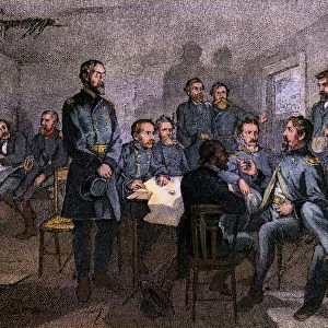
Civil War territory map, 1861
Map showing Confederate-held territory at the end of 1861.
Hand-colored woodcut of a 19th-century illustration
North Wind Picture Archives brings history to life with stock images and hand-colored illustrations
Media ID 5879758
© North Wind Picture Archives
1860s America Confederacy Confederate Federal North South State States Territory Union Confederate States
12"x10" Modern Frame
Step back in time with our stunning Framed Prints from Media Storehouse, featuring this captivating Civil War territory map from North Wind Picture Archives. Dated back to 1861, this intricately detailed hand-colored woodcut illustration showcases the Confederate-held territory at the end of that pivotal year. Add this historical piece to your home or office to ignite conversations and transport you back to an era of great significance in American history. Each print comes with a high-quality frame, ensuring a polished and sophisticated look. Order yours today and let history come alive in your space.
10x8 Print in an MDF Wooden Frame with 180 gsm Satin Finish Paper. Glazed using shatter proof thin plexi glass. Frame thickness is 1 inch and depth 0.75 inch. Fluted cardboard backing held with clips. Supplied ready to hang with sawtooth hanger and rubber bumpers. Spot clean with a damp cloth. Packaged foam wrapped in a card.
Contemporary Framed and Mounted Prints - Professionally Made and Ready to Hang
Estimated Image Size (if not cropped) is 25.4cm x 25.4cm (10" x 10")
Estimated Product Size is 30.5cm x 25.4cm (12" x 10")
These are individually made so all sizes are approximate
Artwork printed orientated as per the preview above, with landscape (horizontal) or portrait (vertical) orientation to match the source image.
FEATURES IN THESE COLLECTIONS
> South America
> Related Images
> North Wind Picture Archives
> Civil War (US)
> North Wind Picture Archives
> Maps
EDITORS COMMENTS
This print showcases a historic Civil War territory map from 1861, providing a visual representation of the Confederate-held territories at the end of that year. The hand-colored woodcut, derived from a 19th-century illustration, exudes an air of vintage charm and traditional artistry. The map itself serves as a tangible link to America's tumultuous past, depicting the geographical divisions between the Union states and the Confederacy during this pivotal period in history. With intricate details and precise labeling, it offers valuable insights into state boundaries, federal territories, and key locations across North America. As we gaze upon this remarkable piece of heritage, we are transported back to an era when our nation was deeply divided along ideological lines. It reminds us of the struggles endured by both sides – the North fighting for preservation of the Union while seeking to abolish slavery; and the South defending their way of life built on agrarian economy with enslaved laborers. Beyond its historical significance lies an artistic masterpiece that captures not only borders but also emotions evoked by this monumental conflict. This photograph print is more than just ink on paper; it represents unity shattered by division and resilience amidst chaos. Let us cherish this relic from our past as a reminder that even through darkness and strife, there is always hope for reconciliation and progress towards a brighter future united under one flag - undivided yet enriched by diverse perspectives.
MADE IN THE USA
Safe Shipping with 30 Day Money Back Guarantee
FREE PERSONALISATION*
We are proud to offer a range of customisation features including Personalised Captions, Color Filters and Picture Zoom Tools
SECURE PAYMENTS
We happily accept a wide range of payment options so you can pay for the things you need in the way that is most convenient for you
* Options may vary by product and licensing agreement. Zoomed Pictures can be adjusted in the Cart.