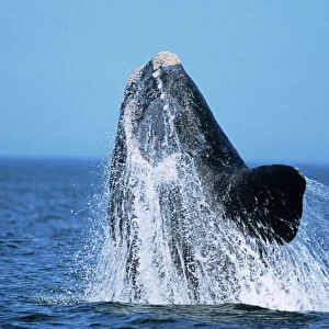
Framed Print > Animals > Mammals > Right Whale
Framed Print : Second Byrd Antarctic Expedition, 1933-35


![]()
Framed Photos from Science Photo Library
Second Byrd Antarctic Expedition, 1933-35
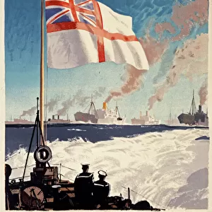
Second Byrd Antarctic Expedition, historical map. This expedition took place between 1933 and 1935, and followed an earlier expedition from 1928 to 1930. It was led by the US polar explorer and naval officer Richard Evelyn Byrd (1888-1957, depicted at upper right). On these, and later expeditions, Byrd used ships, aeroplanes and dog sleds to establish Antarctic bases. The Byrd expeditions laid the foundations for Operation Highjump, during World War II, and the later Operation Deep Freeze that established permanent bases in Antarctica in the 1950s. The inset at upper left shows the routes taken from the USA and New Zealand. The inset at lower right shows the Bay of Whales and the Ross Ice Shelf
Science Photo Library features Science and Medical images including photos and illustrations
Media ID 1699825
© LIBRARY OF CONGRESS, GEOGRAPHY AND MAP DIVISION/SCIENCE PHOTO LIBRARY
1900s 1930s 1933 1934 1935 Antarctica Base Bases Cartography Cold Exploration Explorer Frozen Military Polar Route Routes Naval Officer
12"x10" Modern Frame
Transport yourself back in time with our stunning Framed Print of the Second Byrd Antarctic Expedition, 1933-35, by Science Photo Library. This historical map captures the spirit of adventure and exploration as led by renowned polar explorer, Richard E. Byrd. Add this beautiful piece to your home or office to inspire and educate, making it a perfect addition to any room. The high-quality print is expertly framed in a sleek and modern design, ensuring a lasting impression for years to come. Relive the history and heroism of the Second Byrd Antarctic Expedition with our Framed Print, a true conversation starter.
10x8 Print in an MDF Wooden Frame with 180 gsm Satin Finish Paper. Glazed using shatter proof thin plexi glass. Frame thickness is 1 inch and depth 0.75 inch. Fluted cardboard backing held with clips. Supplied ready to hang with sawtooth hanger and rubber bumpers. Spot clean with a damp cloth. Packaged foam wrapped in a card.
Contemporary Framed and Mounted Prints - Professionally Made and Ready to Hang
Estimated Image Size (if not cropped) is 25.4cm x 25.4cm (10" x 10")
Estimated Product Size is 30.5cm x 25.4cm (12" x 10")
These are individually made so all sizes are approximate
Artwork printed orientated as per the preview above, with landscape (horizontal) or portrait (vertical) orientation to match the source image.
FEATURES IN THESE COLLECTIONS
> Animals
> Mammals
> Right Whale
> Historic
> World War I and II
> Naval warfare
> Historic
> World War I and II
> World War II
> Maps and Charts
> Early Maps
> Maps and Charts
> Related Images
> Maps and Charts
> World
> North America
> United States of America
> Maps
> Oceania
> New Zealand
> Maps
> Oceania
> New Zealand
> Related Images
> Science Photo Library
> History
EDITORS COMMENTS
This print captures the historical Second Byrd Antarctic Expedition, which took place between 1933 and 1935. Led by the renowned US polar explorer and naval officer Richard Evelyn Byrd, this expedition followed a previous one from 1928 to 1930. The image showcases Byrd himself at the upper right corner, symbolizing his leadership and dedication to exploring the frozen landscapes of Antarctica. Byrd's expeditions were groundbreaking in their use of various modes of transportation such as ships, airplanes, and dog sleds to establish Antarctic bases. These ventures laid the foundations for future missions like Operation Highjump during World War II and later Operation Deep Freeze in the 1950s, which aimed to establish permanent bases on this icy continent. The inset maps featured in this print provide additional context. The upper left inset illustrates the routes taken from both the USA and New Zealand, highlighting international collaboration in these ambitious explorations. Meanwhile, at lower right is an inset showcasing the Bay of Whales and Ross Ice Shelf – significant locations that played crucial roles in Byrd's expeditions. This remarkable historical map not only portrays a pivotal moment in exploration history but also reflects upon humanity's relentless pursuit of knowledge even amidst extreme conditions. It serves as a testament to Richard Evelyn Byrd's enduring legacy as a pioneering polar explorer who pushed boundaries for scientific discovery in Antarctica during the early decades of the twentieth century.
MADE IN THE USA
Safe Shipping with 30 Day Money Back Guarantee
FREE PERSONALISATION*
We are proud to offer a range of customisation features including Personalised Captions, Color Filters and Picture Zoom Tools
SECURE PAYMENTS
We happily accept a wide range of payment options so you can pay for the things you need in the way that is most convenient for you
* Options may vary by product and licensing agreement. Zoomed Pictures can be adjusted in the Cart.