Framed Print > Maps and Charts > Related Images
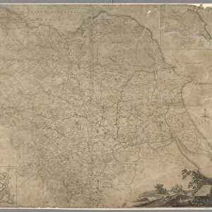
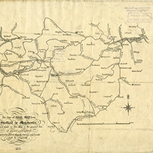
Framed Print : Map of the Southern Part of the West Riding of the County of York by Joseph Dickinson, 1750


![]()
Framed Photos from Sheffield City Archives
Map of the Southern Part of the West Riding of the County of York by Joseph Dickinson, 1750
Scale 2 inches : 1 mile.Original at Sheffield City Archives: WWM/MP/95R
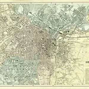
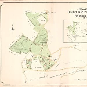
Sheffield City Archives and Local Studies Library has an unrivalled collection of images of Sheffield, England
Media ID 14046198
© Sheffield City Council
12"x10" Modern Frame
Discover the rich history of Yorkshire with our exquisite framed print from Media Storehouse. This stunning reproduction showcases a rare and captivating map of the Southern Part of the West Riding of the County of York, created by Joseph Dickinson in 1750. The original map, housed at Sheffield City Archives (WWM/MP/95R), has been carefully preserved and meticulously reproduced to bring you a high-quality, museum-grade print. Scale: 2 inches : 1 mile. Travel back in time as you admire the intricate details and vibrant colors of this historical treasure, proudly displayed in your home or office. A perfect addition to any room, our framed print is sure to inspire a sense of wonder and appreciation for the past.
10x8 Print in an MDF Wooden Frame with 180 gsm Satin Finish Paper. Glazed using shatter proof thin plexi glass. Frame thickness is 1 inch and depth 0.75 inch. Fluted cardboard backing held with clips. Supplied ready to hang with sawtooth hanger and rubber bumpers. Spot clean with a damp cloth. Packaged foam wrapped in a card.
Contemporary Framed and Mounted Prints - Professionally Made and Ready to Hang
Estimated Image Size (if not cropped) is 25.4cm x 25.4cm (10" x 10")
Estimated Product Size is 30.5cm x 25.4cm (12" x 10")
These are individually made so all sizes are approximate
Artwork printed orientated as per the preview above, with landscape (horizontal) or portrait (vertical) orientation to match the source image.
FEATURES IN THESE COLLECTIONS
> Maps and Charts
> Related Images
> Sheffield City Archives
> Maps and Plans
EDITORS COMMENTS
This print showcases a historical gem, the "Map of the Southern Part of the West Riding of the County of York" by Joseph Dickinson in 1750. With an impressive scale of 2 inches to 1 mile, this meticulously detailed map offers a fascinating glimpse into Yorkshire's past. Preserved at Sheffield City Archives under reference WWM/MP/95R, it stands as a testament to both Dickinson's cartographic expertise and the region's rich history. The map itself is a true work of art, depicting sprawling landscapes dotted with charming villages, winding rivers, and lush greenery. Every road and pathway is intricately illustrated, providing invaluable insight into transportation networks during that era. This visual treasure trove not only serves as an essential resource for historians but also captivates anyone who appreciates fine craftsmanship. Sheffield City Archives has done an exceptional job preserving this piece of history through this remarkable photo print. It allows viewers to admire every minute detail without compromising its integrity or commercializing its use. Whether you are researching local genealogy or simply curious about Yorkshire's heritage, this photograph provides an immersive experience that transports you back in time. In essence, this print from Sheffield City Archives encapsulates more than just geographical information; it encapsulates stories untold and memories long forgotten—a window into Yorkshire's vibrant past waiting to be explored by all those who appreciate the beauty and significance of historical cartography.
MADE IN THE USA
Safe Shipping with 30 Day Money Back Guarantee
FREE PERSONALISATION*
We are proud to offer a range of customisation features including Personalised Captions, Color Filters and Picture Zoom Tools
SECURE PAYMENTS
We happily accept a wide range of payment options so you can pay for the things you need in the way that is most convenient for you
* Options may vary by product and licensing agreement. Zoomed Pictures can be adjusted in the Cart.