Framed Print > Maps and Charts > Related Images
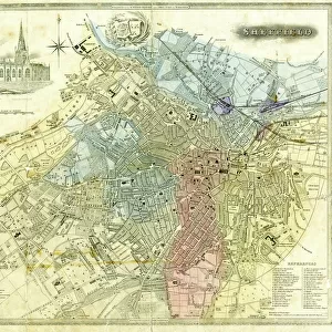
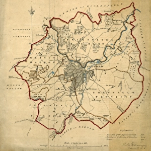
Framed Print : Map of the Town and Environs of Sheffield, 1864


![]()
Framed Photos from Sheffield City Archives
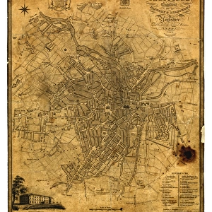
Map of the Town and Environs of Sheffield, 1864
Scale 1 inches : 1 mile. Board and church schools have been indicated at a later date and the ecclesiastical districts have been indicated by colouring.Original at Sheffield Archives ref. SY18/1
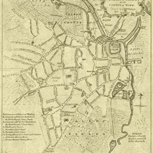
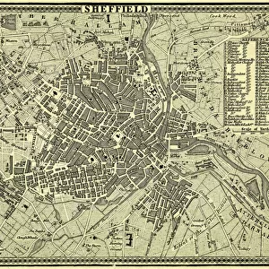
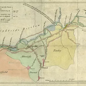
Sheffield City Archives and Local Studies Library has an unrivalled collection of images of Sheffield, England
Media ID 13987657
© Sheffield City Council
12"x10" Modern Frame
Discover the rich history of Sheffield with our exquisite framed print from the Media Storehouse collection. This captivating map, hailing from 1864, showcases the Town and Environs of Sheffield, meticulously detailed at a scale of 1 inch : 1 mile. An original from Sheffield City Archives (SY18/1), this map offers a fascinating glimpse into the past, highlighting the locations of board and church schools and ecclesiastical districts, color-coded for easy identification. Bring the history of Sheffield into your home or office with this beautiful and informative framed print, a perfect addition to any room.
10x8 Print in an MDF Wooden Frame with 180 gsm Satin Finish Paper. Glazed using shatter proof thin plexi glass. Frame thickness is 1 inch and depth 0.75 inch. Fluted cardboard backing held with clips. Supplied ready to hang with sawtooth hanger and rubber bumpers. Spot clean with a damp cloth. Packaged foam wrapped in a card.
Contemporary Framed and Mounted Prints - Professionally Made and Ready to Hang
Estimated Image Size (if not cropped) is 25.4cm x 25.4cm (10" x 10")
Estimated Product Size is 30.5cm x 25.4cm (12" x 10")
These are individually made so all sizes are approximate
Artwork printed orientated as per the preview above, with landscape (horizontal) or portrait (vertical) orientation to match the source image.
FEATURES IN THESE COLLECTIONS
> Maps and Charts
> Related Images
> Sheffield City Archives
> Maps and Plans
> Maps of Sheffield
EDITORS COMMENTS
This print showcases the intricate "Map of the Town and Environs of Sheffield" dating back to 1864. With a scale of 1 inch to 1 mile, this meticulously detailed map offers a fascinating glimpse into the city's past. The print highlights various landmarks such as board and church schools, which have been indicated at a later date, providing valuable insights into Sheffield's educational landscape during that era. What sets this particular map apart is its unique color-coded representation of ecclesiastical districts. Each district has been carefully colored, allowing viewers to easily identify and understand the religious divisions within Sheffield in 1864. This visual depiction adds an extra layer of historical significance to the map, shedding light on how religion played an integral role in shaping communities during that time. Preserved at Sheffield Archives under reference SY18/1, this original piece holds immense value for historians, researchers, and anyone interested in exploring Sheffield's rich heritage. It serves as a tangible link between our present-day understanding of the city and its vibrant past
MADE IN THE USA
Safe Shipping with 30 Day Money Back Guarantee
FREE PERSONALISATION*
We are proud to offer a range of customisation features including Personalised Captions, Color Filters and Picture Zoom Tools
SECURE PAYMENTS
We happily accept a wide range of payment options so you can pay for the things you need in the way that is most convenient for you
* Options may vary by product and licensing agreement. Zoomed Pictures can be adjusted in the Cart.