
Framed Print > Universal Images Group (UIG) > History > Historical Maps
Framed Print : 1868 British Admiralty Chart Or Map Of The Mediterranean Sea


![]()
Framed Photos from Universal Images Group (UIG)
1868 British Admiralty Chart Or Map Of The Mediterranean Sea
1868, British Admiralty Chart or Map of the Mediterranean Sea, Italy, Corsica, Greece, Tunisia
Universal Images Group (UIG) manages distribution for many leading specialist agencies worldwide
Media ID 38549662
© Artokoloro Quint Lox Limited
1868 Corsica Greece Tunisia Antique Map Latitude Longitude Mappa Mundi Old Antique Plan Old Antique View Ols Antique Map Rare Old Maps Topo
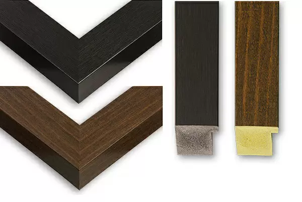
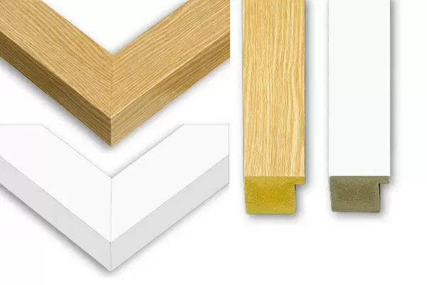
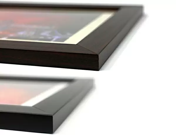
22"x18" (58x48cm) Modern Frame
"Chart your course for a piece of history with our stunning Framed Prints from the Media Storehouse range. This beautiful 1868 British Admiralty Chart or Map of the Mediterranean Sea, courtesy of Universal Images Group (UIG), is a fascinating glimpse into the region's maritime past. Featuring Italy, Corsica, Greece, and Tunisia in exquisite detail, this vintage map is a must-have for anyone with an interest in navigation, geography, or simply admiring the beauty of bygone eras. Our expertly framed prints are designed to elevate any room with their timeless charm and sophistication."
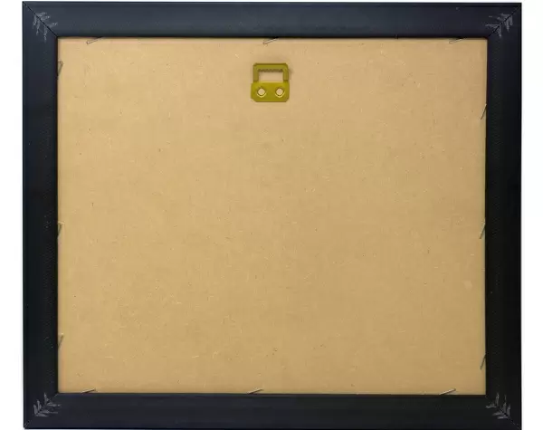
Wood effect frame, card mounted, 16x12 archival quality photo print. Overall outside dimensions 22x18 inches (58x48cm). Environmentally and ozone friendly, 40mm wide x 15mm Polycore® moulding has the look of real wood, is durable and light and easy to hang. Biodegradable and made with non-chlorinated gases (no toxic fumes) it is efficient; producing 100 tons of polystyrene can save 300 tons of trees! Prints are glazed with lightweight, shatterproof, optical clarity acrylic (providing the same general protection from the environment as glass). The back is stapled hardboard with a sawtooth hanger attached. Note: To minimise original artwork cropping, for optimum layout, and to ensure print is secure, the visible print may be marginally smaller
Contemporary Framed and Mounted Prints - Professionally Made and Ready to Hang
Estimated Image Size (if not cropped) is 25.7cm x 39.6cm (10.1" x 15.6")
Estimated Product Size is 47.8cm x 57.9cm (18.8" x 22.8")
These are individually made so all sizes are approximate
Artwork printed orientated as per the preview above, with portrait (vertical) orientation to match the source image.
EDITORS COMMENTS
Step back in time to the 19th century with this stunning print of a 1868 British Admiralty Chart or Map of the Mediterranean Sea. This vintage map is a treasure trove of geographical information, showcasing the region's intricate coastline, islands, and trade routes. From Italy to Corsica, Greece to Tunisia, every detail is meticulously rendered in precise cartography.
This beautiful illustration not only serves as a fascinating piece of historical geography but also provides insight into the maritime history of the Mediterranean during this period. The chart's grid system and latitude-longitude coordinates give us a glimpse into the navigational techniques used by sailors and explorers at that time.
The aged paper has developed a lovely patina over the years, giving it an air of nostalgia and character. The map's geometric lines and shapes evoke a sense of order and precision, while its vintage aesthetic adds an element of whimsy.
Whether you're an avid historian or simply someone who appreciates beautiful illustrations, this print is sure to captivate your imagination. It would make a unique addition to any room's decor, serving as both a conversation starter and a testament to human ingenuity in mapping our world.
MADE IN THE UK
Safe Shipping with 30 Day Money Back Guarantee
FREE PERSONALISATION*
We are proud to offer a range of customisation features including Personalised Captions, Color Filters and Picture Zoom Tools
SECURE PAYMENTS
We happily accept a wide range of payment options so you can pay for the things you need in the way that is most convenient for you
* Options may vary by product and licensing agreement. Zoomed Pictures can be adjusted in the Basket.