Framed Print > Universal Images Group (UIG) > Illustrations > Illustrations 1
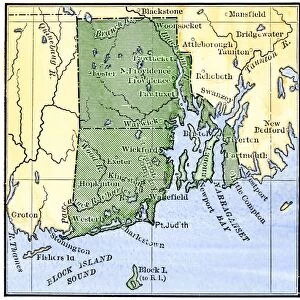
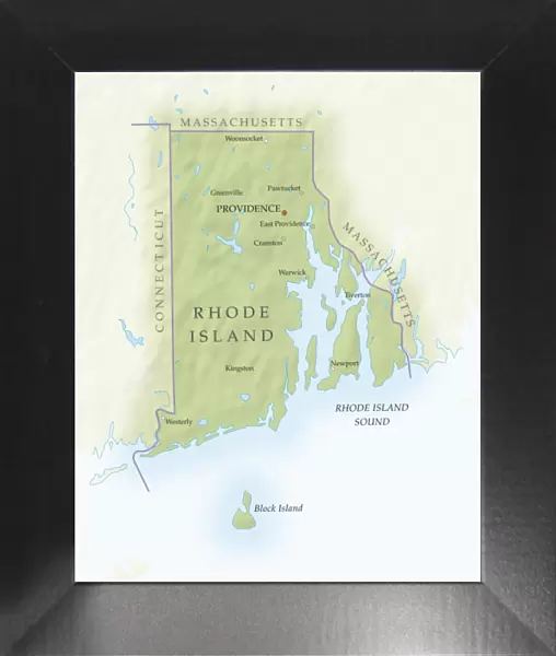
Framed Print : Map of Rhode Island, close-up


![]()
Framed Photos from Universal Images Group (UIG)
Map of Rhode Island, close-up
Universal Images Group (UIG) manages distribution for many leading specialist agencies worldwide
Media ID 9540149
© Dorling Kindersley/UIG
Digitally Generated Direction Guidance Rhode Island State Text Us State Border Western Script
12"x10" Modern Frame
Discover the intricate details of Rhode Island with our stunning framed print from Dorling Kindersley at Media Storehouse. This captivating close-up view of the Map of Rhode Island, brought to you by Universal Images Group (UIG), is a beautiful addition to any room. The high-quality print is expertly framed, ensuring a polished and sophisticated look that adds character and depth to your decor. Bring the history and charm of Rhode Island right into your home with this exquisite framed print. Order now and enjoy free shipping on your purchase.
10x8 Print in an MDF Wooden Frame with 180 gsm Satin Finish Paper. Glazed using shatter proof thin plexi glass. Frame thickness is 1 inch and depth 0.75 inch. Fluted cardboard backing held with clips. Supplied ready to hang with sawtooth hanger and rubber bumpers. Spot clean with a damp cloth. Packaged foam wrapped in a card.
Contemporary Framed and Mounted Prints - Professionally Made and Ready to Hang
Estimated Image Size (if not cropped) is 25.4cm x 25.4cm (10" x 10")
Estimated Product Size is 25.4cm x 30.5cm (10" x 12")
These are individually made so all sizes are approximate
Artwork printed orientated as per the preview above, with landscape (horizontal) or portrait (vertical) orientation to match the source image.
EDITORS COMMENTS
This print showcases a close-up view of the Map of Rhode Island, offering an intricate display of its geographical features. With its vibrant colors and precise cartography, this digitally generated illustration provides a visually stunning representation of the state's physical geography. The map is expertly designed with clear direction indicators and Western script labels, making it an invaluable tool for navigation and guidance. The vertical orientation allows for a comprehensive exploration of Rhode Island's diverse landscapes, from its picturesque coastline to its rolling hills and charming towns. Every detail has been meticulously captured in this artwork by Dorling Kindersley, highlighting the beauty and uniqueness of this northeastern US state. As we delve into the image, we are transported into a world where borders become more than mere lines on paper; they represent history, culture, and identity. This map serves as a reminder that within these boundaries lies endless possibilities waiting to be discovered. While devoid of people in order to focus solely on the land itself, this photograph print invites us to embark on our own personal journey through Rhode Island's rich tapestry. Whether you're planning an adventure or simply appreciating the artistry behind cartography, this mesmerizing image will undoubtedly captivate your imagination.
MADE IN THE USA
Safe Shipping with 30 Day Money Back Guarantee
FREE PERSONALISATION*
We are proud to offer a range of customisation features including Personalised Captions, Color Filters and Picture Zoom Tools
SECURE PAYMENTS
We happily accept a wide range of payment options so you can pay for the things you need in the way that is most convenient for you
* Options may vary by product and licensing agreement. Zoomed Pictures can be adjusted in the Cart.