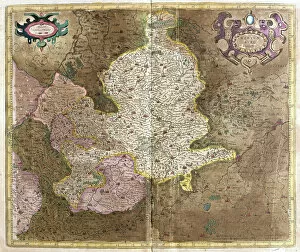
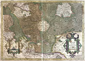
Atlas Book Collection (#16)

Discover the world through the pages of the Atlas Book

Background imageAtlas Book Collection: Frontispice of 'Ephemerides 'with Hercules

Frontispice of "Ephemerides "with Hercules
LSE4108770 Frontispice of " Ephemerides " with Hercules and Atlas by Andreae Argoli, 1786 by Unknown artist, (18th century); Bibliotheque des Franciscains, Paris

Background imageAtlas Book Collection: Atlas of Europe in 814: Empires of the West and the East

Atlas of Europe in 814: Empires of the West and the East
XEE4415296 Atlas of Europe in 814: Empires of the West and the East. Plan draws from " Universal Atlas of Ancient and Modern Geography" by Vuillemin. sd. circa 1851
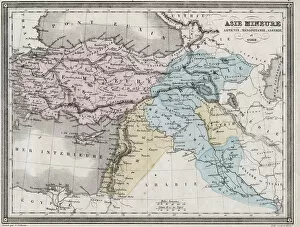
Background imageAtlas Book Collection: Asia Minor, Armenia, Mesopotamia, Assyria and Syria in Antiquite - Plate extracted

Asia Minor, Armenia, Mesopotamia, Assyria and Syria in Antiquite - Plate extracted
XEE4152137 Asia Minor, Armenia, Mesopotamia, Assyria and Syria in Antiquite - Plate extracted from " Universal Atlas of Ancient

Background imageAtlas Book Collection: Europe after the invasion of the barbarians in the 6th century - Plate extracted

Europe after the invasion of the barbarians in the 6th century - Plate extracted
XEE4152134 Europe after the invasion of the barbarians in the 6th century - Plate extracted from " Universal Atlas of Ancient

Background imageAtlas Book Collection: Empire and Expedition of Alexander the Great - Plate from '

Empire and Expedition of Alexander the Great - Plate from "
XEE4152132 Empire and Expedition of Alexander the Great - Plate from " Universal Atlas of Ancient and Modern Geography for the Use of Residential Schools" by Vuillemin - ca

Background imageAtlas Book Collection: Frontispice of the 'Atlas Nouveau'by Seutter Georges Mattaus, 17th century

Frontispice of the "Atlas Nouveau"by Seutter Georges Mattaus, 17th century
LSE4085445 Frontispice of the " Atlas Nouveau" by Seutter Georges Mattaus, 17th century by Unknown Artist, (17th century); Private Collection; (add.info)

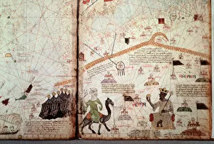
Background imageAtlas Book Collection: The detroit of Gibraltar and North Africa marks the flags of the Moors

The detroit of Gibraltar and North Africa marks the flags of the Moors
JLJ4607755 The detroit of Gibraltar and North Africa marks the flags of the Moors, to the right the King of Mali Kanga Moussa (Kankou Moussa, or Kankan Moussa or Mansa Moussa)

Background imageAtlas Book Collection: Bergen, Norway (engraving, 1588)

Bergen, Norway (engraving, 1588)
LRI4714471 Bergen, Norway (engraving, 1588) by Hogenberg, Franz (1540-c.1590); Private Collection; (add.info.: Bergen (Bergen)

Background imageAtlas Book Collection: France (engraving, 1596)

France (engraving, 1596)
LRI4717159 France (engraving, 1596) by Mercator, Gerardus (1512-94); Private Collection; (add.info.: Gallia, 1595: France - in " Atlas Ssive Corsmographicae Meditationes" by Gerard Mercator)

Background imageAtlas Book Collection: Andalusia, Spain (engraving, 1596)

Andalusia, Spain (engraving, 1596)
LRI4717089 Andalusia, Spain (engraving, 1596) by Mercator, Gerardus (1512-94); Private Collection; (add.info.: Andaluziae nova descript, 1620: Andalusia)

Background imageAtlas Book Collection: Transylvania, Romania (engraving, 1596)

Transylvania, Romania (engraving, 1596)
LRI4716968 Transylvania, Romania (engraving, 1596) by Mercator, Gerardus (1512-94); Private Collection; (add.info.: Transylvania)

Background imageAtlas Book Collection: Denmark (the Island Langeland with Odense) (engraving, 1596)

Denmark (the Island Langeland with Odense) (engraving, 1596)
LRI4716935 Denmark (the Island Langeland with Odense) (engraving, 1596) by Mercator, Gerardus (1512-94); Private Collection; (add.info.: Fionia)

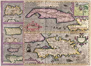
Background imageAtlas Book Collection: Cuba, Jamaica, Haiti, Puerto Rico (Caribbean) (engraving, 1596)

Cuba, Jamaica, Haiti, Puerto Rico (Caribbean) (engraving, 1596)
LRI4718854 Cuba, Jamaica, Haiti, Puerto Rico (Caribbean) (engraving, 1596) by Mercator, Gerardus (1512-94); Private Collection; (add.info.: Cuba insula, Iamaica, S. Joannis, Is)

Background imageAtlas Book Collection: Northwest England (engraving, 1596)

Northwest England (engraving, 1596)
LRI4716800 Northwest England (engraving, 1596) by Mercator, Gerardus (1512-94); Private Collection; (add.info.: West Morlandia, Lancastria, Cestria, Caernarvan, Denbigh, Flint, Meridionidh)

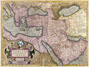
Background imageAtlas Book Collection: Turkey, Balkans, northeastern Africa, Arabia and the Middle East (engraving, 1596)

Turkey, Balkans, northeastern Africa, Arabia and the Middle East (engraving, 1596)
LRI4718667 Turkey, Balkans, northeastern Africa, Arabia and the Middle East (engraving, 1596) by Mercator, Gerardus (1512-94); Private Collection; (add.info.: Turkey Imperii Imago, 1630: Turkish)

Background imageAtlas Book Collection: Map of the Granada Province (Spain) (Engraving, 1717)

Map of the Granada Province (Spain) (Engraving, 1717)
LRI4712759 Map of the Granada Province (Spain) (Engraving, 1717) by Nolin, Jean-Baptiste (c.1657-1708); Private Collection; (add.info)

Background imageAtlas Book Collection: Stockholm, Sweden (engraving, 1588)

Stockholm, Sweden (engraving, 1588)
LRI4714480 Stockholm, Sweden (engraving, 1588) by Hogenberg, Franz (1540-c.1590); Private Collection; (add.info.: Stockholm (Stockholm)

Background imageAtlas Book Collection: Map of the Kingdom of Portugal (Engraving, 1717)

Map of the Kingdom of Portugal (Engraving, 1717)
LRI4712611 Map of the Kingdom of Portugal (Engraving, 1717) by Nolin, Jean-Baptiste (c.1657-1708); Private Collection; (add.info)

Background imageAtlas Book Collection: Hamburg, Germany (engraving, 1572-1617)

Hamburg, Germany (engraving, 1572-1617)
LRI4714454 Hamburg, Germany (engraving, 1572-1617) by Hogenberg, Franz (1540-c.1590); Private Collection; (add.info.: Hamburgum (Hamburg)

Background imageAtlas Book Collection: Map of the south occidental part of the Kingdom of Hungary (Engraving, 1717)

Map of the south occidental part of the Kingdom of Hungary (Engraving, 1717)
LRI4712558 Map of the south occidental part of the Kingdom of Hungary (Engraving, 1717) by Nolin, Jean-Baptiste (c.1657-1708); Private Collection; (add.info)

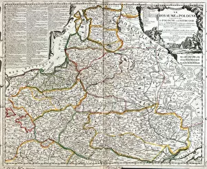
Background imageAtlas Book Collection: Map of Poland and Lithuania (Engraving, 1717)

Map of Poland and Lithuania (Engraving, 1717)
LRI4712502 Map of Poland and Lithuania (Engraving, 1717) by Nolin, Jean-Baptiste (c.1657-1708); Private Collection; (add.info)

Background imageAtlas Book Collection: Map of Austria (Engraving, 1717)

Map of Austria (Engraving, 1717)
LRI4712473 Map of Austria (Engraving, 1717) by Nolin, Jean-Baptiste (c.1657-1708); Private Collection; (add.info.: Map of the Archduche of Austria - Engraving from the atlas le theatre du monde)

Background imageAtlas Book Collection: Oberwesel and Boppard, Germany (engraving, 1588)

Oberwesel and Boppard, Germany (engraving, 1588)
LRI4714217 Oberwesel and Boppard, Germany (engraving, 1588) by Hogenberg, Franz (1540-c.1590); Private Collection; (add.info.: Oberwesel (Oberwesel) - Boppard (Boppard)

Background imageAtlas Book Collection: The coastline from Berck to Gravelines, Belgium (engraving, 1596)

The coastline from Berck to Gravelines, Belgium (engraving, 1596)
LRI4717302 The coastline from Berck to Gravelines, Belgium (engraving, 1596) by Mercator, Gerardus (1512-94); Private Collection; (add.info.: Bolonia & Giunes comitatus)

Background imageAtlas Book Collection: Belgium (engraving, 1596)

Belgium (engraving, 1596)
LRI4717276 Belgium (engraving, 1596) by Mercator, Gerardus (1512-94); Private Collection; (add.info.: Picardia, 1630: Belgium - in " Atlas Ssive Corsmographicae Meditationes" by Gerard)

Background imageAtlas Book Collection: Limoge, France (engraving, 1596)

Limoge, France (engraving, 1596)
LRI4717163 Limoge, France (engraving, 1596) by Mercator, Gerardus (1512-94); Private Collection; (add.info.: Totius Lemovici, 1633: Limoge)

Background imageAtlas Book Collection: Valencia, Spain (engraving, 1596)

Valencia, Spain (engraving, 1596)
LRI4717107 Valencia, Spain (engraving, 1596) by Mercator, Gerardus (1512-94); Private Collection; (add.info.: Regni Valentiae typus, 1620: Valencia (Valencia)

Background imageAtlas Book Collection: Straits of Magellan (engraving, 1596)

Straits of Magellan (engraving, 1596)
LRI4718899 Straits of Magellan (engraving, 1596) by Mercator, Gerardus (1512-94); Private Collection; (add.info.: Exquisita & magno aliquot mensium pericolo lustrata et am retecta freti Magellanici)

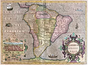
Background imageAtlas Book Collection: South America (engraving, 1596)

South America (engraving, 1596)
LRI4718893 South America (engraving, 1596) by Mercator, Gerardus (1512-94); Private Collection; (add.info.: America meridionalis)

Background imageAtlas Book Collection: Northern part of Jutland, Scandinavia (engraving, 1596)

Northern part of Jutland, Scandinavia (engraving, 1596)
LRI4716901 Northern part of Jutland, Scandinavia (engraving, 1596) by Mercator, Gerardus (1512-94); Private Collection; (add.info.: Iutia septentrionalis, 1631: Northern part of Jutland)

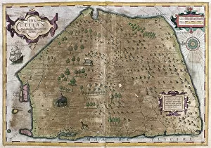
Background imageAtlas Book Collection: Sri Lanka (engraving, 1596)

Sri Lanka (engraving, 1596)
LRI4718789 Sri Lanka (engraving, 1596) by Mercator, Gerardus (1512-94); Private Collection; (add.info.: Ins. Ceilan quae incolis Tenarisin dictur 1630)

Background imageAtlas Book Collection: Yorkshire, Lincolnshire, Staffordshire, Nottinghamshire, Leicestershire

Yorkshire, Lincolnshire, Staffordshire, Nottinghamshire, Leicestershire
LRI4716818 Yorkshire, Lincolnshire, Staffordshire, Nottinghamshire, Leicestershire, Rutland and Norfolf, Great Britain, 1595 (engraving, 1596) by Mercator

Background imageAtlas Book Collection: England, 1565 (engraving, 1596)

England, 1565 (engraving, 1596)
LRI4716753 England, 1565 (engraving, 1596) by Mercator, Gerardus (1512-94); Private Collection; (add.info.: Anglia Regnum)

Background imageAtlas Book Collection: East Ireland, 1565 (engraving, 1596)

East Ireland, 1565 (engraving, 1596)
LRI4716743 East Ireland, 1565 (engraving, 1596) by Mercator, Gerardus (1512-94); Private Collection; (add.info.: Ultoniae orientalis pars)

Background imageAtlas Book Collection: Ireland, 1595 (engraving, 1596)

Ireland, 1595 (engraving, 1596)
LRI4716695 Ireland, 1595 (engraving, 1596) by Mercator, Gerardus (1512-94); Private Collection; (add.info.: Irlandiae Regnum)

Background imageAtlas Book Collection: England, Scotland and Ireland, 1595 (engraving, 1596)

England, Scotland and Ireland, 1595 (engraving, 1596)
LRI4716667 England, Scotland and Ireland, 1595 (engraving, 1596) by Mercator, Gerardus (1512-94); Private Collection; (add.info.: Anglia, Scotia and Hibernia, 1595: England)

Background imageAtlas Book Collection: Africa, 1595 (engraving, 1596)

Africa, 1595 (engraving, 1596)
LRI4716598 Africa, 1595 (engraving, 1596) by Mercator, Gerardus (1512-94); Private Collection; (add.info.: Africa, 1595: Africa - in " Atlas Ssive Corsmographicae Meditationes" by Gerard)

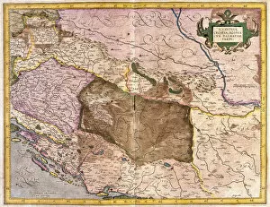
Background imageAtlas Book Collection: Sclavonia, Croatia, Bosnia and Dalmatia (engraving, 1596)

Sclavonia, Croatia, Bosnia and Dalmatia (engraving, 1596)
LRI4718485 Sclavonia, Croatia, Bosnia and Dalmatia (engraving, 1596) by Mercator, Gerardus (1512-94); Private Collection; (add.info.: Sclavonia, Croatia)

Background imageAtlas Book Collection: Steiermark, Austria (engraving, 1596)

Steiermark, Austria (engraving, 1596)
LRI4718462 Steiermark, Austria (engraving, 1596) by Mercator, Gerardus (1512-94); Private Collection; (add.info.: Stiria, 1630: Steiermark)

Background imageAtlas Book Collection: Ancona and Spoleto, Italy (engraving, 1596)

Ancona and Spoleto, Italy (engraving, 1596)
LRI4718357 Ancona and Spoleto, Italy (engraving, 1596) by Mercator, Gerardus (1512-94); Private Collection; (add.info.: Marchia Anconitana Cum Spoletano Ducatu, 1631: Ancona (Ancona)

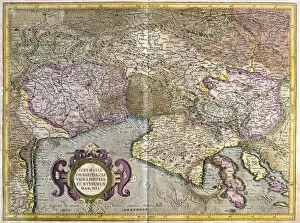
Background imageAtlas Book Collection: Friuli, Italy - Slovenia (Istria) with the Gulf of Trieste and Balkans (engraving, 1596)

Friuli, Italy - Slovenia (Istria) with the Gulf of Trieste and Balkans (engraving, 1596)
LRI4718288 Friuli, Italy - Slovenia (Istria) with the Gulf of Trieste and Balkans (engraving, 1596) by Mercator, Gerardus (1512-94); Private Collection; (add.info.: Furum Iulium - Karstia, Carniola)

Background imageAtlas Book Collection: Hungary (engraving, 1596)

Hungary (engraving, 1596)
LRI4718179 Hungary (engraving, 1596) by Mercator, Gerardus (1512-94); Private Collection; (add.info.: Hungary, 1608: Hungary - in " Atlas Ssive Corsmographicae Meditationes" by Gerard)

Background imageAtlas Book Collection: Isle of Rugen, Germany (engraving, 1596)

Isle of Rugen, Germany (engraving, 1596)
LRI4718089 Isle of Rugen, Germany (engraving, 1596) by Mercator, Gerardus (1512-94); Private Collection; (add.info.: Nova famigerabilis insulae ac ducatus Rugiae descriptio, 1630: Isle of Rugen)

Background imageAtlas Book Collection: Bavaria, Germany (engraving, 1596)

Bavaria, Germany (engraving, 1596)
LRI4718027 Bavaria, Germany (engraving, 1596) by Mercator, Gerardus (1512-94); Private Collection; (add.info.: Bavaria Ducatus, 1610: Bavaria)

Background imageAtlas Book Collection: Wurttemberg, south Germany (engraving, 1596)

Wurttemberg, south Germany (engraving, 1596)
LRI4717901 Wurttemberg, south Germany (engraving, 1596) by Mercator, Gerardus (1512-94); Private Collection; (add.info.: Wirtenberg Ducatus, 1632: Wurttemberg (WAorttemberg)

Background imageAtlas Book Collection: Cologne, Waldeck (Hesse), Germany (engraving, 1596)

Cologne, Waldeck (Hesse), Germany (engraving, 1596)
LRI4717783 Cologne, Waldeck (Hesse), Germany (engraving, 1596) by Mercator, Gerardus (1512-94); Private Collection; (add.info.: Berghe Ducatus Marck and Colonian, 1638: Cologne, Waldeck (Hesse)


For sale as Licensed Images

Choose your image, Select your licence and Download the media

Discover the world through the pages of the Atlas Book. This captivating collection takes you on a journey across time and space, showcasing intricate engravings of maps from various regions. Immerse yourself in history as you explore the Map of Tartar territory, dating back to 1570, or marvel at the detailed depiction of Tuscany in Italy from the same era. Travel further with a glimpse into Poitou Charentes in France during 1717 or delve into Franconia in Germany during 1570. But it doesn't stop there; this remarkable atlas also includes fascinating maps such as Jerusalem, offering a unique perspective on Israel between 1572 and 1617. Explore Les Deux Sevres and Department of Allier in France, both part of an extensive collection featuring one hundred and five meticulously crafted maps by M. VUILLEMIN from 1876. From Corsica's stunning landscapes to Le Gers' picturesque Midi-Pyrenees region, each map offers a window into different corners of France and its colonies. Lose yourself among these beautifully illustrated depictions that were once used by war depots, bridges departments, footwear manufacturers, and even naval forces. The Atlas Book is not just an ordinary compilation; it is a treasure trove for history enthusiasts and cartography aficionados alike. Embark on an extraordinary voyage through time with this exceptional volume that brings centuries-old maps to life before your eyes. Let your imagination soar as you flip through page after page filled with rich details waiting to be discovered within these ancient engravings. Uncover hidden gems like Le Cantal's enchanting landscapes or get lost amidst Brittany's charming beauty captured within La Nievre's borders. Each turn reveals new wonders awaiting exploration - all thanks to M. VUILLEMIN's masterful artistry showcased throughout this remarkable atlas. Whether you're seeking knowledge about historical territories or simply appreciate fine craftsmanship, the a must-have addition to any collection.