Atlas Book Collection (#13)

Discover the world through the pages of the Atlas Book

Background imageAtlas Book Collection: Map of Andalusia, with Seville and Cordoba (Spain) (etching, 1671)

Map of Andalusia, with Seville and Cordoba (Spain) (etching, 1671)
LRI4709572 Map of Andalusia, with Seville and Cordoba (Spain) (etching, 1671) by Wit, Frederick de (1630-1706); Private Collection; (add.info.: Map of Andalusia)

Background imageAtlas Book Collection: Map of the Duche of Gelderland and the Count of Zutphen (Germany) (etching, 1671)

Map of the Duche of Gelderland and the Count of Zutphen (Germany) (etching, 1671)
LRI4710846 Map of the Duche of Gelderland and the Count of Zutphen (Germany) (etching, 1671) by Wit, Frederick de (1630-1706); Private Collection; (add.info)

Background imageAtlas Book Collection: Map of Transylvania Province (Romania) (etching, 1671)

Map of Transylvania Province (Romania) (etching, 1671)
LRI4710801 Map of Transylvania Province (Romania) (etching, 1671) by Wit, Frederick de (1630-1706); Private Collection; (add.info)

Background imageAtlas Book Collection: Map of the island of Malta (etching, 1671)

Map of the island of Malta (etching, 1671)
LRI4710727 Map of the island of Malta (etching, 1671) by Wit, Frederick de (1630-1706); Private Collection; (add.info.: Map of the island of Malta - Strong water extracted from " Theatrum)

Background imageAtlas Book Collection: Map of the Marquisates of the Holy Germanic Empire and the Lordship of Mechelen

Map of the Marquisates of the Holy Germanic Empire and the Lordship of Mechelen
LRI4709617 Map of the Marquisates of the Holy Germanic Empire and the Lordship of Mechelen (Netherlands) (etching, 1671) by Wit

Background imageAtlas Book Collection: Map of the kingdoms of Portugal and the Algarve (etching, 1671)

Map of the kingdoms of Portugal and the Algarve (etching, 1671)
LRI4709561 Map of the kingdoms of Portugal and the Algarve (etching, 1671) by Wit, Frederick de (1630-1706); Private Collection; (add.info)

Background imageAtlas Book Collection: Map of Asia (etching, 1671)

Map of Asia (etching, 1671)
LRI4709503 Map of Asia (etching, 1671) by Wit, Frederick de (1630-1706); Private Collection; (add.info.: Map of Asia - Strong water extracted from " Theatrum Orbis", 1671)

Background imageAtlas Book Collection: Map of Friesland (Germany) (etching, 1671)

Map of Friesland (Germany) (etching, 1671)
LRI4710795 Map of Friesland (Germany) (etching, 1671) by Wit, Frederick de (1630-1706); Private Collection; (add.info.: Map of Friesland (Germany)

Background imageAtlas Book Collection: Map of the Belgian Federation (Belgium) (etching, 1671)

Map of the Belgian Federation (Belgium) (etching, 1671)
LRI4710774 Map of the Belgian Federation (Belgium) (etching, 1671) by Wit, Frederick de (1630-1706); Private Collection; (add.info)

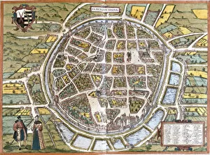
Background imageAtlas Book Collection: Town map of Freiberg (Fribergum Misinae), Germany (etching, 1572-1617)

Town map of Freiberg (Fribergum Misinae), Germany (etching, 1572-1617)
LRI4709348 Town map of Freiberg (Fribergum Misinae), Germany (etching, 1572-1617) by Hogenberg, Franz (1540-c.1590); Private Collection; (add.info.: Town map of Freiberg (Fribergum Misinae)

Background imageAtlas Book Collection: View of Innsbruck (Oenipons or Enipontus), Austria (etching, 1572-1617)

View of Innsbruck (Oenipons or Enipontus), Austria (etching, 1572-1617)
LRI4707322 View of Innsbruck (Oenipons or Enipontus), Austria (etching, 1572-1617) by Hogenberg, Franz (1540-c.1590); Private Collection; (add.info.: View of Innsbruck (Oenipons or Enipontus)

Background imageAtlas Book Collection: Views of Montpellier (Monspessulanus), Tours (Turo) and Poitiers (Pictavis)

Views of Montpellier (Monspessulanus), Tours (Turo) and Poitiers (Pictavis)
LRI4707240 Views of Montpellier (Monspessulanus), Tours (Turo) and Poitiers (Pictavis), France (etching, 1572-1617) by Hogenberg

Background imageAtlas Book Collection: View of Paris (Lutetia), France (etching, 1572-1617)

View of Paris (Lutetia), France (etching, 1572-1617)
LRI4707217 View of Paris (Lutetia), France (etching, 1572-1617) by Hogenberg, Franz (1540-c.1590); Private Collection; (add.info.: Vue de Paris (Lutetia)

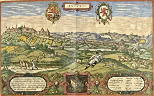
Background imageAtlas Book Collection: View of Limburg (Lympurch), Netherlands (etching, 1572-1617)

View of Limburg (Lympurch), Netherlands (etching, 1572-1617)
LRI4708971 View of Limburg (Lympurch), Netherlands (etching, 1572-1617) by Hogenberg, Franz (1540-c.1590); Private Collection; (add.info.: View of Limburg (Lympurch)

Background imageAtlas Book Collection: View of Granada, Spain (etching, 1572-1617)

View of Granada, Spain (etching, 1572-1617)
LRI4707176 View of Granada, Spain (etching, 1572-1617) by Hogenberg, Franz (1540-c.1590); Private Collection; (add.info.: View of Granada)

Background imageAtlas Book Collection: View of Alhama de Granada (Alhama), Spain (etching, 1572-1617)

View of Alhama de Granada (Alhama), Spain (etching, 1572-1617)
LRI4708691 View of Alhama de Granada (Alhama), Spain (etching, 1572-1617) by Hogenberg, Franz (1540-c.1590); Private Collection; (add.info.: View of Alhama de Granada (Alhama)

Background imageAtlas Book Collection: Map of Messina (Messana), Italy (etching, 1572-1617)

Map of Messina (Messana), Italy (etching, 1572-1617)
LRI4708514 Map of Messina (Messana), Italy (etching, 1572-1617) by Hogenberg, Franz (1540-c.1590); Private Collection; (add.info.: Map of Messina (Messana)

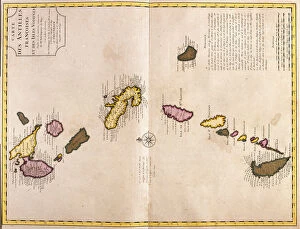
Background imageAtlas Book Collection: Maps of the Caribbean Islands (Guadeloupe, Marie Galante, Dominica, Martinique

Maps of the Caribbean Islands (Guadeloupe, Marie Galante, Dominica, Martinique
LRI4707035 Maps of the Caribbean Islands (Guadeloupe, Marie Galante, Dominica, Martinique, Saint Lucia, Saint Vincent, Barbados, Grenadines and Grenada) (etching, 1730) by Delisle

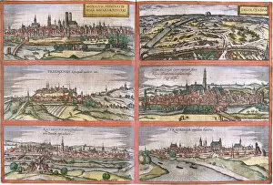
Background imageAtlas Book Collection: Views of Munich (Monacum) Ingolstadt (Ingolstadium), Freising (Frisingensis)

Views of Munich (Monacum) Ingolstadt (Ingolstadium), Freising (Frisingensis)
LRI4708346 Views of Munich (Monacum) Ingolstadt (Ingolstadium), Freising (Frisingensis), Nordlingen (Nordlinga), Regensburg (Ratispona) and Straubing (Stravbinga), Germany (etching)

Background imageAtlas Book Collection: Map of Egypt, Nubia (Sudan) and Abyssinia (Ethiopia) (etching, 1730)

Map of Egypt, Nubia (Sudan) and Abyssinia (Ethiopia) (etching, 1730)
LRI4706896 Map of Egypt, Nubia (Sudan) and Abyssinia (Ethiopia) (etching, 1730) by Delisle, Guillaume (1675-1726); Private Collection; (add.info.: Map of Egypt)

Background imageAtlas Book Collection: Views of Nuremberg (Nurnberga), Ulm (Ulma), Lindau (Lindola)

Views of Nuremberg (Nurnberga), Ulm (Ulma), Lindau (Lindola)
LRI4708130 Views of Nuremberg (Nurnberga), Ulm (Ulma), Lindau (Lindola), Germany and Salzburg (Salisburgensis) in Austria (etching, 1572-1617) by Hogenberg

Background imageAtlas Book Collection: Map of Artois (Pas de Calais, France) (etching, 1730)

Map of Artois (Pas de Calais, France) (etching, 1730)
LRI4706633 Map of Artois (Pas de Calais, France) (etching, 1730) by Delisle, Guillaume (1675-1726); Private Collection; (add.info.: Map of Artois (Pas de Calais)

Background imageAtlas Book Collection: Plan of Mstricht (Traiectum), Netherlands (etching, 1572-1617)

Plan of Mstricht (Traiectum), Netherlands (etching, 1572-1617)
LRI4707966 Plan of Mstricht (Traiectum), Netherlands (etching, 1572-1617) by Hogenberg, Franz (1540-c.1590); Private Collection; (add.info.: Plan of Mstricht (Traiectum)

Background imageAtlas Book Collection: Map of Bruges (Brugae), Belgium (etching, 1572-1617)

Map of Bruges (Brugae), Belgium (etching, 1572-1617)
LRI4707927 Map of Bruges (Brugae), Belgium (etching, 1572-1617) by Hogenberg, Franz (1540-c.1590); Private Collection; (add.info.: Plan de Bruges (Brugae)

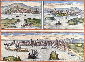
Background imageAtlas Book Collection: Views of Sibenik (Sibinium, Sibenicho), Porec (Parens, Parentium)

Views of Sibenik (Sibinium, Sibenicho), Porec (Parens, Parentium)
LRI4707498 Views of Sibenik (Sibinium, Sibenicho), Porec (Parens, Parentium), Croatia and Modon (Modona), Greece (etching, 1572-1617) by Hogenberg

Background imageAtlas Book Collection: Atlas carrying the world, in a geography map shop (etching, 1730)

Atlas carrying the world, in a geography map shop (etching, 1730)
LRI4706259 Atlas carrying the world, in a geography map shop (etching, 1730) by Delisle, Guillaume (1675-1726); Private Collection; (add.info.: Cover with frontispiece, Atlas carrying the world)

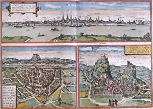
Background imageAtlas Book Collection: Plan of Cologne (Colonia Agrippa), Germany (etching, 1572-1617)

Plan of Cologne (Colonia Agrippa), Germany (etching, 1572-1617)
LRI4708320 Plan of Cologne (Colonia Agrippa), Germany (etching, 1572-1617) by Hogenberg, Franz (1540-c.1590); Private Collection; (add.info.: Plan of Cologne (Colonia Agrippa)

Background imageAtlas Book Collection: Views of Mainz (Moguntia), Wurzburg, Germany and Sion (Sedunum) in Switzerland (etching

Views of Mainz (Moguntia), Wurzburg, Germany and Sion (Sedunum) in Switzerland (etching
LRI4708316 Views of Mainz (Moguntia), WAorzburg, Germany and Sion (Sedunum) in Switzerland (etching, 1572-1617) by Hogenberg

Background imageAtlas Book Collection: Map of Frankfurt (Francofordia), Germany (etching, 1572-1617)

Map of Frankfurt (Francofordia), Germany (etching, 1572-1617)
LRI4708220 Map of Frankfurt (Francofordia), Germany (etching, 1572-1617) by Hogenberg, Franz (1540-c.1590); Private Collection; (add.info.: Map of Frankfurt (Francofordia)

Background imageAtlas Book Collection: Plan de Strasbourg (Argentoratum), France (etching, 1572-1617)

Plan de Strasbourg (Argentoratum), France (etching, 1572-1617)
LRI4708187 Plan de Strasbourg (Argentoratum), France (etching, 1572-1617) by Hogenberg, Franz (1540-c.1590); Private Collection; (add.info.: Plan de Strasbourg (Argentoratum)

Background imageAtlas Book Collection: Map of Coromandel and Malabar (India) (etching, 1730)

Map of Coromandel and Malabar (India) (etching, 1730)
LRI4706753 Map of Coromandel and Malabar (India) (etching, 1730) by Delisle, Guillaume (1675-1726); Private Collection; (add.info)

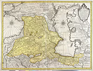
Background imageAtlas Book Collection: Map of neighboring countries of the Caspian Sea (Russia, Armenia, Persia, Kazakhstan

Map of neighboring countries of the Caspian Sea (Russia, Armenia, Persia, Kazakhstan
LRI4706723 Map of neighboring countries of the Caspian Sea (Russia, Armenia, Persia, Kazakhstan, Turkmenistan) (etching, 1730) by Delisle

Background imageAtlas Book Collection: Views of Groningen (Groeninga), Brouwershaven (Broversavia) and Gorinchem (Goricum)

Views of Groningen (Groeninga), Brouwershaven (Broversavia) and Gorinchem (Goricum)
LRI4708013 Views of Groningen (Groeninga), Brouwershaven (Broversavia) and Gorinchem (Goricum), in the Netherlands (etching, 1572-1617) by Hogenberg

Background imageAtlas Book Collection: Map of Germany (etching, 1730)

Map of Germany (etching, 1730)
LRI4706583 Map of Germany (etching, 1730) by Delisle, Guillaume (1675-1726); Private Collection; (add.info.: Map of Germany - Strong water extracted from the " New Atlas containing all parts of)

Background imageAtlas Book Collection: Map of the Nordic countries, kingdoms of Denmark, Sweden and Norway (etching, 1730)

Map of the Nordic countries, kingdoms of Denmark, Sweden and Norway (etching, 1730)
LRI4706363 Map of the Nordic countries, kingdoms of Denmark, Sweden and Norway (etching, 1730) by Delisle, Guillaume (1675-1726); Private Collection; (add.info.: Map of the Nordic countries)

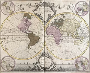
Background imageAtlas Book Collection: Planisphere World (etching, 1730)

Planisphere World (etching, 1730)
LRI4706277 Planisphere World (etching, 1730) by Delisle, Guillaume (1675-1726); Private Collection; (add.info.: Planisphere World - Strong water extracted from the " Atlas Nouveau containing all)

Background imageAtlas Book Collection: View of Liege (Leodium), Belgium (etching, 1572-1617)

View of Liege (Leodium), Belgium (etching, 1572-1617)
LRI4707478 View of Liege (Leodium), Belgium (etching, 1572-1617) by Hogenberg, Franz (1540-c.1590); Private Collection; (add.info.: Vue de Liege (Leodium)

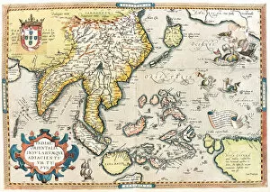
Background imageAtlas Book Collection: Map of East India and South East Asian territory, 1570 (engraving)

Map of East India and South East Asian territory, 1570 (engraving)
LRI4704952 Map of East India and South East Asian territory, 1570 (engraving) by Ortelius, Abraham (1527-98); Museo Navale di Pegli, Genoa

Background imageAtlas Book Collection: Map of Transylvania, 1570 (engraving)

Map of Transylvania, 1570 (engraving)
LRI4704877 Map of Transylvania, 1570 (engraving) by Ortelius, Abraham (1527-98); Museo Navale di Pegli, Genoa, Italy; (add.info)

Background imageAtlas Book Collection: Map of the Swiss and French Alps including lakes, 1570 (engraving)

Map of the Swiss and French Alps including lakes, 1570 (engraving)
LRI4704800 Map of the Swiss and French Alps including lakes, 1570 (engraving) by Ortelius, Abraham (1527-98); Museo Navale di Pegli, Genoa

Background imageAtlas Book Collection: Map of the Duchy of Milan, 1570 (engraving)

Map of the Duchy of Milan, 1570 (engraving)
LRI4704712 Map of the Duchy of Milan, 1570 (engraving) by Ortelius, Abraham (1527-98); Museo Navale di Pegli, Genoa, Italy; (add.info.: Ducatus Mediolanensis)

Background imageAtlas Book Collection: Map of the Netherlands, 1570 (engraving)

Map of the Netherlands, 1570 (engraving)
LRI4704413 Map of the Netherlands, 1570 (engraving) by Ortelius, Abraham (1527-98); Museo Navale di Pegli, Genoa, Italy; (add.info)

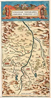
Background imageAtlas Book Collection: Map of the Loire territory with the castles and towns bordering the river

Map of the Loire territory with the castles and towns bordering the river
LRI4704304 Map of the Loire territory with the castles and towns bordering the river, 1570 (engraving) by Ortelius, Abraham (1527-98); Museo Navale di Pegli, Genoa

Background imageAtlas Book Collection: Gouda, Netherlands (engraving, 1572-1617)

Gouda, Netherlands (engraving, 1572-1617)
LRI4714027 Gouda, Netherlands (engraving, 1572-1617) by Hogenberg, Franz (1540-c.1590); Private Collection; (add.info.: Gouda (Goude)

Background imageAtlas Book Collection: Rotterdam, Netherlands (engraving, 1572-1617)

Rotterdam, Netherlands (engraving, 1572-1617)
LRI4714007 Rotterdam, Netherlands (engraving, 1572-1617) by Hogenberg, Franz (1540-c.1590); Private Collection; (add.info.: Roterodamum (Rotterdam)

Background imageAtlas Book Collection: Map of Brittany (France), 1703 (Engraving, 1717)

Map of Brittany (France), 1703 (Engraving, 1717)
LRI4711767 Map of Brittany (France), 1703 (Engraving, 1717) by Nolin, Jean-Baptiste (c.1657-1708); Private Collection; (add.info.: Map of the Duche of Brittany and Count Nantois)

Background imageAtlas Book Collection: Map of the East of Ile de France, 1698 (Engraving, 1717)

Map of the East of Ile de France, 1698 (Engraving, 1717)
LRI4711627 Map of the East of Ile de France, 1698 (Engraving, 1717) by Nolin, Jean-Baptiste (c.1657-1708); Private Collection; (add.info.: Map of the regions of the east of the island of France)


For sale as Licensed Images

Choose your image, Select your licence and Download the media

Discover the world through the pages of the Atlas Book. This captivating collection takes you on a journey across time and space, showcasing intricate engravings of maps from various regions. Immerse yourself in history as you explore the Map of Tartar territory, dating back to 1570, or marvel at the detailed depiction of Tuscany in Italy from the same era. Travel further with a glimpse into Poitou Charentes in France during 1717 or delve into Franconia in Germany during 1570. But it doesn't stop there; this remarkable atlas also includes fascinating maps such as Jerusalem, offering a unique perspective on Israel between 1572 and 1617. Explore Les Deux Sevres and Department of Allier in France, both part of an extensive collection featuring one hundred and five meticulously crafted maps by M. VUILLEMIN from 1876. From Corsica's stunning landscapes to Le Gers' picturesque Midi-Pyrenees region, each map offers a window into different corners of France and its colonies. Lose yourself among these beautifully illustrated depictions that were once used by war depots, bridges departments, footwear manufacturers, and even naval forces. The Atlas Book is not just an ordinary compilation; it is a treasure trove for history enthusiasts and cartography aficionados alike. Embark on an extraordinary voyage through time with this exceptional volume that brings centuries-old maps to life before your eyes. Let your imagination soar as you flip through page after page filled with rich details waiting to be discovered within these ancient engravings. Uncover hidden gems like Le Cantal's enchanting landscapes or get lost amidst Brittany's charming beauty captured within La Nievre's borders. Each turn reveals new wonders awaiting exploration - all thanks to M. VUILLEMIN's masterful artistry showcased throughout this remarkable atlas. Whether you're seeking knowledge about historical territories or simply appreciate fine craftsmanship, the a must-have addition to any collection.