
Atlas Book Collection (#4)

Discover the world through the pages of the Atlas Book

Background imageAtlas Book Collection: View of Nimegue (Noviomagium), Netherlands (etching, 1572-1617)

View of Nimegue (Noviomagium), Netherlands (etching, 1572-1617)
LRI4709103 View of Nimegue (Noviomagium), Netherlands (etching, 1572-1617) by Hogenberg, Franz (1540-c.1590); Private Collection; (add.info.: View of Nimegue (Noviomagium)

Background imageAtlas Book Collection: Vues de Dunkirk (Duynkercke), Gravelines (Grevelinge) and Bourbourg (Borborch)

Vues de Dunkirk (Duynkercke), Gravelines (Grevelinge) and Bourbourg (Borborch)
LRI4709050 Vues de Dunkirk (Duynkercke), Gravelines (Grevelinge) and Bourbourg (Borborch), France (etching, 1572-1617) by Hogenberg

Background imageAtlas Book Collection: View of Antequera, Spain (etching, 1572-1617)

View of Antequera, Spain (etching, 1572-1617)
LRI4708712 View of Antequera, Spain (etching, 1572-1617) by Hogenberg, Franz (1540-c.1590); Private Collection; (add.info.: View of Antequera)

Background imageAtlas Book Collection: Map of Corsica (France) (etching, 1730)

Map of Corsica (France) (etching, 1730)
LRI4707105 Map of Corsica (France) (etching, 1730) by Delisle, Guillaume (1675-1726); Private Collection; (add.info.: Map of Corsica (France)

Background imageAtlas Book Collection: Map of Cambridge (Cantebrigia), England (etching, 1572-1617)

Map of Cambridge (Cantebrigia), England (etching, 1572-1617)
LRI4708624 Map of Cambridge (Cantebrigia), England (etching, 1572-1617) by Hogenberg, Franz (1540-c.1590); Private Collection; (add.info.: Map of Cambridge (Cantebrigia)

Background imageAtlas Book Collection: Map of Meridional Africa (Angola, Namibia, Zambia, Zimbabwe, Mozambique

Map of Meridional Africa (Angola, Namibia, Zambia, Zimbabwe, Mozambique
LRI4706875 Map of Meridional Africa (Angola, Namibia, Zambia, Zimbabwe, Mozambique, South Africa) with the island of Madagascar (etching, 1730) by Delisle

Background imageAtlas Book Collection: Map of Africa (etching, 1730)

Map of Africa (etching, 1730)
LRI4706860 Map of Africa (etching, 1730) by Delisle, Guillaume (1675-1726); Private Collection; (add.info.: Map of Africa - Strong water extracted from the " New Atlas containing all parts of)

Background imageAtlas Book Collection: Plan of Naples (Neapolis), Italy (etching, 1572-1617)

Plan of Naples (Neapolis), Italy (etching, 1572-1617)
LRI4708454 Plan of Naples (Neapolis), Italy (etching, 1572-1617) by Hogenberg, Franz (1540-c.1590); Private Collection; (add.info.: Plan of Naples (Neapolis)

Background imageAtlas Book Collection: Plan of Augsburg (Augusta Vindelicorum), Germany (etching, 1572-1617)

Plan of Augsburg (Augusta Vindelicorum), Germany (etching, 1572-1617)
LRI4708338 Plan of Augsburg (Augusta Vindelicorum), Germany (etching, 1572-1617) by Hogenberg, Franz (1540-c.1590); Private Collection; (add.info.: Plan of Augsburg (Augusta Vindelicorum)

Background imageAtlas Book Collection: Map of South America (engraving, 1635)

Map of South America (engraving, 1635)
LRI4706249 Map of South America (engraving, 1635) by Blaeu, Willem (1571-1638); Museo Navale di Pegli, Genoa, Italy; (add.info.: Map of South America - Plate from " Theatrum orbis Terrarum)

Background imageAtlas Book Collection: Map of northern Africa, 1570 (engraving)

Map of northern Africa, 1570 (engraving)
LRI4705031 Map of northern Africa, 1570 (engraving) by Ortelius, Abraham (1527-98); Museo Navale di Pegli, Genoa, Italy; (add.info.: Barbariae and Biledulgerid, Nova Descriptio)

Background imageAtlas Book Collection: Map of the territory of Russia, 1570 (engraving)

Map of the territory of Russia, 1570 (engraving)
LRI4704916 Map of the territory of Russia, 1570 (engraving) by Ortelius, Abraham (1527-98); Museo Navale di Pegli, Genoa, Italy; (add.info.: Russiae, Moscoviae and Tartariae descriptio)

Background imageAtlas Book Collection: Map of Poland, 1570 (engraving)

Map of Poland, 1570 (engraving)
LRI4704888 Map of Poland, 1570 (engraving) by Ortelius, Abraham (1527-98); Museo Navale di Pegli, Genoa, Italy; (add.info.: Poloniae finitimarumque locorum descriptio)

Background imageAtlas Book Collection: View of Damascus (Damascus), Syria (etching, 1572-1617)

View of Damascus (Damascus), Syria (etching, 1572-1617)
LRI4707573 View of Damascus (Damascus), Syria (etching, 1572-1617) by Hogenberg, Franz (1540-c.1590); Private Collection; (add.info.: View of Damascus (Damascus)

Background imageAtlas Book Collection: Plan of La Rochelle (Rochella), France (etching, 1572-1617)

Plan of La Rochelle (Rochella), France (etching, 1572-1617)
LRI4708825 Plan of La Rochelle (Rochella), France (etching, 1572-1617) by Hogenberg, Franz (1540-c.1590); Private Collection; (add.info.: Plan de La Rochelle (Rochella)

Background imageAtlas Book Collection: View of Meissen (Misena), Germany (etching, 1572-1617)

View of Meissen (Misena), Germany (etching, 1572-1617)
LRI4707336 View of Meissen (Misena), Germany (etching, 1572-1617) by Hogenberg, Franz (1540-c.1590); Private Collection; (add.info.: View of Meissen (Misena)

Background imageAtlas Book Collection: View of Rouen (Rotomagus), Nimes (Nemausus) and Bordeaux (Burdigala), France (etching

View of Rouen (Rotomagus), Nimes (Nemausus) and Bordeaux (Burdigala), France (etching
LRI4707261 View of Rouen (Rotomagus), Nimes (Nemausus) and Bordeaux (Burdigala), France (etching, 1572-1617) by Hogenberg

Background imageAtlas Book Collection: Views of Oxford (Oxonium) and Windsor (Vindesorium), England (etching, 1572-1617)

Views of Oxford (Oxonium) and Windsor (Vindesorium), England (etching, 1572-1617)
LRI4708676 Views of Oxford (Oxonium) and Windsor (Vindesorium), England (etching, 1572-1617) by Hogenberg, Franz (1540-c.1590); Private Collection; (add.info)

Background imageAtlas Book Collection: Map of Europe and North African Coasts (etching, 1730)

Map of Europe and North African Coasts (etching, 1730)
LRI4707086 Map of Europe and North African Coasts (etching, 1730) by Delisle, Guillaume (1675-1726); Private Collection; (add.info)

Background imageAtlas Book Collection: Map of Louisiana (USA) and the Mississippi River (etching, 1730)

Map of Louisiana (USA) and the Mississippi River (etching, 1730)
LRI4707000 Map of Louisiana (USA) and the Mississippi River (etching, 1730) by Delisle, Guillaume (1675-1726); Private Collection; (add.info)

Background imageAtlas Book Collection: Map of North America (Greenland, Canada, USA, Mexico and the Caribbean Islands: Cuba

Map of North America (Greenland, Canada, USA, Mexico and the Caribbean Islands: Cuba
LRI4706891 Map of North America (Greenland, Canada, USA, Mexico and the Caribbean Islands: Cuba, Haiti, Jamaica, West Indies) (etching, 1730) by Delisle

Background imageAtlas Book Collection: Plan of Cagliari (Calaris), Sardinia (Italy), Malta (Malta)

Plan of Cagliari (Calaris), Sardinia (Italy), Malta (Malta)
LRI4708517 Plan of Cagliari (Calaris), Sardinia (Italy), Malta (Malta), Rhodes (Rhodus) and Famagusta (Famaugusta), Cyprus (etching, 1572-1617) by Hogenberg

Background imageAtlas Book Collection: Views of Parma (Parma), Siena (Sena), Palermo (Panhormus) and Trapani (Drepanum) (Sicily)

Views of Parma (Parma), Siena (Sena), Palermo (Panhormus) and Trapani (Drepanum) (Sicily)
LRI4708468 Views of Parma (Parma), Siena (Sena), Palermo (Panhormus) and Trapani (Drepanum) (Sicily), Italy (etching, 1572-1617) by Hogenberg

Background imageAtlas Book Collection: Map of Italy, with Corsica, Sardinia and Sicily (etching, 1730)

Map of Italy, with Corsica, Sardinia and Sicily (etching, 1730)
LRI4706647 Map of Italy, with Corsica, Sardinia and Sicily (etching, 1730) by Delisle, Guillaume (1675-1726); Private Collection; (add.info.: Map of Italy, with Corsica)

Background imageAtlas Book Collection: Views of Genes (Genua) and Florence (Florentia), Italy (etching, 1572-1617)

Views of Genes (Genua) and Florence (Florentia), Italy (etching, 1572-1617)
LRI4708419 Views of Genes (Genua) and Florence (Florentia), Italy (etching, 1572-1617) by Hogenberg, Franz (1540-c.1590); Private Collection; (add.info)

Background imageAtlas Book Collection: Plan of Venice (Venetia), Italy (etching, 1572-1617)

Plan of Venice (Venetia), Italy (etching, 1572-1617)
LRI4708397 Plan of Venice (Venetia), Italy (etching, 1572-1617) by Hogenberg, Franz (1540-c.1590); Private Collection; (add.info.: Plan of Venice (Venetia)

Background imageAtlas Book Collection: Map of the meridional part of the great principality of Moscow (Russia) (etching, 1730)

Map of the meridional part of the great principality of Moscow (Russia) (etching, 1730)
LRI4706431 Map of the meridional part of the great principality of Moscow (Russia) (etching, 1730) by Delisle, Guillaume (1675-1726); Private Collection; (add.info)

Background imageAtlas Book Collection: Map of the Great Principality of Moscow (Russia) (etching, 1730)

Map of the Great Principality of Moscow (Russia) (etching, 1730)
LRI4706415 Map of the Great Principality of Moscow (Russia) (etching, 1730) by Delisle, Guillaume (1675-1726); Private Collection; (add.info)

Background imageAtlas Book Collection: Views of Wittenburg (Wittenburga), Frankfurt (Francfordiensis)

Views of Wittenburg (Wittenburga), Frankfurt (Francfordiensis)
LRI4708070 Views of Wittenburg (Wittenburga), Frankfurt (Francfordiensis), Wismar (Wismaria) and Rostock (Rostochium), Germany (etching, 1572-1617) by Hogenberg

Background imageAtlas Book Collection: View of Munster (Monasterium), Osnabruck (Osnabrugum) and Wesel (Weselia)

View of Munster (Monasterium), Osnabruck (Osnabrugum) and Wesel (Weselia)
LRI4708030 View of Munster (Monasterium), Osnabruck (Osnabrugum) and Wesel (Weselia), Germany (etching, 1572-1617) by Hogenberg

Background imageAtlas Book Collection: Views of Bois le Duc (Buscumducis), in the Netherlands, Leuven (Lovanium

Views of Bois le Duc (Buscumducis), in the Netherlands, Leuven (Lovanium
LRI4707955 Views of Bois le Duc (Buscumducis), in the Netherlands, Leuven (Lovanium) and Machelen (Mechlineen) in Belgium (etching, 1572-1617) by Hogenberg

Background imageAtlas Book Collection: Views of Tunis (Tunes) and Mahdia (Aphrodisium) in Tunisia

Views of Tunis (Tunes) and Mahdia (Aphrodisium) in Tunisia
LRI4707713 Views of Tunis (Tunes) and Mahdia (Aphrodisium) in Tunisia, and Penon de Velez de la Gomera or Badis (Bades) (Penon de Veles), penon de Veles, disputed between Spain and Morocco (etching)

Background imageAtlas Book Collection: Mexico (engraving, 1596)

Mexico (engraving, 1596)
LRI4718850 Mexico (engraving, 1596) by Mercator, Gerardus (1512-94); Private Collection; (add.info.: Hispaniae novae descriptio)

Background imageAtlas Book Collection: Japan (engraving, 1596)

Japan (engraving, 1596)
LRI4718817 Japan (engraving, 1596) by Mercator, Gerardus (1512-94); Private Collection; (add.info.: Iaponia, 1633: Japan - in " Atlas Ssive Corsmographicae Meditationes" by Gerard Mercator)

Background imageAtlas Book Collection: Iraq and Afghanistan (engraving, 1596)

Iraq and Afghanistan (engraving, 1596)
LRI4718723 Iraq and Afghanistan (engraving, 1596) by Mercator, Gerardus (1512-94); Private Collection; (add.info.: Persici vel Sophorum Regni tipus)

Background imageAtlas Book Collection: North Africa with siege of Tunis and Nile delta (engraving, 1596)

North Africa with siege of Tunis and Nile delta (engraving, 1596)
LRI4718587 North Africa with siege of Tunis and Nile delta (engraving, 1596) by Mercator, Gerardus (1512-94); Private Collection; (add.info.: Barbaria)

Background imageAtlas Book Collection: Africa (engraving, 1596)

Africa (engraving, 1596)
LRI4718573 Africa (engraving, 1596) by Mercator, Gerardus (1512-94); Private Collection; (add.info.: Nova Africae tabula, 1630)

Background imageAtlas Book Collection: Macedonia and Greece (engraving, 1596)

Macedonia and Greece (engraving, 1596)
LRI4718516 Macedonia and Greece (engraving, 1596) by Mercator, Gerardus (1512-94); Private Collection; (add.info.: Macedonia Epirus and Achaia)

Background imageAtlas Book Collection: Corsica, France (engraving, 1596)

Corsica, France (engraving, 1596)
LRI4718426 Corsica, France (engraving, 1596) by Mercator, Gerardus (1512-94); Private Collection; (add.info.: Corsica, 1631: Corsica)

Background imageAtlas Book Collection: Piemond, Genoa and Montserrat (engraving, 1596)

Piemond, Genoa and Montserrat (engraving, 1596)
LRI4718233 Piemond, Genoa and Montserrat (engraving, 1596) by Mercator, Gerardus (1512-94); Private Collection; (add.info.: Pedemontana regio um um Genuensium territorio & Montisferrati Marchionatu)

Background imageAtlas Book Collection: Italy (engraving, 1596)

Italy (engraving, 1596)
LRI4718195 Italy (engraving, 1596) by Mercator, Gerardus (1512-94); Private Collection; (add.info.: Italia, 1630: Italy - in " Atlas Ssive Corsmographicae Meditationes" by Gerard Mercator)

Background imageAtlas Book Collection: Moravia, Czech Republic (engraving, 1596)

Moravia, Czech Republic (engraving, 1596)
LRI4718120 Moravia, Czech Republic (engraving, 1596) by Mercator, Gerardus (1512-94); Private Collection; (add.info.: Moravia, 1630: Moravia (Moravia)

Background imageAtlas Book Collection: Prague, Czech Republic (engraving, 1596)

Prague, Czech Republic (engraving, 1596)
LRI4718102 Prague, Czech Republic (engraving, 1596) by Mercator, Gerardus (1512-94); Private Collection; (add.info.: Bohemia, 1634: Prague)

Background imageAtlas Book Collection: Braunschweig and Magdeburg, Germany (engraving, 1596)

Braunschweig and Magdeburg, Germany (engraving, 1596)
LRI4717965 Braunschweig and Magdeburg, Germany (engraving, 1596) by Mercator, Gerardus (1512-94); Private Collection; (add.info.: Braunswyck & Meydburg um ceteris adiacentbus)

Background imageAtlas Book Collection: Alsace, France (engraving, 1596)

Alsace, France (engraving, 1596)
LRI4717918 Alsace, France (engraving, 1596) by Mercator, Gerardus (1512-94); Private Collection; (add.info.: Alsatia inferior, 1630: Alsace)

Background imageAtlas Book Collection: Holland and Brabant, Belgium (engraving, 1596)

Holland and Brabant, Belgium (engraving, 1596)
LRI4717853 Holland and Brabant, Belgium (engraving, 1596) by Mercator, Gerardus (1512-94); Private Collection; (add.info)

Background imageAtlas Book Collection: The course of the Rhine river in Westphalia, Germany (engraving, 1596)

The course of the Rhine river in Westphalia, Germany (engraving, 1596)
LRI4717805 The course of the Rhine river in Westphalia, Germany (engraving, 1596) by Mercator, Gerardus (1512-94); Private Collection; (add.info.: Comitatus Walls, 1630. Germania, Moers)


For sale as Licensed Images

Choose your image, Select your licence and Download the media

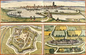
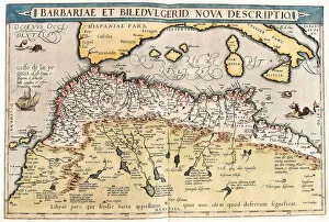
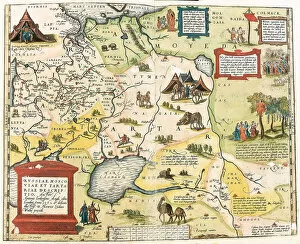
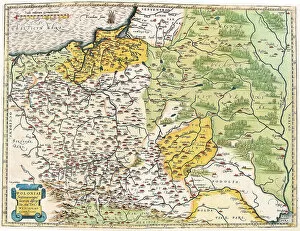
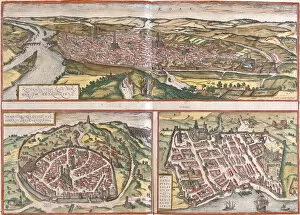
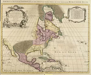
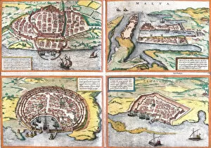
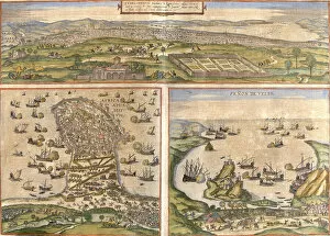
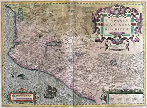
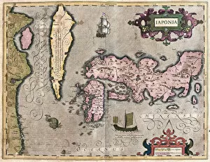
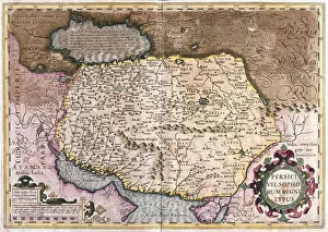
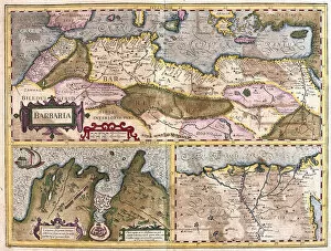
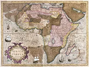
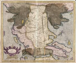
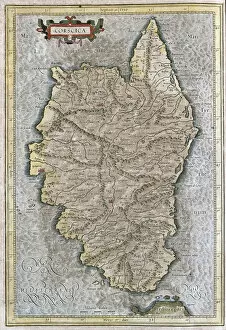
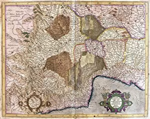
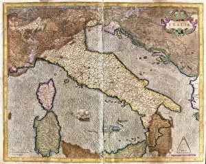
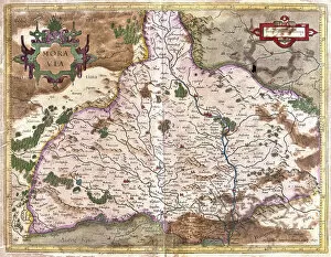
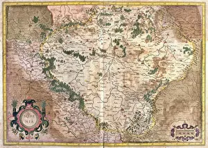
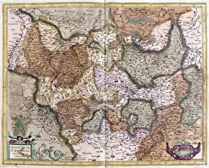
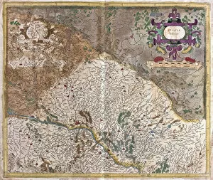
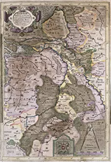
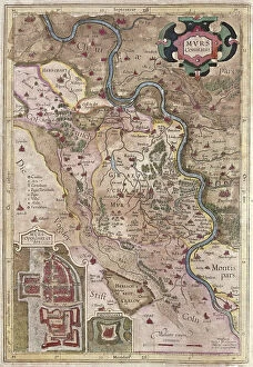
Discover the world through the pages of the Atlas Book. This captivating collection takes you on a journey across time and space, showcasing intricate engravings of maps from various regions. Immerse yourself in history as you explore the Map of Tartar territory, dating back to 1570, or marvel at the detailed depiction of Tuscany in Italy from the same era. Travel further with a glimpse into Poitou Charentes in France during 1717 or delve into Franconia in Germany during 1570. But it doesn't stop there; this remarkable atlas also includes fascinating maps such as Jerusalem, offering a unique perspective on Israel between 1572 and 1617. Explore Les Deux Sevres and Department of Allier in France, both part of an extensive collection featuring one hundred and five meticulously crafted maps by M. VUILLEMIN from 1876. From Corsica's stunning landscapes to Le Gers' picturesque Midi-Pyrenees region, each map offers a window into different corners of France and its colonies. Lose yourself among these beautifully illustrated depictions that were once used by war depots, bridges departments, footwear manufacturers, and even naval forces. The Atlas Book is not just an ordinary compilation; it is a treasure trove for history enthusiasts and cartography aficionados alike. Embark on an extraordinary voyage through time with this exceptional volume that brings centuries-old maps to life before your eyes. Let your imagination soar as you flip through page after page filled with rich details waiting to be discovered within these ancient engravings. Uncover hidden gems like Le Cantal's enchanting landscapes or get lost amidst Brittany's charming beauty captured within La Nievre's borders. Each turn reveals new wonders awaiting exploration - all thanks to M. VUILLEMIN's masterful artistry showcased throughout this remarkable atlas. Whether you're seeking knowledge about historical territories or simply appreciate fine craftsmanship, the a must-have addition to any collection.