Atlas Book Collection (#19)

Discover the world through the pages of the Atlas Book

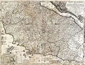
Background imageAtlas Book Collection: Map of the Church territories in Italy (etching, 1717)

Map of the Church territories in Italy (etching, 1717)
LRI4711287 Map of the Church territories in Italy (etching, 1717) by Nolin, Jean-Baptiste (c.1657-1708); Private Collection; (add.info.: Map of the states of the Church in Italy (the Ferrari)

Background imageAtlas Book Collection: Map of Swabia (Germany) (etching, 1671)

Map of Swabia (Germany) (etching, 1671)
LRI4710330 Map of Swabia (Germany) (etching, 1671) by Wit, Frederick de (1630-1706); Private Collection; (add.info.: Map of Swabia (Germany) - Strong water extracted from " Theatrum Orbis"

Background imageAtlas Book Collection: Map of Moscow (Russia), the Kingdom of Sweden, the Baltic Provinces and Part of Poland

Map of Moscow (Russia), the Kingdom of Sweden, the Baltic Provinces and Part of Poland
LRI4711219 Map of Moscow (Russia), the Kingdom of Sweden, the Baltic Provinces and Part of Poland (etching, 1717) by Nolin

Background imageAtlas Book Collection: Map of the Duche of Meklembourg Schwerin (Germany) (etching, 1671)

Map of the Duche of Meklembourg Schwerin (Germany) (etching, 1671)
LRI4710169 Map of the Duche of Meklembourg Schwerin (Germany) (etching, 1671) by Wit, Frederick de (1630-1706); Private Collection; (add.info)

Background imageAtlas Book Collection: Map of the Margraviate of Brandenburg (Germany) (etching, 1671)

Map of the Margraviate of Brandenburg (Germany) (etching, 1671)
LRI4710141 Map of the Margraviate of Brandenburg (Germany) (etching, 1671) by Wit, Frederick de (1630-1706); Private Collection; (add.info)

Background imageAtlas Book Collection: Map of the Dauphine (France) (etching, 1671)

Map of the Dauphine (France) (etching, 1671)
LRI4709815 Map of the Dauphine (France) (etching, 1671) by Wit, Frederick de (1630-1706); Private Collection; (add.info.: Map of the Dauphine (France)

Background imageAtlas Book Collection: Map of the Count of Zelande (Netherlands) (etching, 1671)

Map of the Count of Zelande (Netherlands) (etching, 1671)
LRI4710922 Map of the Count of Zelande (Netherlands) (etching, 1671) by Wit, Frederick de (1630-1706); Private Collection; (add.info)

Background imageAtlas Book Collection: Map of the Duche of Brittany (France) (etching, 1671)

Map of the Duche of Brittany (France) (etching, 1671)
LRI4709686 Map of the Duche of Brittany (France) (etching, 1671) by Wit, Frederick de (1630-1706); Private Collection; (add.info)

Background imageAtlas Book Collection: Map of the Iberic Peninsula, Spain and Portugal (etching, 1671)

Map of the Iberic Peninsula, Spain and Portugal (etching, 1671)
LRI4709541 Map of the Iberic Peninsula, Spain and Portugal (etching, 1671) by Wit, Frederick de (1630-1706); Private Collection; (add.info.: Map of the Iberic Peninsula)

Background imageAtlas Book Collection: Frontispice of the first volume: allegory of geography, a woman holding comppas

Frontispice of the first volume: allegory of geography, a woman holding comppas
LRI4709388 Frontispice of the first volume: allegory of geography, a woman holding comppas, square and rulle, truncating above a female soldier and a naked man (etching, 1572-1617) by Hogenberg

Background imageAtlas Book Collection: Views of Constance (Contantia), Germany and St. Galli (S

Views of Constance (Contantia), Germany and St. Galli (S
LRI4709380 Views of Constance (Contantia), Germany and St. Galli (S. Galli), Switzerland (etching, 1572-1617) by Hogenberg

Background imageAtlas Book Collection: Map of Weissenburg (Wissenburgum) in Germany, Rouffach (Rubeacum) and Colmar (Colmaria

Map of Weissenburg (Wissenburgum) in Germany, Rouffach (Rubeacum) and Colmar (Colmaria
LRI4709270 Map of Weissenburg (Wissenburgum) in Germany, Rouffach (Rubeacum) and Colmar (Colmaria) in France and Baden in Switzerland (etching, 1572-1617) by Hogenberg

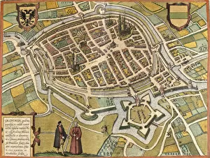
Background imageAtlas Book Collection: Plan of Groningen (Groninga), Netherlands (etching, 1572-1617)

Plan of Groningen (Groninga), Netherlands (etching, 1572-1617)
LRI4709172 Plan of Groningen (Groninga), Netherlands (etching, 1572-1617) by Hogenberg, Franz (1540-c.1590); Private Collection; (add.info.: Plan of Groningen (Groninga)

Background imageAtlas Book Collection: Plan de Brielle (Brilium), Netherlands (etching, 1572-1617)

Plan de Brielle (Brilium), Netherlands (etching, 1572-1617)
LRI4709107 Plan de Brielle (Brilium), Netherlands (etching, 1572-1617) by Hogenberg, Franz (1540-c.1590); Private Collection; (add.info.: Plan de Brielle (Brilium)

Background imageAtlas Book Collection: Map of the Ottoman Empire, 1570 (engraving)

Map of the Ottoman Empire, 1570 (engraving)
LRI4704979 Map of the Ottoman Empire, 1570 (engraving) by Ortelius, Abraham (1527-98); Museo Navale di Pegli, Genoa, Italy; (add.info)

Background imageAtlas Book Collection: Map of Scandinavia and Northern Europe, 1570 (engraving)

Map of Scandinavia and Northern Europe, 1570 (engraving)
LRI4704904 Map of Scandinavia and Northern Europe, 1570 (engraving) by Ortelius, Abraham (1527-98); Museo Navale di Pegli, Genoa, Italy; (add.info.: Septentrionalium Regionum Descrip)

Background imageAtlas Book Collection: Map of Hungary, 1570 (engraving)

Map of Hungary, 1570 (engraving)
LRI4704855 Map of Hungary, 1570 (engraving) by Ortelius, Abraham (1527-98); Museo Navale di Pegli, Genoa, Italy; (add.info.: Hungarian Descriptio, Wolfgango Lazio Auct)

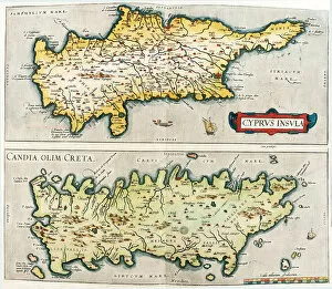
Background imageAtlas Book Collection: Map of the Mediterranean islands of Cyprus and Crete in Greece, 1570 (engraving)

Map of the Mediterranean islands of Cyprus and Crete in Greece, 1570 (engraving)
LRI4704810 Map of the Mediterranean islands of Cyprus and Crete in Greece, 1570 (engraving) by Ortelius, Abraham (1527-98); Museo Navale di Pegli, Genoa, Italy; (add.info.: Cyprus Insula - Candia)

Background imageAtlas Book Collection: Map of Bavaria in Germany, 1570 (engraving)

Map of Bavaria in Germany, 1570 (engraving)
LRI4704635 Map of Bavaria in Germany, 1570 (engraving) by Ortelius, Abraham (1527-98); Museo Navale di Pegli, Genoa, Italy; (add.info)

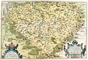
Background imageAtlas Book Collection: Map of Bohemia, 1570 (engraving)

Map of Bohemia, 1570 (engraving)
LRI4704600 Map of Bohemia, 1570 (engraving) by Ortelius, Abraham (1527-98); Museo Navale di Pegli, Genoa, Italy; (add.info)

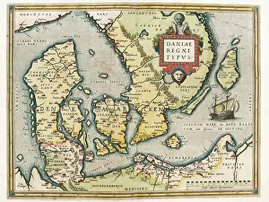
Background imageAtlas Book Collection: Map of Denmark and southern Sweden, 1570 (engraving)

Map of Denmark and southern Sweden, 1570 (engraving)
LRI4704499 Map of Denmark and southern Sweden, 1570 (engraving) by Ortelius, Abraham (1527-98); Museo Navale di Pegli, Genoa

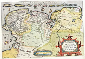
Background imageAtlas Book Collection: Map of the Netherlands with the cities of Groningen and Leeuwarden, 1570 (engraving)

Map of the Netherlands with the cities of Groningen and Leeuwarden, 1570 (engraving)
LRI4704492 Map of the Netherlands with the cities of Groningen and Leeuwarden, 1570 (engraving) by Ortelius, Abraham (1527-98); Museo Navale di Pegli, Genoa

Background imageAtlas Book Collection: Map of the south of the Germanic Netherlands (Kempeland), 1570 (engraving)

Map of the south of the Germanic Netherlands (Kempeland), 1570 (engraving)
LRI4704443 Map of the south of the Germanic Netherlands (Kempeland), 1570 (engraving) by Ortelius, Abraham (1527-98); Museo Navale di Pegli, Genoa

Background imageAtlas Book Collection: Map of Germania (Holy Empire), 1570 (engraving)

Map of Germania (Holy Empire), 1570 (engraving)
LRI4704403 Map of Germania (Holy Empire), 1570 (engraving) by Ortelius, Abraham (1527-98); Museo Navale di Pegli, Genoa, Italy; (add.info)

Background imageAtlas Book Collection: Map of Narbonne, 1570 (engraving)

Map of Narbonne, 1570 (engraving)
LRI4704371 Map of Narbonne, 1570 (engraving) by Ortelius, Abraham (1527-98); Museo Navale di Pegli, Genoa, Italy; (add.info)

Background imageAtlas Book Collection: Map of Portugal, 1570 (engraving)

Map of Portugal, 1570 (engraving)
LRI4704286 Map of Portugal, 1570 (engraving) by Ortelius, Abraham (1527-98); Museo Navale di Pegli, Genoa, Italy; (add.info)

Background imageAtlas Book Collection: Map of Africa. (engraving, 1638)

Map of Africa. (engraving, 1638)
LRI4678163 Map of Africa. (engraving, 1638) by Blaeu, Willem (1571-1638); Private Collection; (add.info.: Map of Africa. Plate from an Atlas by Willem Janszoon Blaeu (Guilielmus Jansonius Blavius)

Background imageAtlas Book Collection: Map of Asia. (engraving, 1638)

Map of Asia. (engraving, 1638)
LRI4678148 Map of Asia. (engraving, 1638) by Blaeu, Willem (1571-1638); Private Collection; (add.info.: Map of Asia. Plate from an Atlas by Willem Janszoon Blaeu (Guilielmus Jansonius Blavius)


For sale as Licensed Images

Choose your image, Select your licence and Download the media

Discover the world through the pages of the Atlas Book. This captivating collection takes you on a journey across time and space, showcasing intricate engravings of maps from various regions. Immerse yourself in history as you explore the Map of Tartar territory, dating back to 1570, or marvel at the detailed depiction of Tuscany in Italy from the same era. Travel further with a glimpse into Poitou Charentes in France during 1717 or delve into Franconia in Germany during 1570. But it doesn't stop there; this remarkable atlas also includes fascinating maps such as Jerusalem, offering a unique perspective on Israel between 1572 and 1617. Explore Les Deux Sevres and Department of Allier in France, both part of an extensive collection featuring one hundred and five meticulously crafted maps by M. VUILLEMIN from 1876. From Corsica's stunning landscapes to Le Gers' picturesque Midi-Pyrenees region, each map offers a window into different corners of France and its colonies. Lose yourself among these beautifully illustrated depictions that were once used by war depots, bridges departments, footwear manufacturers, and even naval forces. The Atlas Book is not just an ordinary compilation; it is a treasure trove for history enthusiasts and cartography aficionados alike. Embark on an extraordinary voyage through time with this exceptional volume that brings centuries-old maps to life before your eyes. Let your imagination soar as you flip through page after page filled with rich details waiting to be discovered within these ancient engravings. Uncover hidden gems like Le Cantal's enchanting landscapes or get lost amidst Brittany's charming beauty captured within La Nievre's borders. Each turn reveals new wonders awaiting exploration - all thanks to M. VUILLEMIN's masterful artistry showcased throughout this remarkable atlas. Whether you're seeking knowledge about historical territories or simply appreciate fine craftsmanship, the a must-have addition to any collection.