Carte Geographique Collection (#4)

"Exploring the World Through Carte Geographique: A Journey Across Time and Space" Step into the past as we delve into the captivating world of "carte geographique

Background imageCarte Geographique Collection: Map of the Principaut and town of Correggio near Modene in Italy by M. Bianchi, 1685

Map of the Principaut and town of Correggio near Modene in Italy by M. Bianchi, 1685. Archivio di Stato de Modene
VEN5028382 Map of the Principaut and town of Correggio near Modene in Italy by M. Bianchi, 1685. Archivio di Stato de Modene.; (add.info)

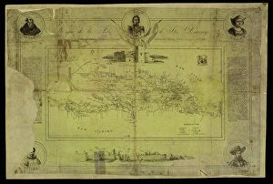
Background imageCarte Geographique Collection: Geography Atlas: representation of the island of Santo Domingo in the West Indies

Geography Atlas: representation of the island of Santo Domingo in the West Indies
VEN5031364 Geography Atlas: representation of the island of Santo Domingo in the West Indies. Map taken from an atlas by Antonio del Monte y Tejada (1783-1861) with portraits of Christopher Columbus
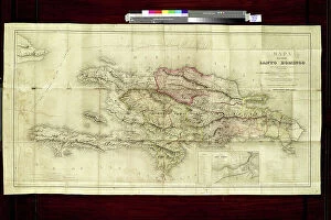
Background imageCarte Geographique Collection: Geography: map of the island of Santo Domingo (Dominican Republic) in the West Indies

Geography: map of the island of Santo Domingo (Dominican Republic) in the West Indies
VEN5031333 Geography: map of the island of Santo Domingo (Dominican Republic) in the West Indies. Map from an Atlas of Geography of Mendes, 1858
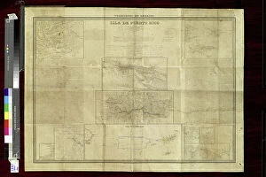
Background imageCarte Geographique Collection: Geography: Map of Puerto Rico Island in the Caribbean with descriptive text

Geography: Map of Puerto Rico Island in the Caribbean with descriptive text
VEN5031321 Geography: Map of Puerto Rico Island in the Caribbean with descriptive text. Map from an Atlas of Geopolitics from 1851

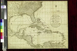
Background imageCarte Geographique Collection: Geography: general view of Central and Latin America: map from 'The west indian atlas or general

Geography: general view of Central and Latin America: map from "The west indian atlas or general description of
VEN5031310 Geography: general view of Central and Latin America: map from "The west indian atlas or general description of west indies" by Thomas Jefferys

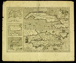
Background imageCarte Geographique Collection: Geography: map of the island of Cuba, the island of Hispaniola (Santo Domingo and Haiti)

Geography: map of the island of Cuba, the island of Hispaniola (Santo Domingo and Haiti), the island of Jamaica
VEN5031283 Geography: map of the island of Cuba, the island of Hispaniola (Santo Domingo and Haiti), the island of Jamaica, the island of Margarita (Margarita) and the island of Saint John

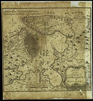
Background imageCarte Geographique Collection: Map of the city of Havana at the time of the siege of the British fleet in the port on 6/06/1762

Map of the city of Havana at the time of the siege of the British fleet in the port on 6/06/1762
VEN5031279 Map of the city of Havana at the time of the siege of the British fleet in the port on 6/06/1762. Card made on 15/08/1762

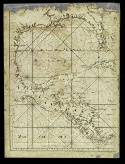
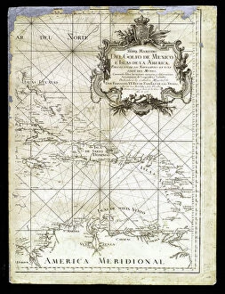
Background imageCarte Geographique Collection: Geography: map for navigators representing the Gulf of Mexico, Mexico, Yucatan, Honduras

Geography: map for navigators representing the Gulf of Mexico, Mexico, Yucatan, Honduras
VEN5031234 Geography: map for navigators representing the Gulf of Mexico, Mexico, Yucatan, Honduras, Nicaragua and Costarica from an Atlas of 1755, Bibliotheque Jose Marti, Havana

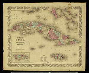
Background imageCarte Geographique Collection: Geography: map of the Greater Antilles (Cuba, Jamaica, Puerto Rico and the Bahamas) from an Atlas

Geography: map of the Greater Antilles (Cuba, Jamaica, Puerto Rico and the Bahamas) from an Atlas, 1855
VEN5031228 Geography: map of the Greater Antilles (Cuba, Jamaica, Puerto Rico and the Bahamas) from an Atlas, 1855, Bibliotheque Jose Marti, Havana

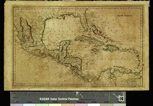
Background imageCarte Geographique Collection: Geography: map showing the Gulf of Mexico, the Caribbean Islands, Central America (Mexico)

Geography: map showing the Gulf of Mexico, the Caribbean Islands, Central America (Mexico, Yucatan, Honduras)
VEN5031226 Geography: map showing the Gulf of Mexico, the Caribbean Islands, Central America (Mexico, Yucatan, Honduras, Nicaragua and Costa Rica) part of the United States

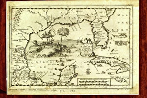
Background imageCarte Geographique Collection: Geography: map for navigators representing the Gulf of Mexico

Geography: map for navigators representing the Gulf of Mexico and the Caribbean Islands from an Atlas of 1755
VEN5031213 Geography: map for navigators representing the Gulf of Mexico and the Caribbean Islands from an Atlas of 1755, Bibliotheque Jose Marti, Havana

Background imageCarte Geographique Collection: Geography Atlas: representation of the island of Antigua and Barbuda (Antilles)

Geography Atlas: representation of the island of Antigua and Barbuda (Antilles)
VEN5031159 Geography Atlas: representation of the island of Antigua and Barbuda (Antilles). Map taken from "The west indian atlas or general description of west indies" by Thomas Jefferys

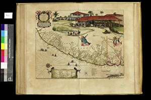
Background imageCarte Geographique Collection: Geography map: representation of the state of Penambuco in northern Brazil in South America

Geography map: representation of the state of Penambuco in northern Brazil in South America from an Atlas made by
VEN5030370 Geography map: representation of the state of Penambuco in northern Brazil in South America from an Atlas made by cartographer Willem Janszoon Blaeu (1571-1638)

Background imageCarte Geographique Collection: Astronomical chart of the constellations of Ursa Major and Ursa Minor

Astronomical chart of the constellations of Ursa Major and Ursa Minor. Copperplate engraving by Milton after a drawing
FLO4594305 Astronomical chart of the constellations of Ursa Major and Ursa Minor. Copperplate engraving by Milton after a drawing by L

Background imageCarte Geographique Collection: Map of an estate in East Sheen, Surrey, surveyed and delineated using a theodolite by James

Map of an estate in East Sheen, Surrey, surveyed and delineated using a theodolite by James Wadmore, 1811
FLO4593042 Map of an estate in East Sheen, Surrey, surveyed and delineated using a theodolite by James Wadmore, 1811. Copperplate engraving by W

Background imageCarte Geographique Collection: Map of Africa, circa 1820. Handcoloured copperplate engraving from Giulio Ferrario's Costumes

Map of Africa, circa 1820. Handcoloured copperplate engraving from Giulio Ferrario's Costumes Antique
FLO4619802 Map of Africa, circa 1820. Handcoloured copperplate engraving from Giulio Ferrario's Costumes Antique and Modern of All Peoples (Il Costume Antico e Moderno di Tutti i Popoli)

Background imageCarte Geographique Collection: Map of the world circa 1810. Handcoloured copperplate engraving by Andrea Bernieri from Giulio

Map of the world circa 1810. Handcoloured copperplate engraving by Andrea Bernieri from Giulio Ferrario's Ancient
FLO4622350 Map of the world circa 1810. Handcoloured copperplate engraving by Andrea Bernieri from Giulio Ferrario's Ancient and Modern Costumes of all the Peoples of the World

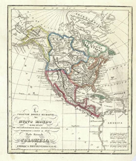
Background imageCarte Geographique Collection: Map of the European colonies in the New World (North and Central America), 1846

Map of the European colonies in the New World (North and Central America), 1846
FLO4621821 Map of the European colonies in the New World (North and Central America), 1846. Handcoloured copperplate engraving from Giulio Ferrario's Ancient

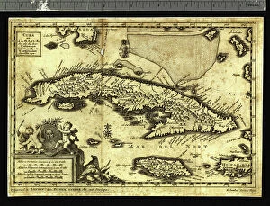
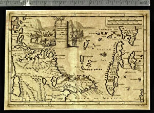
Background imageCarte Geographique Collection: Geography: representation of the Caribbean Sea with the island of Cuba, Jamaica and Hispaniola

Geography: representation of the Caribbean Sea with the island of Cuba, Jamaica and Hispaniola
VEN5031173 Geography: representation of the Caribbean Sea with the island of Cuba, Jamaica and Hispaniola. Map taken from an Atlas of American Cotes by Pieter Vander AA based on the description of

Background imageCarte Geographique Collection: Geography Atlas: representation of the Caribbean Sea region, the Greater Antilles (Cuba, Jamaica)

Geography Atlas: representation of the Caribbean Sea region, the Greater Antilles (Cuba, Jamaica)
VEN5030080 Geography Atlas: representation of the Caribbean Sea region, the Greater Antilles (Cuba, Jamaica, Hispaniola) and the Lesser Antilles. Map from an Atlas of 1818

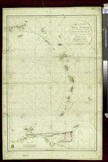
Background imageCarte Geographique Collection: Geography: map of the islands of the Lesser Antilles in the Caribbean Sea

Geography: map of the islands of the Lesser Antilles in the Caribbean Sea
VEN5031325 Geography: map of the islands of the Lesser Antilles in the Caribbean Sea. Map made by naval officers Cosme Churruca and Francisco Fidalgo, 1802

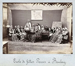
Background imageCarte Geographique Collection: Zoroastrianism: parsis school in Bombay (India) - Second half of the 19th century photography

Zoroastrianism: parsis school in Bombay (India) - Second half of the 19th century photography
CSO4985164 Zoroastrianism: parsis school in Bombay (India) - Second half of the 19th century photography -; (add.info.: Zoroastrianism)

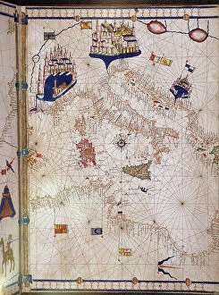
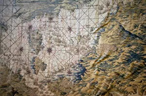
Background imageCarte Geographique Collection: Portulan representing the Mediterranean basin (the coasts of Italy)

Portulan representing the Mediterranean basin (the coasts of Italy, southern France and northern Africa)
VEN5027752 Portulan representing the Mediterranean basin (the coasts of Italy, southern France and northern Africa). The city of Venice, Marseille and Budva (= Budua)

Background imageCarte Geographique Collection: Geography Atlas: representation of the Caribbean Sea, Caribbean Sea (Cuba, Jamaica, Hispaniola)

Geography Atlas: representation of the Caribbean Sea, Caribbean Sea (Cuba, Jamaica, Hispaniola), Bahamas Islands
VEN5029608 Geography Atlas: representation of the Caribbean Sea, Caribbean Sea (Cuba, Jamaica, Hispaniola), Bahamas Islands, South United States (Florida, Virginia, Carolina)

Background imageCarte Geographique Collection: Geography Atlas: representation of the Caribbean Sea, Caribbean Sea (Cuba, Jamaica)

Geography Atlas: representation of the Caribbean Sea, Caribbean Sea (Cuba, Jamaica, Caiman Islands), Bahamas Islands
VEN5029603 Geography Atlas: representation of the Caribbean Sea, Caribbean Sea (Cuba, Jamaica, Caiman Islands), Bahamas Islands, South United States (Florida)

Background imageCarte Geographique Collection: Geography Atlas: frontispiece of 'The west indian atlas or general description of west indies' by

Geography Atlas: frontispiece of "The west indian atlas or general description of west indies" by Thomas
VEN5029591 Geography Atlas: frontispiece of "The west indian atlas or general description of west indies" by Thomas Jefferys, Prince of Wales geographer, 1794

Background imageCarte Geographique Collection: COSA, Juan de la (1460-1510). Cartographer. Chart by Juan de la Cosa (1500). SPAIN

COSA, Juan de la (1460-1510). Cartographer. Chart by Juan de la Cosa (1500). SPAIN. MADRID (AUTONOMOUS COMMUNITY)
CUL4869240 COSA, Juan de la (1460-1510). Cartographer. Chart by Juan de la Cosa (1500). SPAIN. MADRID (AUTONOMOUS COMMUNITY). Madrid. Navy Museum; (add.info.: COSA, Juan de la (1460-1510)

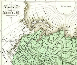
Background imageCarte Geographique Collection: The Ural Mountains, in Russia, on the border between Europe and Asia, 1860 (engraving)

The Ural Mountains, in Russia, on the border between Europe and Asia, 1860 (engraving)
PCT5617985 The Ural Mountains, in Russia, on the border between Europe and Asia, 1860 (engraving) by French School, (19th century); (add.info)

Background imageCarte Geographique Collection: Colbert Presenting the Members of the Royal Academy of Sciences to Louis XIV in 1667 (oil on canvas)

Colbert Presenting the Members of the Royal Academy of Sciences to Louis XIV in 1667 (oil on canvas)
JLJ4626852 Colbert Presenting the Members of the Royal Academy of Sciences to Louis XIV in 1667 (oil on canvas) by Testelin

Background imageCarte Geographique Collection: Representation of a geographic map of France at the end of the 19th century with areas

Representation of a geographic map of France at the end of the 19th century with areas corresponding to diseases
ELD4948341 Representation of a geographic map of France at the end of the 19th century with areas corresponding to diseases (scrofule, phtisia, malaria, goiter and cretinism, pellagre, moth)

Background imageCarte Geographique Collection: Benito Mussolini seizes power in Italy, 1922 (illustration)

Benito Mussolini seizes power in Italy, 1922 (illustration)
7343427 Benito Mussolini seizes power in Italy, 1922 (illustration) by Lecoultre, Marcel (1867-1942); (add.info.: Benito Mussolini (1883-1945), leader of fascism

Background imageCarte Geographique Collection: 'Around the world with family' by Lady Brassey, 1887 (illustration)

"Around the world with family" by Lady Brassey, 1887 (illustration)
7311787 "Around the world with family" by Lady Brassey, 1887 (illustration) by Souze, Auguste (b.1829 - fl.1860s); Private Collection; (add.info)

Background imageCarte Geographique Collection: The Tour de France of a Little Parisian by Constant Amero, circa 1880 - 1885 (illustration)

The Tour de France of a Little Parisian by Constant Amero, circa 1880 - 1885 (illustration)
7298984 The Tour de France of a Little Parisian by Constant Amero, circa 1880 - 1885 (illustration) by Souze, Auguste (b.1829 - fl.1860s); (add.info)

Background imageCarte Geographique Collection: Map of Paris. (Illustration, circa 1930)

Map of Paris. (Illustration, circa 1930)
5975932 Map of Paris. (Illustration, circa 1930) by Rossillon, Marius (O Galop) (1867-1946); Private Collection; (add.info.: Geography. France. Map of outings from Paris)

Background imageCarte Geographique Collection: Carte de l Amerique du Sud. Portulan de Bartolomeo Velhio, 1561. Museo Navale de La Spezia

Carte de l Amerique du Sud. Portulan de Bartolomeo Velhio, 1561. Museo Navale de La Spezia
GIA4693760 Carte de l Amerique du Sud. Portulan de Bartolomeo Velhio, 1561.Museo Navale de La Spezia by Velho, Bartolomeu (d.1568); Museo Tecnico Navale, La Spezia

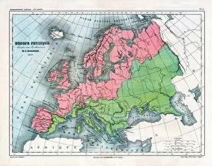
Background imageCarte Geographique Collection: Map of Physical Europe, 1867 (print)

Map of Physical Europe, 1867 (print)
7211492 Map of Physical Europe, 1867 (print) by Vuillemin, Alexandre (1812-1886); (add.info.: Map of Physical Europe drawn up under the direction of E. Cortambert in 1867 and drawn by A)

Background imageCarte Geographique Collection: Map of the Mediterranean Sea - Detail of the conquete of Tunis (Tunisia) - Tapestry by Francisco

Map of the Mediterranean Sea - Detail of the conquete of Tunis (Tunisia) - Tapestry by Francisco
LSE4317460 Map of the Mediterranean Sea - Detail of the conquete of Tunis (Tunisia) - Tapestry by Francisco and Cornelius Van der Ggot (18th century), woven into the royal tapestry factory

Background imageCarte Geographique Collection: Detail of a Catalan nautical chart (portulan) representing Asia of the 13th century

Detail of a Catalan nautical chart (portulan) representing Asia of the 13th century
JLJ4601120 Detail of a Catalan nautical chart (portulan) representing Asia of the 13th century, on which one can see a caravan walking towards Cathay

Background imageCarte Geographique Collection: Geographical map of Italy in 1850 with the delimitation of the borders of the different

Geographical map of Italy in 1850 with the delimitation of the borders of the different
GIA4794396 Geographical map of Italy in 1850 with the delimitation of the borders of the different states that made up the country before the Risorgimento

Background imageCarte Geographique Collection: Map of Anvers (Antverpia), Belgique (etching, 1572-1617)

Map of Anvers (Antverpia), Belgique (etching, 1572-1617)
LRI4707946 Map of Anvers (Antverpia), Belgique (etching, 1572-1617) by Hogenberg, Franz (1540-c.1590); Private Collection; (add.info.: Plan d Anvers (Antverpia)

Background imageCarte Geographique Collection: Plan de Lucques en 1585. Atlas de Braun & Hogenberg

Plan de Lucques en 1585. Atlas de Braun & Hogenberg
GIA4693098 Plan de Lucques en 1585. Atlas de Braun & Hogenberg. by Braun, Georg (1541-1622) and Hogenberg, Franz (1535-90); Private Collection; (add.info.: Plan de Lucques en 1585)

Background imageCarte Geographique Collection: The King of France Louis XVI (1754-1793) giving instructions to Captain Jean-Francois

The King of France Louis XVI (1754-1793) giving instructions to Captain Jean-Francois
JLJ4643255 The King of France Louis XVI (1754-1793) giving instructions to Captain Jean-Francois Galaup, Earl of La Perouse (Jean Francois Laperouse)

Background imageCarte Geographique Collection: The Woman in the Lute - Painting by Johannes Vermeer (Vermeer de Delft) (1632-1675)

The Woman in the Lute - Painting by Johannes Vermeer (Vermeer de Delft) (1632-1675)
XEE5033354 The Woman in the Lute - Painting by Johannes Vermeer (Vermeer de Delft) (1632-1675), oil on canvas, circa 1663, 51, 4x45, 7 cm

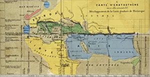
Background imageCarte Geographique Collection: Carte d Eratosthene, astronome, geographe grec du 3eme siecle av. JC. 220 av. JC

Carte d Eratosthene, astronome, geographe grec du 3eme siecle av. JC. 220 av. JC
GIA4792151 Carte d Eratosthene, astronome, geographe grec du 3eme siecle av. JC. 220 av. JC by French School; Private Collection; (add.info.: Map of Eratosthene, astronomer)

Background imageCarte Geographique Collection: Bale (Suisse), vue d oiseau - in 'Atlas'de Braun & Hogenberg

Bale (Suisse), vue d oiseau - in "Atlas"de Braun & Hogenberg
GIA4693110 BAle (Suisse), vue d oiseau - in " Atlas" de Braun & Hogenberg, 1585. by Braun, Georg (1541-1622) and Hogenberg, Franz (1535-90); Private Collection; (add.info.: BAle (Suisse)

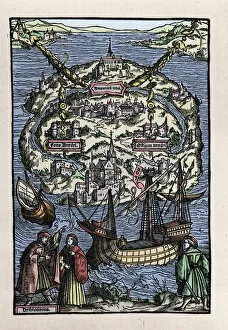
Background imageCarte Geographique Collection: View of the island of Utopia (Utopia) from the book of Thomas More (1478-1535)

View of the island of Utopia (Utopia) from the book of Thomas More (1478-1535)
GIA4786491 View of the island of Utopia (Utopia) from the book of Thomas More (1478-1535), " De optmo republicae statu deque nova insula Utopia". Engraved by Johann Froben. 1518

Background imageCarte Geographique Collection: Thirty Years War (1618-1648): map representing the seat of Arras

Thirty Years War (1618-1648): map representing the seat of Arras
JLJ4600474 Thirty Years War (1618-1648): map representing the seat of Arras, 1640 - Painting by Savior Le Conte (Leconte, Le Counte, Lecomte) (1659-1694), 17th century Ec en - Oil on canvas - Sun: 0


For sale as Licensed Images

Choose your image, Select your licence and Download the media

"Exploring the World Through Carte Geographique: A Journey Across Time and Space" Step into the past as we delve into the captivating world of "carte geographique, " where art, history, and geography intertwine to paint a vivid picture of our planet's evolution. In 1667, Colbert presents Louis XIV with an oil on canvas masterpiece depicting members of the Royal Academy of Sciences. This remarkable artwork not only showcases their brilliance but also highlights the importance of cartography in understanding our world. Traveling further through time, we encounter a representation of a geographic map from late 19th-century France. Astonishingly, this map reveals areas corresponding to diseases such as scrofula, phthisis, malaria, goiter and cretinism, pellagra, and moth – reminding us that geography is not merely about landforms but also encompasses human health. The year 1922 witnesses Benito Mussolini seizing power in Italy – an event immortalized in an illustration that demonstrates how maps can capture significant historical moments. Similarly capturing history is Lady Brassey's illustrated journey "Around the World with Family" from 1887; it serves as a testament to both exploration and familial bonds. Continuing our voyage through visual representations, Constant Amero's illustrations take us back to late 19th-century Paris during the Tour de France. These images transport us to an era when cycling became intertwined with French culture and identity. Shifting focus towards specific locations within maps themselves brings forth intriguing details. A circa 1930 illustration unveils a map showcasing Paris' intricate layout – its streets forming a labyrinth waiting for adventurers to explore. Meanwhile, Lustucru pasta takes center stage in another illustration from 1934 - reminding us that even culinary delights find their place on geographical canvases.