Carte Geographique Collection (#3)

"Exploring the World Through Carte Geographique: A Journey Across Time and Space" Step into the past as we delve into the captivating world of "carte geographique

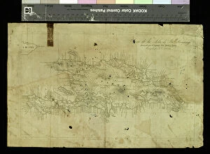
Background imageCarte Geographique Collection: Geography Atlas: representation of the island of Santo Domingo in the West Indies

Geography Atlas: representation of the island of Santo Domingo in the West Indies
VEN5031371 Geography Atlas: representation of the island of Santo Domingo in the West Indies. Map from an atlas by Antonio del Monte y Tejada (1783-1861), 1860
Background imageCarte Geographique Collection: Geography Atlas: representation of the island of Santo Domingo in the West Indies

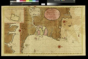
Geography Atlas: representation of the island of Santo Domingo in the West Indies. Map from an atlas by J. B
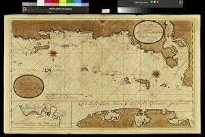
VEN5031350 Geography Atlas: representation of the island of Santo Domingo in the West Indies. Map from an atlas by J. B. Poirson (1761-1831), French geographer, 1803

Background imageCarte Geographique Collection: Geography Atlas: representation of Cape Francais (Cap de la Republique)

Geography Atlas: representation of Cape Francais (Cap de la Republique) in Santo Domingo in the West Indies
VEN5031342 Geography Atlas: representation of Cape Francais (Cap de la Republique) in Santo Domingo in the West Indies. Map from an atlas by Thomas Jefferys, geographer of the Prince of Wales, 1760

Background imageCarte Geographique Collection: Geography: map of the island of Guadeloupe in the West Indies

Geography: map of the island of Guadeloupe in the West Indies. Map from an Atlas de Villers from 1843
VEN5031313 Geography: map of the island of Guadeloupe in the West Indies. Map from an Atlas de Villers from 1843. Biblioteca Jose Marti, Havana

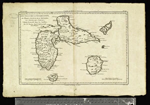
Background imageCarte Geographique Collection: Geography: map of the island of Guadeloupe, Marie Galante, Desirade in the West Indies

Geography: map of the island of Guadeloupe, Marie Galante, Desirade in the West Indies
VEN5031309 Geography: map of the island of Guadeloupe, Marie Galante, Desirade in the West Indies. Map from an Atlas by Rigobert Bonne (1756-1823) from 1780

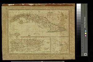
Background imageCarte Geographique Collection: Geography: map of Cuba, Puerto Rico and general view of the Caribbean Sea

Geography: map of Cuba, Puerto Rico and general view of the Caribbean Sea. Map from an Atlas of Camilo Alabern, 1853
VEN5031293 Geography: map of Cuba, Puerto Rico and general view of the Caribbean Sea. Map from an Atlas of Camilo Alabern, 1853

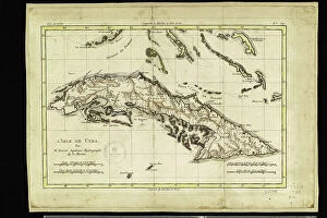
Background imageCarte Geographique Collection: Geography: map of the island of Cuba with map in the Caribbean Sea

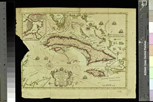
Geography: map of the island of Cuba with map in the Caribbean Sea. Map from an Atlas by Rigobert Bonne (1756-1823)
VEN5031278 Geography: map of the island of Cuba with map in the Caribbean Sea. Map from an Atlas by Rigobert Bonne (1756-1823) from 1780

Background imageCarte Geographique Collection: Geography: map showing Central America (Mexico, Yucatan, Honduras, Nicaragua, Costa Rica)

Geography: map showing Central America (Mexico, Yucatan, Honduras, Nicaragua, Costa Rica)
VEN5031262 Geography: map showing Central America (Mexico, Yucatan, Honduras, Nicaragua, Costa Rica), the Gulf of Mexico and the Caribbean Sea islands (Antilles)

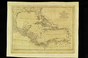
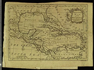
Background imageCarte Geographique Collection: Geography: map showing the Gulf of Mexico and the Caribbean Sea islands (Caribbean)

Geography: map showing the Gulf of Mexico and the Caribbean Sea islands (Caribbean)
VEN5031256 Geography: map showing the Gulf of Mexico and the Caribbean Sea islands (Caribbean). Plate from an Atlas by Thomas Kitchin (1718-1784) 1780-1790 Biblioteca Jose Marti, Havana

Background imageCarte Geographique Collection: Geography: map showing the Gulf of Mexico, the Caribbean Islands, Central America (Mexico)

Geography: map showing the Gulf of Mexico, the Caribbean Islands, Central America (Mexico, Yucatan, Salvador, Honduras)
VEN5031245 Geography: map showing the Gulf of Mexico, the Caribbean Islands, Central America (Mexico, Yucatan, Salvador, Honduras, Nicaragua, Costarica)

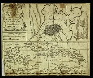
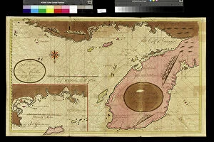
Background imageCarte Geographique Collection: Geography: map of the island of Cuba with detailed map of the city of Havana

Geography: map of the island of Cuba with detailed map of the city of Havana. View of the entire Gulf of Mexico
VEN5031239 Geography: map of the island of Cuba with detailed map of the city of Havana. View of the entire Gulf of Mexico. Map from an Atlas of 1763

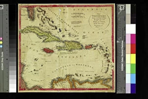
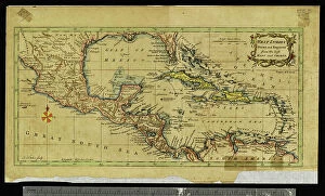
Background imageCarte Geographique Collection: Geography: map representing the Greater and Lesser Antilles in the Caribbean Sea

Geography: map representing the Greater and Lesser Antilles in the Caribbean Sea
VEN5031208 Geography: map representing the Greater and Lesser Antilles in the Caribbean Sea. Plate taken from an Atlas of the geographer Robert, 1750

Background imageCarte Geographique Collection: Geography: map showing Central America (Mexico, Honduras, Yucatan)

Geography: map showing Central America (Mexico, Honduras, Yucatan) and the Caribbean Sea Islands (Antilles)
VEN5031197 Geography: map showing Central America (Mexico, Honduras, Yucatan) and the Caribbean Sea Islands (Antilles). Plate taken from an Atlas by Thomas Kitchin (1718-1784)

Background imageCarte Geographique Collection: Geography map: representation of Central America with Mexico, Yucatan, Honduras, Nicaragua

Geography map: representation of Central America with Mexico, Yucatan, Honduras, Nicaragua, Costa Rica
VEN5031137 Geography map: representation of Central America with Mexico, Yucatan, Honduras, Nicaragua, Costa Rica, Florida and North South America. The West Indies are also represented

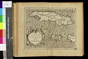
Background imageCarte Geographique Collection: Geography map: representation of the islands of the Greater Antilles (Cuba, Hispaniola)

Geography map: representation of the islands of the Greater Antilles (Cuba, Hispaniola, Jamaica) in the Caribbean Sea
VEN5030433 Geography map: representation of the islands of the Greater Antilles (Cuba, Hispaniola, Jamaica) in the Caribbean Sea. Engraved board from an Atlas of the 18th century

Background imageCarte Geographique Collection: Frontispice of the atlas ' Theatre of the World' (Theatrum Orbis Terrarum)

Frontispice of the atlas " Theatre of the World" (Theatrum Orbis Terrarum) by Abraham Ortelius (1528-1598)
VEN5030419 Frontispice of the atlas " Theatre of the World" (Theatrum Orbis Terrarum) by Abraham Ortelius (1528-1598), Dutch cartographer in an Italian edition, late 16th century

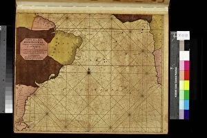
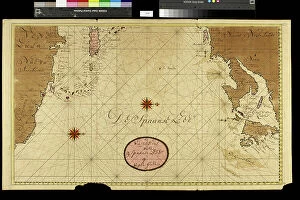
Background imageCarte Geographique Collection: Geography map: representation of the Meridional Ocean (or southern Atlantic Ocean)

Geography map: representation of the Meridional Ocean (or southern Atlantic Ocean) with South American (Brazil)
VEN5030383 Geography map: representation of the Meridional Ocean (or southern Atlantic Ocean) with South American (Brazil) and West African coasts

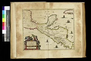
Background imageCarte Geographique Collection: Geography map: representation of Central America with Honduras, Guatemala

Geography map: representation of Central America with Honduras, Guatemala
VEN5030327 Geography map: representation of Central America with Honduras, Guatemala and the Yucatan Peninsula from an Atlas by Willem Janszoon Blaeu (1571-1638), approximately 1630

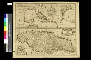
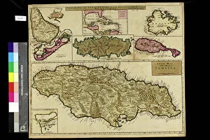
Background imageCarte Geographique Collection: Geography map: general view of the Caribbean Sea and the Caribbean Islands

Geography map: general view of the Caribbean Sea and the Caribbean Islands
VEN5030283 Geography map: general view of the Caribbean Sea and the Caribbean Islands and a detailed view of Jamaica from an Atlas by Charles Price, beginning of the 18th century

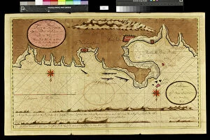
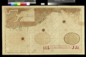
Background imageCarte Geographique Collection: Geography map: representation of Panama's coasts on the Caribbean Sea

Geography map: representation of Panama's coasts on the Caribbean Sea
VEN5030232 Geography map: representation of Panama's coasts on the Caribbean Sea, made by Dutch cartographer Gerard van Keulen (1678-1726) 1709-1713

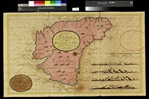
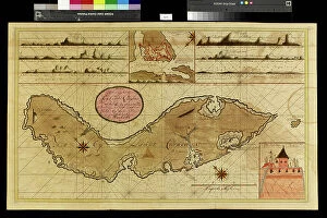
Background imageCarte Geographique Collection: Geography map: representation of Barbados Island in the Caribbean Sea by Dutch cartographer Gerard

Geography map: representation of Barbados Island in the Caribbean Sea by Dutch cartographer Gerard van Keulen
VEN5030212 Geography map: representation of Barbados Island in the Caribbean Sea by Dutch cartographer Gerard van Keulen (1678-1726) 1709-1713

Background imageCarte Geographique Collection: Geography map: depiction of the island of Curacao in the small West Indies

Geography map: depiction of the island of Curacao in the small West Indies
VEN5030201 Geography map: depiction of the island of Curacao in the small West Indies, made by Dutch cartographer Gerard van Keulen (1678-1726) 1709-1713

Background imageCarte Geographique Collection: Geography map: representation of the island of Hispaniola grouping the present-day Haiti

Geography map: representation of the island of Hispaniola grouping the present-day Haiti
VEN5030177 Geography map: representation of the island of Hispaniola grouping the present-day Haiti and Santo Domingo in the West Indies

Background imageCarte Geographique Collection: Geography map: representation of Tierra de fuego and Patagonia (Argentina, Chile)

Geography map: representation of Tierra de fuego and Patagonia (Argentina, Chile)
VEN5030138 Geography map: representation of Tierra de fuego and Patagonia (Argentina, Chile), made by Dutch cartographer Gerard van Keulen (1678-1726) 1709-1713

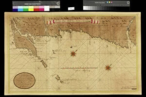
Background imageCarte Geographique Collection: Geography map: representation of Florida's coasts in the south of the United States

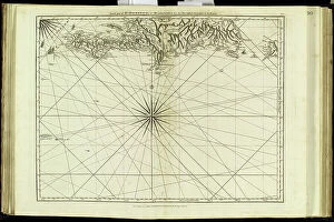
Geography map: representation of Florida's coasts in the south of the United States
VEN5030113 Geography map: representation of Florida's coasts in the south of the United States, made by Dutch cartographer Gerard van Keulen (1678-1726) 1709-1713

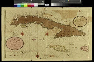
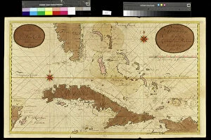
Background imageCarte Geographique Collection: Geography map: representation of the island of Cuba in the Caribbean

Geography map: representation of the island of Cuba in the Caribbean, made by Dutch cartographer Gerard van Keulen
VEN5030107 Geography map: representation of the island of Cuba in the Caribbean, made by Dutch cartographer Gerard van Keulen (1678-1726) 1709-1713

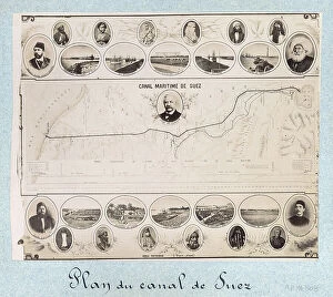
Background imageCarte Geographique Collection: Plan of the Suez Canal (Egypt), with portraits of Ferdinand de Lesseps (1805-1894)

Plan of the Suez Canal (Egypt), with portraits of Ferdinand de Lesseps (1805-1894)
CSO4983168 Plan of the Suez Canal (Egypt), with portraits of Ferdinand de Lesseps (1805-1894), Ismail Pasha (1830-1895) Khedive of Egypt and Sudan

Background imageCarte Geographique Collection: Letter F, G, H and I. Engraving (Chromolithography - Chromo) in ' Le grand alphabet de Bebe'

Letter F, G, H and I. Engraving (Chromolithography - Chromo) in " Le grand alphabet de Bebe"
DUV4210181 Letter F, G, H and I. Engraving (Chromolithography - Chromo) in " Le grand alphabet de Bebe". Paul Bernardin, bookseller-publisher, Paris, circa 1900. Bibliotheque des Bebes

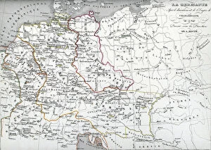
Background imageCarte Geographique Collection: Map of Germania following Treaty of Verdun in 843 dividing the Charlemagne Empire into three parts

Map of Germania following Treaty of Verdun in 843 dividing the Charlemagne Empire into three parts among the sons of
ELD4924537 Map of Germania following Treaty of Verdun in 843 dividing the Charlemagne Empire into three parts among the sons of Louis the Pious: the Western Francie

Background imageCarte Geographique Collection: Geography map: double page of an Atlas showing maps and descriptive texts of the islands of

Geography map: double page of an Atlas showing maps and descriptive texts of the islands of Hispagnola
VEN5030442 Geography map: double page of an Atlas showing maps and descriptive texts of the islands of Hispagnola (Santo Domingo and Haiti) and the small Antilles in the Caribbean Sea

Background imageCarte Geographique Collection: Geography map: representation of part of the territories of New Spain (Florida, Mexico)

Geography map: representation of part of the territories of New Spain (Florida, Mexico)
VEN5030337 Geography map: representation of part of the territories of New Spain (Florida, Mexico, Central America) and taken from an Atlas by Willem Janszoon Blaeu (1571-1638), approximately 1630

Background imageCarte Geographique Collection: Geography map: representation of South America from an Atlas of the widow of Nicolas Visscher II

Geography map: representation of South America from an Atlas of the widow of Nicolas Visscher II (1649-1702)
VEN5030303 Geography map: representation of South America from an Atlas of the widow of Nicolas Visscher II (1649-1702), beginning of the 18th century

Background imageCarte Geographique Collection: Geography map: representation of South America from an Atlas of Guillaume de l'Isle (1675-1726)

Geography map: representation of South America from an Atlas of Guillaume de l'Isle (1675-1726), 1708
VEN5030290 Geography map: representation of South America from an Atlas of Guillaume de l'Isle (1675-1726), 1708. Biblioteca Angelica

Background imageCarte Geographique Collection: Geography map: representation of the main British islands of the Caribbean Sea (Antigua, Barbados)

Geography map: representation of the main British islands of the Caribbean Sea (Antigua, Barbados, Jamaica, Tobago, St)
VEN5030281 Geography map: representation of the main British islands of the Caribbean Sea (Antigua, Barbados, Jamaica, Tobago, St. Christopher Island or St)

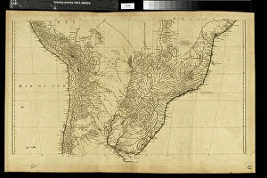
Background imageCarte Geographique Collection: Geography map: representation of the central part of South America (Peru, Brazil, Paraguay)

Geography map: representation of the central part of South America (Peru, Brazil, Paraguay)
VEN5030262 Geography map: representation of the central part of South America (Peru, Brazil, Paraguay, Chile) from the Atlas " Amerique meridionale" by French cartographer Jean-Baptiste

Background imageCarte Geographique Collection: Geography map: representation of the border area between Nicaragua and Costa Rica in Central America

Geography map: representation of the border area between Nicaragua and Costa Rica in Central America
VEN5030233 Geography map: representation of the border area between Nicaragua and Costa Rica in Central America, made by Dutch cartographer Gerard van Keulen (1678-1726) 1709-1713

Background imageCarte Geographique Collection: Geography map: representation of the Caribbean Sea with part of the archipelago of the Great

Geography map: representation of the Caribbean Sea with part of the archipelago of the Great Antilles (Hispaniola)
VEN5030217 Geography map: representation of the Caribbean Sea with part of the archipelago of the Great Antilles (Hispaniola)

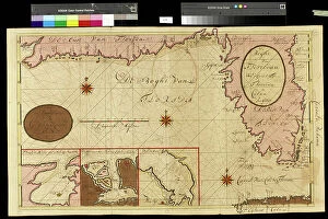
Background imageCarte Geographique Collection: Geography map: representation of the coasts of Venezuela, made by Dutch cartographer Gerard van

Geography map: representation of the coasts of Venezuela, made by Dutch cartographer Gerard van Keulen (1678-1726)
VEN5030202 Geography map: representation of the coasts of Venezuela, made by Dutch cartographer Gerard van Keulen (1678-1726) 1709-1713

Background imageCarte Geographique Collection: Geography map: representation of the coasts of the island of Hispaniola (Santo Domingo and Haiti)

Geography map: representation of the coasts of the island of Hispaniola (Santo Domingo and Haiti) in the West Indies
VEN5030191 Geography map: representation of the coasts of the island of Hispaniola (Santo Domingo and Haiti) in the West Indies, made by Dutch cartographer Gerard van Keulen (1678-1726) 1709-1713

Background imageCarte Geographique Collection: Geography map: representation of the island of Puerto Rico in the Caribbean

Geography map: representation of the island of Puerto Rico in the Caribbean
VEN5030187 Geography map: representation of the island of Puerto Rico in the Caribbean, made by Dutch cartographer Gerard van Keulen (1678-1726) 1709-1713

Background imageCarte Geographique Collection: Geography map: A representation of the regions visited by British buccaneer William Dampier

Geography map: A representation of the regions visited by British buccaneer William Dampier (1652-1715)
VEN5030160 Geography map: A representation of the regions visited by British buccaneer William Dampier (1652-1715) during his trip to Panama in Central America

Background imageCarte Geographique Collection: Geography map: representation of the coasts of Chile, made by Dutch cartographer Gerard van Keulen

Geography map: representation of the coasts of Chile, made by Dutch cartographer Gerard van Keulen (1678-1726)
VEN5030133 Geography map: representation of the coasts of Chile, made by Dutch cartographer Gerard van Keulen (1678-1726) 1709-1713

Background imageCarte Geographique Collection: Geography map: representation of the Yucatan ratings in southern Mexico and the Honduras coasts

Geography map: representation of the Yucatan ratings in southern Mexico and the Honduras coasts
VEN5030127 Geography map: representation of the Yucatan ratings in southern Mexico and the Honduras coasts, made by Dutch cartographer Gerard van Keulen (1678-1726) 1709-1713

Background imageCarte Geographique Collection: Geography map: representation of the coasts of Florida, the Bahamas Islands

Geography map: representation of the coasts of Florida, the Bahamas Islands
VEN5030120 Geography map: representation of the coasts of Florida, the Bahamas Islands, the island of Cuba and part of the island of Hispaniola (Santo Domingo and Haiti)

Background imageCarte Geographique Collection: Geography map: representation of the coasts of Surinam (Suriname) or Dutch Guiana

Geography map: representation of the coasts of Surinam (Suriname) or Dutch Guiana
VEN5030104 Geography map: representation of the coasts of Surinam (Suriname) or Dutch Guiana, made by Dutch cartographer Gerard van Keulen (1678-1726) 1709-1713

Background imageCarte Geographique Collection: Geography Atlas: representation of the island of Hispaniola (Haiti and Santo Domingo)

Geography Atlas: representation of the island of Hispaniola (Haiti and Santo Domingo)
VEN5030000 Geography Atlas: representation of the island of Hispaniola (Haiti and Santo Domingo) and the passage of the Winds (or Under-wind) in the Caribbean archipelago. Below is a Wind Rose

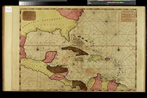
Background imageCarte Geographique Collection: Geography Atlas: representation of the Caribbean Sea, Caribbean Sea (Cuba, Jamaica, Hispaniola)

Geography Atlas: representation of the Caribbean Sea, Caribbean Sea (Cuba, Jamaica, Hispaniola), Bahamas Islands
VEN5029612 Geography Atlas: representation of the Caribbean Sea, Caribbean Sea (Cuba, Jamaica, Hispaniola), Bahamas Islands, South United States (Florida, Virginia, Carolina)

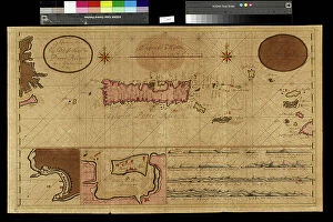
Background imageCarte Geographique Collection: Geography Atlas: representation of the Virgin Islands (Antilles)

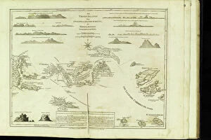
Geography Atlas: representation of the Virgin Islands (Antilles). Map taken from "The west indian atlas or general
VEN5029596 Geography Atlas: representation of the Virgin Islands (Antilles). Map taken from "The west indian atlas or general description of west indies" by Thomas Jefferys


For sale as Licensed Images

Choose your image, Select your licence and Download the media

"Exploring the World Through Carte Geographique: A Journey Across Time and Space" Step into the past as we delve into the captivating world of "carte geographique, " where art, history, and geography intertwine to paint a vivid picture of our planet's evolution. In 1667, Colbert presents Louis XIV with an oil on canvas masterpiece depicting members of the Royal Academy of Sciences. This remarkable artwork not only showcases their brilliance but also highlights the importance of cartography in understanding our world. Traveling further through time, we encounter a representation of a geographic map from late 19th-century France. Astonishingly, this map reveals areas corresponding to diseases such as scrofula, phthisis, malaria, goiter and cretinism, pellagra, and moth – reminding us that geography is not merely about landforms but also encompasses human health. The year 1922 witnesses Benito Mussolini seizing power in Italy – an event immortalized in an illustration that demonstrates how maps can capture significant historical moments. Similarly capturing history is Lady Brassey's illustrated journey "Around the World with Family" from 1887; it serves as a testament to both exploration and familial bonds. Continuing our voyage through visual representations, Constant Amero's illustrations take us back to late 19th-century Paris during the Tour de France. These images transport us to an era when cycling became intertwined with French culture and identity. Shifting focus towards specific locations within maps themselves brings forth intriguing details. A circa 1930 illustration unveils a map showcasing Paris' intricate layout – its streets forming a labyrinth waiting for adventurers to explore. Meanwhile, Lustucru pasta takes center stage in another illustration from 1934 - reminding us that even culinary delights find their place on geographical canvases.