
Cartographer Collection (page 2)

"Unveiling the World

Background imageCartographer Collection: Amerigo Vespucci

Amerigo Vespucci
3586022 Amerigo Vespucci; (add.info.: Portrait of Amerigo Vespucci (1454-1512) an Italian explorer, financier, navigator and cartographer. Dated 16th Century.); Universal History Archive/UIG

Background imageCartographer Collection: Amerigo Vespucci

Amerigo Vespucci
3586021 Amerigo Vespucci; (add.info.: Portrait of Amerigo Vespucci (1454-1512) an Italian explorer, financier, navigator and cartographer. Dated 16th Century.); Universal History Archive/UIG

Background imageCartographer Collection: A fire seen in the night sky over Italy during the 6th Century from the Nuremburg Chronicle

A fire seen in the night sky over Italy during the 6th Century from the Nuremburg Chronicle
3740713 A fire seen in the night sky over Italy during the 6th Century from the Nuremburg Chronicle; (add.info.: Engraving depicting a fire seen in the night sky over Italy during the 6th Century)

Background imageCartographer Collection: The creation of Adam and Eve from the Nuremburg Chronicle

The creation of Adam and Eve from the Nuremburg Chronicle
3740696 The creation of Adam and Eve from the Nuremburg Chronicle; (add.info.: Engraving depicting the creation of Adam and Eve from the Nuremburg Chronicle by Hartmann Schedel (1440-1514)

Background imageCartographer Collection: Planisphere by Diego Ribero o Diogo Ribeiro, a Portuguese cartographer, in 1529

Planisphere by Diego Ribero o Diogo Ribeiro, a Portuguese cartographer, in 1529
3600112 Planisphere by Diego Ribero o Diogo Ribeiro, a Portuguese cartographer, in 1529; Biblioteca Apostolica Vaticana, Vatican City; (add.info.: Planisphere by Diego Ribero o Diogo Ribeiro)

Background imageCartographer Collection: Amerigo Vespucci and others greeting natives upon landing in the Americas

Amerigo Vespucci and others greeting natives upon landing in the Americas
2623778 Amerigo Vespucci and others greeting natives upon landing in the Americas; (add.info.: Lithograph print of Amerigo Vespucci (1454-1512) an Italian explorer, financier

Background imageCartographer Collection: Captain James Cook, 1770

Captain James Cook, 1770
1577082 Captain James Cook, 1770; (add.info.: Portrait of Captain James Cook (1728-1779) British explorer, navigator, cartographer, and captain in the Royal Navy

Background imageCartographer Collection: Sir Robert Dudley, Duke of Northumberland, c1600. Creator: Nicholas Hilliard

Sir Robert Dudley, Duke of Northumberland, c1600. Creator: Nicholas Hilliard
Sir Robert Dudley, Duke of Northumberland, c1600

Background imageCartographer Collection: Portrait of Petrus Bertius, Professor at Leiden, 1700-1732. Creator: Arnoud van Halen

Portrait of Petrus Bertius, Professor at Leiden, 1700-1732. Creator: Arnoud van Halen
Portrait of Petrus Bertius, Professor at Leiden, 1700-1732

Background imageCartographer Collection: Johan François Adriaan Cateau van Rosevelt... 1885. Creator: Lovera

Johan François Adriaan Cateau van Rosevelt... 1885. Creator: Lovera
Johan Francois Adriaan Cateau van Rosevelt, Chief of the Construction Department and Agent General of Immigration in Suriname, 1885

Background imageCartographer Collection: The Art Gallery of Jan Gildemeester Jansz, 1794-1795. Creator: Adriaan De Lelie

The Art Gallery of Jan Gildemeester Jansz, 1794-1795. Creator: Adriaan De Lelie
The Art Gallery of Jan Gildemeester Jansz, 1794-1795. In 1792, Gildemeester, a merchant, turned two large rooms at his house on Amsterdam's Herengracht into an art gallery

Background imageCartographer Collection: Geological Survey art room, between 1910 and 1920. Creator: Harris & Ewing

Geological Survey art room, between 1910 and 1920. Creator: Harris & Ewing
Geological Survey art room, [Washington, DC], between 1910 and 1920. [Map-making]

Background imageCartographer Collection: Portrait of Girolamo Ruscelli, 1566. Creator: Nicolo Nelli

Portrait of Girolamo Ruscelli, 1566. Creator: Nicolo Nelli
Portrait of Girolamo Ruscelli, 1566

Background imageCartographer Collection: Map of California shown as an island, c 1650. Creator: Johannes Vingboons

Map of California shown as an island, c 1650. Creator: Johannes Vingboons
Map of California shown as an island, c 1650. This map from around 1650 shows California as an island. A half-century would pass before Spanish explorers determined with certainty that California was

Background imageCartographer Collection: Carte re´duite des de´couvertes des Russes, entre l'Asie et l'Amerique, (1747?)

Carte re´duite des de´couvertes des Russes, entre l'Asie et l'Amerique, (1747?). This French map of Alaska, Siberia, and the North Pacific, published in 1747

Background imageCartographer Collection: General Map of Ekaterinoslav Province: Showing Postal and Major Roads, Stations and the... 1821

General Map of Ekaterinoslav Province: Showing Postal and Major Roads, Stations and the... 1821
General Map of Ekaterinoslav Province: Showing Postal and Major Roads, Stations and the Distance in Versts between Them, 1821

Background imageCartographer Collection: General Map of Kharkiv Province: Showing Postal and Major Roads, Stations and the... 1821

General Map of Kharkiv Province: Showing Postal and Major Roads, Stations and the... 1821
General Map of Kharkiv Province: Showing Postal and Major Roads, Stations and the Distance in Versts between Them, 1821. This 1821 map of Kharkiv Provinceis from a larger work

Background imageCartographer Collection: General Map of Tver Province: Showing Postal and Major Roads, Stations and the... 1821

General Map of Tver Province: Showing Postal and Major Roads, Stations and the... 1821
General Map of Tver Province: Showing Postal and Major Roads, Stations and the Distance in Versts between Them, 1821. This 1821 map of Tver Provinceis from a larger work

Background imageCartographer Collection: General Map of Novgorod Province: Showing Postal and Major Roads, Stations and the... 1821

General Map of Novgorod Province: Showing Postal and Major Roads, Stations and the... 1821
General Map of Novgorod Province: Showing Postal and Major Roads, Stations and the Distance in Versts between Them, 1821. This 1821 map of Novgorod Provinceis from a larger work

Background imageCartographer Collection: General Map of Bessarabia: Showing Postal and Major Roads, Stations and the... 1821

General Map of Bessarabia: Showing Postal and Major Roads, Stations and the... 1821
General Map of Bessarabia: Showing Postal and Major Roads, Stations and the Distance in Versts between Them, 1821. This 1821 map of Bessarabia is from a larger work

Background imageCartographer Collection: General Map of Minsk Province: Showing Postal and Major Roads, Stations and the... 1821

General Map of Minsk Province: Showing Postal and Major Roads, Stations and the... 1821
General Map of Minsk Province: Showing Postal and Major Roads, Stations and the Distance in Versts between Them, 1821. This 1821 map of Minsk Province is from a larger work

Background imageCartographer Collection: General Map of Vitebsk Province: Showing Postal and Major Roads, Stations and the... 1820

General Map of Vitebsk Province: Showing Postal and Major Roads, Stations and the... 1820
General Map of Vitebsk Province: Showing Postal and Major Roads, Stations and the Distance in Versts between Them, 1820. This 1820 map of Vitebsk Provinceis from a larger work

Background imageCartographer Collection: General Map of Saint Petersburg Province: Showing Postal and Major Roads, Stations and the... 1820

General Map of Saint Petersburg Province: Showing Postal and Major Roads, Stations and the... 1820
General Map of Saint Petersburg Province: Showing Postal and Major Roads, Stations and the Distance in Versts between Them, 1820

Background imageCartographer Collection: General Map of Livland Province: Showing Postal and Major Roads, Stations and the... 1820

General Map of Livland Province: Showing Postal and Major Roads, Stations and the... 1820
General Map of Livland Province: Showing Postal and Major Roads, Stations and the Distance in Versts between Them, 1820. This 1820 map of Livland Provinceis from a larger work

Background imageCartographer Collection: General Map of Courland Province: Showing Postal and Major Roads, Stations and the... 1820

General Map of Courland Province: Showing Postal and Major Roads, Stations and the... 1820
General Map of Courland Province: Showing Postal and Major Roads, Stations and the Distance in Versts between Them, 1820. This 1820 map of Courland Province is from a larger work

Background imageCartographer Collection: General Map of Vilnius Province: Showing Postal and Major Roads, Stations and the... 1820

General Map of Vilnius Province: Showing Postal and Major Roads, Stations and the... 1820
General Map of Vilnius Province: Showing Postal and Major Roads, Stations and the Distance in Versts between Them, 1820. This 1820 map of Vilnius Provinceis from a larger work

Background imageCartographer Collection: Map of the City of London by John Ogilby 1676. Ogilby (also Ogelby

Map of the City of London by John Ogilby 1676. Ogilby (also Ogelby, Oglivie - 16001676) was a Scottish translator, impresario and cartographer

Background imageCartographer Collection: 1818 Pinkerton Map Of The Northern United States

1818 Pinkerton Map Of The Northern United States
1818, Pinkerton Map of the Northern United States, John Pinkerton, 1758 - 1826, Scottish antiquarian, cartographer, UK

Background imageCartographer Collection: 1818 Pinkerton Map Of The Austrian Empire John Pinkerton

1818 Pinkerton Map Of The Austrian Empire John Pinkerton
1818, Pinkerton Map of the Austrian Empire, John Pinkerton, 1758 - 1826, Scottish antiquarian, cartographer, UK

Background imageCartographer Collection: 1818 Pinkerton Map Of Spain And Portugal John Pinkerton

1818 Pinkerton Map Of Spain And Portugal John Pinkerton
1818, Pinkerton Map of Spain and Portugal, John Pinkerton, 1758 - 1826, Scottish antiquarian, cartographer, UK

Background imageCartographer Collection: 1818 Pinkerton Map Of South America John Pinkerton

1818 Pinkerton Map Of South America John Pinkerton
1818, Pinkerton Map of South America, John Pinkerton, 1758 - 1826, Scottish antiquarian, cartographer, UK

Background imageCartographer Collection: 1818 Pinkerton Map Of Southern Scotland John Pinkerton

1818 Pinkerton Map Of Southern Scotland John Pinkerton
1818, Pinkerton Map of Southern Scotland, John Pinkerton, 1758 - 1826, Scottish antiquarian, cartographer, UK

Background imageCartographer Collection: 1818 Pinkerton Map Of Russia In Europe John Pinkerton

1818 Pinkerton Map Of Russia In Europe John Pinkerton
1818, Pinkerton Map of Russia in Europe, John Pinkerton, 1758 - 1826, Scottish antiquarian, cartographer, UK

Background imageCartographer Collection: 1818 Pinkerton Map Of Portugal John Pinkerton

1818 Pinkerton Map Of Portugal John Pinkerton
1818, Pinkerton Map of Portugal, John Pinkerton, 1758 - 1826, Scottish antiquarian, cartographer, UK

Background imageCartographer Collection: 1818 Pinkerton Map Of Poland John Pinkerton 1758 – 1826

1818 Pinkerton Map Of Poland John Pinkerton 1758 – 1826
1818, Pinkerton Map of Poland, John Pinkerton, 1758 - 1826, Scottish antiquarian, cartographer, UK

Background imageCartographer Collection: 1818 Pinkerton Map Of Peru John Pinkerton 1758 – 1826

1818 Pinkerton Map Of Peru John Pinkerton 1758 – 1826
1818, Pinkerton Map of Peru, John Pinkerton, 1758 - 1826, Scottish antiquarian, cartographer, UK

Background imageCartographer Collection: 1818 Pinkerton Map Of Of Europe John Pinkerton

1818 Pinkerton Map Of Of Europe John Pinkerton
1818, Pinkerton Map of of Europe, John Pinkerton, 1758 - 1826, Scottish antiquarian, cartographer, UK

Background imageCartographer Collection: 1818 Pinkerton Map Of North America And South America

1818 Pinkerton Map Of North America And South America
1818, Pinkerton Map of North America and South America, John Pinkerton, 1758 - 1826, Scottish antiquarian, cartographer, UK

Background imageCartographer Collection: 1818 Pinkerton Map Of North America John Pinkerton

1818 Pinkerton Map Of North America John Pinkerton
1818, Pinkerton Map of North America, John Pinkerton, 1758 - 1826, Scottish antiquarian, cartographer, UK

Background imageCartographer Collection: 1818 Pinkerton Map Of Northern Scotland John Pinkerton

1818 Pinkerton Map Of Northern Scotland John Pinkerton
1818, Pinkerton Map of Northern Scotland, John Pinkerton, 1758 - 1826, Scottish antiquarian, cartographer, UK

Background imageCartographer Collection: 1818 Pinkerton Map Of Northern England John Pinkerton

1818 Pinkerton Map Of Northern England John Pinkerton
1818, Pinkerton Map of Northern England, John Pinkerton, 1758 - 1826, Scottish antiquarian, cartographer, UK

Background imageCartographer Collection: 1818 Pinkerton Map Of Northern Africa And The Mediterranean

1818 Pinkerton Map Of Northern Africa And The Mediterranean
1818, Pinkerton Map of Northern Africa and the Mediterranean, John Pinkerton, 1758 - 1826, Scottish antiquarian, cartographer, UK

Background imageCartographer Collection: 1818 Pinkerton Map Of Korea And Japan John Pinkerton

1818 Pinkerton Map Of Korea And Japan John Pinkerton
1818, Pinkerton Map of Korea and Japan, John Pinkerton, 1758 - 1826, Scottish antiquarian, cartographer, UK

Background imageCartographer Collection: 1818 Pinkerton Map Of Ireland John Pinkerton

1818 Pinkerton Map Of Ireland John Pinkerton
1818, Pinkerton Map of Ireland, John Pinkerton, 1758 - 1826, Scottish antiquarian, cartographer, UK

Background imageCartographer Collection: 1818 Pinkerton Map Of Holland Or The Netherlands

1818 Pinkerton Map Of Holland Or The Netherlands
1818, Pinkerton Map of Holland or the Netherlands, John Pinkerton, 1758 - 1826, Scottish antiquarian, cartographer, UK

Background imageCartographer Collection: 1818 Pinkerton Map Of France John Pinkerton 1758 – 1826

1818 Pinkerton Map Of France John Pinkerton 1758 – 1826
1818, Pinkerton Map of France, John Pinkerton, 1758 - 1826, Scottish antiquarian, cartographer, UK

Background imageCartographer Collection: 1818 Pinkerton Map Of Egypt John Pinkerton 1758 – 1826

1818 Pinkerton Map Of Egypt John Pinkerton 1758 – 1826
1818, Pinkerton Map of Egypt, John Pinkerton, 1758 - 1826, Scottish antiquarian, cartographer, UK

Background imageCartographer Collection: 1818 Pinkerton Map Of Beligum John Pinkerton

1818 Pinkerton Map Of Beligum John Pinkerton
1818, Pinkerton Map of Beligum, John Pinkerton, 1758 - 1826, Scottish antiquarian, cartographer, UK


For sale as Licensed Images

Choose your image, Select your licence and Download the media

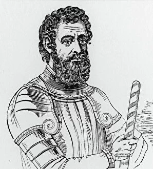
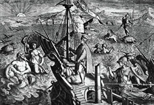
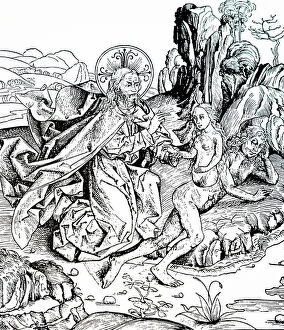
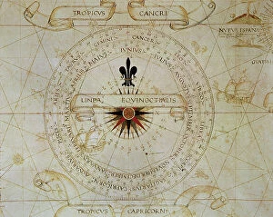
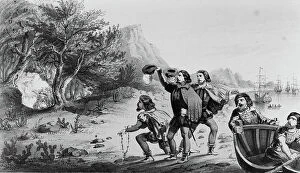
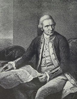
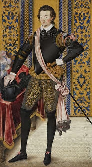
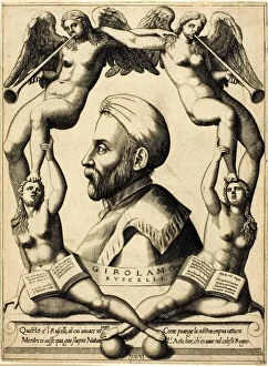
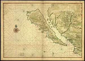
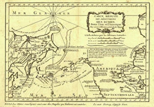
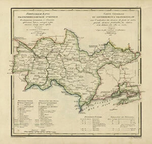
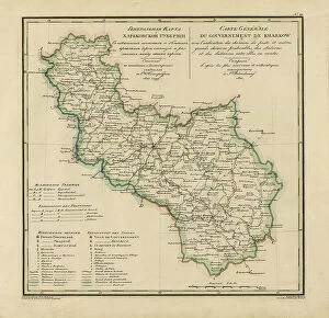
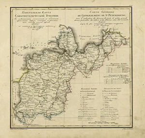
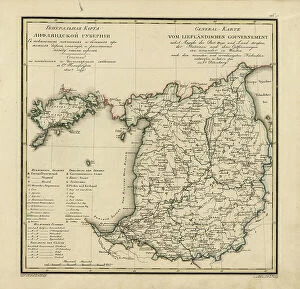
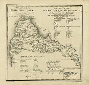
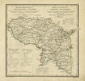
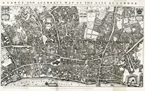
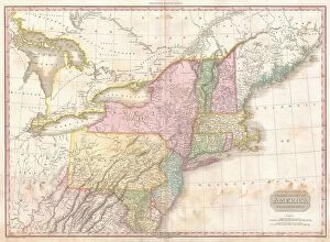
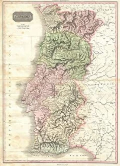
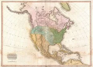
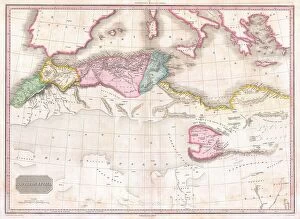
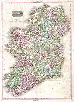
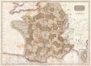
"Unveiling the World: A Journey through the Eyes of Cartographers" Embark on a captivating voyage through time and space as we delve into the fascinating world of cartography. From the intrepid explorations of Captain James Cook in 1775 to Gerardus Mercator's groundbreaking map, Septentrionalium Terrarum descriptio, in 1595, these visionary individuals shaped our understanding of the globe. Traveling eastward, we encounter the Kingdom of Saxony's eastern part meticulously charted by skilled cartographers. The bustling ports of Portsmouth and Southampton come alive on Pinkerton Map's depiction of the British Isles in 1818, revealing their vital role in maritime history. Abraham Ortelius' magnum opus, Theatrum Orbis Terrarum (Theatre of the World), showcases an intricate tapestry that connects continents and cultures. Meanwhile, a glimpse at an old map from 1855 transports us to California's early days when its borders were still taking shape. A Vintage Map of the World invites us to explore distant lands like Bosnia, Dalmatia, Istria, Croatia, and Slavonia – regions steeped in rich history and cultural heritage. Leonard Euler's caricature adds a touch of whimsy to this journey as he playfully navigates his way across mathematical realms. As we turn back time once more with Sir Thomas More's Utopia woodcut from 1518 edition and Andreas Cellarius' masterful works capturing celestial wonders during Dutch-German Renaissance era; it becomes clear that cartography is not merely about maps but also about storytelling - weaving tales that transcend borders and eras. Join us as we celebrate these remarkable cartographers who dared to dream beyond horizons unknown – forever leaving their mark on our collective imagination. Let their artistry inspire you to see our world with fresh eyes while cherishing its ever-evolving beauty.