Cartographer Collection (page 5)

"Unveiling the World

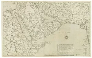
Background imageCartographer Collection: Map of India and Southeastern Asia; Il Disegno Della Terza Parte Dell Asia

Map of India and Southeastern Asia; Il Disegno Della Terza Parte Dell Asia
1195417 Map of India and Southeastern Asia; Il Disegno Della Terza Parte Dell Asia, 1561 (engraving) by Gastaldi, Giacomo (c.1500-66) (after); 48x73, 2 cm; Private Collection; (add.info.: Gastaldi)

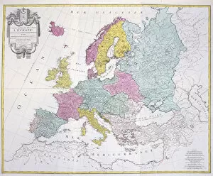
Background imageCartographer Collection: General Map of the whole of Europe, divided into its main countries

General Map of the whole of Europe, divided into its main countries
986324 General Map of the whole of Europe, divided into its main countries, 1782 (hand-coloured engraving.) by German School

Background imageCartographer Collection: Map of Africa, Arabia and India (double-page), 1695-1702 (hand-coloured engraving)

Map of Africa, Arabia and India (double-page), 1695-1702 (hand-coloured engraving)
986321 Map of Africa, Arabia and India (double-page), 1695-1702 (hand-coloured engraving) by Jaillot, Alexis-Hubert (1632-1712); 63x102

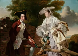
Background imageCartographer Collection: Portrait of Peter Perez Burdett and His First Wife Hannah, 1765 (oil on canvas)

Portrait of Peter Perez Burdett and His First Wife Hannah, 1765 (oil on canvas)
5614471 Portrait of Peter Perez Burdett and His First Wife Hannah, 1765 (oil on canvas) by Wright of Derby, Joseph (1734-97); 145X205 cm; Narodni Galerie, Prague

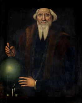
Background imageCartographer Collection: Portrait of Sebastian Cabot (c. 1475-1557) (oil on canvas)

Portrait of Sebastian Cabot (c. 1475-1557) (oil on canvas)
BAG46376 Portrait of Sebastian Cabot (c.1475-1557) (oil on canvas) by Herring, James (1794-1867) (attr. to); 88.9x61.1 cm; Bristol Museum and Art Gallery, UK; eBristol Museums

Background imageCartographer Collection: Captain Cook approaching New Zealand, illustration from Hutchinson

Captain Cook approaching New Zealand, illustration from Hutchinson
IL370610 Captain Cook approaching New Zealand, illustration from Hutchinsons Story of the British Nation, c.1923 (litho) by Woodville

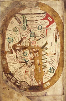
Background imageCartographer Collection: Ms. 89 Higden fol. 13v Map of the World (ink on vellum)

Ms. 89 Higden fol. 13v Map of the World (ink on vellum)
CCC397776 Ms.89 Higden fol.13v Map of the World (ink on vellum) by Higden, Ranulf (d.1364); Corpus Christi College, Oxford

Background imageCartographer Collection: Plans and views of magnetic compasses with dipping needles

Plans and views of magnetic compasses with dipping needles
Plans and views of magnetic compasses, including the dipping needle built by Dr. John Lorimer (1732-1795), surgeon, mathematician, politician and cartographer

Background imageCartographer Collection: Patriotism (w / c on paper)

Patriotism (w / c on paper)
810313 Patriotism (w/c on paper) by Dadd, Richard (1817-86); Victoria & Albert Museum, London, UK; The Stapleton Collection; English, out of copyright

Background imageCartographer Collection: Martin Behaim, German explorer and cartographer (engraving)

Martin Behaim, German explorer and cartographer (engraving)
3647373 Martin Behaim, German explorer and cartographer (engraving) by German School, (19th century); Private Collection; (add.info.: Martin Behaim (1459-1507), German explorer and cartographer

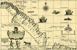
Background imageCartographer Collection: Map of the Coast of Guiana, 1646-47

Map of the Coast of Guiana, 1646-47
3786720 Map of the Coast of Guiana, 1646-47; (add.info.: Map of the Coast of Guiana - published in Dudleys Dell Arcano del Mare, 1646- 47)

Background imageCartographer Collection: Amerigo Vespucci Discovering the Southern Cross with an Astrolabe, from Nova Reperta, pub

Amerigo Vespucci Discovering the Southern Cross with an Astrolabe, from Nova Reperta, pub
3715348 Amerigo Vespucci Discovering the Southern Cross with an Astrolabe, from Nova Reperta, pub. 1600 (engraving) by Straet

Background imageCartographer Collection: Map of Willesden, London (litho)

Map of Willesden, London (litho)
1762020 Map of Willesden, London (litho) by English School; London Metropolitan Archives, City of London; (add.info.: Willesden is an area in North West London which forms part of the London Borough)

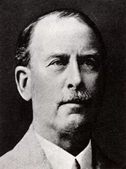
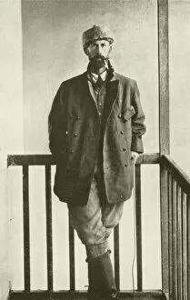
Background imageCartographer Collection: Colonel P H Fawcett

Colonel P H Fawcett
Colonel Percy H Fawcett (1867 - 1925), British geographer, artillery officer, cartographer, archaeologist, and explorer of South America. 1932

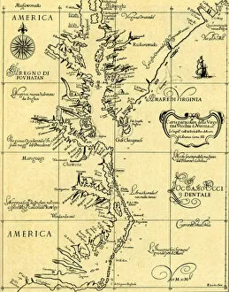
Background imageCartographer Collection: Map of Old and New Virginia, 1646-47

Map of Old and New Virginia, 1646-47
3786721 Map of Old and New Virginia, 1646-47; (add.info.: Map of Old and New Virginia - published in Dudleys Dell Arcano del Mare, 1646- 47)

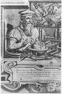
Background imageCartographer Collection: Gerardus Mercator, Flemish geographer and cartographer (engraving)

Gerardus Mercator, Flemish geographer and cartographer (engraving)
3647427 Gerardus Mercator, Flemish geographer and cartographer (engraving) by German School, (19th century); Private Collection; (add.info.: Gerardus Mercator (1512-1594)

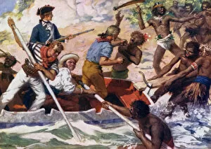
Background imageCartographer Collection: I resolved to make the chief alone fall a victim to his own treachery (colour litho)

I resolved to make the chief alone fall a victim to his own treachery (colour litho)
3648944 I resolved to make the chief alone fall a victim to his own treachery (colour litho) by Williamson, J. (active c. 1905); Private Collection; (add.info)

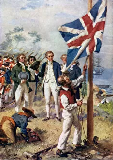
Background imageCartographer Collection: I now took possession in right of His Majesty King George III by the name of New South Wales

I now took possession in right of His Majesty King George III by the name of New South Wales (colour litho)
3648929 I now took possession in right of His Majesty King George III by the name of New South Wales (colour litho) by Williamson, J. (active c)

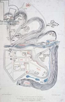
Background imageCartographer Collection: Plan of Jerusalem in 1308, illustration from a facsimile edition of

Plan of Jerusalem in 1308, illustration from a facsimile edition of
CHT221549 Plan of Jerusalem in 1308, illustration from a facsimile edition of Liber de Expeditione Terrae Sanctae by Marino Sanuto di Torcello (c.1260-1338) (colour litho) by French School

Background imageCartographer Collection: Nicolaus Germanus, German cartographer

Nicolaus Germanus, German cartographer
6039977 Nicolaus Germanus, German cartographer. by Bry, Theodor de (1528-98); Private Collection; (add.info.: Nicolaus Germanus)

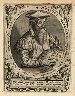
Background imageCartographer Collection: Gerardus Mercator, geographer

Gerardus Mercator, geographer
6039970 Gerardus Mercator, geographer. by Bry, Theodor de (1528-98); Private Collection; (add.info.: Gerardus Mercator, geographer, cosmographer and cartographer from Flanders, 1512-1594)

Background imageCartographer Collection: A View-Plan of Zurich, 1576 (woodcut)

A View-Plan of Zurich, 1576 (woodcut)
1195496 A View-Plan of Zurich, 1576 (woodcut) by Murer, Jos (1530-80) & Froschauer, Christoffel (c.1490-1564); 89x123 cm; Private Collection; (add.info.: Murer, Jos (1530-1580) & Froschower

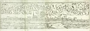
Background imageCartographer Collection: Town View of Vienna in 1548, 1550 (woodcut)

Town View of Vienna in 1548, 1550 (woodcut)
1195494 Town View of Vienna in 1548, 1550 (woodcut) by Deutsch, Hans Rudolf Manuel (1525-71); 23x78.5 cm; Private Collection; (add.info.: Deutsch)

Background imageCartographer Collection: Jedediah Smith, from Colliers Weekly, pub. 1906 (colour litho)

Jedediah Smith, from Colliers Weekly, pub. 1906 (colour litho)
3467960 Jedediah Smith, from Colliers Weekly, pub. 1906 (colour litho) by Remington, Frederic (1861-1909); Private Collection; (add.info)

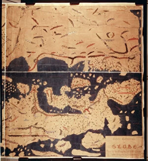
Background imageCartographer Collection: Ms. Arabe 2221 fol. 203 & 204 Map of the Mediterranean, Europe and Africa, 1300 (vellum)

Ms. Arabe 2221 fol. 203 & 204 Map of the Mediterranean, Europe and Africa, 1300 (vellum)
CHT206200 Ms. Arabe 2221 fol.203 & 204 Map of the Mediterranean, Europe and Africa, 1300 (vellum) by Al-Idrisi or Edrisi, Abu Muhammad (c.1100-64) (after); Bibliotheque Nationale, Paris

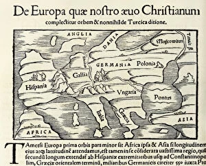
Background imageCartographer Collection: De Europa, quae nostro aeuo Christianum a map of Christian Europe

De Europa, quae nostro aeuo Christianum a map of Christian Europe
5668991 De Europa, quae nostro aeuo Christianum a map of Christian Europe, from 1550 edition of Cosmographia by Sebastian Munster (woodcut) by Munster

Background imageCartographer Collection: Percy Harrison Fawcett, Pelechuco, 1911 (b / w photo)

Percy Harrison Fawcett, Pelechuco, 1911 (b / w photo)
5997940 Percy Harrison Fawcett, Pelechuco, 1911 (b/w photo) by European Photographer, (19th century); Private Collection; (add.info.: Percy Harrison Fawcett, Pelechuco, 1911)

Background imageCartographer Collection: William Barents writing his diary while spending the winter in a hut on Nova Zembla (litho)

William Barents writing his diary while spending the winter in a hut on Nova Zembla (litho)
5198211 William Barents writing his diary while spending the winter in a hut on Nova Zembla (litho) by Sheldon, Charles Mills (1866-1928) (after); Private Collection; (add.info)

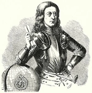
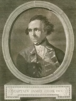
Background imageCartographer Collection: Portrait of Captain James Cook, 1777 (engraving)

Portrait of Captain James Cook, 1777 (engraving)
2630205 Portrait of Captain James Cook, 1777 (engraving) by Basire, James (1730-1802); Private Collection; (add.info.: Portrait of Captain James Cook by James Basire (English)

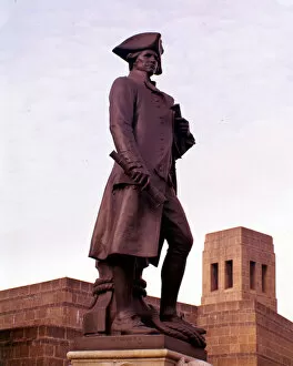
Background imageCartographer Collection: Statue of Captain James Cook, 1914 (bronze)

Statue of Captain James Cook, 1914 (bronze)
3849687 Statue of Captain James Cook, 1914 (bronze) by Brock, Thomas (1847-1922); (add.info.: This bronze statue of British explorer, navigator, cartographer and captain of the Royal Navy)

Background imageCartographer Collection: Gerard Mercator (1512-94) engraved for inclusion in the Mercator

Gerard Mercator (1512-94) engraved for inclusion in the Mercator
3086636 Gerard Mercator (1512-94) engraved for inclusion in the Mercator and Hondius series of atlases, 1619 (engraving) (b/w photo) (see also 10457 and 174686) by Flemish School

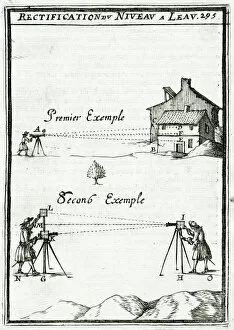
Background imageCartographer Collection: Illustration from 'La Geometrie Pratique'1702, (engraving)

Illustration from "La Geometrie Pratique"1702, (engraving)
937189 Illustration from " La Geometrie Pratique" 1702, (engraving) by Mallet, Alain Manesson (1630-1706); Private Collection; (add.info)

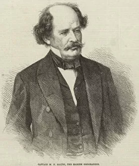
Background imageCartographer Collection: Matthew Fontaine Maury (engraving)

Matthew Fontaine Maury (engraving)
815689 Matthew Fontaine Maury (engraving) by English School, (19th century); Private Collection; (add.info.: Captain Maury, born Matthew Fontaine Maury (1806-1873)

Background imageCartographer Collection: Title page to John Ogilbys Britannia, engraved by Wenceslaus Hollar

Title page to John Ogilbys Britannia, engraved by Wenceslaus Hollar
XJF451353 Title page to John Ogilbys Britannia, engraved by Wenceslaus Hollar, 1675 (engraving) by Barlow, Francis (1626-1702) (after); Private Collection; (add.info)

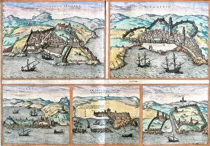
Background imageCartographer Collection: Tangier, Safi, Ceuta, Asilah, Sale, Morocco, From the book Civitates orbis terrarum by Braun

Tangier, Safi, Ceuta, Asilah, Sale, Morocco, From the book Civitates orbis terrarum by Braun and Hogenberg
3917690 Tangier, Safi, Ceuta, Asilah, Sale, Morocco, From the book Civitates orbis terrarum by Braun and Hogenberg. Publication year 1572, Cologne

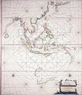
Background imageCartographer Collection: Sea chart East of India (Indonesia) (Double-page), c. 1658 (hand-coloured engraving)

Sea chart East of India (Indonesia) (Double-page), c. 1658 (hand-coloured engraving)
986260 Sea chart East of India (Indonesia) (Double-page), c.1658 (hand-coloured engraving) by Dutch School, (17th century); 56x66 cm; Private Collection; (add.info)

Background imageCartographer Collection: A Map of East Africa, Arabia and India, 1598 (hand-coloured engraving)

A Map of East Africa, Arabia and India, 1598 (hand-coloured engraving)
986157 A Map of East Africa, Arabia and India, 1598 (hand-coloured engraving) by Beckit, Robert (fl.1598); 38x51.5 cm; Private Collection; (add.info.: A Map of East Africa)

Background imageCartographer Collection: Ms Elkins 169 A description of the sea coast from the hill of Guatemala to

Ms Elkins 169 A description of the sea coast from the hill of Guatemala to
700759 Ms Elkins 169 A description of the sea coast from the hill of Guatemala to... Illustration from Waggoner of the Sea (pen & ink with w/c on paper) by Hack

Background imageCartographer Collection: Captain John Smith (1580-1631), 1st Governor of Virginia, c. 1616 (oil on canvas)

Captain John Smith (1580-1631), 1st Governor of Virginia, c. 1616 (oil on canvas)
SGS142537 Captain John Smith (1580-1631), 1st Governor of Virginia, c.1616 (oil on canvas) by English School, (17th century)

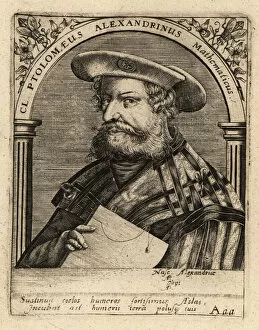
Background imageCartographer Collection: Wolfgang Laz, Austrian cartographer and historian

Wolfgang Laz, Austrian cartographer and historian
6039964 Wolfgang Laz, Austrian cartographer and historian. by Bry, Theodor de (1528-98); Private Collection; (add.info.: Wolfgang Laz or Wolfgang Lazius)

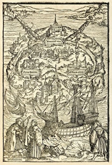
Background imageCartographer Collection: Map of the New Island of Utopia from a 1518 edition of Utopia

Map of the New Island of Utopia from a 1518 edition of Utopia
5615727 Map of the New Island of Utopia from a 1518 edition of Utopia by Sir Thomas More (1478-1535), first published in 1516. Woodcut by Ambrosius Holbein (c. 1494-c)

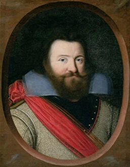
Background imageCartographer Collection: Portrait of a man, possibly Isaac Abrahamsz. Massa, c. 1622 (oil on canvas on wood panel)

Portrait of a man, possibly Isaac Abrahamsz. Massa, c. 1622 (oil on canvas on wood panel)
3934281 Portrait of a man, possibly Isaac Abrahamsz. Massa, c.1622 (oil on canvas on wood panel) by Hals, Frans (1582/3-1666); 107x85 cm; eThe Devonshire Collections


For sale as Licensed Images

Choose your image, Select your licence and Download the media

"Unveiling the World: A Journey through the Eyes of Cartographers" Embark on a captivating voyage through time and space as we delve into the fascinating world of cartography. From the intrepid explorations of Captain James Cook in 1775 to Gerardus Mercator's groundbreaking map, Septentrionalium Terrarum descriptio, in 1595, these visionary individuals shaped our understanding of the globe. Traveling eastward, we encounter the Kingdom of Saxony's eastern part meticulously charted by skilled cartographers. The bustling ports of Portsmouth and Southampton come alive on Pinkerton Map's depiction of the British Isles in 1818, revealing their vital role in maritime history. Abraham Ortelius' magnum opus, Theatrum Orbis Terrarum (Theatre of the World), showcases an intricate tapestry that connects continents and cultures. Meanwhile, a glimpse at an old map from 1855 transports us to California's early days when its borders were still taking shape. A Vintage Map of the World invites us to explore distant lands like Bosnia, Dalmatia, Istria, Croatia, and Slavonia – regions steeped in rich history and cultural heritage. Leonard Euler's caricature adds a touch of whimsy to this journey as he playfully navigates his way across mathematical realms. As we turn back time once more with Sir Thomas More's Utopia woodcut from 1518 edition and Andreas Cellarius' masterful works capturing celestial wonders during Dutch-German Renaissance era; it becomes clear that cartography is not merely about maps but also about storytelling - weaving tales that transcend borders and eras. Join us as we celebrate these remarkable cartographers who dared to dream beyond horizons unknown – forever leaving their mark on our collective imagination. Let their artistry inspire you to see our world with fresh eyes while cherishing its ever-evolving beauty.