Cartographic Collection (#36)

"Unveiling the World Through Cartographic Masterpieces" Step back in time and embark on a journey through history with these captivating cartographic treasures

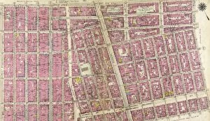
Background imageCartographic Collection: Plate 16: Bounded by Lexington Avenue, E. 40th Street, First Avenue East River, and E

Plate 16: Bounded by Lexington Avenue, E. 40th Street, First Avenue East River, and E. 25th Street

Background imageCartographic Collection: Part of Section 5: New York City

Part of Section 5: New York City

Background imageCartographic Collection: Plate 8: Bounded by W. 3rd Street, Great Jones Street, E

Plate 8: Bounded by W. 3rd Street, Great Jones Street, E. 3rd Street, Avenue A, Essex Street, Broome Street, and West Broadway

Background imageCartographic Collection: Plate 7: Bounded by E. 3rd Street, East River, Piers 60-64 Tompkins Street, East River

Plate 7: Bounded by E. 3rd Street, East River, Piers 60-64 Tompkins Street, East River, Piers 55-60 East Street, Water Street, Corlears Street, Grand Street, Attorney Street, Essex Street

Background imageCartographic Collection: Plate 15: Bounded by Plate 32: Bounded by E. 25th Street, Exterior Street East River

Plate 15: Bounded by Plate 32: Bounded by E. 25th Street, Exterior Street East River, Avenue C, E. 14th Street, and Second Avenue

Background imageCartographic Collection: Part of Section 1 : New York City

Part of Section 1 : New York City

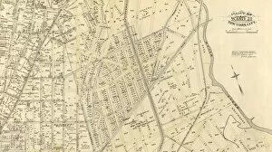
Background imageCartographic Collection: Plate 39: Bounded by Twelfth Avenue Hudson River, Riverside Drive, W. 142nd Street

Plate 39: Bounded by Twelfth Avenue Hudson River, Riverside Drive, W. 142nd Street, 10th Avenue, W. 141st Street, Convent Avenue, and W. 125th Street

Background imageCartographic Collection: Plate 38: Bounded by Hudson River Riverside Park, Riverside Drive, W. 125th Street

Plate 38: Bounded by Hudson River Riverside Park, Riverside Drive, W. 125th Street, Morningside Drive, Columbus Avenue, and W. 108th Street

Background imageCartographic Collection: Part of Section 8 : New York City

Part of Section 8 : New York City

Background imageCartographic Collection: Plate 49: Bounded by Harlem River N. Y, C. & H. R. R. R. Channel Line U. S. Ship Canal

Plate 49: Bounded by Harlem River N. Y, C. & H. R. R. R. Channel Line U. S. Ship Canal
Plate 49: Bounded by Harlem River N.Y, C. & H.R.R.R. Channel Line U.S. Ship Canal, Prescott Avenue, Emerson Street, Isham Street, Seaman Avenue, Emerson Street, Broadway Kingsbridge Road

Background imageCartographic Collection: Plate 47: Bounded by Harlem River, W. 182nd Street, W. 183rd Street, and Hudson River

Plate 47: Bounded by Harlem River, W. 182nd Street, W. 183rd Street, and Hudson River

Background imageCartographic Collection: Plate 43: Bounded by Hudson River Riverside Drive, W. 158th Street, Amsterdam Avenue, W

Plate 43: Bounded by Hudson River Riverside Drive, W. 158th Street, Amsterdam Avenue, W. 147th Street, St. Nicholas Avenue, W. 141st Street, Amsterdam Avenue, and W. 142nd Street

Background imageCartographic Collection: Part of Sections 6 & 7 : New York City

Part of Sections 6 & 7 : New York City

Background imageCartographic Collection: Plate 40: Bounded by W. 136th Street, Fifth Avenue, W

Plate 40: Bounded by W. 136th Street, Fifth Avenue, W. 125th Street, and Morningside Avenue

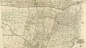
Background imageCartographic Collection: Plate 38: Bounded by Harlem River, Highbridge Road, Jerome Avenue, Primrose Street

Plate 38: Bounded by Harlem River, Highbridge Road, Jerome Avenue, Primrose Street, Vanderbilt Avenue

Background imageCartographic Collection: Part of Ward 24, New York City

Part of Ward 24, New York City

Background imageCartographic Collection: Plate 36: Bounded by Horton Street, Third Boston Road, Briston Street, ... Bronx River

Plate 36: Bounded by Horton Street, Third Boston Road, Briston Street, ... Bronx River
Plate 36: Bounded by Horton Street, Third Boston Road, Briston Street, ....Bronx River, Dickey Street, Hunts Point Road, Southern Boulevard, ...... Clifton Street and Third Avenue

Background imageCartographic Collection: Plate 35: Bounded by... N. Third Avenue, 161st Street, Jerome Avenue, Harlem River

Plate 35: Bounded by... N. Third Avenue, 161st Street, Jerome Avenue, Harlem River
Plate 35: Bounded by.....N. Third Avenue, 161st Street, Jerome Avenue, Harlem River and Depot Place

Background imageCartographic Collection: Plate 39: Vanderbilt Avenue, Pelham Avenue, Boston Road

Plate 39: Vanderbilt Avenue, Pelham Avenue, Boston Road

Background imageCartographic Collection: Part of Ward 22, New York City

Part of Ward 22, New York City

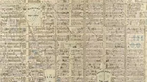
Background imageCartographic Collection: Plate 12: Bounded by W. 27th Street, E. 27th Street, First Avenue, E. 26th Street

Plate 12: Bounded by W. 27th Street, E. 27th Street, First Avenue, E. 26th Street, Avenue A, E. 14th Street, and Sixth Avenue

Background imageCartographic Collection: Part of Wards 16 &20, New York City

Part of Wards 16 &20, New York City

Background imageCartographic Collection: Plate 22: Bounded by E. 115th Street, East River Pleasant Avenue, E. 102nd Street

Plate 22: Bounded by E. 115th Street, East River Pleasant Avenue, E. 102nd Street and Fifth Avenue

Background imageCartographic Collection: Part of Wards 7, 11 & 13, New York City

Part of Wards 7, 11 & 13, New York City

Background imageCartographic Collection: Plate 5: Bounded by Clinton Street, Madison Street, Jefferson Street, Cherry Street

Plate 5: Bounded by Clinton Street, Madison Street, Jefferson Street, Cherry Street, Rutgers Slip, South Street East River, Piers 32-44, James Slip, New Chambers Street, New Bowery Street

Background imageCartographic Collection: Part of Ward 17, New York City

Part of Ward 17, New York City

Background imageCartographic Collection: Plate 4: West Broadway, Canal Street, Sullivan Street, W. Houston Street, Bowery Street

Plate 4: West Broadway, Canal Street, Sullivan Street, W. Houston Street, Bowery Street, New Bowery Square, New Chambers Street, Chambers Street, Broadway and Reade Street

Background imageCartographic Collection: Part of Wards 5 & 8, New York City

Part of Wards 5 & 8, New York City

Background imageCartographic Collection: Part of Wards 1, 2, 4 & 6, New York City

Part of Wards 1, 2, 4 & 6, New York City

Background imageCartographic Collection: Plate 84: Bounded by E. 59th Street, Third Avenue, E. 53rd Street, and Fifth Avenue

Plate 84: Bounded by E. 59th Street, Third Avenue, E. 53rd Street, and Fifth Avenue

Background imageCartographic Collection: Plate 31: Bounded by W. 8th Street, E. 8th Street, Broadway, W. 3rd Street, Macdougal

Plate 31: Bounded by W. 8th Street, E. 8th Street, Broadway, W. 3rd Street, Macdougal, Washington Square, and West Street

Background imageCartographic Collection: Part of Section 4 : Plate 82

Part of Section 4 : Plate 82

Background imageCartographic Collection: Plate 33: Bounded by Barrow Street, Bleecker Street, Cornelia Street, Sixth Avenue, W

Plate 33: Bounded by Barrow Street, Bleecker Street, Cornelia Street, Sixth Avenue, W. 3rd Street, Sullivan Street, Bedford Street, Macdougal Street, King Street

Background imageCartographic Collection: Part of Section 4 : Plate 86

Part of Section 4 : Plate 86

Background imageCartographic Collection: Plate 85: Bounded by E. 59th Street, Avenue A East River, E. 53rd Street and Third Avenue

Plate 85: Bounded by E. 59th Street, Avenue A East River, E. 53rd Street and Third Avenue

Background imageCartographic Collection: Plate 81: Bounded by W. 59th Street, Ninth Avenue, W. 53rd Street, and Eleventh Avenue

Plate 81: Bounded by W. 59th Street, Ninth Avenue, W. 53rd Street, and Eleventh Avenue

Background imageCartographic Collection: Plate 169: Bounded by W. 173rd Street, Amsterdam Avenue, Edgecombe Avenue High Bridge

Plate 169: Bounded by W. 173rd Street, Amsterdam Avenue, Edgecombe Avenue High Bridge Park, Speedway, Harlem River, W. 167th Street, and Broadway

Background imageCartographic Collection: Plate 183: Bounded by Nicholas Place, Prescott Avenue, Emerson Place, W. 207th Street

Plate 183: Bounded by Nicholas Place, Prescott Avenue, Emerson Place, W. 207th Street, Broadway and Dyckman Street

Background imageCartographic Collection: Part of Section 8: Plate 170

Part of Section 8: Plate 170

Background imageCartographic Collection: Plate 168: Bounded by W. 173rd Street, St

Plate 168: Bounded by W. 173rd Street, St. Nicholas Avenue, W. 168th Street, ...Harlem River, Fort Washington Park Riverside Drive

Background imageCartographic Collection: Part of Section 8: Plate 167

Part of Section 8: Plate 167

Background imageCartographic Collection: Plate 164: Bounded by W. 162nd Street, Amsterdam Avenue, W. 157th Street and Broadway

Plate 164: Bounded by W. 162nd Street, Amsterdam Avenue, W. 157th Street and Broadway

Background imageCartographic Collection: Part of Section 8: Plate 165

Part of Section 8: Plate 165

Background imageCartographic Collection: Part of Section 8: Plate 166

Part of Section 8: Plate 166

Background imageCartographic Collection: Part of Section 8: Plate 163

Part of Section 8: Plate 163

Background imageCartographic Collection: Part of Sections 7 & 8: Plate 162

Part of Sections 7 & 8: Plate 162

Background imageCartographic Collection: Part of Section 8: Plate 181

Part of Section 8: Plate 181

Background imageCartographic Collection: Part of Section 8: Plate 182

Part of Section 8: Plate 182


For sale as Licensed Images

Choose your image, Select your licence and Download the media

"Unveiling the World Through Cartographic Masterpieces" Step back in time and embark on a journey through history with these captivating cartographic treasures. From Al-Idrisi's world map of 1154 to Orteliuss' intricate creations from the 16th century, each map tells a unique story about the world as it was known at that time. Al-Idrisi's world map, crafted in 1154, offers a glimpse into medieval Islamic geography, showcasing an impressive understanding of global trade routes and geographical features. Meanwhile, the British Empire world map from the 19th century illustrates the vast extent of Britain's dominion across continents and oceans. The Catalan Atlas transports us to the 14th century with its exquisite craftsmanship and detailed depictions of various regions. It serves as a testament to Catalonia's rich maritime tradition and exploration during this period. Orteliuss' maps take center stage throughout this collection, providing invaluable insights into specific regions such as Ottoman Empire, Italy, Poland, Greece, Germany, Netherlands - all meticulously documented in his renowned Theatrum Orbis Terrarum. These masterpieces not only showcase Orteliuss' cartographic expertise but also shed light on political boundaries and cultural nuances prevalent during his era. Moving closer to home is the Map of City Dublin from 1797 which showcases Ireland's capital city at that time - offering glimpses into its urban layout and architectural landmarks that have shaped Dublin's identity over centuries. Lastly Zaragoza’s (19th c. ) Map takes us to Spain where we can explore Madrid through intricate details capturing its streetscape during that period - allowing us to immerse ourselves in Spanish history while navigating through its vibrant capital city. These remarkable cartographic works serve as windows into our past – they are not just maps; they are gateways connecting us with bygone eras.