Cartographic Collection (#43)

"Unveiling the World Through Cartographic Masterpieces" Step back in time and embark on a journey through history with these captivating cartographic treasures

Background imageCartographic Collection: Plan of the archbishopric of Mexico: Mexico City

Plan of the archbishopric of Mexico: Mexico City and his lagoon. 1767. Collection Lorenzana-Borb󮮠 Miniature Painting. SPAIN. Toledo. State Public Library

Background imageCartographic Collection: Universa ac Navigabilis Totius Terrarum Orbis

Universa ac Navigabilis Totius Terrarum Orbis

Background imageCartographic Collection: BARENTS, Willem (1550-1597). Dutch Navigator

BARENTS, Willem (1550-1597). Dutch Navigator

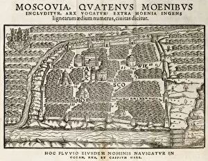
Background imageCartographic Collection: Map of Moscow, 16th century

Map of Moscow, 16th century
Map of Moscow, Russia. This 16th-century map was drawn by the German diplomat, geographer and historian Sigismund von Herberstein (1486-1566)

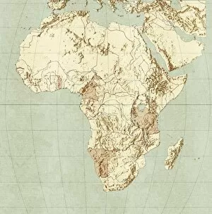
Background imageCartographic Collection: Map of Africa

Map of Africa

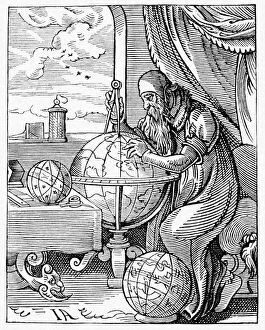
Background imageCartographic Collection: Medieval geographer

Medieval geographer. Artwork of a 15th century geographer using a pair of dividers to measure distances on a terrestrial globe showing the known regions of the Earth

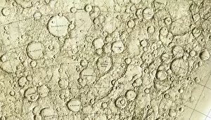
Background imageCartographic Collection: Mercury map, 1977

Mercury map, 1977. Part of the cratered surface of Mercury as shown in a 1977 map issued for NASA by the National Geological Survey in the USA

Background imageCartographic Collection: Walk-on street map in Paris

Walk-on street map in Paris
A map on a pavement in Paris, near the Hotel de Ville. The " Main Verte" (green hand) logo with the watering can

Background imageCartographic Collection: John Ogilby, Scottish translator

John Ogilby, Scottish translator
John Ogilby (1600-1676), Scottish translator and cartographer. Ogilbys early career was as lord deputy and tutor in Ireland for the Earl of Strafford

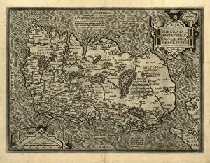
Background imageCartographic Collection: Orteliuss map of Ireland, 1598

Orteliuss map of Ireland, 1598
Orteliuss map of Ireland, from an atlas of 1598. North is at right. This map is titled: Hiberniae, Britannicae Insulae Nova Descriptio (A new depiction of Ireland, a British Isle)

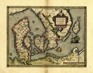
Background imageCartographic Collection: Orteliuss map of Denmark, 1570

Orteliuss map of Denmark, 1570
Orteliuss map of Denmark. This map is from the 1570 first edition of Theatrum orbis terrarum ( Theatre of the World ). Drawn by the Flemish mapmaker Abraham Ortelius (1527-1598)

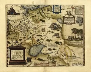
Background imageCartographic Collection: Orteliuss map of European Russia, 1570

Orteliuss map of European Russia, 1570
Orteliuss map of European Russia. This map is from the 1570 first edition of Theatrum orbis terrarum ( Theatre of the World )

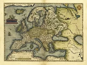
Background imageCartographic Collection: Orteliuss map of Europe, 1570

Orteliuss map of Europe, 1570. This map is from the 1570 first edition of Theatrum orbis terrarum ( Theatre of the World )

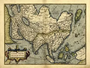
Background imageCartographic Collection: Orteliuss map of Asia, 1570

Orteliuss map of Asia, 1570
Orteliuss map of Asia. This map is from the 1570 first edition of Theatrum orbis terrarum ( Theatre of the World ). Drawn by the Flemish mapmaker Abraham Ortelius (1527-1598)

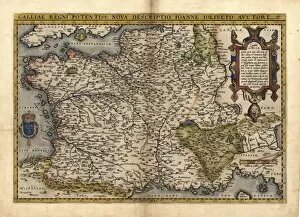
Background imageCartographic Collection: Orteliuss map of France, 1570

Orteliuss map of France, 1570
Orteliuss map of France. This map is from the 1570 first edition of Theatrum orbis terrarum ( Theatre of the World ). Drawn by the Flemish mapmaker Abraham Ortelius (1527-1598)

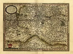
Background imageCartographic Collection: Orteliuss map of Austria, 1570

Orteliuss map of Austria, 1570
Orteliuss map of Austria. This map is from the 1570 first edition of Theatrum orbis terrarum ( Theatre of the World ). Drawn by the Flemish mapmaker Abraham Ortelius (1527-1598)

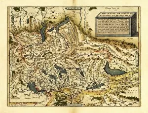
Background imageCartographic Collection: Orteliuss map of Switzerland, 1570

Orteliuss map of Switzerland, 1570
Orteliuss map of Switzerland. This map is from the 1570 first edition of Theatrum orbis terrarum ( Theatre of the World )

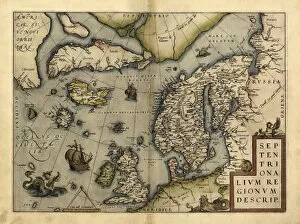
Background imageCartographic Collection: Orteliuss map of Northern Europe, 1570

Orteliuss map of Northern Europe, 1570
Orteliuss map of Northern Europe. This map is from the 1570 first edition of Theatrum orbis terrarum ( Theatre of the World )

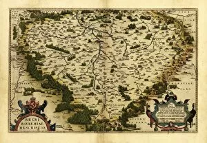
Background imageCartographic Collection: Orteliuss map of Bohemia, 1570

Orteliuss map of Bohemia, 1570
Orteliuss map of Bohemia. This map is from the 1570 first edition of Theatrum orbis terrarum ( Theatre of the World ). Drawn by the Flemish mapmaker Abraham Ortelius (1527-1598)

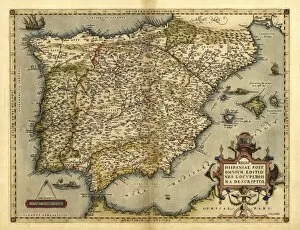
Background imageCartographic Collection: Orteliuss map of Iberian Peninsula, 1570

Orteliuss map of Iberian Peninsula, 1570
Orteliuss map of Iberian Peninsula. This map is from the 1570 first edition of Theatrum orbis terrarum ( Theatre of the World )

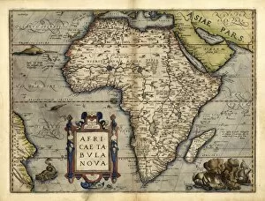
Background imageCartographic Collection: Orteliuss map of Africa, 1570

Orteliuss map of Africa, 1570
Orteliuss map of Africa. This map is from the 1570 first edition of Theatrum orbis terrarum ( Theatre of the World ). Drawn by the Flemish mapmaker Abraham Ortelius (1527-1598)

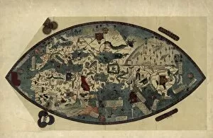
Background imageCartographic Collection: Genoese world map, 1450

Genoese world map, 1450
Genoese world map. This world map was drawn in around 1450, possibly by the Italian mathematician, astronomer, and geographer Paolo dal Pozzo Toscanelli (1397-1482)

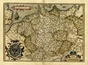
Background imageCartographic Collection: Orteliuss map of Germany, 1570

Orteliuss map of Germany, 1570
Orteliuss map of Germany. This map is from the 1570 first edition of Theatrum orbis terrarum ( Theatre of the World ). Drawn by the Flemish mapmaker Abraham Ortelius (1527-1598)


For sale as Licensed Images

Choose your image, Select your licence and Download the media

"Unveiling the World Through Cartographic Masterpieces" Step back in time and embark on a journey through history with these captivating cartographic treasures. From Al-Idrisi's world map of 1154 to Orteliuss' intricate creations from the 16th century, each map tells a unique story about the world as it was known at that time. Al-Idrisi's world map, crafted in 1154, offers a glimpse into medieval Islamic geography, showcasing an impressive understanding of global trade routes and geographical features. Meanwhile, the British Empire world map from the 19th century illustrates the vast extent of Britain's dominion across continents and oceans. The Catalan Atlas transports us to the 14th century with its exquisite craftsmanship and detailed depictions of various regions. It serves as a testament to Catalonia's rich maritime tradition and exploration during this period. Orteliuss' maps take center stage throughout this collection, providing invaluable insights into specific regions such as Ottoman Empire, Italy, Poland, Greece, Germany, Netherlands - all meticulously documented in his renowned Theatrum Orbis Terrarum. These masterpieces not only showcase Orteliuss' cartographic expertise but also shed light on political boundaries and cultural nuances prevalent during his era. Moving closer to home is the Map of City Dublin from 1797 which showcases Ireland's capital city at that time - offering glimpses into its urban layout and architectural landmarks that have shaped Dublin's identity over centuries. Lastly Zaragoza’s (19th c. ) Map takes us to Spain where we can explore Madrid through intricate details capturing its streetscape during that period - allowing us to immerse ourselves in Spanish history while navigating through its vibrant capital city. These remarkable cartographic works serve as windows into our past – they are not just maps; they are gateways connecting us with bygone eras.