
Cartographies Collection
"Exploring the Cartographies: Tracing Spain's Rich History through Maps" From the intricate 19th-century map of Zaragoza to the geometrical masterpiece by Josè


For sale as Licensed Images
Choose your image, Select your licence and Download the media
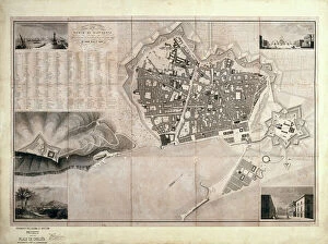
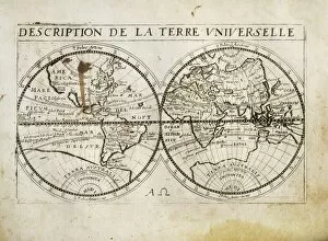
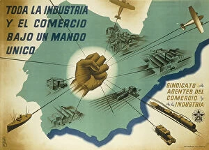
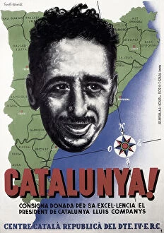
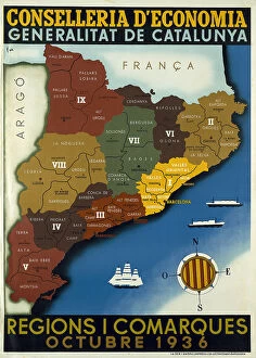
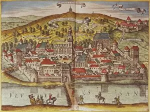
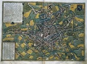
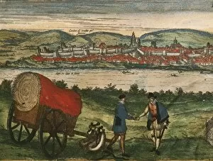
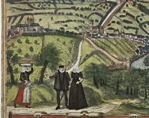
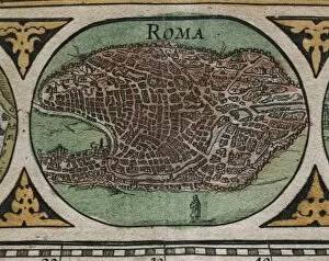
"Exploring the Cartographies: Tracing Spain's Rich History through Maps" From the intricate 19th-century map of Zaragoza to the geometrical masterpiece by Josè, they have long been a window into Spain's past. The "Description de la Terre Universelle" from 1667 takes us back in time, revealing the world as it was seen centuries ago. Meanwhile, Juan de la Cosa's chart from 1500 showcases Madrid during a pivotal era. During the Spanish Civil War (1936-1939), maps became powerful tools for propaganda and resistance. "Toda la industria" portrays an industrialized nation at war, while "Catalunya. " highlights Catalonia's fight for independence. The detailed map of Catalonia regions offers insights into this tumultuous period. The call to action is evident in maps like "Ayudad a Madrid, " urging support for the capital city during its darkest hours. Even beyond Spain's borders, Villa Farnese's map of Europe in Caprarola, Italy reminds us that cartography transcends national boundaries. Not only were cities mapped but also agricultural landscapes; Joan Vilanova i Piera’s agronomic map provides valuable insight into land use practices during his time. And let us not forget about Barcelona – even French cartographers recognized its significance with their own depiction in 1706 and can more than just lines on paper; they tell stories of conquests and revolutions, struggles and triumphs. They invite us to explore history through visual representations and understand how places have evolved over time. So take a journey through these captivating cartographies and discover Spain's rich tapestry woven across centuries.