
City Plan Collection
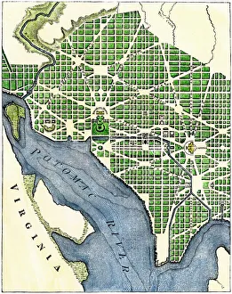
"Unveiling the Blueprint: A Glimpse into City Plans Throughout History" The meticulously crafted Plan of Washington DC, 1793


For sale as Licensed Images
Choose your image, Select your licence and Download the media
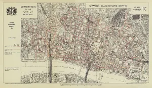
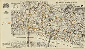
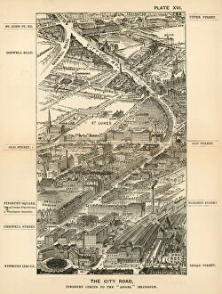
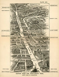
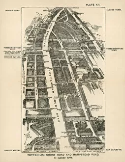
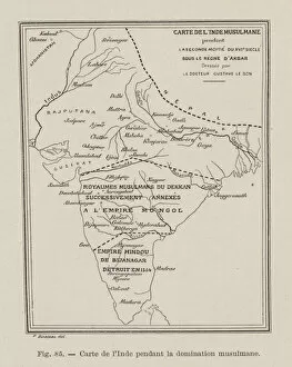
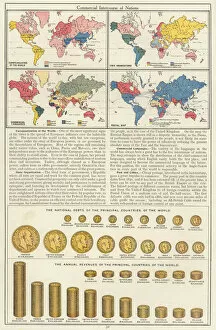
"Unveiling the Blueprint: A Glimpse into City Plans Throughout History" The meticulously crafted Plan of Washington DC, 1793, stands as a testament to the visionary minds that shaped America's capital city. Delving beneath the surface, Sewer depths in the City of London, 1944 (colour litho) reveals an intricate network designed to keep the bustling metropolis running smoothly. Step back in time with London in 1888: The City Road, Finsbury Circus to the "Angel" Islington (engraving), capturing the charm and vibrancy of Victorian-era streets. Traverse through history along Euston Road and Marylebone Road with London in 1888: Kings Cross to Paddington (engraving), witnessing how these iconic thoroughfares evolved over time. Embark on a journey from Tottenham Court Road and Hampstead Road to Camden Town with London in 1888: exploring an engraving that showcases a bygone era of bustling city life. Marvel at the intricacies of a 16th Century Plan of Rome, offering insight into one of history's greatest cities and its architectural wonders. Immerse yourself in India's rich past with Map of India during Mughal Emperor Akbar's reign - a captivating engraving that unveils this ancient civilization's vast territories. Reflect upon America's tumultuous past as you explore Map of Slavery in the United States, 1863 - revealing stark divisions between states where slavery persisted despite President Lincoln’s Emancipation Proclamation. Witness geopolitical tensions unfold through Map of Czechoslovakia during Sudetenland crisis, 1938 (colour litho), shedding light on Europe’s prelude to World War II and diplomatic struggles for power. Travel across continents with Commercial Intercourse of Nations (colour litho), a captivating map showcasing the interconnectedness of global trade and cultural exchange.