
Computer Graphic Collection (#12)

Unleash your creativity with the mesmerizing world of computer graphics

Background imageComputer Graphic Collection: CT Hartford West Hartford Vector Road Map

CT Hartford West Hartford Vector Road Map. All source data is in the public domain. U.S. Census Bureau Census Tiger. Used Layers: areawater, linearwater, roads, rails, cousub, pointlm, uac10

Background imageComputer Graphic Collection: CT Hartford Suffield Vector Road Map

CT Hartford Suffield Vector Road Map. All source data is in the public domain. U.S. Census Bureau Census Tiger. Used Layers: areawater, linearwater, roads, rails, cousub, pointlm, uac10

Background imageComputer Graphic Collection: CT Litchfield Cornwall Vector Road Map

CT Litchfield Cornwall Vector Road Map. All source data is in the public domain. U.S. Census Bureau Census Tiger. Used Layers: areawater, linearwater, roads, rails, cousub, pointlm, uac10

Background imageComputer Graphic Collection: CT Litchfield Harwinton Vector Road Map

CT Litchfield Harwinton Vector Road Map. All source data is in the public domain. U.S. Census Bureau Census Tiger. Used Layers: areawater, linearwater, roads, rails, cousub, pointlm, uac10

Background imageComputer Graphic Collection: CT Litchfield Kent Vector Road Map

CT Litchfield Kent Vector Road Map. All source data is in the public domain. U.S. Census Bureau Census Tiger. Used Layers: areawater, linearwater, roads, rails, cousub, pointlm, uac10

Background imageComputer Graphic Collection: CT Litchfield Bethlehem Vector Road Map

CT Litchfield Bethlehem Vector Road Map. All source data is in the public domain. U.S. Census Bureau Census Tiger. Used Layers: areawater, linearwater, roads, rails, cousub, pointlm, uac10

Background imageComputer Graphic Collection: CT Litchfield Bridgewater Vector Road Map

CT Litchfield Bridgewater Vector Road Map. All source data is in the public domain. U.S. Census Bureau Census Tiger. Used Layers: areawater, linearwater, roads, rails, cousub, pointlm, uac10

Background imageComputer Graphic Collection: CT Litchfield Barkhamsted Vector Road Map

CT Litchfield Barkhamsted Vector Road Map. All source data is in the public domain. U.S. Census Bureau Census Tiger. Used Layers: areawater, linearwater, roads, rails, cousub, pointlm, uac10

Background imageComputer Graphic Collection: CT Litchfield Colebrook Vector Road Map

CT Litchfield Colebrook Vector Road Map. All source data is in the public domain. U.S. Census Bureau Census Tiger. Used Layers: areawater, linearwater, roads, rails, cousub, pointlm, uac10

Background imageComputer Graphic Collection: CT Litchfield Canaan Vector Road Map

CT Litchfield Canaan Vector Road Map. All source data is in the public domain. U.S. Census Bureau Census Tiger. Used Layers: areawater, linearwater, roads, rails, cousub, pointlm, uac10

Background imageComputer Graphic Collection: CT Litchfield Goshen Vector Road Map

CT Litchfield Goshen Vector Road Map. All source data is in the public domain. U.S. Census Bureau Census Tiger. Used Layers: areawater, linearwater, roads, rails, cousub, pointlm, uac10

Background imageComputer Graphic Collection: CT Litchfield Torrington Vector Road Map

CT Litchfield Torrington Vector Road Map. All source data is in the public domain. U.S. Census Bureau Census Tiger. Used Layers: areawater, linearwater, roads, rails, cousub, pointlm, uac10

Background imageComputer Graphic Collection: CT Litchfield Thomaston Vector Road Map

CT Litchfield Thomaston Vector Road Map. All source data is in the public domain. U.S. Census Bureau Census Tiger. Used Layers: areawater, linearwater, roads, rails, cousub, pointlm, uac10

Background imageComputer Graphic Collection: CT Litchfield Sharon Vector Road Map

CT Litchfield Sharon Vector Road Map. All source data is in the public domain. U.S. Census Bureau Census Tiger. Used Layers: areawater, linearwater, roads, rails, cousub, pointlm, uac10

Background imageComputer Graphic Collection: CT Litchfield Roxbury Vector Road Map

CT Litchfield Roxbury Vector Road Map. All source data is in the public domain. U.S. Census Bureau Census Tiger. Used Layers: areawater, linearwater, roads, rails, cousub, pointlm, uac10

Background imageComputer Graphic Collection: CT Litchfield Plymouth Vector Road Map

CT Litchfield Plymouth Vector Road Map. All source data is in the public domain. U.S. Census Bureau Census Tiger. Used Layers: areawater, linearwater, roads, rails, cousub, pointlm, uac10

Background imageComputer Graphic Collection: CT Litchfield New Hartford Vector Road Map

CT Litchfield New Hartford Vector Road Map. All source data is in the public domain. U.S. Census Bureau Census Tiger. Used Layers: areawater, linearwater, roads, rails, cousub, pointlm, uac10

Background imageComputer Graphic Collection: CT Litchfield Litchfield Town Vector Road Map

CT Litchfield Litchfield Town Vector Road Map. All source data is in the public domain. U.S. Census Bureau Census Tiger. Used Layers: areawater, linearwater, roads, rails, cousub, pointlm, uac10

Background imageComputer Graphic Collection: CT Litchfield New Milford Vector Road Map

CT Litchfield New Milford Vector Road Map. All source data is in the public domain. U.S. Census Bureau Census Tiger. Used Layers: areawater, linearwater, roads, rails, cousub, pointlm, uac10

Background imageComputer Graphic Collection: CT Litchfield Morris Vector Road Map

CT Litchfield Morris Vector Road Map. All source data is in the public domain. U.S. Census Bureau Census Tiger. Used Layers: areawater, linearwater, roads, rails, cousub, pointlm, uac10

Background imageComputer Graphic Collection: CT Litchfield Norfolk Vector Road Map

CT Litchfield Norfolk Vector Road Map. All source data is in the public domain. U.S. Census Bureau Census Tiger. Used Layers: areawater, linearwater, roads, rails, cousub, pointlm, uac10

Background imageComputer Graphic Collection: CT Litchfield North Canaan Vector Road Map

CT Litchfield North Canaan Vector Road Map. All source data is in the public domain. U.S. Census Bureau Census Tiger. Used Layers: areawater, linearwater, roads, rails, cousub, pointlm, uac10

Background imageComputer Graphic Collection: CT Litchfield Salisbury Vector Road Map

CT Litchfield Salisbury Vector Road Map. All source data is in the public domain. U.S. Census Bureau Census Tiger. Used Layers: areawater, linearwater, roads, rails, cousub, pointlm, uac10

Background imageComputer Graphic Collection: CT Middlesex Durham Vector Road Map

CT Middlesex Durham Vector Road Map. All source data is in the public domain. U.S. Census Bureau Census Tiger. Used Layers: areawater, linearwater, roads, rails, cousub, pointlm, uac10

Background imageComputer Graphic Collection: CT Middlesex East Haddam Vector Road Map

CT Middlesex East Haddam Vector Road Map. All source data is in the public domain. U.S. Census Bureau Census Tiger. Used Layers: areawater, linearwater, roads, rails, cousub, pointlm, uac10

Background imageComputer Graphic Collection: CT Middlesex Deep River Vector Road Map

CT Middlesex Deep River Vector Road Map. All source data is in the public domain. U.S. Census Bureau Census Tiger. Used Layers: areawater, linearwater, roads, rails, cousub, pointlm, uac10

Background imageComputer Graphic Collection: CT Middlesex Cromwell Vector Road Map

CT Middlesex Cromwell Vector Road Map. All source data is in the public domain. U.S. Census Bureau Census Tiger. Used Layers: areawater, linearwater, roads, rails, cousub, pointlm, uac10

Background imageComputer Graphic Collection: CT Litchfield Winchester Vector Road Map

CT Litchfield Winchester Vector Road Map. All source data is in the public domain. U.S. Census Bureau Census Tiger. Used Layers: areawater, linearwater, roads, rails, cousub, pointlm, uac10

Background imageComputer Graphic Collection: CT Litchfield Washington Vector Road Map

CT Litchfield Washington Vector Road Map. All source data is in the public domain. U.S. Census Bureau Census Tiger. Used Layers: areawater, linearwater, roads, rails, cousub, pointlm, uac10

Background imageComputer Graphic Collection: CT Litchfield Watertown Vector Road Map

CT Litchfield Watertown Vector Road Map. All source data is in the public domain. U.S. Census Bureau Census Tiger. Used Layers: areawater, linearwater, roads, rails, cousub, pointlm, uac10

Background imageComputer Graphic Collection: CT Litchfield Warren Vector Road Map

CT Litchfield Warren Vector Road Map. All source data is in the public domain. U.S. Census Bureau Census Tiger. Used Layers: areawater, linearwater, roads, rails, cousub, pointlm, uac10

Background imageComputer Graphic Collection: CT Litchfield Woodbury Vector Road Map

CT Litchfield Woodbury Vector Road Map. All source data is in the public domain. U.S. Census Bureau Census Tiger. Used Layers: areawater, linearwater, roads, rails, cousub, pointlm, uac10

Background imageComputer Graphic Collection: CT Middlesex Chester Vector Road Map

CT Middlesex Chester Vector Road Map. All source data is in the public domain. U.S. Census Bureau Census Tiger. Used Layers: areawater, linearwater, roads, rails, cousub, pointlm, uac10

Background imageComputer Graphic Collection: CT Middlesex Clinton Vector Road Map

CT Middlesex Clinton Vector Road Map. All source data is in the public domain. U.S. Census Bureau Census Tiger. Used Layers: areawater, linearwater, roads, rails, cousub, pointlm, uac10

Background imageComputer Graphic Collection: MA Worcester Northbridge Vector Road Map

MA Worcester Northbridge Vector Road Map. All source data is in the public domain. U.S. Census Bureau Census Tiger. Used Layers: areawater, linearwater, roads, rails, cousub, pointlm, uac10

Background imageComputer Graphic Collection: MA Berkshire Dalton Vector Road Map

MA Berkshire Dalton Vector Road Map. All source data is in the public domain. U.S. Census Bureau Census Tiger. Used Layers: areawater, linearwater, roads, rails, cousub, pointlm, uac10

Background imageComputer Graphic Collection: MA Berkshire Lanesborough Vector Road Map

MA Berkshire Lanesborough Vector Road Map. All source data is in the public domain. U.S. Census Bureau Census Tiger. Used Layers: areawater, linearwater, roads, rails, cousub, pointlm, uac10

Background imageComputer Graphic Collection: MA Norfolk Weymouth Town Vector Road Map

MA Norfolk Weymouth Town Vector Road Map. All source data is in the public domain. U.S. Census Bureau Census Tiger. Used Layers: areawater, linearwater, roads, rails, cousub, pointlm, uac10

Background imageComputer Graphic Collection: William Hogarth, famouse English painter and satirist

William Hogarth, famouse English painter and satirist
Photo of an original engraving from the Works of William Hogarth published in 1833

Background imageComputer Graphic Collection: Colorado Springs Colorado US City Street Map

Colorado Springs Colorado US City Street Map
Vector Illustration of a City Street Map of Colorado Springs, Colorado, USA. Scale 1:60, 000. All source data is in the public domain. U.S

Background imageComputer Graphic Collection: Thornton Colorado US City Street Map

Thornton Colorado US City Street Map
Vector Illustration of a City Street Map of Thornton, Colorado, USA. Scale 1:60, 000. All source data is in the public domain. U.S

Background imageComputer Graphic Collection: Centennial Colorado US City Street Map

Centennial Colorado US City Street Map
Vector Illustration of a City Street Map of Centennial, Colorado, USA. Scale 1:60, 000. All source data is in the public domain. U.S

Background imageComputer Graphic Collection: Fargo North Dakota US City Street Map

Fargo North Dakota US City Street Map
Vector Illustration of a City Street Map of Fargo, North Dakota, USA. Scale 1:60, 000. All source data is in the public domain. U.S

Background imageComputer Graphic Collection: Columbia Missouri US City Street Map

Columbia Missouri US City Street Map
Vector Illustration of a City Street Map of Columbia, Missouri, USA. Scale 1:60, 000. All source data is in the public domain. U.S

Background imageComputer Graphic Collection: Kansas City Kansas US City Street Map

Kansas City Kansas US City Street Map
Vector Illustration of a City Street Map of Kansas City, Kansas, USA. Scale 1:60, 000. All source data is in the public domain. U.S

Background imageComputer Graphic Collection: San Antonio Texas US City Street Map

San Antonio Texas US City Street Map
Vector Illustration of a City Street Map of San Antonio, Texas, USA. Scale 1:60, 000. All source data is in the public domain. U.S

Background imageComputer Graphic Collection: Dallas Texas US City Street Map

Dallas Texas US City Street Map
Vector Illustration of a City Street Map of Dallas, Texas, USA. Scale 1:60, 000. All source data is in the public domain. U.S

Background imageComputer Graphic Collection: Oklahoma City Oklahoma US City Street Map

Oklahoma City Oklahoma US City Street Map
Vector Illustration of a City Street Map of Oklahoma City, Oklahoma, USA. Scale 1:60, 000. All source data is in the public domain. U.S


For sale as Licensed Images

Choose your image, Select your licence and Download the media

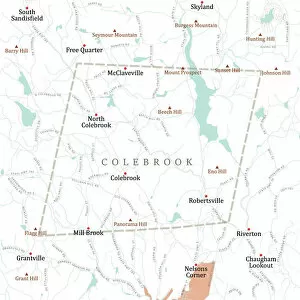
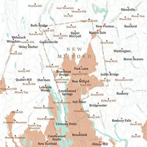
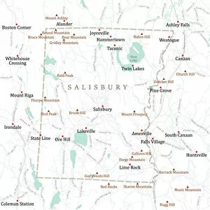
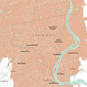
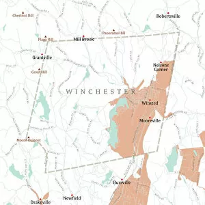
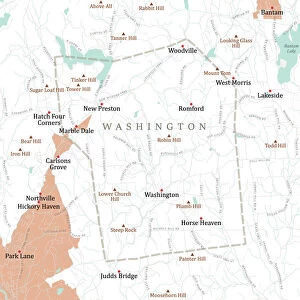
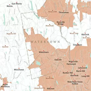
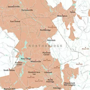
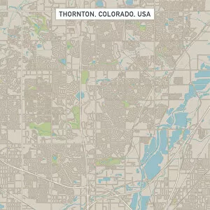
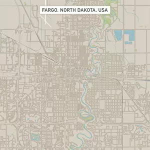
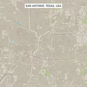
Unleash your creativity with the mesmerizing world of computer graphics. 🎨✨ Let the 'Be yourself' gold foil message guide you as you explore the limitless possibilities of digital art. Dive into the captivating Art of Schrodingers Cat experiment, where reality and imagination merge seamlessly on your screen. Travel back in time with an old Caucasus map, or embark on a new adventure with Costa Rica Vector Map - let them inspire your next masterpiece. Marvel at the intricate Computer artwork of ATLAS detector at CERN, showcasing the beauty of science through pixels and colors. Navigate through Ipswich Suffolk UK City Street Map and trust that every step is part of your unique journey. Delve into Fusion research with tokamak device, unraveling secrets to sustainable energy while admiring its elegant design. Lose yourself in the enchanting Fractal artwork, where math meets aesthetics in a symphony of patterns and shapes resembling delicate butterflies fluttering gracefully. And who could resist The pineapple (Ananas comosus) - a tropical delight brought to life by computer graphics? Finally, get captivated by 2C-B psychedelic drug's molecular model; witness how technology can visualize complex structures beyond our perception. With computer graphics as your canvas, let your imagination soar.