Continent Collection (#31)

"Exploring the Vastness: A Journey through Continents" Al-Idrisi's World Map, 1154: Unveiling the ancient knowledge of continents and their boundaries

Background imageContinent Collection: Earth globe

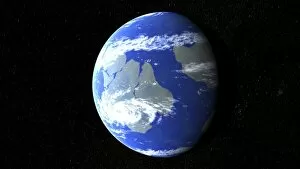
Earth globe centred on Australia

Background imageContinent Collection: Eurasia and Africa at night

Eurasia and Africa at night. Computer artwork of the Earth at night, centred on Asia. Africa is at centre to bottom left with Europe above it. Urban areas are shown by clusters of bright lights

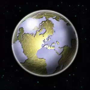
Background imageContinent Collection: Connected Earth

Connected Earth. Conceptual computer artwork of Earth with its continents linked by a network of lines, representing global connections

Background imageContinent Collection: Americas at night

Americas at night. Computer artwork of the Earth at night, centred on the Americas. North America is at top, South America is at bottom right. Urban areas are shown by clusters of bright lights

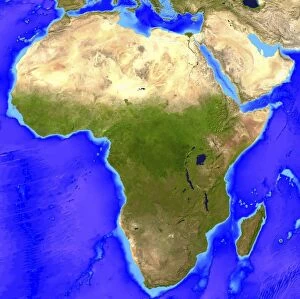
Background imageContinent Collection: Africa

Africa. Computer artwork, based on a satellite image, of Africa. North is at top. Water is blue, vegetation is green and desert is yellow

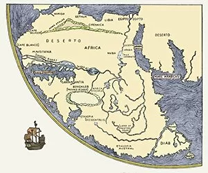
Background imageContinent Collection: Africa, from Fra Mauros world map, 1457

Africa, from Fra Mauros world map, 1457
Africa, from Fra Mauros Great Map of the World, 1457. Fra Mauro was a 15th century Italian monk and cartographer. In producing this map, which has been inverted from the original to put north at top

Background imageContinent Collection: Earth

Earth. Computer artwork, based on a satellite image, of Earth from space centred on North America. Water is blue, vegetation is green, desert is yellow and ice is white

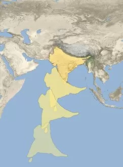
Background imageContinent Collection: Formation of the Himalayas, artwork

Formation of the Himalayas, artwork
Formation of the Himalayas. Artwork showing a sequence of four images of the Indian landmass (yellow) colliding with Asia to form the Himalayas mountain range

Background imageContinent Collection: Ice Age Europe

Ice Age Europe. Map showing the extent of glaciation in Europe during the period of peak glaciation during the current Ice Age

Background imageContinent Collection: Map of Africa

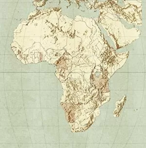
Map of Africa

Background imageContinent Collection: Hominid fossil sites in Africa

Hominid fossil sites in Africa. Map of the continent of Africa, where humans first evolved, showing eight sites (dots) where the famous fossils have been found

Background imageContinent Collection: Global winds, artwork

Global winds, artwork
Global winds. Computer artwork showing the path of the prevailing and dominant winds around the globe. Prevailing winds are winds that blow predominantly from a single general direction over a

Background imageContinent Collection: Sonar image of ocean floor off Louisiana, USA

Sonar image of ocean floor off Louisiana, USA
Sea floor off Louisiana. High-definition coloured sonar image of the continental shelf off the Louisiana coast, USA. This most detailed mapping of the Gulf of Mexico ocean floor off the North

Background imageContinent Collection: Sonar image of ocean floor off Oregon, USA

Sonar image of ocean floor off Oregon, USA
Sea floor off Oregon. High-definition coloured sonar image of the continental shelf off the Oregon coast, USA. This most detailed mapping of the east Pacific floor off the North American coast was

Background imageContinent Collection: Prehistoric Earth 550 million years ago

Prehistoric Earth 550 million years ago
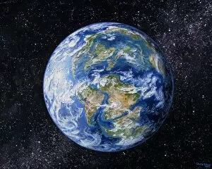
Pannotia. Artwork of prehistoric Earth with its land mass formed as one supercontinent, known as Pannotia, or the Vendian supercontinent

Background imageContinent Collection: Artwork of the Earth 100 million years ago

Artwork of the Earth 100 million years ago
Cretaceous continental drift. Artwork of the position of the Earths continents 100 million years ago, about mid-way through the Cretaceous period (136-65 million years ago)

Background imageContinent Collection: Sonar image of ocean floor off California, USA

Sonar image of ocean floor off California, USA

Background imageContinent Collection: Sonar image of ocean floor off New Jersey, USA

Sonar image of ocean floor off New Jersey, USA
Sea floor off New Jersey. High-definition coloured sonar image of the continental slope off the coast of New Jersey, Delaware and Maryland, USA

Background imageContinent Collection: Balancing Asias economy and population

Balancing Asias economy and population, conceptual artwork

Background imageContinent Collection: Over-populated planet, artwork

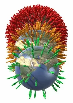
Over-populated planet, artwork
Over-populated planet, conceptual artwork

Background imageContinent Collection: Issues of overcrowding, conceptual image

Issues of overcrowding, conceptual image

Background imageContinent Collection: Overpopulated country, conceptual artwork

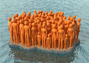
Overpopulated country, conceptual artwork

Background imageContinent Collection: Over-populating the planet, artwork

Over-populating the planet, artwork
Over-populating the planet, conceptual artwork

Background imageContinent Collection: Global temperatures, artwork

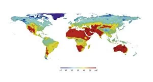
Global temperatures, artwork
Global temperatures. Computer artwork of a map of the World showing the average temperatures for all the different land areas

Background imageContinent Collection: Sir Francis Drakes voyage 1585-1586

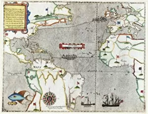
Sir Francis Drakes voyage 1585-1586. 16th century map showing the journey Sir Francis Drake made to the New World from 1585-1586

Background imageContinent Collection: Environmentally friendly planet, artwork

Environmentally friendly planet, artwork
Environmentally friendly planet, conceptual artwork

Background imageContinent Collection: Earths land cover classification, 2003

Earths land cover classification, 2003. Produced using data obtained during 2003 from the MODIS instrument on NASAs Terra satellite

Background imageContinent Collection: Lactose tolerance, Eurasia and Africa

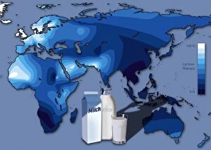
Lactose tolerance, Eurasia and Africa
GERMAN LANGUAGE VERSION. Lactose tolerance. Map of Eurasia, African and Australia, showing the varying tolerance for lactose, the milk sugar found in dairy products from cows milk (lower centre)

Background imageContinent Collection: Earth, topographic and bathymetric map

Earth, topographic and bathymetric map. Computer generated image showing the varying heights and depths of the Worlds landmasses, oceans and seas

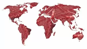
Background imageContinent Collection: Global meat eating, conceptual artwork

Global meat eating, conceptual artwork. This global map with the outline of the Earths countries filled in with a close-up of raw beef

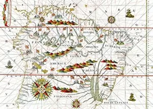
Background imageContinent Collection: South America, 16th century map

South America, 16th century map
South America. 16th century map of South America. From " Atlas" by Juan Martinez (Madrid, 1582)

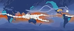
Background imageContinent Collection: La Nina, artwork

La Nina, artwork
La Nina. Computer artwork showing the path and effects of the La Nina climate pattern. La Nina is the cool phase of the El Nino/La Nina-Southern Oscillation (ENSO)

Background imageContinent Collection: Near-Earth asteroids, artwork

Near-Earth asteroids, artwork
A 10-kilometer-sized Asteroid and smaller co-asteroids approaching the Earth, bringing death from space. Here an impact in North America seems to be possible

Background imageContinent Collection: El Nino, artwork

El Nino, artwork
El Nino. Computer artwork showing the path and effects of the El Nino climate pattern. El Nino is the warm phase of the El Nino/La Nina-Southern Oscillation (ENSO)

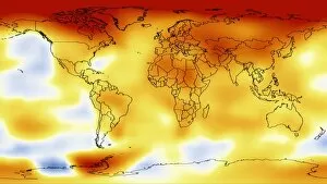
Background imageContinent Collection: Global temperature anomalies 2006-2010

Global temperature anomalies 2006-2010
Global temperature anomalies. Illustration showing five-year average global temperature anomalies from 2006 to 2010. The scale runs from dark red, indicating areas warmer than average, to dark blue

Background imageContinent Collection: Gobal refuse, conceptual image

Gobal refuse, conceptual image
Global refuse, conceptual image

Background imageContinent Collection: Prehistoric sea level map, Europe

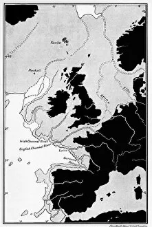
Prehistoric sea level map, Europe
Prehistoric sea level map. Published in 1913, this map shows changes in rivers and drainage patterns with sea level changes in Western Europe in prehistoric times (40, 000 to 100, 000 years ago)

Background imageContinent Collection: European refuse, conceptual image

European refuse, conceptual image

Background imageContinent Collection: Map of the Southern Hemisphere, 1657

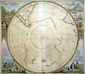
Map of the Southern Hemisphere, 1657
Map of Antarctica. Map showing what was known to the Dutch of the Southern Hemisphere, below the Tropic of Capricorn, in 1657

Background imageContinent Collection: Arctic, 17th century map

Arctic, 17th century map
Arctic map. Engraving from " Le Theatre du Monde" G. Blaeu (Amsterdam, 1645)

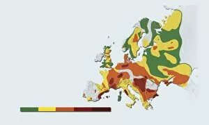
Background imageContinent Collection: Geothermal mapping, Europe

Geothermal mapping, Europe. Map of Europe, showing the temperature at a depth of five kilometres below the surface. This shows areas with a high potential for boreholes to be drilled to those depths

Background imageContinent Collection: Continental drift, 200 million years ago

Continental drift, 200 million years ago, showing the Earth at the time of the break-up of the ancient supercontinent of Pangea. This supercontinent formed around 300 million years ago

Background imageContinent Collection: Arctic exploration, route maps

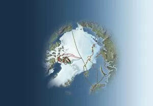
Arctic exploration, route maps
Arctic exploration. Map of the Arctic showing the routes taken by Fridtjof Nansen (1893 to 1896, brown), Frederick Cook (1907 to 1909, red), Robert Peary (1909, blue) and Umberto Nobile (1926)

Background imageContinent Collection: Global temperatures, April 2003

Global temperatures, April 2003. Infrared satellite map of worldwide surface and cloud temperatures in April 2003. The colour-coded map shows temperatures in degrees Celsius

Background imageContinent Collection: Europe at night, satellite image

Europe at night, satellite image
Europe at night. Satellite image of the Earth seen at 00:00 (midnight) GMT (UTC), centred on Europe. City lights (yellow) in dark areas show areas of dense population

Background imageContinent Collection: Global temperatures, May 2009

Global temperatures, May 2009. Infrared satellite map of average daytime air temperatures at 3000 metres elevation worldwide in May 2009

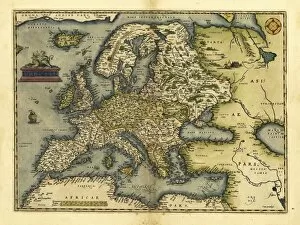
Background imageContinent Collection: Orteliuss map of Europe, 1570

Orteliuss map of Europe, 1570. This map is from the 1570 first edition of Theatrum orbis terrarum ( Theatre of the World )

Background imageContinent Collection: Orteliuss map of Asia, 1570

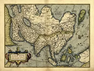
Orteliuss map of Asia, 1570
Orteliuss map of Asia. This map is from the 1570 first edition of Theatrum orbis terrarum ( Theatre of the World ). Drawn by the Flemish mapmaker Abraham Ortelius (1527-1598)


For sale as Licensed Images

Choose your image, Select your licence and Download the media

"Exploring the Vastness: A Journey through Continents" Al-Idrisi's World Map, 1154: Unveiling the ancient knowledge of continents and their boundaries. Continental Drift after 250 Million Years: Witnessing the ever-changing face of our planet over millions of years. Europe at Night - Satellite Image: Illuminating the vibrant tapestry of cities and civilizations under a starry sky. Europe at Night: A captivating nocturnal view showcasing the continent's bustling energy and urban landscapes. 17th Century World Map: Tracing the evolving perception of continents through historical cartography. Whole Earth at Night - Satellite Image: Glimpsing humanity's interconnectedness as lights twinkle across continents in unison. Our "Little Contemptibles, " 1914: Reflecting on bravery and resilience amidst global conflicts that shaped continents' destinies. 16th Century World Map: Discovering early explorers' visions as they unveiled new lands and expanded continental horizons. Earth from Space - Satellite Image: Beholding our magnificent home from afar, where continents blend seamlessly into one unified entity. Oronce Fine's World Map, 1531: Marveling at an intricate masterpiece that laid foundations for understanding vast continental expanses. Map of the Word with Lines Marking Boundaries of Tectonic Plates : Unraveling nature's hidden forces shaping continents throughout time The Devilfish in Egyptian Waters – An American cartoon from 1882 depicting John Bull (England) as the octopus of imperialism grabbing land on every continent .