Continent Collection (page 33)

"Exploring the Vastness: A Journey through Continents" Al-Idrisi's World Map, 1154: Unveiling the ancient knowledge of continents and their boundaries

Background imageContinent Collection: Antarctica, Neko Cove (Harbour). Gentoo penguin family Neko Cove (Harbour), Antarctica

Antarctica, Neko Cove (Harbour). Gentoo penguin family Neko Cove (Harbour), Antarctica

Background imageContinent Collection: Nash Car 192

Nash Car 192
Warren. Nash Motor Corporation - Nash Car 192 Model after trip across continent with driver

Background imageContinent Collection: Sturts Explorations in Australia - At Depot Creek

Sturts Explorations in Australia - At Depot Creek
Captain Charles Sturt (1795 - 1869) - English explorer of Australia, part of the European Exploration of Australia. He led several expeditions into the interior of the continent

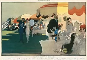
Background imageContinent Collection: Le Five O Clock At Deauville by Edmund Blampied

Le Five O Clock At Deauville by Edmund Blampied
An impression of the polo ground at Deauville during the tea hour. Since the war, afternoon tea - that formerly despised meal - has become the most fashionable of ceremonies among l haut monde

Background imageContinent Collection: Swearing In Indian Recruits to the British Army, 1878

Swearing In Indian Recruits to the British Army, 1878
Engraving showing the swearing in of an Indian recruit to the British Army, on a parade ground in the sub-continent, 1878

Background imageContinent Collection: German woman and her daily ration, Berlin, 1945

German woman and her daily ration, Berlin, 1945
Photograph showing a German woman in Berlin holding her daily ration: a small piece of bread, a few carrots and some dehydrated potatoes, August 1945

Background imageContinent Collection: Earls Court as a dormitory

Earls Court as a dormitory
Photograph of the auditorium at Earls Court, converted into a dormitory to house refugees from the war-torn continent. With tiers of beds, the auditorium held around 2000

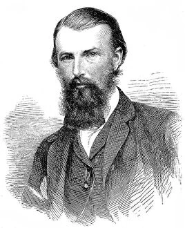
Background imageContinent Collection: William John Wills (1834-1861)

William John Wills (1834-1861)
Engraving of William John Wills, the Australian surveyor and explorer, pictured in 1860. Wills was born in England and emigrated to Australia in 1852, joining the staff of Melbournes observatory

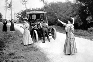
Background imageContinent Collection: Playing Diabolo while the motor gets mended 1907

Playing Diabolo while the motor gets mended 1907
Photograph showing ladies playing Diabolo whilst the car is mended. Motorists on the continent carry a set with them to pass the time in event of breakdown

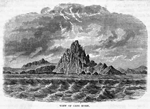
Background imageContinent Collection: Chile Cape Horn

Chile Cape Horn
View of the southern extremity of the American continent

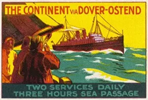
Background imageContinent Collection: Advert / Dover-Ostend

Advert / Dover-Ostend
The Continent via Dover and Ostend

Background imageContinent Collection: The Arctic, night-day satellite image

The Arctic, night-day satellite image
Asia, night-day satellite image. This composite image of the Earth is set against a background of stars, and is centred on the continent of Asia. North is at top

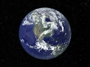
Background imageContinent Collection: North America, satellite image

North America, satellite image
North America. Satellite image of the Earth, set against a background of stars, centred on the continent of North America. North is at top. Clouds (white) are seen in the atmosphere

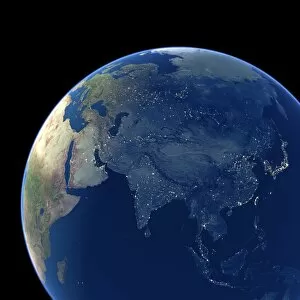
Background imageContinent Collection: Asia at night, satellite image

Asia at night, satellite image. City lights (yellow) show areas of dense population. Large, densely populated areas include India (lower centre), China (lower right) and Japan (right)

Background imageContinent Collection: Arabian Sea, satellite image

Arabian Sea, satellite image
Arabian Sea. Satellite image of the Earth centred on the Arabian Sea and western India. Clouds and Arctic ice (top) are white, oceans are blue and land is green and brown

Background imageContinent Collection: The Americas, satellite image

The Americas, satellite image
The Americas. Satellite image of the Earth centred on the Caribbean Islands, with North America at upper left and South America at bottom

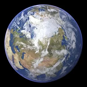
Background imageContinent Collection: Northern Asia and the Arctic

Northern Asia and the Arctic. Satellite image of the Earth centred on Siberia, with the North Pole at upper centre. Clouds and Arctic sea ice are white, oceans are blue and land is green and brown

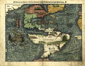
Background imageContinent Collection: Map of the Americas, 1550

Map of the Americas, 1550
16th century map of the Americas. Published in 1550, this German map shows a rudimentary geography of the newly-discovered Americas

Background imageContinent Collection: Close-up of the continent of Europe on a

Close-up of the continent of Europe on a world globe

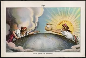
Background imageContinent Collection: Sf Earthquake Cartoon 2

Sf Earthquake Cartoon 2
Help for San Francisco after the earthquake comes from across the continent

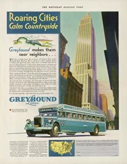
Background imageContinent Collection: Greyhound Coach 1931

Greyhound Coach 1931
Take the GREYHOUND LINES to New York - or cross the continent to Los Angeles - the scenic, friendly, enjoyable way to go

Background imageContinent Collection: Advert / Harwich Gateway

Advert / Harwich Gateway
HARWICH the Gateway to the Continent

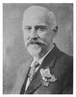
Background imageContinent Collection: Colonel James Churchward

Colonel James Churchward (1852-1936), soldier, researcher into lost continent of Mu


For sale as Licensed Images

Choose your image, Select your licence and Download the media

"Exploring the Vastness: A Journey through Continents" Al-Idrisi's World Map, 1154: Unveiling the ancient knowledge of continents and their boundaries. Continental Drift after 250 Million Years: Witnessing the ever-changing face of our planet over millions of years. Europe at Night - Satellite Image: Illuminating the vibrant tapestry of cities and civilizations under a starry sky. Europe at Night: A captivating nocturnal view showcasing the continent's bustling energy and urban landscapes. 17th Century World Map: Tracing the evolving perception of continents through historical cartography. Whole Earth at Night - Satellite Image: Glimpsing humanity's interconnectedness as lights twinkle across continents in unison. Our "Little Contemptibles, " 1914: Reflecting on bravery and resilience amidst global conflicts that shaped continents' destinies. 16th Century World Map: Discovering early explorers' visions as they unveiled new lands and expanded continental horizons. Earth from Space - Satellite Image: Beholding our magnificent home from afar, where continents blend seamlessly into one unified entity. Oronce Fine's World Map, 1531: Marveling at an intricate masterpiece that laid foundations for understanding vast continental expanses. Map of the Word with Lines Marking Boundaries of Tectonic Plates : Unraveling nature's hidden forces shaping continents throughout time The Devilfish in Egyptian Waters – An American cartoon from 1882 depicting John Bull (England) as the octopus of imperialism grabbing land on every continent .