
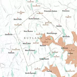
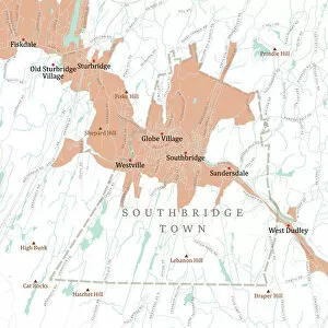
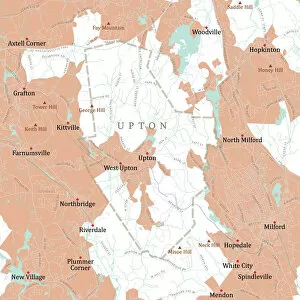
Digital Composite Collection (page 4)

"Unveiling the Wonders of Digital Composite

Background imageDigital Composite Collection: MA Worcester Brookfield Vector Road Map

MA Worcester Brookfield Vector Road Map. All source data is in the public domain. U.S. Census Bureau Census Tiger. Used Layers: areawater, linearwater, roads, rails, cousub, pointlm, uac10

Background imageDigital Composite Collection: MA Worcester Boylston Vector Road Map

MA Worcester Boylston Vector Road Map. All source data is in the public domain. U.S. Census Bureau Census Tiger. Used Layers: areawater, linearwater, roads, rails, cousub, pointlm, uac10

Background imageDigital Composite Collection: MA Worcester Charlton Vector Road Map

MA Worcester Charlton Vector Road Map. All source data is in the public domain. U.S. Census Bureau Census Tiger. Used Layers: areawater, linearwater, roads, rails, cousub, pointlm, uac10

Background imageDigital Composite Collection: MA Norfolk Westwood Vector Road Map

MA Norfolk Westwood Vector Road Map. All source data is in the public domain. U.S. Census Bureau Census Tiger. Used Layers: areawater, linearwater, roads, rails, cousub, pointlm, uac10

Background imageDigital Composite Collection: MA Norfolk Vector Road Map

MA Norfolk Vector Road Map. All source data is in the public domain. U.S. Census Bureau Census Tiger. Used Layers: areawater, linearwater, roads, rails, cousub, pointlm, uac10

Background imageDigital Composite Collection: MA Worcester Douglas Vector Road Map

MA Worcester Douglas Vector Road Map. All source data is in the public domain. U.S. Census Bureau Census Tiger. Used Layers: areawater, linearwater, roads, rails, cousub, pointlm, uac10

Background imageDigital Composite Collection: MA Worcester Dudley Vector Road Map

MA Worcester Dudley Vector Road Map. All source data is in the public domain. U.S. Census Bureau Census Tiger. Used Layers: areawater, linearwater, roads, rails, cousub, pointlm, uac10

Background imageDigital Composite Collection: MA Worcester Fitchburg Vector Road Map

MA Worcester Fitchburg Vector Road Map. All source data is in the public domain. U.S. Census Bureau Census Tiger. Used Layers: areawater, linearwater, roads, rails, cousub, pointlm, uac10

Background imageDigital Composite Collection: MA Worcester Clinton Vector Road Map

MA Worcester Clinton Vector Road Map. All source data is in the public domain. U.S. Census Bureau Census Tiger. Used Layers: areawater, linearwater, roads, rails, cousub, pointlm, uac10

Background imageDigital Composite Collection: MA Worcester Hardwick Vector Road Map

MA Worcester Hardwick Vector Road Map. All source data is in the public domain. U.S. Census Bureau Census Tiger. Used Layers: areawater, linearwater, roads, rails, cousub, pointlm, uac10

Background imageDigital Composite Collection: MA Worcester Gardner Vector Road Map

MA Worcester Gardner Vector Road Map. All source data is in the public domain. U.S. Census Bureau Census Tiger. Used Layers: areawater, linearwater, roads, rails, cousub, pointlm, uac10

Background imageDigital Composite Collection: MA Worcester Lancaster Vector Road Map

MA Worcester Lancaster Vector Road Map. All source data is in the public domain. U.S. Census Bureau Census Tiger. Used Layers: areawater, linearwater, roads, rails, cousub, pointlm, uac10

Background imageDigital Composite Collection: MA Worcester Harvard Vector Road Map

MA Worcester Harvard Vector Road Map. All source data is in the public domain. U.S. Census Bureau Census Tiger. Used Layers: areawater, linearwater, roads, rails, cousub, pointlm, uac10

Background imageDigital Composite Collection: MA Worcester Hubbardston Vector Road Map

MA Worcester Hubbardston Vector Road Map. All source data is in the public domain. U.S. Census Bureau Census Tiger. Used Layers: areawater, linearwater, roads, rails, cousub, pointlm, uac10

Background imageDigital Composite Collection: MA Worcester Holden Vector Road Map

MA Worcester Holden Vector Road Map. All source data is in the public domain. U.S. Census Bureau Census Tiger. Used Layers: areawater, linearwater, roads, rails, cousub, pointlm, uac10

Background imageDigital Composite Collection: MA Worcester Millbury Vector Road Map

MA Worcester Millbury Vector Road Map. All source data is in the public domain. U.S. Census Bureau Census Tiger. Used Layers: areawater, linearwater, roads, rails, cousub, pointlm, uac10

Background imageDigital Composite Collection: MA Worcester Leicester Vector Road Map

MA Worcester Leicester Vector Road Map. All source data is in the public domain. U.S. Census Bureau Census Tiger. Used Layers: areawater, linearwater, roads, rails, cousub, pointlm, uac10

Background imageDigital Composite Collection: MA Worcester Barre Vector Road Map

MA Worcester Barre Vector Road Map. All source data is in the public domain. U.S. Census Bureau Census Tiger. Used Layers: areawater, linearwater, roads, rails, cousub, pointlm, uac10

Background imageDigital Composite Collection: MA Worcester Ashburnham Vector Road Map

MA Worcester Ashburnham Vector Road Map. All source data is in the public domain. U.S. Census Bureau Census Tiger. Used Layers: areawater, linearwater, roads, rails, cousub, pointlm, uac10

Background imageDigital Composite Collection: MA Worcester Auburn Vector Road Map

MA Worcester Auburn Vector Road Map. All source data is in the public domain. U.S. Census Bureau Census Tiger. Used Layers: areawater, linearwater, roads, rails, cousub, pointlm, uac10

Background imageDigital Composite Collection: MA Worcester Millville Vector Road Map

MA Worcester Millville Vector Road Map. All source data is in the public domain. U.S. Census Bureau Census Tiger. Used Layers: areawater, linearwater, roads, rails, cousub, pointlm, uac10

Background imageDigital Composite Collection: MA Worcester North Brookfield Vector Road Map

MA Worcester North Brookfield Vector Road Map. All source data is in the public domain. U.S. Census Bureau Census Tiger. Used Layers: areawater, linearwater, roads, rails, cousub, pointlm, uac10

Background imageDigital Composite Collection: MA Worcester New Braintree Vector Road Map

MA Worcester New Braintree Vector Road Map. All source data is in the public domain. U.S. Census Bureau Census Tiger. Used Layers: areawater, linearwater, roads, rails, cousub, pointlm, uac10

Background imageDigital Composite Collection: MA Worcester Northborough Vector Road Map

MA Worcester Northborough Vector Road Map. All source data is in the public domain. U.S. Census Bureau Census Tiger. Used Layers: areawater, linearwater, roads, rails, cousub, pointlm, uac10

Background imageDigital Composite Collection: MA Worcester Bolton Vector Road Map

MA Worcester Bolton Vector Road Map. All source data is in the public domain. U.S. Census Bureau Census Tiger. Used Layers: areawater, linearwater, roads, rails, cousub, pointlm, uac10

Background imageDigital Composite Collection: MA Worcester Blackstone Vector Road Map

MA Worcester Blackstone Vector Road Map. All source data is in the public domain. U.S. Census Bureau Census Tiger. Used Layers: areawater, linearwater, roads, rails, cousub, pointlm, uac10

Background imageDigital Composite Collection: MA Worcester East Brookfield Vector Road Map

MA Worcester East Brookfield Vector Road Map. All source data is in the public domain. U.S. Census Bureau Census Tiger. Used Layers: areawater, linearwater, roads, rails, cousub, pointlm, uac10

Background imageDigital Composite Collection: MA Worcester Hopedale Vector Road Map

MA Worcester Hopedale Vector Road Map. All source data is in the public domain. U.S. Census Bureau Census Tiger. Used Layers: areawater, linearwater, roads, rails, cousub, pointlm, uac10

Background imageDigital Composite Collection: MA Worcester Grafton Vector Road Map

MA Worcester Grafton Vector Road Map. All source data is in the public domain. U.S. Census Bureau Census Tiger. Used Layers: areawater, linearwater, roads, rails, cousub, pointlm, uac10

Background imageDigital Composite Collection: MA Worcester Paxton Vector Road Map

MA Worcester Paxton Vector Road Map. All source data is in the public domain. U.S. Census Bureau Census Tiger. Used Layers: areawater, linearwater, roads, rails, cousub, pointlm, uac10

Background imageDigital Composite Collection: MA Worcester Petersham Vector Road Map

MA Worcester Petersham Vector Road Map. All source data is in the public domain. U.S. Census Bureau Census Tiger. Used Layers: areawater, linearwater, roads, rails, cousub, pointlm, uac10

Background imageDigital Composite Collection: MA Worcester Oakham Vector Road Map

MA Worcester Oakham Vector Road Map. All source data is in the public domain. U.S. Census Bureau Census Tiger. Used Layers: areawater, linearwater, roads, rails, cousub, pointlm, uac10

Background imageDigital Composite Collection: MA Worcester Princeton Vector Road Map

MA Worcester Princeton Vector Road Map. All source data is in the public domain. U.S. Census Bureau Census Tiger. Used Layers: areawater, linearwater, roads, rails, cousub, pointlm, uac10

Background imageDigital Composite Collection: MA Worcester Oxford Vector Road Map

MA Worcester Oxford Vector Road Map. All source data is in the public domain. U.S. Census Bureau Census Tiger. Used Layers: areawater, linearwater, roads, rails, cousub, pointlm, uac10

Background imageDigital Composite Collection: MA Worcester Phillipston Vector Road Map

MA Worcester Phillipston Vector Road Map. All source data is in the public domain. U.S. Census Bureau Census Tiger. Used Layers: areawater, linearwater, roads, rails, cousub, pointlm, uac10

Background imageDigital Composite Collection: MA Worcester Leominster Vector Road Map

MA Worcester Leominster Vector Road Map. All source data is in the public domain. U.S. Census Bureau Census Tiger. Used Layers: areawater, linearwater, roads, rails, cousub, pointlm, uac10

Background imageDigital Composite Collection: MA Worcester Lunenburg Vector Road Map

MA Worcester Lunenburg Vector Road Map. All source data is in the public domain. U.S. Census Bureau Census Tiger. Used Layers: areawater, linearwater, roads, rails, cousub, pointlm, uac10

Background imageDigital Composite Collection: MA Worcester Mendon Vector Road Map

MA Worcester Mendon Vector Road Map. All source data is in the public domain. U.S. Census Bureau Census Tiger. Used Layers: areawater, linearwater, roads, rails, cousub, pointlm, uac10

Background imageDigital Composite Collection: MA Worcester Rutland Vector Road Map

MA Worcester Rutland Vector Road Map. All source data is in the public domain. U.S. Census Bureau Census Tiger. Used Layers: areawater, linearwater, roads, rails, cousub, pointlm, uac10

Background imageDigital Composite Collection: MA Worcester Spencer Vector Road Map

MA Worcester Spencer Vector Road Map. All source data is in the public domain. U.S. Census Bureau Census Tiger. Used Layers: areawater, linearwater, roads, rails, cousub, pointlm, uac10

Background imageDigital Composite Collection: MA Worcester Southborough Vector Road Map

MA Worcester Southborough Vector Road Map. All source data is in the public domain. U.S. Census Bureau Census Tiger. Used Layers: areawater, linearwater, roads, rails, cousub, pointlm, uac10

Background imageDigital Composite Collection: MA Worcester Sterling Vector Road Map

MA Worcester Sterling Vector Road Map. All source data is in the public domain. U.S. Census Bureau Census Tiger. Used Layers: areawater, linearwater, roads, rails, cousub, pointlm, uac10

Background imageDigital Composite Collection: MA Worcester Southbridge Town Vector Road Map

MA Worcester Southbridge Town Vector Road Map. All source data is in the public domain. U.S. Census Bureau Census Tiger. Used Layers: areawater, linearwater, roads, rails, cousub, pointlm, uac10

Background imageDigital Composite Collection: MA Worcester Sturbridge Vector Road Map

MA Worcester Sturbridge Vector Road Map. All source data is in the public domain. U.S. Census Bureau Census Tiger. Used Layers: areawater, linearwater, roads, rails, cousub, pointlm, uac10

Background imageDigital Composite Collection: MA Worcester Sutton Vector Road Map

MA Worcester Sutton Vector Road Map. All source data is in the public domain. U.S. Census Bureau Census Tiger. Used Layers: areawater, linearwater, roads, rails, cousub, pointlm, uac10

Background imageDigital Composite Collection: MA Worcester Upton Vector Road Map

MA Worcester Upton Vector Road Map. All source data is in the public domain. U.S. Census Bureau Census Tiger. Used Layers: areawater, linearwater, roads, rails, cousub, pointlm, uac10

Background imageDigital Composite Collection: MA Worcester Uxbridge Vector Road Map

MA Worcester Uxbridge Vector Road Map. All source data is in the public domain. U.S. Census Bureau Census Tiger. Used Layers: areawater, linearwater, roads, rails, cousub, pointlm, uac10

Background imageDigital Composite Collection: MA Worcester Royalston Vector Road Map

MA Worcester Royalston Vector Road Map. All source data is in the public domain. U.S. Census Bureau Census Tiger. Used Layers: areawater, linearwater, roads, rails, cousub, pointlm, uac10


For sale as Licensed Images

Choose your image, Select your licence and Download the media

"Unveiling the Wonders of Digital Composite: A Captivating Journey Through Nature's Marvels" Witness the ethereal grace of a Barn owl soaring through a snow-covered countryside in Surrey, England. (January) Immerse yourself in the vibrant hues of Devil's-bit scabious blooming in Derbyshire's Peak District National Park, UK. (September) Behold the mesmerizing Irish Bend Bridge in Corvallis, Oregon, as it comes to life through a stunning digital composite with HDR effects. Explore the vastness of MACS J0717, an awe-inspiring galaxy cluster that unveils secrets from deep within our universe. Experience the breathtaking spectacle of Seattle witnessing the beginning of an enchanting Blood Moon lunar eclipse - nature's celestial masterpiece. (USA, Washington State) Dive into a microscopic world where water fleas dance alongside green algae in a garden pond - showcasing nature's intricate harmony. Embark on an extraordinary journey around Australia as day and night blend seamlessly together in this captivating satellite image of Earth. Observe with fascination as Line Leaf-cutter ants march tirelessly while carrying leaves - revealing their remarkable teamwork and resilience. Delve into UK pond waters to discover Chlorophyte or green alga Volvox aureus; witness these tiny spheres creating wonders beneath the surface. Surrender to wonderment as a Basking shark majestically glides above water while a Sperm whale dives below, forming an exquisite composition against a radiant rainbow backdrop. Walk alongside Transparent Man amidst desert sands.