Drone Point Of View Collection

Experience the breathtaking beauty of the world from a drone's perspective

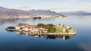
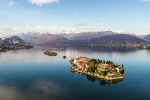
Background imageDrone Point Of View Collection: Sunset over Isola Bella, Lake Maggiore, Italy

Sunset over Isola Bella, Lake Maggiore, Italy
Borromean islands in the gulf of Pallanza, Lake Maggiore, Piedmont, Italy

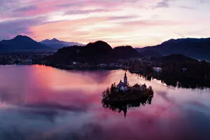
Background imageDrone Point Of View Collection: Aerial view of lake Bled at sunrise, Slovenia

Aerial view of lake Bled at sunrise, Slovenia
Aerial drone view of Bled lake and island at sunrise, Upper Carniola, Slovenia

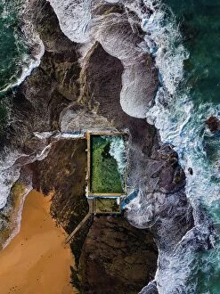
Background imageDrone Point Of View Collection: Mona Vale Rock Pool

Mona Vale Rock Pool
Mona Vale rock pool is situated on the tip of a sand spit near the northern end of Mona Vale Beach. There are two rock pools here: a larger pool measuring 30 metres long

Background imageDrone Point Of View Collection: Sunset over Borromeean islands, Lake Maggiore, Italy

Sunset over Borromeean islands, Lake Maggiore, Italy
Borromean islands in the gulf of Pallanza, Lake Maggiore, Piedmont, Italy

Background imageDrone Point Of View Collection: Panoramic sunset over Borromean islands, Lake Maggiore, Italy

Panoramic sunset over Borromean islands, Lake Maggiore, Italy
Borromean islands in the gulf of Pallanza, Lake Maggiore, Piedmont, Italy

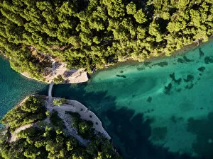
Background imageDrone Point Of View Collection: Aerial view of bridge over lake (Veliko Jezero)

Aerial view of bridge over lake (Veliko Jezero)
Mljet National Park, Croatia

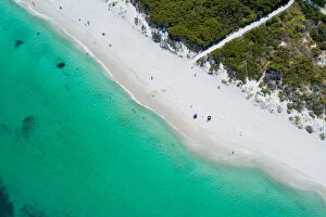
Background imageDrone Point Of View Collection: aerial of white sandy beach

aerial of white sandy beach
aerial view of white sandy beach blue ocean in summer

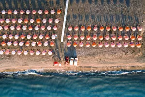
Background imageDrone Point Of View Collection: Aerial view of beach umbrellas in a row on sand beach washed by waves, Vieste

Aerial view of beach umbrellas in a row on sand beach washed by waves, Vieste, Foggia province, Gargano, Apulia, Italy

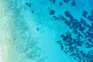
Background imageDrone Point Of View Collection: Boat sails on the Mediterranean sea. Lefkada, Ionian Islands region, Greece

Boat sails on the Mediterranean sea. Lefkada, Ionian Islands region, Greece

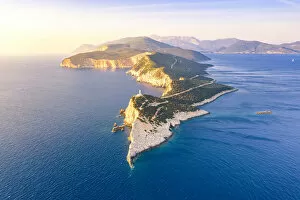
Background imageDrone Point Of View Collection: Aerial view of the lighthouse of Cape Lefkatas, Lefkada, Ionian Islands region, Greece

Aerial view of the lighthouse of Cape Lefkatas, Lefkada, Ionian Islands region, Greece

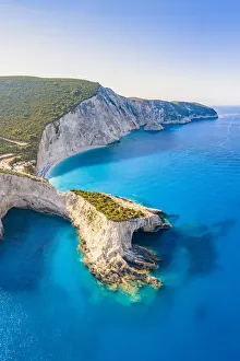
Background imageDrone Point Of View Collection: Arial view of the bay of Porto Katsiki, Lefkada, Ionian Islands region, Greece

Arial view of the bay of Porto Katsiki, Lefkada, Ionian Islands region, Greece

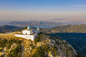
Background imageDrone Point Of View Collection: Aerial view of the Orthodox church of the Prophet Elias at sunset in summer

Aerial view of the Orthodox church of the Prophet Elias at sunset in summer. Lefkada, Ionian Islands region, Greece

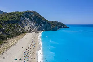
Background imageDrone Point Of View Collection: Sunshades on Milos Beach in summer. Agios Nikitas, Lefkada, Ionian Islands region

Sunshades on Milos Beach in summer. Agios Nikitas, Lefkada, Ionian Islands region, Greece

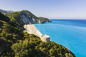
Background imageDrone Point Of View Collection: Tower above Milos Beach, Agios Nikitas, Lefkada, Ionian Islands region, Greece

Tower above Milos Beach, Agios Nikitas, Lefkada, Ionian Islands region, Greece

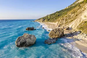
Background imageDrone Point Of View Collection: Rocks on Megali Petra beach, Lefkada, Ionian Islands region, Greece

Rocks on Megali Petra beach, Lefkada, Ionian Islands region, Greece

Background imageDrone Point Of View Collection: Aerial view of beach and waves. Lefkada, Ionian Islands region, Greece

Aerial view of beach and waves. Lefkada, Ionian Islands region, Greece

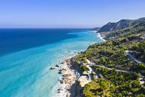
Background imageDrone Point Of View Collection: Aerial view of the winding road to Megali Petra beach. Lefkada, Ionian Islands region

Aerial view of the winding road to Megali Petra beach. Lefkada, Ionian Islands region, Greece

Background imageDrone Point Of View Collection: Aerial drone panorama of Urca neighbourhood and surrounding Botafogo and Guanabara Bay

Aerial drone panorama of Urca neighbourhood and surrounding Botafogo and Guanabara Bay, UNESCO World Heritage Site, between the Mountain and the Sea, inscribed on the World Heritage List in 2012

Background imageDrone Point Of View Collection: A person admires the Rocca Calascio castle during an autumn sunrise

A person admires the Rocca Calascio castle during an autumn sunrise, National Park of Gran Sasso and Monti of Laga, Abruzzo, Italy, Europe

Background imageDrone Point Of View Collection: Aerial view taken by drone of the famous village of Corniglia, Cinque Terre National Park

Aerial view taken by drone of the famous village of Corniglia, Cinque Terre National Park, UNESCO World Heritage Site, La Spezia, Liguria, Italy, Europe

Background imageDrone Point Of View Collection: Aerial view taken by drone of Rocca Calascio castle during an autumn sunrise

Aerial view taken by drone of Rocca Calascio castle during an autumn sunrise, National Park of Gran Sasso and Monti of Laga, Abruzzo, Italy, Europe

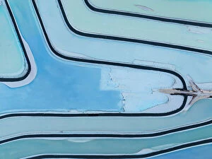
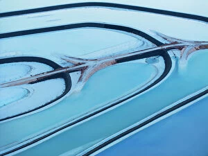
Background imageDrone Point Of View Collection: Aerial abstract view taken by drone of Potash Pond during a summer day, Moab, Utah

Aerial abstract view taken by drone of Potash Pond during a summer day, Moab, Utah, United States of America, North America

Background imageDrone Point Of View Collection: Aerial abstract view taken by drone of Potash Pond during a summer day, Moab, Utah

Aerial abstract view taken by drone of Potash Pond during a summer day, Moab, Utah, United States of America, North America

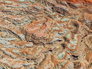
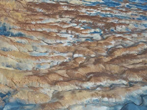
Background imageDrone Point Of View Collection: Aerial abstract view taken by drone of desert area near to Goblin Valley National Park during a

Aerial abstract view taken by drone of desert area near to Goblin Valley National Park during a sunny summer day, Utah, United States of America, North America

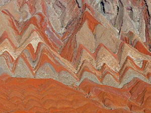
Background imageDrone Point Of View Collection: Aerial abstract view taken by drone of particular rocks formation during a sunny summer day, Utah

Aerial abstract view taken by drone of particular rocks formation during a sunny summer day, Utah, United States of America, North America

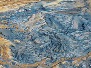
Background imageDrone Point Of View Collection: Aerial abstract view taken by drone of desert area near to Big Water during a sunny summer day, Utah

Aerial abstract view taken by drone of desert area near to Big Water during a sunny summer day, Utah, United States of America, North America

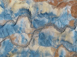
Background imageDrone Point Of View Collection: Aerial abstract view taken by drone of desert area near to Big Water during a sunny summer day, Utah

Aerial abstract view taken by drone of desert area near to Big Water during a sunny summer day, Utah, United States of America, North America

Background imageDrone Point Of View Collection: Aerial abstract view taken by drone of desert area near to Big Water during a sunny summer day, Utah

Aerial abstract view taken by drone of desert area near to Big Water during a sunny summer day, Utah, United States of America, North America

Background imageDrone Point Of View Collection: Aerial abstract view taken by drone of Potash Pond during a summer day, Moab, Utah

Aerial abstract view taken by drone of Potash Pond during a summer day, Moab, Utah, United States of America, North America

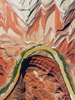
Background imageDrone Point Of View Collection: Aerial abstract view taken by drone of particular rock formation during a sunny summer day

Aerial abstract view taken by drone of particular rock formation during a sunny summer day, Mexican Hat, Utah, United States of America, North America

Background imageDrone Point Of View Collection: Aerial of the Tobyl River, south of Kostanay, northern Kazakhstan, Central Asia, Asia

Aerial of the Tobyl River, south of Kostanay, northern Kazakhstan, Central Asia, Asia

Background imageDrone Point Of View Collection: Aerial of the Lower Kolsai Lake, Kolsay Lakes National Park, Tian Shan mountains, Kazakhstan

Aerial of the Lower Kolsai Lake, Kolsay Lakes National Park, Tian Shan mountains, Kazakhstan, Central Asia, Asia

Background imageDrone Point Of View Collection: Aerial by drone of Cangas de Onis, Asturias, Spain, Europe

Aerial by drone of Cangas de Onis, Asturias, Spain, Europe

Background imageDrone Point Of View Collection: people snorkeling around a shipwreck

people snorkeling around a shipwreck
The " Omeo" was a 789 ton was an iron framed four masted clinker-built barque with one deck and a square stern. The ship was built at Newcastle, England in 1858

Background imageDrone Point Of View Collection: Aerial view of tropical Japanese island with coral reef and blue water, Okinawa

Aerial view of tropical Japanese island with coral reef and blue water, Okinawa
Beautiful tropical island with coral reef and clear blue lagoon water from above, Minna-jima Island, Okinawa, Japan

Background imageDrone Point Of View Collection: Fisherman fishing in the middle of nipa palm forest, Quang Ngai, Vietnam, Indochina

Fisherman fishing in the middle of nipa palm forest, Quang Ngai, Vietnam, Indochina, Southeast Asia, Asia

Background imageDrone Point Of View Collection: Aerial view by drone of ski slopes of Pian Delle Betulle and Alpe Paglio lit by sunset

Aerial view by drone of ski slopes of Pian Delle Betulle and Alpe Paglio lit by sunset, Valsassina, Lecco province, Lombardy, Italy, Europe

Background imageDrone Point Of View Collection: Aerial view by drone over Bath, Somerset, England, United Kingdom, Europe

Aerial view by drone over Bath, Somerset, England, United Kingdom, Europe

Background imageDrone Point Of View Collection: Majestic ├×j├│rs├í River Aerial, Iceland

Majestic ├×j├│rs├í River Aerial, Iceland
The majestic ├×j├│rs├í is Icelands longest and second-most voluminous river. At 230 kilometres (143 miles) long, it runs through the south of the country

Background imageDrone Point Of View Collection: Drone aerial of the Kyffhaeuser Monument, Barbarossa monument, Thuringia, Germany, Europe

Drone aerial of the Kyffhaeuser Monument, Barbarossa monument, Thuringia, Germany, Europe

Background imageDrone Point Of View Collection: Desert safari adventure in 4x4 vehicle bashing side to side through the desert dunes

Desert safari adventure in 4x4 vehicle bashing side to side through the desert dunes at sunset in Qatar and Saudi Arabia, Qatar, Middle East

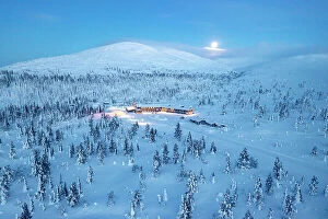
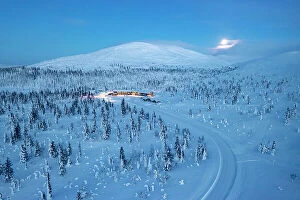
Background imageDrone Point Of View Collection: Ski area nearby a frozen snowy forest lit by moon at blue hour, aerial view

Ski area nearby a frozen snowy forest lit by moon at blue hour, aerial view, Yllastunturi National Park, Pallas, Lapland, Finland

Background imageDrone Point Of View Collection: Aerial view of a snowy mountain road in the frozen forest nearby a ski area at dusk

Aerial view of a snowy mountain road in the frozen forest nearby a ski area at dusk, Yllastunturi National Park, Lapland, Finland

Background imageDrone Point Of View Collection: Whitewashed houses in the old town of Vieste at sunrise, aerial view, Foggia province

Whitewashed houses in the old town of Vieste at sunrise, aerial view, Foggia province, Gargano National Park, Apulia, Italy

Background imageDrone Point Of View Collection: The ancient castle Castello Aragonese overlooking the sea, Ortona, province of Chieti

The ancient castle Castello Aragonese overlooking the sea, Ortona, province of Chieti, Abruzzo, Italy

Background imageDrone Point Of View Collection: Aerial view of old town and lighthouse of Vieste at dawn, Foggia province

Aerial view of old town and lighthouse of Vieste at dawn, Foggia province, Gargano National Park, Apulia, Italy

Background imageDrone Point Of View Collection: Beach umbrellas on sand washed by waves of turquoise sea from above, Vieste

Beach umbrellas on sand washed by waves of turquoise sea from above, Vieste, Foggia province, Gargano, Apulia, Italy

Background imageDrone Point Of View Collection: Aerial view of Vieste lighthouse on Sant Eufemia islet by the sea, Foggia province

Aerial view of Vieste lighthouse on Sant Eufemia islet by the sea, Foggia province, Gargano National Park, Apulia, Italy

Background imageDrone Point Of View Collection: White buildings by the sea at dawn, aerial view, Vieste, Foggia province

White buildings by the sea at dawn, aerial view, Vieste, Foggia province, Gargano National Park, Apulia, Italy

Background imageDrone Point Of View Collection: Rows of striped multi colored beach umbrellas and its shadows from above, Vieste

Rows of striped multi colored beach umbrellas and its shadows from above, Vieste, Foggia province, Gargano, Apulia, Italy

Background imageDrone Point Of View Collection: Aerial view of white sunbeds in a row on empty sand beach in summer, Vieste

Aerial view of white sunbeds in a row on empty sand beach in summer, Vieste, Foggia province, Gargano, Apulia, Italy

Background imageDrone Point Of View Collection: Aerial view from Presolanapass road in Bergamo province, Lombardy, Italy, Europe

Aerial view from Presolanapass road in Bergamo province, Lombardy, Italy, Europe

Background imageDrone Point Of View Collection: Narrow bends of icy road along the snow capped mountain pass from above, Dolomites, Italy

Narrow bends of icy road along the snow capped mountain pass from above, Dolomites, Italy

Background imageDrone Point Of View Collection: Aerial view of cars driving on narrow bends of mountain road in the snow

Aerial view of cars driving on narrow bends of mountain road in the snow

Background imageDrone Point Of View Collection: Aerial view of Brescia prealpi in Brescia province, Lombardy district, Italy, Europe

Aerial view of Brescia prealpi in Brescia province, Lombardy district, Italy, Europe

Background imageDrone Point Of View Collection: Sunrise in Brescia prealpi, Brescia province, Lombardy district, Italy

Sunrise in Brescia prealpi, Brescia province, Lombardy district, Italy

Background imageDrone Point Of View Collection: Aerial view of a colorful forest in Autumn season Brenta valley in Madonna di Campiglio

Aerial view of a colorful forest in Autumn season Brenta valley in Madonna di Campiglio, Italy

Background imageDrone Point Of View Collection: Aerial panoramic of Oeschinensee lake surrounded by woods in summer, Bernese Oberland

Aerial panoramic of Oeschinensee lake surrounded by woods in summer, Bernese Oberland, Kandersteg, Canton of Bern, Switzerland

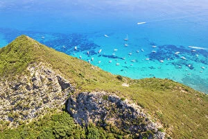
Background imageDrone Point Of View Collection: Coastline and sea. Lefkada, Ionian Islands region, Greece

Coastline and sea. Lefkada, Ionian Islands region, Greece

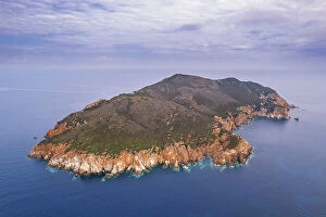
Background imageDrone Point Of View Collection: Drone view of Zannone island on a cloudy day, Zannone island, Ponza municipality

Drone view of Zannone island on a cloudy day, Zannone island, Ponza municipality, Circeo National Park, Pontine archipelago, Tyrrhenian sea, Latina province, Latium (Lazio), Italy Europe

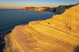
Background imageDrone Point Of View Collection: Aerial shot of Scala dei Turchi staircase seen from a drone at sunrise, Realmonte

Aerial shot of Scala dei Turchi staircase seen from a drone at sunrise, Realmonte, Agrigento province, Sicily, Italy, Mediterranean, Europe

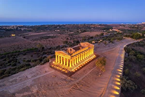
Background imageDrone Point Of View Collection: The illuminated Temple of Concordia seen from a drone at dawn, Valley of the Temples

The illuminated Temple of Concordia seen from a drone at dawn, Valley of the Temples, UNESCO World Heritage Site, Agrigento, Sicily, Italy, Mediterranean, Europe

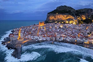
Background imageDrone Point Of View Collection: The illuminated fishing village of Cefalu with the rock on top of the old town seen from the drone

The illuminated fishing village of Cefalu with the rock on top of the old town seen from the drone at dusk, Cefalu, Palermo province, Tyrrhenian Sea, Sicily, Italy, Mediterranean, Europe

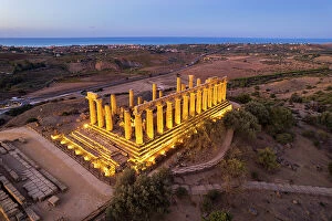
Background imageDrone Point Of View Collection: The illuminated Greek Temple of Hera seen from a drone, Valley of the Temples

The illuminated Greek Temple of Hera seen from a drone, Valley of the Temples, UNESCO World Heritage Site, Agrigento, Sicily, Italy, Mediterranean, Europe

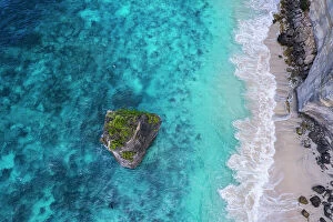
Background imageDrone Point Of View Collection: Aerial view of Suwehan white sandy beach with turquoise sea water and the big rock (sea stack)

Aerial view of Suwehan white sandy beach with turquoise sea water and the big rock (sea stack) in the sea seen from a drone, Nusa Penida, Klungkung regency, Bali, Indonesia, Southeast Asia, Asia

Background imageDrone Point Of View Collection: Aerial drone panoramic view of Braga, known for its religious heritage including Bom Jesus do

Aerial drone panoramic view of Braga, known for its religious heritage including Bom Jesus do Monte complex, and medieval Braga Cathedral, home to a Sacred Art Museum and Gothic-style Kings Chapel

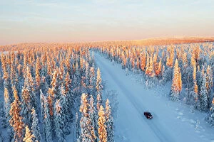
Background imageDrone Point Of View Collection: View from a drone of a car travelling an icy road among pine tree wood at sunrise

View from a drone of a car travelling an icy road among pine tree wood at sunrise, Swedish Lapland, Sweden, Scandinavia, Europe

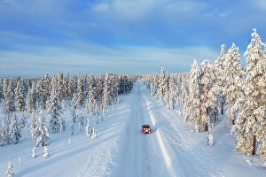
Background imageDrone Point Of View Collection: Drone view of a car driving on an empty and frozen road in the white landscape of Swedish Lapland

Drone view of a car driving on an empty and frozen road in the white landscape of Swedish Lapland, Sweden, Scandinavia, Europe

Background imageDrone Point Of View Collection: Outcrops in the saline soda lake, Mono Lake, California, United States of America, North America

Outcrops in the saline soda lake, Mono Lake, California, United States of America, North America

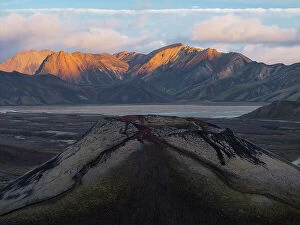
Background imageDrone Point Of View Collection: Aerial view taken by drone of little volcano in Landmannalaugar area on a summer day, Iceland

Aerial view taken by drone of little volcano in Landmannalaugar area on a summer day, Iceland, Polar Regions

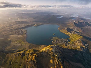
Background imageDrone Point Of View Collection: Aerial view taken by drone of natural landscape in Landmannaugar area on a summer day, Iceland

Aerial view taken by drone of natural landscape in Landmannaugar area on a summer day, Iceland, Polar Regions

Background imageDrone Point Of View Collection: Mountains of Palmarola island, Ponza municipality, Pontine archipelago, Tyrrhenian sea

Mountains of Palmarola island, Ponza municipality, Pontine archipelago, Tyrrhenian sea, Latina Province, Latium (Lazio), Italy, Europe

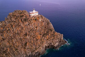
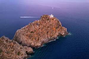
Background imageDrone Point Of View Collection: Punta della Guardia basalt cliff with the lighthouse at dusk, Ponza island, Tyrrhenian Sea

Punta della Guardia basalt cliff with the lighthouse at dusk, Ponza island, Tyrrhenian Sea, Pontine islands, Latina Province, Latium (Lazio), Italy, Europe

Background imageDrone Point Of View Collection: High angle view of the lighthouse of Ponza (Punta della Guardia lighthouse)

High angle view of the lighthouse of Ponza (Punta della Guardia lighthouse) on top of basalt cliff at dusk, Ponza island, Tyrrhenian Sea, Pontine islands, Latina Province, Latium (Lazio), Italy

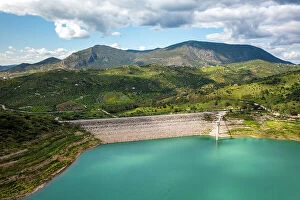
Background imageDrone Point Of View Collection: Drone aerial view of Zahara de la Sierra water reservoir dam with turquoise water

Drone aerial view of Zahara de la Sierra water reservoir dam with turquoise water and mountains in the background, Andalusia, Spain, Europe

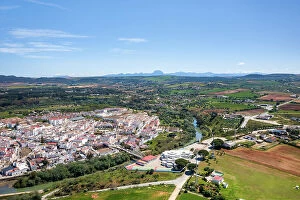
Background imageDrone Point Of View Collection: Drone aerial view of Arcos de la Frontera village of the Pueblos Blancos region, Andalusia, Spain

Drone aerial view of Arcos de la Frontera village of the Pueblos Blancos region, Andalusia, Spain, Europe

Background imageDrone Point Of View Collection: Elevated view of road snaking through trees near Borello, Emilia Romagna, Italy, Europe

Elevated view of road snaking through trees near Borello, Emilia Romagna, Italy, Europe

Background imageDrone Point Of View Collection: Paradise Beach, Thassos Island, Greek Islands, Greece, Europe

Paradise Beach, Thassos Island, Greek Islands, Greece, Europe

Background imageDrone Point Of View Collection: Aerial view of Hakodate city at night, Hakodate, Hokkaido, Japan, Asia

Aerial view of Hakodate city at night, Hakodate, Hokkaido, Japan, Asia

Background imageDrone Point Of View Collection: Aerial of the skyline of Hakodate at night, Hakodate, Hokkaido, Japan, Asia

Aerial of the skyline of Hakodate at night, Hakodate, Hokkaido, Japan, Asia

Background imageDrone Point Of View Collection: Aerial of city centre skyline at night, Hakodate, Hokkaido, Japan, Asia

Aerial of city centre skyline at night, Hakodate, Hokkaido, Japan, Asia

Background imageDrone Point Of View Collection: Skyline of Onomichi during blue hour, Onomichi, Honshu, Japan, Asia

Skyline of Onomichi during blue hour, Onomichi, Honshu, Japan, Asia


For sale as Licensed Images

Choose your image, Select your licence and Download the media

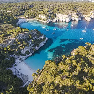
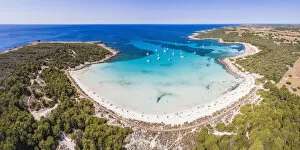
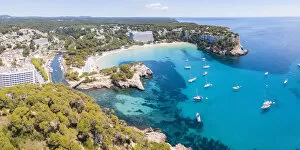
Experience the breathtaking beauty of the world from a drone's perspective. From high above, witness the stunning aerial panoramic of Cala Galdana beach in Menorca, Balearic Islands, Spain. The crystal-clear waters and golden sands stretch out before you, inviting you to dive into paradise. As the sun rises over Lake Bled in Slovenia, immerse yourself in its ethereal charm. The aerial view captures the serenity of this picturesque destination, with its emerald-green waters reflecting the vibrant colors of nature awakening. Discover the hidden gems of Menorca as you soar above Cala Macarella and Cala Macarelleta. These secluded coves offer an idyllic escape from reality, surrounded by cliffs and turquoise waters that seem straight out of a postcard. Mona Vale Rock Pool becomes a mesmerizing sight when viewed from a drone's lens. This unique formation nestled along Australia's coastline showcases nature's artistry at its finest – where waves crash against ancient rocks creating an awe-inspiring spectacle. Witness nature bidding farewell to another day as sunset paints Isola Bella on Lake Maggiore with warm hues. The tranquil atmosphere is further enhanced as Borromean islands come alive under the fading light – a true feast for your eyes captured through aerial photography. Crossing bridges takes on new meaning when seen from above Veliko Jezero lake. Aerial footage reveals intricate designs blending harmoniously with natural surroundings – reminding us that human ingenuity can coexist beautifully with Mother Nature. Embark on a spiritual journey as drones capture sunrise illuminating Holy Monastery of Varlaam - UNESCO World Heritage Site standing tall amidst rugged landscapes. Its architectural grandeur stands testament to centuries-old traditions preserved within these sacred walls. Travel back in time to Altit Village and Altit Fort in Hunza, Pakistan - their rich history unfolds beneath your feet while soaring high above them all.

© Copyright Media Storehouse, All Rights Reserved 2003 - 2024
Facebook     Pinterest     Card Payments