Geographical Map Collection (#4)

"Journey through Time: Exploring the Intricate World of Geographical Maps" Step into a world where maps were not just tools, but works of art

Background imageGeographical Map Collection: Universal Geography: French Department of Savoy (73). Advertising images edited for the brand Louit

Universal Geography: French Department of Savoy (73). Advertising images edited for the brand Louit
DUV4218046 Universal Geography: French Department of Savoy (73). Advertising images edited for the brand Louit. Debut 20th century. (lithograph); 9.5x6.5 cm; Photo © Duvallon

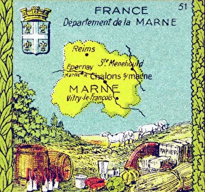
Background imageGeographical Map Collection: Universal Geography: French Department of Marne (51). Advertising images edited for the brand Louit

Universal Geography: French Department of Marne (51). Advertising images edited for the brand Louit
DUV4218107 Universal Geography: French Department of Marne (51). Advertising images edited for the brand Louit. Debut 20th century. (lithograph); 9.5x6.5 cm; Photo © Duvallon

Background imageGeographical Map Collection: Universal Geography: French Department of the Deux Sevres (79)

Universal Geography: French Department of the Deux Sevres (79). Advertising images edited for the brand Louit
DUV4218033 Universal Geography: French Department of the Deux Sevres (79). Advertising images edited for the brand Louit. Debut 20th century. (lithograph); 9.5x6.5 cm; Photo © Duvallon

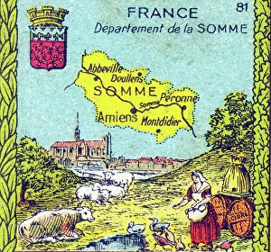
Background imageGeographical Map Collection: Universal Geography: French Department of the Somme (80). Advertising images edited for the brand

Universal Geography: French Department of the Somme (80). Advertising images edited for the brand Louit
DUV4218028 Universal Geography: French Department of the Somme (80). Advertising images edited for the brand Louit. Debut 20th century. (lithograph); 9.5x6.5 cm; Photo © Duvallon

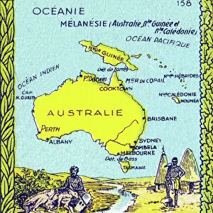
Background imageGeographical Map Collection: Universal Geography: Melanesie (Australia, New Guinee (New Guinee) and New Caledonia)

Universal Geography: Melanesie (Australia, New Guinee (New Guinee) and New Caledonia), beg of 20th century (lithograph)
DUV4218010 Universal Geography: Melanesie (Australia, New Guinee (New Guinee) and New Caledonia), beg of 20th century (lithograph); 9.5x6.5 cm; (add.info)

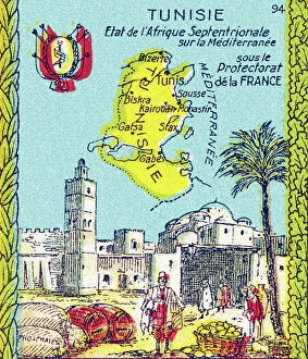
Background imageGeographical Map Collection: Universal Geography: Tunisia, under the Protectorate of France, beg of 20th century (lithograph)

Universal Geography: Tunisia, under the Protectorate of France, beg of 20th century (lithograph)
DUV4218001 Universal Geography: Tunisia, under the Protectorate of France, beg of 20th century (lithograph); 9.5x6.5 cm; (add.info)

Background imageGeographical Map Collection: Letter I. Young boy at school during a geography lecture. Engraving (Chromolithography - Chromo)
Letter I. Young boy at school during a geography lecture. Engraving (Chromolithography - Chromo)
DUV4210203 Letter I. Young boy at school during a geography lecture. Engraving (Chromolithography - Chromo) in " The Great Bebe Alphabet"

Background imageGeographical Map Collection: First World War: France, Postcard, studio photo showing two soldiers in uniform discussing

First World War: France, Postcard, studio photo showing two soldiers in uniform discussing strategy in a bucolic
LUX4735967 First World War: France, Postcard, studio photo showing two soldiers in uniform discussing strategy in a bucolic landscape looking at a map of staff, 1915

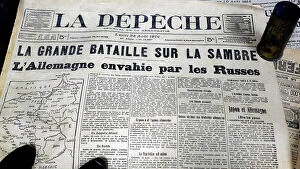
Background imageGeographical Map Collection: Great Battle on the Sambre, Germany invaded by the Russians, 1914 (print)

Great Battle on the Sambre, Germany invaded by the Russians, 1914 (print)
PCT5618366 Great Battle on the Sambre, Germany invaded by the Russians, 1914 (print); (add.info.: First World War 14-18 (1914 - 1918)

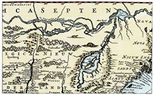
Background imageGeographical Map Collection: Dutch geographic map of eastern North America, Great Lakes region, with description of colonies

Dutch geographic map of eastern North America, Great Lakes region, with description of colonies
NWI4846151 Dutch geographic map of eastern North America, Great Lakes region, with description of colonies: New Holland and New England, New France, 1670

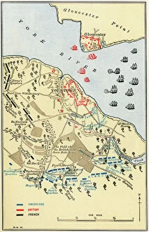
Background imageGeographical Map Collection: United States of America Independence War (1775-1783): Map of the Battle of Yorktown where

United States of America Independence War (1775-1783): Map of the Battle of Yorktown where the English army was
NWI4840453 United States of America Independence War (1775-1783): Map of the Battle of Yorktown where the English army was defeated by the American-French alliance during the war, 1781

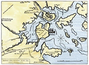
Background imageGeographical Map Collection: Map of Boston, Massachusetts, Charlestown, Cambridge, Dorchester, and Vicinity, 1775

Map of Boston, Massachusetts, Charlestown, Cambridge, Dorchester, and Vicinity, 1775. Coloured water, 19th century
NWI4841059 Map of Boston, Massachusetts, Charlestown, Cambridge, Dorchester, and Vicinity, 1775. Coloured water, 19th century.; (add.info.: Map of Boston, Massachusetts, Charlestown, Cambridge)

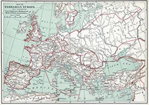
Background imageGeographical Map Collection: Map of barbarian europe Engraving from 'History of the world' by Ridpath 1885 Private collection

Map of barbarian europe Engraving from "History of the world" by Ridpath 1885 Private collection
ELD4932567 Map of barbarian europe Engraving from "History of the world" by Ridpath 1885 Private collection; (add.info)

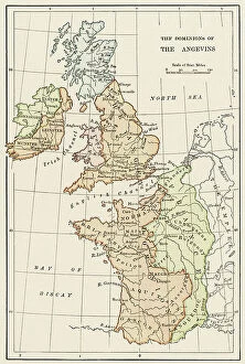
Background imageGeographical Map Collection: Geographic map of England and France during the Angevins dynasty, 12th-15th century

Geographic map of England and France during the Angevins dynasty, 12th-15th century. Lithograph of the 19th century
NWI4874543 Geographic map of England and France during the Angevins dynasty, 12th-15th century. Lithograph of the 19th century.; (add.info)

Background imageGeographical Map Collection: Map of the Earl of Westmorland (England), circa 1870. 19th century lithography

Map of the Earl of Westmorland (England), circa 1870. 19th century lithography
NWI4875494 Map of the Earl of Westmorland (England), circa 1870. 19th century lithography.; (add.info.: Map of the Earl of Westmorland (England), circa 1870

Background imageGeographical Map Collection: Map of Scotland in the 1520s, showing Highland (Highlander) territories

Map of Scotland in the 1520s, showing Highland (Highlander) territories. Colouring engraving of the 19th century
NWI4874428 Map of Scotland in the 1520s, showing Highland (Highlander) territories. Colouring engraving of the 19th century.; (add.info.: Map of Scotland in the 1520s)

Background imageGeographical Map Collection: Geographic map of Ireland with decoupage of the regions of Ulster, Connaught, Meath

Geographic map of Ireland with decoupage of the regions of Ulster, Connaught, Meath
NWI4873064 Geographic map of Ireland with decoupage of the regions of Ulster, Connaught, Meath, Munster and Leinster before the English invasion, circa 1850

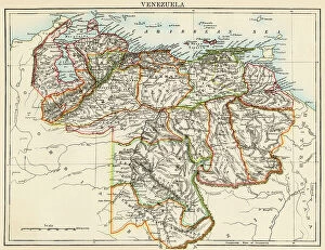
Background imageGeographical Map Collection: Map of Venezuela, around 1870 - Lithography 19th century (Map of Venezuela)

Map of Venezuela, around 1870 - Lithography 19th century (Map of Venezuela)
NWI4876433 Map of Venezuela, around 1870 - Lithography 19th century (Map of Venezuela, 1870s - Color lithograph of a 19th-century illustration); (add.info.: Map of Venezuela)

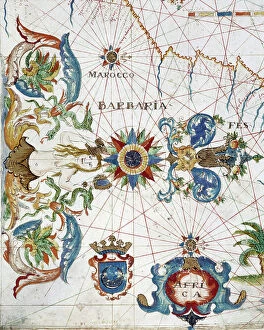
Background imageGeographical Map Collection: Geographic atlas: detail of the portulan of Francois Ollive representing Barbarie (Algeria, Tunisia)

Geographic atlas: detail of the portulan of Francois Ollive representing Barbarie (Algeria, Tunisia)
JEB4874959 Geographic atlas: detail of the portulan of Francois Ollive representing Barbarie (Algeria, Tunisia, Tripolitan) and Morocco

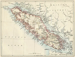
Background imageGeographical Map Collection: Geographic map of Vancouver Island (British Columbia, Canada) and its coastline, 1887

Geographic map of Vancouver Island (British Columbia, Canada) and its coastline, 1887. Lithograph of the 19th century
NWI4867453 Geographic map of Vancouver Island (British Columbia, Canada) and its coastline, 1887. Lithograph of the 19th century; (add.info.: Geographic map of Vancouver Island (British Columbia)

Background imageGeographical Map Collection: Map of the Iberic Peninsula under the Moors (Arab Muslim domination), 11th century

Map of the Iberic Peninsula under the Moors (Arab Muslim domination), 11th century. 19th century lithography
NWI4871897 Map of the Iberic Peninsula under the Moors (Arab Muslim domination), 11th century. 19th century lithography.; (add.info)

Background imageGeographical Map Collection: Map of Italy, with Sicily and Sardinia, circa 1870. 19th century lithography

Map of Italy, with Sicily and Sardinia, circa 1870. 19th century lithography
NWI4871628 Map of Italy, with Sicily and Sardinia, circa 1870. 19th century lithography.; (add.info.: Map of Italy, with Sicily and Sardinia, circa 1870)

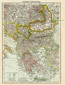
Background imageGeographical Map Collection: Map of the peninsula of the Balkans, (Bosnia, Serbia, Moldova, Hungary, Montenegro, Bulgaria)

Map of the peninsula of the Balkans, (Bosnia, Serbia, Moldova, Hungary, Montenegro, Bulgaria, Romania)
NWI4871491 Map of the peninsula of the Balkans, (Bosnia, Serbia, Moldova, Hungary, Montenegro, Bulgaria, Romania, Greece and Turkey), circa 1870

Background imageGeographical Map Collection: Geographic map of Europe at the beginning of the Protestant reform. 19th century colour engraving

Geographic map of Europe at the beginning of the Protestant reform. 19th century colour engraving
NWI4869862 Geographic map of Europe at the beginning of the Protestant reform. 19th century colour engraving; (add.info.: Geographic map of Europe at the beginning of the Protestant reform)

Background imageGeographical Map Collection: Map of the ancient regions of Asia Minor (present-day Anatolia, Turkey). 19th century lithography

Map of the ancient regions of Asia Minor (present-day Anatolia, Turkey). 19th century lithography
NWI4878395 Map of the ancient regions of Asia Minor (present-day Anatolia, Turkey). 19th century lithography.; (add.info.: Map of the ancient regions of Asia Minor (present-day Anatolia, Turkey)

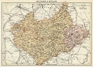
Background imageGeographical Map Collection: Map of the Counts of Leicester and Rutland (England), circa 1870. 19th century lithography

Map of the Counts of Leicester and Rutland (England), circa 1870. 19th century lithography
NWI4875099 Map of the Counts of Leicester and Rutland (England), circa 1870. 19th century lithography.; (add.info.: Map of the Counts of Leicester and Rutland (England), circa 1870

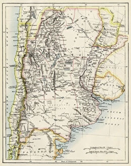
Background imageGeographical Map Collection: Geographic map of Argentina, Uruguay and Paraguay in South America, years 1870

Geographic map of Argentina, Uruguay and Paraguay in South America, years 1870. Colour engraving of the 19th century
NWI4876306 Geographic map of Argentina, Uruguay and Paraguay in South America, years 1870. Colour engraving of the 19th century.; (add.info.: Geographic map of Argentina)

Background imageGeographical Map Collection: Geographic atlas: detail of Augustin Roussin's portulan representing the coast near Marseille, 1630

Geographic atlas: detail of Augustin Roussin's portulan representing the coast near Marseille, 1630
JEB4874848 Geographic atlas: detail of Augustin Roussin's portulan representing the coast near Marseille, 1630. Municipal library of Marseille.; (add.info.: Geographic atlas)

Background imageGeographical Map Collection: Map of the Count of Dorset (England), circa 1870. 19th century lithography

Map of the Count of Dorset (England), circa 1870. 19th century lithography
NWI4874816 Map of the Count of Dorset (England), circa 1870. 19th century lithography.; (add.info.: Map of the Count of Dorset (England), circa 1870

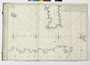
Background imageGeographical Map Collection: Geographic atlas: portulan or nautical map of the Mediterranean Sea and its coasts (Africa)

Geographic atlas: portulan or nautical map of the Mediterranean Sea and its coasts (Africa, Barbaria, Europe)
JEB4874770 Geographic atlas: portulan or nautical map of the Mediterranean Sea and its coasts (Africa, Barbaria, Europe, Middle East). Nautical chart of Augustin Roussin, 1630

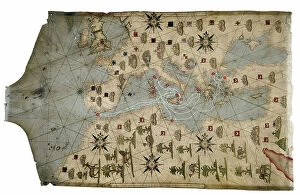
Background imageGeographical Map Collection: Portulan of the Mediterranean Sea and its coasts (Africa, Barbary, Europe, Middle East)

Portulan of the Mediterranean Sea and its coasts (Africa, Barbary, Europe, Middle East)
JEB4874759 Portulan of the Mediterranean Sea and its coasts (Africa, Barbary, Europe, Middle East). Nautical chart by Joan Oliva on parchment, 1593 preserved at the Municipal Library of Marseille

Background imageGeographical Map Collection: Geographic atlas: portulan or nautical map of the Mediterranean Sea and its coasts (Africa)

Geographic atlas: portulan or nautical map of the Mediterranean Sea and its coasts (Africa, Barbaria, Europe)
JEB4874690 Geographic atlas: portulan or nautical map of the Mediterranean Sea and its coasts (Africa, Barbaria, Europe, Middle East)

Background imageGeographical Map Collection: Map of the Province of Quebec (Canada) and Gaspe Peninsula (Gaspesie), circa 1870

Map of the Province of Quebec (Canada) and Gaspe Peninsula (Gaspesie), circa 1870. Color lithography, 19th century
NWI4867537 Map of the Province of Quebec (Canada) and Gaspe Peninsula (Gaspesie), circa 1870. Color lithography, 19th century.; (add.info)

Background imageGeographical Map Collection: Map of New Brunswick and Nova Scotia and Prince Edward Island (Canada) in the Atlantic Ocean

Map of New Brunswick and Nova Scotia and Prince Edward Island (Canada) in the Atlantic Ocean, circa 1870
NWI4867510 Map of New Brunswick and Nova Scotia and Prince Edward Island (Canada) in the Atlantic Ocean, circa 1870. Color lithography

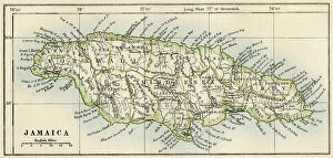
Background imageGeographical Map Collection: Map of Jamaica, circa 1870 - Lithography - (Map of Jamaica, 1870s. Color lithograph)

Map of Jamaica, circa 1870 - Lithography - (Map of Jamaica, 1870s. Color lithograph)
NWI4866898 Map of Jamaica, circa 1870 - Lithography - (Map of Jamaica, 1870s. Color lithograph); (add.info.: Map of Jamaica, circa 1870 - Lithography - (Map of Jamaica, 1870s)

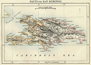
Background imageGeographical Map Collection: Map of the island of Hispaniola (Santo Domingo or Haiti), Caribbean Sea

Map of the island of Hispaniola (Santo Domingo or Haiti), Caribbean Sea, circa 1870 - Lithograph 19th century
NWI4866878 Map of the island of Hispaniola (Santo Domingo or Haiti), Caribbean Sea, circa 1870 - Lithograph 19th century (Map of Hispaniola, including Haiti and Santo Domingo, 1870s)

Background imageGeographical Map Collection: Map of Turkestan (Central Asia) Regions, ca. 1870 - Lithography - (Map of Turkestan region)

Map of Turkestan (Central Asia) Regions, ca. 1870 - Lithography - (Map of Turkestan region, 1870s). Color lithograph)
NWI4865727 Map of Turkestan (Central Asia) Regions, ca. 1870 - Lithography - (Map of Turkestan region, 1870s). Color lithograph); (add.info.: Map of Turkestan (Central Asia) Regions, ca

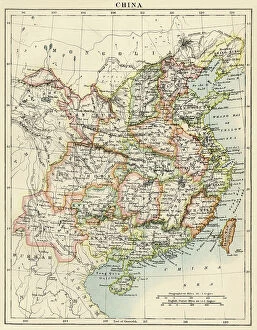
Background imageGeographical Map Collection: Map of China, circa 1870. Lithography after 19th century illustration

Map of China, circa 1870. Lithography after 19th century illustration
NWI4865676 Map of China, circa 1870. Lithography after 19th century illustration.; (add.info.: Map of China, circa 1870. Lithography after 19th century illustration.); Photo © North Wind Pictures

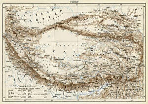
Background imageGeographical Map Collection: Map of the Tibet Peninsula, circa 1870. Lithograph from 19th century illustration

Map of the Tibet Peninsula, circa 1870. Lithograph from 19th century illustration
NWI4865617 Map of the Tibet Peninsula, circa 1870. Lithograph from 19th century illustration.; (add.info.: Map of the Tibet Peninsula, circa 1870)

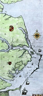
Background imageGeographical Map Collection: Map of Virginia and Carolina coasts drawn up by John White where Roanoke Colony was located

Map of Virginia and Carolina coasts drawn up by John White where Roanoke Colony was located, 16th century
NWI4849927 Map of Virginia and Carolina coasts drawn up by John White where Roanoke Colony was located, 16th century. Colouring engraving of the 19th century.; (add.info)

Background imageGeographical Map Collection: Map of Louis Armand de Lom d'Arce known as Baron de La Hontan

Map of Louis Armand de Lom d'Arce known as Baron de La Hontan, French traveller and anthropologist (1666-1716)
NWI4849869 Map of Louis Armand de Lom d'Arce known as Baron de La Hontan, French traveller and anthropologist (1666-1716) of the Great Lakes and the Vallee of Saint Laurent in North America

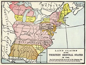
Background imageGeographical Map Collection: Map showing the states claimed by the 13 colonies originated in the United States in 1783

Map showing the states claimed by the 13 colonies originated in the United States in 1783. Color lithopgraphy
NWI4849259 Map showing the states claimed by the 13 colonies originated in the United States in 1783. Color lithopgraphy.; (add.info)

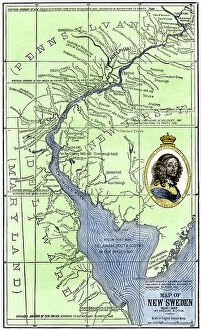
Background imageGeographical Map Collection: Colonial map of New Sweden (Nya Sverige) located in North America, on the Atlantic coast

Colonial map of New Sweden (Nya Sverige) located in North America, on the Atlantic coast, at the mouth of Delaware
NWI4848649 Colonial map of New Sweden (Nya Sverige) located in North America, on the Atlantic coast, at the mouth of Delaware, founded in March 1638, 1638-1685

Background imageGeographical Map Collection: Theory of Round Earth: Map of the world drawn up from the discoveries of Christopher Columbus

Theory of Round Earth: Map of the world drawn up from the discoveries of Christopher Columbus (1451-1506)
NWI4848339 Theory of Round Earth: Map of the world drawn up from the discoveries of Christopher Columbus (1451-1506) and Vasco Nunez de Balboa

Background imageGeographical Map Collection: Map of Fort Rozalie des Natchez on the Mississippi River (St. Louis River), 1770

Map of Fort Rozalie des Natchez on the Mississippi River (St. Louis River), 1770
NWI4847917 Map of Fort Rozalie des Natchez on the Mississippi River (St. Louis River), 1770. The north is represented on the right

Background imageGeographical Map Collection: Geographic map of the territory of the United States in 1830

Geographic map of the territory of the United States in 1830, with the borders of territories not connected to
NWI4847887 Geographic map of the territory of the United States in 1830, with the borders of territories not connected to the Union

Background imageGeographical Map Collection: Geographic map of the United States of America, circa 1870, description of the borders of

Geographic map of the United States of America, circa 1870, description of the borders of the states of the territory
NWI4846906 Geographic map of the United States of America, circa 1870, description of the borders of the states of the territory

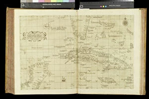
Background imageGeographical Map Collection: Geography map: representation of the island of Cuba, Jamaica, Bahamas, South Florida

Geography map: representation of the island of Cuba, Jamaica, Bahamas, South Florida
VEN5030476 Geography map: representation of the island of Cuba, Jamaica, Bahamas, South Florida and Yucatan in the Gulf of Mexico from an Atlas made by the Italian cartographer Antonio Francesco


For sale as Licensed Images

Choose your image, Select your licence and Download the media

"Journey through Time: Exploring the Intricate World of Geographical Maps" Step into a world where maps were not just tools, but works of art. The Plum Pudding in Danger or State Epicures taking un Petit Souper, 1805 engraving captures the essence of an era when cartography was both informative and visually captivating. Travel back to 1570 with the Map of the Tartar territory engraving, revealing a glimpse into ancient lands and distant cultures. Meanwhile, the Map of Tuscany in Italy from the same year showcases intricate details that transport us to Renaissance Europe. Gerardus Mercator's Atlas 1587 takes us on a comprehensive journey across continents, as his Orbis Terrae Compendiosa Descriptio reveals his mastery in capturing our vast planet's beauty. Delve deeper into specific regions like Algeria with its Geographic map highlighting Algiers, Oran, and Constantine provinces. Witness history unfold as Emperor Albert I studies France's map during Pope Boniface VIII and King Philip IV's conflict – a testament to how geography played a pivotal role even in medieval times. Jean Guerard's Universal hydrographic map manuscript from 1734 offers insights into maritime exploration while showcasing French expertise in cartography. And let us not forget the Representation of a geographic map depicting diseases prevalent at the end of the 19th century – reminding us that maps can also shed light on societal challenges. Finally, immerse yourself in Europe's past with an enchanting Map from 1743; it unveils borders long gone but still etched within historical memory. These they are more than mere navigational aids; they are gateways to different eras and windows into diverse worlds. Join us on this extraordinary expedition through time as we unravel their secrets and marvel at their enduring allure.