Geographie Collection (#6)

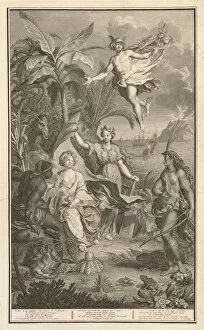
Geographie, the study of our world's vast landscapes and intricate details, encompasses a multitude of captivating historical moments

Background imageGeographie Collection: 'Around the world with family' by Lady Brassey, 1887 (illustration)

"Around the world with family" by Lady Brassey, 1887 (illustration)
7311787 "Around the world with family" by Lady Brassey, 1887 (illustration) by Souze, Auguste (b.1829 - fl.1860s); Private Collection; (add.info)

Background imageGeographie Collection: The Tour de France of a Little Parisian by Constant Amero, circa 1880 - 1885 (illustration)

The Tour de France of a Little Parisian by Constant Amero, circa 1880 - 1885 (illustration)
7298984 The Tour de France of a Little Parisian by Constant Amero, circa 1880 - 1885 (illustration) by Souze, Auguste (b.1829 - fl.1860s); (add.info)

Background imageGeographie Collection: Map of Paris. (Illustration, circa 1930)

Map of Paris. (Illustration, circa 1930)
5975932 Map of Paris. (Illustration, circa 1930) by Rossillon, Marius (O Galop) (1867-1946); Private Collection; (add.info.: Geography. France. Map of outings from Paris)

Background imageGeographie Collection: Carte de l Amerique du Sud. Portulan de Bartolomeo Velhio, 1561. Museo Navale de La Spezia

Carte de l Amerique du Sud. Portulan de Bartolomeo Velhio, 1561. Museo Navale de La Spezia
GIA4693760 Carte de l Amerique du Sud. Portulan de Bartolomeo Velhio, 1561.Museo Navale de La Spezia by Velho, Bartolomeu (d.1568); Museo Tecnico Navale, La Spezia

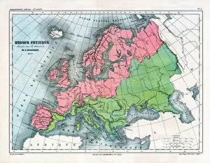
Background imageGeographie Collection: Map of Physical Europe, 1867 (print)

Map of Physical Europe, 1867 (print)
7211492 Map of Physical Europe, 1867 (print) by Vuillemin, Alexandre (1812-1886); (add.info.: Map of Physical Europe drawn up under the direction of E. Cortambert in 1867 and drawn by A)

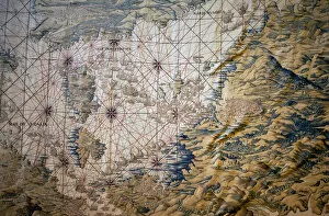
Background imageGeographie Collection: Map of the Mediterranean Sea - Detail of the conquete of Tunis (Tunisia) - Tapestry by Francisco

Map of the Mediterranean Sea - Detail of the conquete of Tunis (Tunisia) - Tapestry by Francisco
LSE4317460 Map of the Mediterranean Sea - Detail of the conquete of Tunis (Tunisia) - Tapestry by Francisco and Cornelius Van der Ggot (18th century), woven into the royal tapestry factory

Background imageGeographie Collection: Portrait en pied de Marie Antoinette de Lorraine Habsburg (1754-1793) dit '

Portrait en pied de Marie Antoinette de Lorraine Habsburg (1754-1793) dit "
JLJ4569150 Portrait en pied de Marie Antoinette de Lorraine Habsburg (1754-1793) dit " portrait au globe" Marie-Antoinette, queen of France, is represented in 1775, in a large court suit

Background imageGeographie Collection: Detail of a Catalan nautical chart (portulan) representing Asia of the 13th century

Detail of a Catalan nautical chart (portulan) representing Asia of the 13th century
JLJ4601120 Detail of a Catalan nautical chart (portulan) representing Asia of the 13th century, on which one can see a caravan walking towards Cathay

Background imageGeographie Collection: Geographical map of Italy in 1850 with the delimitation of the borders of the different

Geographical map of Italy in 1850 with the delimitation of the borders of the different
GIA4794396 Geographical map of Italy in 1850 with the delimitation of the borders of the different states that made up the country before the Risorgimento

Background imageGeographie Collection: Map of Anvers (Antverpia), Belgique (etching, 1572-1617)

Map of Anvers (Antverpia), Belgique (etching, 1572-1617)
LRI4707946 Map of Anvers (Antverpia), Belgique (etching, 1572-1617) by Hogenberg, Franz (1540-c.1590); Private Collection; (add.info.: Plan d Anvers (Antverpia)

Background imageGeographie Collection: Plan de Lucques en 1585. Atlas de Braun & Hogenberg

Plan de Lucques en 1585. Atlas de Braun & Hogenberg
GIA4693098 Plan de Lucques en 1585. Atlas de Braun & Hogenberg. by Braun, Georg (1541-1622) and Hogenberg, Franz (1535-90); Private Collection; (add.info.: Plan de Lucques en 1585)

Background imageGeographie Collection: The King of France Louis XVI (1754-1793) giving instructions to Captain Jean-Francois

The King of France Louis XVI (1754-1793) giving instructions to Captain Jean-Francois
JLJ4643255 The King of France Louis XVI (1754-1793) giving instructions to Captain Jean-Francois Galaup, Earl of La Perouse (Jean Francois Laperouse)

Background imageGeographie Collection: Bibliotheque nationale, Galerie de geographie (engraving)

Bibliotheque nationale, Galerie de geographie (engraving)
3645880 Bibliotheque nationale, Galerie de geographie (engraving) by French School, (19th century); Private Collection; (add.info.: Bibliotheque nationale, Galerie de geographie)

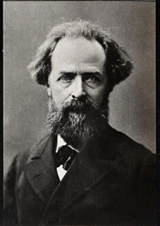
Background imageGeographie Collection: Portrait of Elysee Reclus (1830-1905), French geographer, writer and anarchist

Portrait of Elysee Reclus (1830-1905), French geographer, writer and anarchist
XEE555904 Portrait of Elysee Reclus (1830-1905), French geographer, writer and anarchist. by French Photographer, (19th century); Private Collection; Stefano Bianchetti; French, out of copyright

Background imageGeographie Collection: The amateur practice called the Gallery of Art Objects. They were also called the offices

The amateur practice called the Gallery of Art Objects. They were also called the offices
JLJ4645222 The amateur practice called the Gallery of Art Objects. They were also called the offices of curiosites. Painting by Cornelis de Baellieur (1607-1671). 1637. Dim 0.51 x 0.74 m

Background imageGeographie Collection: The Lecon of Geography Two young women of high society and their teacher showing them a

The Lecon of Geography Two young women of high society and their teacher showing them a
QUA5035844 The Lecon of Geography Two young women of high society and their teacher showing them a globe of earth Painting by Eleuterio Pagliano (1826-1903) 1880 Private collection by Pagliano

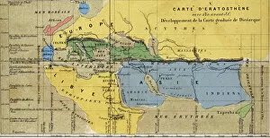
Background imageGeographie Collection: Carte d Eratosthene, astronome, geographe grec du 3eme siecle av. JC. 220 av. JC

Carte d Eratosthene, astronome, geographe grec du 3eme siecle av. JC. 220 av. JC
GIA4792151 Carte d Eratosthene, astronome, geographe grec du 3eme siecle av. JC. 220 av. JC by French School; Private Collection; (add.info.: Map of Eratosthene, astronomer)

Background imageGeographie Collection: Bale (Suisse), vue d oiseau - in 'Atlas'de Braun & Hogenberg

Bale (Suisse), vue d oiseau - in "Atlas"de Braun & Hogenberg
GIA4693110 BAle (Suisse), vue d oiseau - in " Atlas" de Braun & Hogenberg, 1585. by Braun, Georg (1541-1622) and Hogenberg, Franz (1535-90); Private Collection; (add.info.: BAle (Suisse)

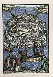
Background imageGeographie Collection: View of the island of Utopia (Utopia) from the book of Thomas More (1478-1535)

View of the island of Utopia (Utopia) from the book of Thomas More (1478-1535)
GIA4786491 View of the island of Utopia (Utopia) from the book of Thomas More (1478-1535), " De optmo republicae statu deque nova insula Utopia". Engraved by Johann Froben. 1518

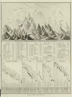
Background imageGeographie Collection: Height of the principal mountains above the level of the ocean (engraving)

Height of the principal mountains above the level of the ocean (engraving)
979813 Height of the principal mountains above the level of the ocean (engraving) by Drioux, M.M. & Leroy, Ch. (fl.1830-40); Private Collection; (add.info)

Background imageGeographie Collection: Thirty Years War (1618-1648): map representing the seat of Arras

Thirty Years War (1618-1648): map representing the seat of Arras
JLJ4600474 Thirty Years War (1618-1648): map representing the seat of Arras, 1640 - Painting by Savior Le Conte (Leconte, Le Counte, Lecomte) (1659-1694), 17th century Ec en - Oil on canvas - Sun: 0

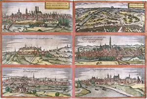
Background imageGeographie Collection: Views of Munich (Monacum) Ingolstadt (Ingolstadium), Freising (Frisingensis)

Views of Munich (Monacum) Ingolstadt (Ingolstadium), Freising (Frisingensis)
LRI4708346 Views of Munich (Monacum) Ingolstadt (Ingolstadium), Freising (Frisingensis), Nordlingen (Nordlinga), Regensburg (Ratispona) and Straubing (Stravbinga), Germany (etching)

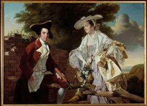
Background imageGeographie Collection: Portrait of the cartographer Peter Perez Burdett (1735-1793

Portrait of the cartographer Peter Perez Burdett (1735-1793
JLJ4657567 Portrait of the cartographer Peter Perez Burdett (1735-1793) and his wife Hannah Painting by Joseph Wright Of Derby (1734-1797) 1765 Prague, National Gallery by Wright of Derby

Background imageGeographie Collection: Historical geographical map of Palestine according to the Atlas of Abraham Ortelius

Historical geographical map of Palestine according to the Atlas of Abraham Ortelius
GIA4772119 Historical geographical map of Palestine according to the Atlas of Abraham Ortelius, Amsterdam, 1588. by Ortelius

Background imageGeographie Collection: Historical geographical map of Palestine. Jansson Atlas, 1685

Historical geographical map of Palestine. Jansson Atlas, 1685
GIA4772099 Historical geographical map of Palestine. Jansson Atlas, 1685. by Jansson, Joannes (1588-1664); Private Collection; (add.info.: Historical Geographic Map of Palestine)

Background imageGeographie Collection: Plan de Milan en 1585 tire de l Atlas de Braun & Hogenberg

Plan de Milan en 1585 tire de l Atlas de Braun & Hogenberg
GIA4693804 Plan de Milan en 1585 tirede l Atlas de Braun & Hogenberg. by Braun, Georg (1541-1622) and Hogenberg, Franz (1535-90); Private Collection; (add.info)

Background imageGeographie Collection: Atlas historique ou Nouvelle introduction l histoire

Atlas historique ou Nouvelle introduction l histoire
Atlas historique, ou, Nouvelle introduction a l histoire, a la chronologie and a la geographie ancienne and moderne: representee dans de nouvelles cartes

Background imageGeographie Collection: Aeschylos, Handbuch der alten Geographie, 19th century engraving

Aeschylos, Handbuch der alten Geographie, 19th century engraving

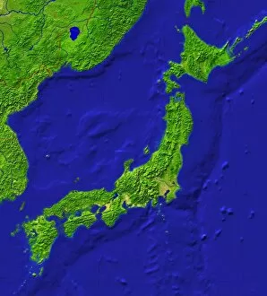
Background imageGeographie Collection: Japan topography

Japan topography
Japan / Japan

Background imageGeographie Collection: Les tables de geographie, reduites en... iev de cartes

Les tables de geographie, reduites en... iev de cartes
Les tables de geographie, reduites en...iev de cartes

Background imageGeographie Collection: Geog Commerciale 1887

Geog Commerciale 1887
A meeting of the Societe de Geographie Commerciale, Paris


For sale as Licensed Images

Choose your image, Select your licence and Download the media

Geographie, the study of our world's vast landscapes and intricate details, encompasses a multitude of captivating historical moments. In 1667, Colbert presented the Members of the Royal Academy of Sciences to Louis XIV, showcasing their dedication to unraveling nature's mysteries. This oil on canvas masterpiece immortalizes their pursuit for knowledge. Fast forward to the end of the 19th century when a geographic map of France emerged, depicting areas afflicted by diseases such as scrofule, phtisia, malaria, goiter and cretinism, pellagre, and moth. This representation serves as a stark reminder of humanity's struggle against these ailments throughout history. In 1922, Benito Mussolini seized power in Italy; an illustration capturing this pivotal moment showcases how geography intertwines with politics and shapes nations' destinies. "Around the world with family, " an enchanting illustration from Lady Brassey's 1887 work transports us into an era where travel was both adventurous and exclusive. It reminds us that geography is not only about maps but also about exploration and discovery. The Tour de France takes center stage in Constant Amero's circa 1880-1885 illustration titled "The Tour de France of a Little Parisian. " It highlights how geography can inspire sporting events that unite people across regions. Delhi Ruins depicted in an engraving from 1833 transport us back in time to witness architectural marvels standing tall amidst changing landscapes—a testament to human resilience through centuries. A map illustrating Paris circa 1930 captures its charm while Lustucru pasta tempts our taste buds through a delightful depiction from 1934—showcasing how geography influences culture and culinary traditions. Bartolomeo Velhio's Portulan de Bartolomeo Velhio (1561) at Museo Navale de La Spezia unveils Carte de l'Amerique du Sud, revealing the exploration and cartographic advancements that shaped our understanding of distant lands.