
Geographie Collection (#2)
Geographie, the study of our world's vast landscapes and intricate details, encompasses a multitude of captivating historical moments


For sale as Licensed Images
Choose your image, Select your licence and Download the media
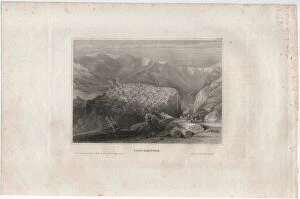
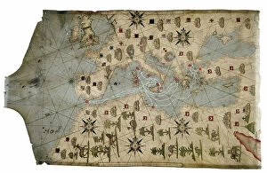
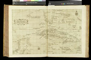
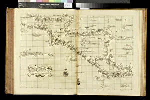
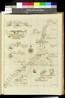
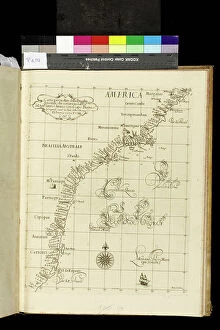
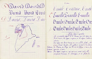
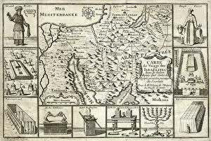
Geographie, the study of our world's vast landscapes and intricate details, encompasses a multitude of captivating historical moments. In 1667, Colbert presented the Members of the Royal Academy of Sciences to Louis XIV, showcasing their dedication to unraveling nature's mysteries. This oil on canvas masterpiece immortalizes their pursuit for knowledge. Fast forward to the end of the 19th century when a geographic map of France emerged, depicting areas afflicted by diseases such as scrofule, phtisia, malaria, goiter and cretinism, pellagre, and moth. This representation serves as a stark reminder of humanity's struggle against these ailments throughout history. In 1922, Benito Mussolini seized power in Italy; an illustration capturing this pivotal moment showcases how geography intertwines with politics and shapes nations' destinies. "Around the world with family, " an enchanting illustration from Lady Brassey's 1887 work transports us into an era where travel was both adventurous and exclusive. It reminds us that geography is not only about maps but also about exploration and discovery. The Tour de France takes center stage in Constant Amero's circa 1880-1885 illustration titled "The Tour de France of a Little Parisian. " It highlights how geography can inspire sporting events that unite people across regions. Delhi Ruins depicted in an engraving from 1833 transport us back in time to witness architectural marvels standing tall amidst changing landscapes—a testament to human resilience through centuries. A map illustrating Paris circa 1930 captures its charm while Lustucru pasta tempts our taste buds through a delightful depiction from 1934—showcasing how geography influences culture and culinary traditions. Bartolomeo Velhio's Portulan de Bartolomeo Velhio (1561) at Museo Navale de La Spezia unveils Carte de l'Amerique du Sud, revealing the exploration and cartographic advancements that shaped our understanding of distant lands.